


Northallerton, United Kingdom
Northallerton is a town of 16,832 people in England, United Kingdom.
Why visit Northallerton
Townapedia lists 10 museums and landmarks, 13 parks and trails, 79 places to eat, 7 places to stay and 6 attractions in and around town.
Highlights include Morton Bridge, North Northallerton bridge, Romanby War Memorial Clock Tower and Romanby Cenotaph.
Weather in Northallerton
Forecast from MET Norway (CC BY 4.0). Full forecast
About Northallerton
Northallerton is a market town and civil parish in North Yorkshire, England. It is near the River Wiske in the Vale of Mowbray and had a population of 16,832 in 2011. Northallerton is an administrative centre for York and North Yorkshire Combined Authority and North Yorkshire Council.
From the Wikipedia article Northallerton (this version), under CC BY-SA 4.0.
Travel tips from other travellers: Northallerton on Wikivoyage (CC BY-SA 4.0).
Photos of Northallerton


Things to do6

Morton Bridge
Bridge · 3.4 mi
Bridge in Morton-on-Swale, Hambleton, North Yorkshire, England, UK

North Northallerton bridge
Bridge · 0.8 mi
Road bridge in North Yorkshire, England


South Otterington Bridge
Bridge · 3.9 mi
Bridge in South Otterington, Hambleton, North Yorkshire, England, UK


Museums and landmarks10
Romanby War Memorial Clock Tower
Monument and historic site · 0.7 mi
War memorial clock tower in Romanby, North Yorkshire, England, UK



Parks, trails and playgrounds13



1 more on the map.
Restaurants and cafes79

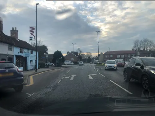
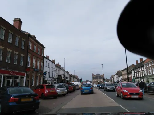
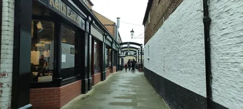

Caffè Nero
Cafe · Coffee Shop
93 High Street, Northallerton
Mo-Fr 07:00-18:00; Sa 07:30-18:00; Su 07:30-17:30

67 more on the map.
History
Due to its proximity to a Roman road, entrenchments and relics, the earliest settlement at Northallerton was a Roman military station. There is evidence that the Romans had a signal station on Castle Hills just to the west of the town as part of the imperial Roman postal system and a path connecting Hadrian's Wall with Eboracum (York) ran through what is now the neighbouring village of Brompton.
The first church was set up by St Paulinus of York on the site of the present All Saints Parish Church sometime in the early 7th century. It was made from wood and nothing survives of it. In 855 a stone church was built on the same site; fragments of stone have been found during restoration work which provide strong evidence of this Anglian church.
It was believed that an Anglo-Saxon town known as Alvertune then developed. In Pierre de Langtoft's history of King Alfred he writes that in 865 it was the site of a number of battles between King Elfrid and his brother Alfred on one side and five Danish kings and a similar number of earls. Later, in the 10th century, Danes settled at Romanby and Brompton. A fine example of English stonecarving from the period, the Brompton Hogbacks, can be found in Brompton Parish Church.
Read more of the history
In the Domesday Survey, Norman scribes named the settlement Alvertune, Aluertune and Alretone and there is a reference to the Alvertune wapentac, an area almost identical to the Allertonshire wapentake of the North Riding, which was named after the town.
The origin of the town's name is uncertain, though it is believed that the name derives from a derivation of the name Aelfere, Aelfereton translates as the farm belonging to Aelfere or even of King Alfred. Alternatively it may be referring to the Alder trees which grew nearby. The prefix of North was added in the 12th century to differentiate from the parish of Allerton Mauleverer, 25 miles (40 kilometres) to the south.
Its position on a major route brought death and destruction to the town on many occasions. In 1069, in an attempt to quell rebellion in the north, the area between the Ouse and the Tyne was laid waste by the armies of William the Conqueror. The town of Northallerton was almost totally destroyed or depopulated. Just a few years later it is described in the Domesday Book as modo est in manu regis et wastum est ("it is now in the king's hand and is a waste").
On 22 August 1138, English forces repelled a Scottish army on Cowton Moor in Brompton parish, around 2 mi (3 km) north of the town. This was the first major battle between the Scots and the English after the Norman conquest and one of the two major battles in the civil war between King Stephen and Empress Matilda. The English forces were summoned by Archbishop Thurstan of York, who had gathered local militia and baronial armies from Yorkshire and the North Midlands. They arrayed themselves round a chariot with a ship's mast carrying the consecrated banners of St Peter of York, St John of Beverley, St Wilfrid of Ripon and St Cuthbert of Durham, it was this standard-bearing chariot that gave the battle its name.
King David had entered England in support of his niece, Empress Matilda, who was viewed as the rightful heiress to the English throne usurped by King Stephen. With Stephen fighting rebel barons in the south, the Scottish armies had already taken Cumberland and Northumberland, the city of Carlisle and the royal castle at Bamburgh. Finding the English in a defensive position on a hill, David elected to force a battle counting on his superior numbers, 16,000 Scots against 10,000 Englishmen. Repeated attacks by native Scots failed against the onslaught from the English archers, with losses of up to 12,000 Scots. A subsequent attack by mounted knights met initial success but fell back due to lack of infantry support. The battle ended when David's reserve deserted, forcing him to retreat. The English elected not to pursue, and despite their great losses the Scots were able to regroup in sufficient number to besiege and capture Wark Castle. The victory by the English ensured the safety of Northern England.
Shortly after his accession William Rufus gave the town, with the lands adjacent, to the see of Durham, and, under the patronage of the bishops of that diocese, it grew in importance, and became an episcopal residence. In 1130 a castle was built on the west side of the town adjacent to North Beck by Bishop Rufus and was expanded in 1142 after William Cumin had seized the Bishopric of Durham in 1141. The castle was further expanded in 1173 by Hugh Pudsey and garrisoned by Flemish soldiers, an act which enraged King Henry II who ordered it be razed to the ground in 1177. A more substantial fortified palace surrounded by a moat was built on the same site in 1199, replacing the motte-and-bailey castle. The palace became an important administrative centre for the bishops' lands in Yorkshire and served as a major residence for the bishops and their staff. The palace lay on the main road from York to Durham and was a regular stopping place for royalty and other dignitaries. The palace had fallen into ruin by 1658 and the site is now a cemetery.
In 1318, the town was destroyed by the Scots, under Sir James Douglas following the Capture of Berwick upon Tweed. A Carmelite priory was founded in 1354, but was demolished soon after the dissolution of the monasteries in 1538. The site passed to various people and was used for arable farming before a workhouse was built on the site in 1857. Subsequently, the Friarage Hospital, which takes its name from the friary, was built. Following development of the site in 2006, archaeologists uncovered the remains of eight monks along with other artefacts.
From the History section of Northallerton on Wikipedia, under CC BY-SA 4.0.
More about Northallerton
Geography
Northallerton lies north of the Vale of York in the Vale of Mowbray just south of County Durham. To the west are the Pennines, a range of hills that rise to around 2,000 feet (600 metres), and to the east are the North York Moors which rise to around 1,500 feet (450 metres). The proximity of these hills is significant in the climatology of the area. The River Wiske, a tributary of the River Swale passes to the west of the town. The Wiske is fed by Brompton Beck, Turker Beck, Willow Beck and North Beck all of which flow through the town. Although small in nature these have been the focus of flash flooding in Northallerton and in Brompton village in the 21st century.
According to the Köppen classification, the British Isles experience a maritime climate characterised by relatively cool summers and mild winters. Compared with other parts of the country, the Vale of York is slightly warmer and sunnier in the summer and colder and frostier in the winter. Owing to its inland position, and sheltered by the Pennines to the west, North Yorkshire is one of the driest counties in the UK, receiving, on average, around 600 mm (24 in) of rain per year. The mean annual daily duration of bright sunshine is three hours and 42 minutes.
Economy
The economic activity of residents aged 16–74 was 44.3% in full-time employment, 15% in part-time employment, 6.8% self-employed, 2.5% unemployed, 2.6% students with jobs, 4.7% students without jobs, 15.8% retired, 6.5% looking after home or family, 5.3% permanently sick or disabled, and 3.1% economically inactive for other reasons.
The average price of a house in Northallerton for the 12-month period ending July 2008 was £209,082 compared to £200,433 for North Yorkshire and the national average of £178,364.
The town is a market centre for the area and also draws traders from further afield to its two annual fairs (formerly four). Cattle drovers bringing cattle, horses and sheep from Northumbria and Scotland regularly came to the town. The original cattle market was by the church, but sheep were sold on High Street until the early part of the 20th century. With the arrival of the railway, a mart was built close to the station, but this closed in 1981 and all business was concentrated on the cattle market held in Applegarth Court.
Northallerton's wide High Street incorporates shops, restaurants, pubs and cafes, including local, independent retailers Bettys, Lewis & Cooper, Barkers and Boyes.
Education
There are six primary schools in Northallerton (Alverton, Applegarth, Broomfield, Mill Hill, Oakbridge, and Sacred Heart), with Oakbridge being a new school opened in 2024 coupled with a new housing development in north Northallerton. There is also a secondary school and a Technology College. After completing primary education children move on to the Northallerton School, a secondary school and sixth form. In addition further adult learning courses are run at the college through the learndirect and Nextstep schemes.
From the Wikipedia article Northallerton, under CC BY-SA 4.0.
Notable people from Northallerton
 Michael DawsonEnglish association football playerPhoto: https://www.flickr.com/photos/bensutherland/, CC BY 2.0
 Dorothy E. SmithCanadian anthropologistPhoto: Schmendrick2112, CC BY-SA 4.0
 William LambtonBritish geographerPhoto: William Havell (1782–1857), Public domain
 Alan HinkesBritish Himalayan mountaineerPhoto: derivative work: Kauk0r ( talk )..., CC BY-SA 2.0 de
 Phillip MannBritish science fiction writer (1942–2022)Photo: New Zealand Government, Office of..., CC BY 4.0
 Marc ScottBritish athletics competitorPhoto: Sandro Halank, Wikimedia Commons, CC BY-SA 4.0
 Olivia BlakeBritish politician and Labour MPPhoto: ©House of Commons, CC BY 3.0
 Scott LincolnEnglish shot putterPhoto: Sandro Halank , Wikimedia Commons, CC BY-SA 4.0
- Jessica BardenBritish actress
- Andy DawsonEnglish association football player (born 1978)
- Wendy MortonBritish politician (born 1967)
- Joanne JacksonBritish swimmer
Born in Northallerton, according to Wikidata (CC0). Each name links to its Wikipedia article.
Where to stay7
Churches and places of worship27
Shopping24
Gas and EV charging3
Schools, colleges and libraries12
Sacred Heart Catholic Primary School
School · Roman Catholic · 0.6 mi
Broomfield Avenue, Northallerton
Healthcare4
Map of Northallerton
185 places. The map loads OpenStreetMap tiles when you open it.
Getting there and nearby towns
Teesside International Airport (MME) is the nearest airport with scheduled flights listed in OpenStreetMap, 12 miles away.
- Yarm 12 mi north, about 19 min by car
- Thornaby-on-Tees 14 mi north, about 23 min by car
- Ripon 15 mi south, about 23 min by car
- Middlesbrough 18 mi northeast, about 29 min by car
- Newton Aycliffe 20 mi north, about 32 min by car
- Spennymoor 26 mi north, about 41 min by car
- Wetherby 28 mi south, about 46 min by car
- Peterlee 29 mi north, about 47 min by car
- York 30 mi southeast, about 48 min by car
- Leeds 38 mi south, about 1 h by car
Drive times are estimates from straight-line distance, not routes.
Towns near Northallerton


Keep exploring
Local news
Headlines from INDB.
Reviews, tips and questions
Loading what members have shared...
Sources and licences
- GeoNames (CC BY 4.0): population, coordinates, regions and time zone
- Mapillary (see each image): photos
- OpenStreetMap contributors (ODbL 1.0): places, airports, map data
- Wikidata (CC0 1.0): elevation, founding date, time zone, website, landmarks and historic places
- Wikimedia Commons (see each image): photos
- Wikipedia (CC BY-SA 4.0): overview and history text
Photo credits
- All Saints Church Northallerton, Bob Embleton, CC BY-SA 2.0
- Register House, Northallerton, The joy of all things, CC BY-SA 4.0
- Northallerton prison wfm IMG 20150728 111111, Finlay McWalter, CC BY-SA 4.0
- Northallerton prison wfm IMG 20150728 111100, Finlay McWalter, CC BY-SA 4.0
- Northallerton prison wfm IMG 20150728 110949, Finlay McWalter, CC BY-SA 4.0
- Northallerton prison wfm IMG 20150728 110929, Finlay McWalter, CC BY-SA 4.0
- Northallerton prison wfm IMG 20150728 110912, Finlay McWalter, CC BY-SA 4.0
- Northallerton prison wfm IMG 20150728 110956, Finlay McWalter, CC BY-SA 4.0
- Northallerton prison wfm IMG 20150728 111119, Finlay McWalter, CC BY-SA 4.0
- Northallerton prison wfm IMG 20150728 111133, Finlay McWalter, CC BY-SA 4.0
- Northallerton prison wfm IMG 20150728 111206, Finlay McWalter, CC BY-SA 4.0
- Northallerton prison wfm IMG 20150728 111445, Finlay McWalter, CC BY-SA 4.0
- Northallerton prison wfm IMG 20150728 111610, Finlay McWalter, CC BY-SA 4.0
- Northallerton prison wfm IMG 20150728 111646, Finlay McWalter, CC BY-SA 4.0
- Northallerton prison wfm IMG 20150728 111621, Finlay McWalter, CC BY-SA 4.0
- Northallerton prison wfm IMG 20150728 111631, Finlay McWalter, CC BY-SA 4.0
- Northallerton prison wfm IMG 20150728 111731, Finlay McWalter, CC BY-SA 4.0
- Northallerton prison wfm IMG 20150728 111742, Finlay McWalter, CC BY-SA 4.0
- Northallerton prison wfm IMG 20150728 111419, Finlay McWalter, CC BY-SA 4.0
- Northallerton prison wfm IMG 20150728 111843, Finlay McWalter, CC BY-SA 4.0
- Morton-on-Swale bridge, The joy of all things, CC BY-SA 4.0
- Ainderby-Steeple-Parish-Church, Kreuzschnabel, CC BY-SA 3.0
- All Saints, Chrisloader, Public domain
- United Reformed Church, Northallerton, The joy of all things, CC BY-SA 4.0
- Friarage Hospital, Chrisloader, CC BY-SA 3.0
- Northallerton Forum, Mick Garratt, CC BY-SA 2.0
- Northallerton Library, Chrisloader, CC BY-SA 3.0
- Nags Head, Northallerton, The joy of all things, CC BY-SA 4.0
- Golden Lion Hotel, Northallerton, The joy of all things, CC BY-SA 4.0
- North Northallerton Bridge, The joy of all things, CC BY-SA 4.0
- Joe Cornish Gallery - panoramio, flipflopnick, CC BY-SA 3.0
- Register House - panoramio, flipflopnick, CC BY-SA 3.0
- Golden Lion Hotel - panoramio, flipflopnick, CC BY-SA 3.0
- Market Cross - panoramio, flipflopnick, CC BY-SA 3.0
- Porch House (Plaque) - panoramio, flipflopnick, CC BY-SA 3.0
- Street-level photo, locator, CC BY-SA 4.0
- Street-level photo, chris_debian, CC BY-SA 4.0
- Street-level photo, chris_debian, CC BY-SA 4.0
- Street-level photo, chris_debian, CC BY-SA 4.0
- Street-level photo, parson983, CC BY-SA 4.0
- Street-level photo, jethro10, CC BY-SA 4.0
- Street-level photo, locator, CC BY-SA 4.0
- Street-level photo, locator, CC BY-SA 4.0
- Street-level photo, jethro10, CC BY-SA 4.0
- Street-level photo, locator, CC BY-SA 4.0
- Street-level photo, locator, CC BY-SA 4.0
- Street-level photo, locator, CC BY-SA 4.0
- Street-level photo, locator, CC BY-SA 4.0
- Street-level photo, parson983, CC BY-SA 4.0
- Street-level photo, parson983, CC BY-SA 4.0
- Street-level photo, locator, CC BY-SA 4.0
- Street-level photo, endszbrxns, CC BY-SA 4.0
- Street-level photo, locator, CC BY-SA 4.0
- Street-level photo, locator, CC BY-SA 4.0
- Street-level photo, locator, CC BY-SA 4.0
- Street-level photo, parson983, CC BY-SA 4.0
- Street-level photo, chris_debian, CC BY-SA 4.0
- Street-level photo, locator, CC BY-SA 4.0
- Street-level photo, jethro10, CC BY-SA 4.0
- Street-level photo, locator, CC BY-SA 4.0
- Street-level photo, chris_debian, CC BY-SA 4.0
- Street-level photo, locator, CC BY-SA 4.0
- Street-level photo, locator, CC BY-SA 4.0
- Street-level photo, parson983, CC BY-SA 4.0


Page built November 10, 2026. Spotted a mistake? Tell us or suggest a place.