


Nuneaton, United Kingdom
Nuneaton is a town of 88,813 people in England, United Kingdom.
Why visit Nuneaton
Townapedia lists 6 museums and landmarks, 23 parks and trails, 65 places to eat, 6 places to stay and 4 attractions in and around town.
Highlights include Abbey Theatre, Bedworth Civic Hall, Nuneaton Museum and Art Gallery and Arbury Hall.
Weather in Nuneaton
Forecast from MET Norway (CC BY 4.0). Full forecast
About Nuneaton
Nuneaton is a market town in the Nuneaton and Bedworth district, in northern Warwickshire, England, close to the county border with Leicestershire to the north-east. Nuneaton's population at the 2021 census was 88,813, making it the largest town in Warwickshire. Nuneaton's urban area, which also includes the large villages of Bulkington and Hartshill, had a population of 99,372 at the 2021 census.
From the Wikipedia article Nuneaton (this version), under CC BY-SA 4.0.
Travel tips from other travellers: Nuneaton on Wikivoyage (CC BY-SA 4.0).
Photos of Nuneaton

Things to do4
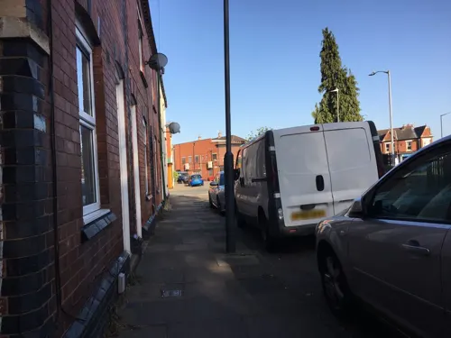

Bedworth Civic Hall
Cinema and theater · 3.1 mi
Arts centre in Bedworth, Warwickshire, England


Museums and landmarks6

Nuneaton Museum and Art Gallery
Museum
Museum and gallery in Riversley Park, Nuneaton, England, United Kingdom
We-Sa 10:30-16:30

Arbury Hall
Museum · 2.4 mi
Grade I listed historic house museum in Warwickshire, England, UK

Parks, trails and playgrounds23


Hartshill Hayes Country Park
Park · 3.1 mi
Country park in Warwickshire, England



11 more on the map.
Restaurants and cafes65
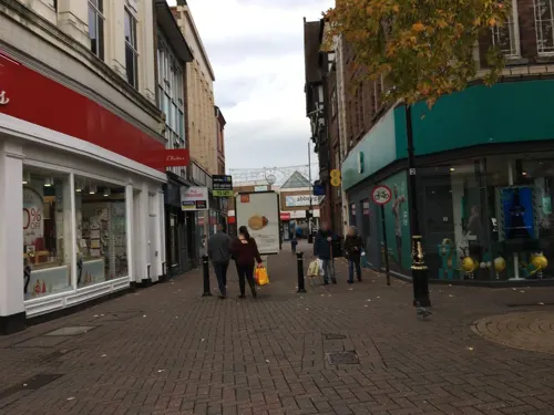
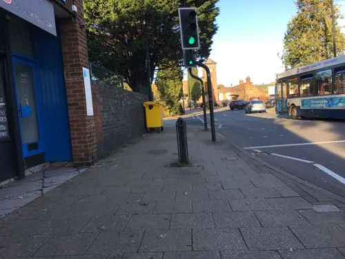




Cafe Pausa
Cafe
Regent Street, Nuneaton
Mo-Fr 10:00-16:00; Sa 09:00-17:00; Su 10:30-16:30
53 more on the map.
History
Nuneaton was originally an Anglo-Saxon settlement known as 'Etone' or 'Eaton', which translates literally as 'settlement by water', referring to the River Anker. 'Etone' was listed in the Domesday Book as a small farming settlement with a population of around 150. In the early 12th century, the settlement came under the control of the Beaumont family, and in around 1155 Robert de Beaumont granted his manor of Etone to the French Abbey of Fontevraud, who established a Benedictine nunnery here, which became known as Nuneaton Priory. This led to Etone becoming known as Nuneaton. A document from 1272 referred to the town as Nunne Eton. The nunnery was closed in 1539 during King Henry VIII's dissolution of the monasteries, and subsequently fell into ruin. Some ruins remain, and part of the Abbey church was rebuilt in the 19th and early 20th centuries.
Nuneaton obtained a market charter in around 1160 from Henry II which was reconfirmed in 1226, causing Nuneaton to develop into a market town and become the economic focal point of the local villages.
In 1485, the Battle of Bosworth, the last significant battle of the Wars of the Roses, was fought around 5 miles (8 km) to the north-west of Nuneaton, across the Leicestershire border
Read more of the history
King Edward VI School was established in 1552 by a royal charter by King Edward VI. The school was originally a fee-paying school, although the county council provided some scholarships, and became non-fee-paying as a result of the Education Act of 1944. The voluntary aided school had around 400 boys in the 1960s. In 1974 the grammar school closed and was re-established as a sixth form college.
In 1543, Nuneaton was recorded as containing 169 houses, with a population of around 800. By 1670 this had grown to 415 households, with a population of 1,867, and by 1740 the population had risen further to 2,480.
In the mid-17th century, a silk ribbon weaving industry became established in the local area which included Nuneaton, Bedworth, Coventry and much of North Warwickshire. This industry was enhanced by the arrival of French Huguenot immigrants in the latter part of the century, who brought with them new techniques. This industry operated as a cottage industry, with the weavers working from top-shops; a type of building which was specific to the local area, and had living space in the two lower floors, and a workshop with very large windows on the top floor. This industry flourished for nearly two centuries, albeit with periodic booms and slumps. However, by the early 19th century the industry was struggling to compete against the factory produced textiles from northern manufacturers, and the local weavers strongly resisted adopting factory production methods as they valued their independence. Nevertheless, in 1851 46% of Nuneaton's workforce was still employed by the ribbon trade. The industry was finally wiped out after 1860 by cheap imports, following the Cobden–Chevalier Treaty, which removed duties on imported French silks. This caused a slump in the local economy which lasted nearly two decades.
Another major industry which grew in the local area was coal mining. Nuneaton was located in the Warwickshire coalfield, and mining was recorded locally as early as 1338. However the lack of efficient transport and the primitive mining techniques kept the industry on a small scale. Mining did not start to develop on a larger scale until the 17th century, with the dawn of the Industrial Revolution, which led to greater demand for fuel and technical advancement. A major problem was the drainage of water from coal pits as they were dug deeper. The use of a waterwheel to drive drainage pumps was recorded as early as 1683. The first recorded use of an atmospheric engine; a primitive form of steam engine, to pump water from coal pits was recorded at Griff Colliery in 1714; this was the first recorded use of a steam engine in Warwickshire. Another major problem facing the industry was poor transport. Sir Roger Newdigate, who owned several local coal mines, developed a turnpike road to Coventry in the 1750s, which partially resolved this problem. Early on Newdigate recognised the potential of canals as a means for transporting bulk cargoes. He developed a system of private canals on his land on the Arbury Estate from 1764 to transport coal, and helped promote the Coventry Canal, which opened from Coventry to Nuneaton in 1769, before being finally completed to Staffordshire in 1790. He also helped promote the Oxford Canal. Ironically, the new canal system led to a decline in the Warwickshire coal industry after 1800, as it was exploited by Staffordshire coal producers to capture the local market. The local coal industry was not exploited to its maximum potential until the development of the railway network in the 19th century.
The first railway to reach Nuneaton was the Trent Valley Railway which opened in 1847, linking Nuneaton to the growing national railway network at Rugby and Stafford. This was followed by a branch line to Coventry in 1850. In 1864 a line was opened from Birmingham to Leicester via Nuneaton, and this proved to be the most important for the local economy, as it linked Nuneaton with the rapidly growing town (later city) of Birmingham. Due largely to this, the local coal industry expanded rapidly in the latter half of the 19th century, with production from the Warwickshire coalfield expanding nearly tenfold between 1860 and 1913 from around 545,000 tons to over five million tons. The industry peaked in the early 20th century; in 1911 one third of the male workforce in Nuneaton were employed as miners. The industry, however, declined rapidly in the 1950s and 1960s, with the last coal mine in Nuneaton closing in 1968, although Newdigate colliery at Bedworth lasted until 1982. The last Warwickshire coal mine at nearby Daw Mill closed in 2013.
From the History section of Nuneaton on Wikipedia, under CC BY-SA 4.0.
More about Nuneaton
Geography
Nuneaton is 9 miles (14 km) north of Coventry, 18 miles (29 km) east of Birmingham and 16 miles (26 km) south west of Leicester.
The town centre lies 2 miles (3 km) south west of the Leicestershire border (which is defined by the A5 road the former Roman Watling Street), 8 miles (13 km) south east of Staffordshire, and 12 miles (19 km) south-south east from Derbyshire’s southernmost point.
Nuneaton lies very close to the geographic centre of England, which since 2002 has been recognised as being at Lindley Hall Farm, about 3 miles (5 km) north of Nuneaton, across the county border in Leicestershire.
The River Anker runs through the town. Nuneaton town centre was historically prone to regular flooding from the Anker, with especially bad floods in 1932 and 1968. This was relieved in 1976 by the construction of a flood relief channel.
Nuneaton forms the largest part of the Nuneaton built-up area which also includes the large villages of Hartshill and Bulkington. It had a population of 132,236 at the 2001 Census. In the 2011 Census it had a considerably lower population of 92,698 because Hinckley ceased to be defined as part of the urban area. In the 2021 Census the urban area was recorded as having a population of 99,372, and comprising Nuneaton, Bulkington and Hartshill.
Economy
Nuneaton's traditional industries like textiles, mining and manufacturing have declined significantly in the post-war years. Due to its transport links, Nuneaton is to some extent a commuter town for nearby Coventry and Birmingham. However a relatively large number of businesses involved in the automotive, aerospace and engineering supply chains industries are active in the area. MIRA Limited, formerly the Motor Industry Research Association, is based on a disused wartime airfield on the A5, to the north of the town.
One of the biggest developments in the town's history, the multimillion-pound Ropewalk Shopping Centre, opened in September 2005 in the hope that it will give the town extra income from the shopping, attract more visitors and retailers, and attract shoppers as an alternative to larger retail centres such as Birmingham, Coventry, Leicester and Solihull. An older shopping centre, the Abbeygate Shopping Centre in the town centre was first opened in the 1960s, and was formerly known as Heron Way.
The European headquarters of Holland & Barrett are based in the town, as is the UK head office of FedEx. While Bermuda Park, which is south of Nuneaton, is the location of the national distribution centres of Dairy Crest and RS Components. Nuneaton is also the location of several international online marketing companies.
Arts and culture
Nuneaton has two non-league football teams: Nuneaton Borough and Nuneaton Griff who both play in the Midland Football League. Sunday League football is played in the town, with teams from Nuneaton, Bedworth and North Warwickshire competing in the Nuneaton & District Sunday Football League (NDSFL).
There are three rugby union clubs: Nuneaton R.F.C. (nicknamed "the Nuns"), who play in National 3 Midlands, Nuneaton Old Edwardians of Midlands 2 West (South) division and Manor Park of the Midlands 3 West (South) league.
The town is also the location of Nuneaton Bowling club, where flat green bowls is played.
There are three main leisure centres and one stadium in the town owned by Nuneaton and Bedworth Borough Council and managed by Everyone Active on the council's behalf (after a competitive tender process):
Nuneaton has a museum and art gallery in the grounds of Riversley Park adjacent to the town centre. The museum includes a display on George Eliot. Eliot's family home Griff House is now a restaurant and hotel on the A444.
The Abbey Theatre is Nuneaton's only theatre and hosts a wide variety of performances including visiting opera and ballet companies, touring shows, musicals, pantomime and drama. Run solely by volunteers, the Abbey Theatre seats 250 plus space for wheelchair patrons.
From the Wikipedia article Nuneaton, under CC BY-SA 4.0.
Notable people from Nuneaton
 George EliotEnglish novelist, essayist, poet and journalist (1819–1880)Photo: replica by François D’Albert Durade..., Public domain
 Gareth EdwardsBritish filmmakerPhoto: Gage Skidmore, CC BY-SA 3.0
 Peter WhittinghamEnglish footballer (1984–2020)Photo: Jon Candy from Cardiff, Wales, CC BY-SA 2.0
 Ben DanielsBritish actorPhoto: Luigi Novi, CC BY 4.0
 Richard K. GuyBritish mathematician (1916-2020)Photo: Thane Plambeck from Palo Alto, California, CC BY 2.0
 Stuart AttwellEnglish football refereePhoto: jamesboyes, CC BY 2.0
 Laura BassettEnglish association football player (born 1983)Photo: Katie Chan, CC BY-SA 4.0
 Laura HarveyEnglish association football coach (born 1980)Photo: Rh723, CC BY 4.0
 Jake DennisBritish racing driverPhoto: DriverDatabase1, CC0
- Ken LoachEnglish film director and screenwriter (born 1936)
- Caroline GrahamEnglish playwright, screenwriter and novelist
- Graeme ObreeScottish cyclist
Born in Nuneaton, according to Wikidata (CC0). Each name links to its Wikipedia article.
Where to stay6
Churches and places of worship21
Shopping22
Gas and EV charging7
Schools, colleges and libraries27
St Thomas More Catholic Academy and Sixth Form College
School · Roman Catholic · 0.8 mi
Greenmoor Road, Nuneaton
Healthcare5
Map of Nuneaton
186 places. The map loads OpenStreetMap tiles when you open it.
Getting there and nearby towns
Birmingham Airport (BHX) is the nearest airport with scheduled flights listed in OpenStreetMap, 13 miles away.
- Bedworth 3 mi south, about 5 min by car
- Hartshill 3 mi northwest, about 5 min by car
- Atherstone 5 mi northwest, about 8 min by car
- Earl Shilton 7 mi northeast, about 12 min by car
- Coventry 8 mi south, about 13 min by car
- Tamworth 12 mi northwest, about 20 min by car
- Chelmsley Wood 12 mi west, about 19 min by car
- Leicester Forest East 13 mi northeast, about 20 min by car
- Kenilworth 13 mi south, about 21 min by car
- Rugby 14 mi southeast, about 22 min by car
Drive times are estimates from straight-line distance, not routes.
Towns near Nuneaton


Keep exploring
Local news
Headlines from INDB.
Reviews, tips and questions
Loading what members have shared...
Sources and licences
- GeoNames (CC BY 4.0): population, coordinates, regions and time zone
- Mapillary (see each image): photos
- OpenStreetMap contributors (ODbL 1.0): places, airports, map data
- Wikidata (CC0 1.0): elevation, founding date, time zone, website, landmarks and historic places
- Wikimedia Commons (see each image): photos
- Wikipedia (CC BY-SA 4.0): overview and history text
Photo credits
- Justice Walk, Nuneaton - Stagecoach bus (17208918383), Elliott Brown from Birmingham, United Kingdom, CC BY-SA 2.0
- Midland Red South bus 281 Leyland National in Nuneaton Bus Station, Warwickshire February 1983, Martin Addison, CC BY-SA 2.0
- Church Street, Nuneaton - Stagecoach bus - tulips and flowers (17643091179), Elliott Brown from Birmingham, United Kingdom, CC BY-SA 2.0
- Church Street, Nuneaton - Stagecoach bus - tulips and flowers (17829718021), Elliott Brown from Birmingham, United Kingdom, CC BY-SA 2.0
- Nuneaton Library - Church Street, Nuneaton (17640942568), Elliott Brown from Birmingham, United Kingdom, CC BY-SA 2.0
- Nuneaton Library - Church Street, Nuneaton (17802459176), Elliott Brown from Birmingham, United Kingdom, CC BY-SA 2.0
- Nuneaton Museum and Art Gallery Riversley Park, © Copyright Stephen Pointer and licensed for reuse under this Creative Commons Licence., CC BY-SA 2.0
- Arbury Hall 01, David Stowell, CC BY-SA 2.0
- St francis of assisi RC bedworth 3u07, Snowmanradio, CC BY-SA 3.0
- Our Lady of the Angels Catholic Church, Nuneaton, JThomas, 5313233, JThomas, CC BY-SA 2.0
- St Thomas More Roman Catholic Secondary School-7Dec2005, Peter Lloyd, CC BY-SA 2.0
- Nuneaton Priory, JohnArmagh, CC BY-SA 3.0
- Nuneaton School for Girls in first 10- years of opening, unknown - website owners claim copyright despite not knowing who took it, Public domain
- Nuneaton, Riversley Park (1) 6.19, G-13114, CC BY-SA 4.0
- Hartshill Hayes trees, Rubbish computer, CC BY-SA 4.0
- “Animals are such agreeable friends―they ask no questions, they pass no criticisms.” (46495500875), Kevin Prince, CC BY-SA 2.0
- Nick Skelton's gold postbox at Bedworth Civic Hall, Warwickshire, Oosoom (original), cropped by User:Ultra7, CC BY-SA 3.0
- Street-level photo, tallguy, CC BY-SA 4.0
- Street-level photo, gness, CC BY-SA 4.0
- Street-level photo, gness, CC BY-SA 4.0
- Street-level photo, gness, CC BY-SA 4.0
- Street-level photo, southglos, CC BY-SA 4.0
- Street-level photo, tallguy, CC BY-SA 4.0
- Street-level photo, gness, CC BY-SA 4.0
- Street-level photo, gness, CC BY-SA 4.0
- Street-level photo, tallguy, CC BY-SA 4.0
- Street-level photo, gness, CC BY-SA 4.0
- Street-level photo, gness, CC BY-SA 4.0
- Street-level photo, gness, CC BY-SA 4.0
- Street-level photo, gness, CC BY-SA 4.0
- Street-level photo, gness, CC BY-SA 4.0
- Street-level photo, southglos, CC BY-SA 4.0
- Street-level photo, tallguy, CC BY-SA 4.0
- Street-level photo, tallguy, CC BY-SA 4.0
- Street-level photo, gness, CC BY-SA 4.0
- Street-level photo, southglos, CC BY-SA 4.0
- Street-level photo, gness, CC BY-SA 4.0


Page built November 10, 2026. Spotted a mistake? Tell us or suggest a place.