
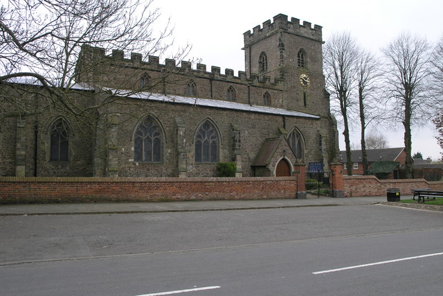


Earl Shilton, United Kingdom
Earl Shilton is a town of 19,578 people in England, United Kingdom.
Why visit Earl Shilton
Townapedia lists 3 parks and trails, 21 places to eat and 2 attractions in and around town.
Highlights include Concordia Theatre.
Weather in Earl Shilton
Forecast from MET Norway (CC BY 4.0). Full forecast
About Earl Shilton
Earl Shilton ( or locally [ɪw ʃɪwʔn̩] 'ill Shilton') is a market town in Leicestershire, England, about 5 miles (8 km) from Hinckley and about 10 mi (16 km) from Leicester. The 2011 Census recorded its population as 10,047.
From the Wikipedia article Earl Shilton (this version), under CC BY-SA 4.0.
Photos of Earl Shilton


Things to do2
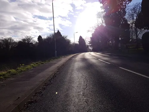

Parks, trails and playgrounds3
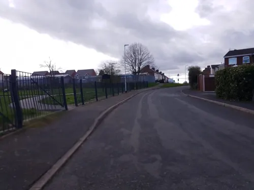

Restaurants and cafes21
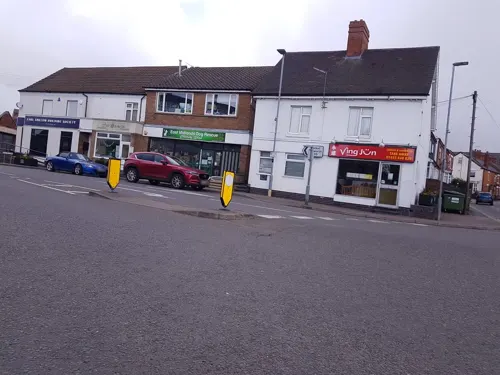
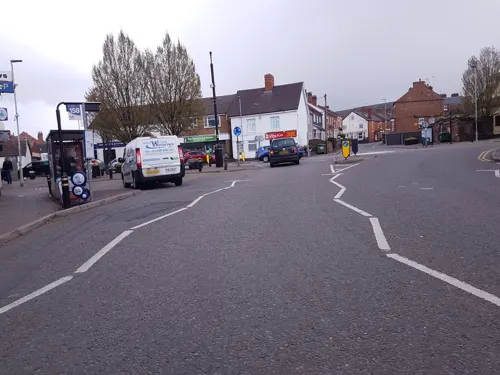
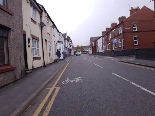
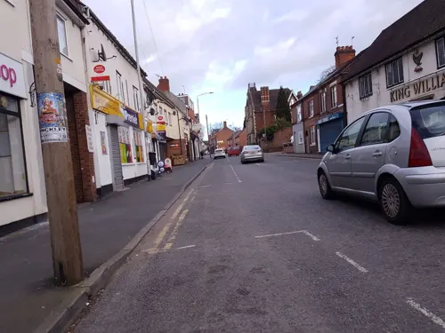
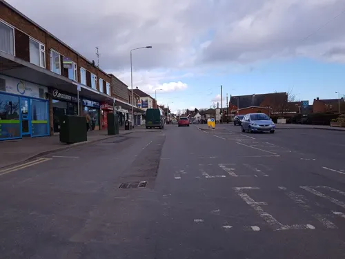
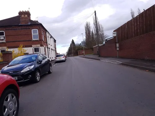
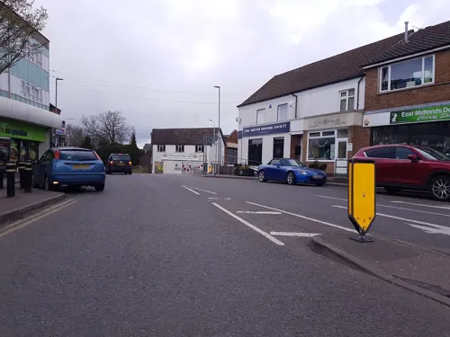

Fourwards
Restaurant · Regional
4 High Street, Leicester
Tu-Fr 12:00-14:00 "Lunch"; Mo-Th "Evening from 18:30"; Fr-Sa...


Hottest Chinese Kitchen
Fast food · Chinese, Noodle
2 High Street, Leicester
Tu-Th,Su 16:30-22:30, Fr-Sa 16:30-23:00
9 more on the map.
Churches and places of worship6

Church of St Mary
Church · 1.6 mi
Church in Barwell, Leicestershire, England, UK

Church of St Peter
Church · 3.2 mi
Church building in Aston Flamville, Blaby, Leicestershire, England, UK
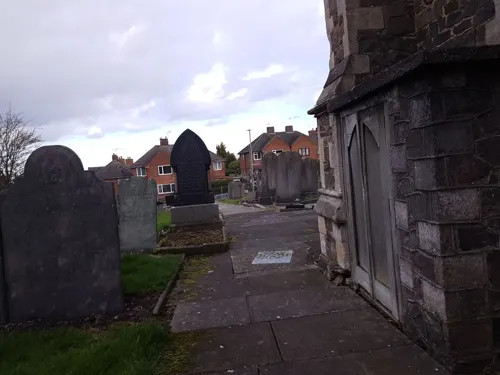
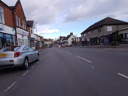

History
The village of Earl Shilton would evolve on Shilton Hill in what would be south Leicestershire. Below the hill ran an ancient trackway known as the Salt Road, connecting east and west Leicestershire. A tribe known as the Corieltauvi constructed this road, running along the southern edge of the Great Leicester Forest, a vast tract of woodland which entirely covered west Leicestershire and stretched up into Nottinghamshire and Derbyshire. The Salt Road was a major artery of trade and passage for many centuries to come.
The Corieltauvi tribe had moved to Britain from continental Europe some time after 100 BC. They were a confederation of Belgic warriors who carved out a kingdom which stretched from the Humber to south Leicestershire. These ancient Britons were not really a unified tribe, but a collection of peoples sharing the same way of life. The tribe generally did not rely on hill forts for their protection. It appears that the Corieltauvi were better farmers than warriors, for they lived in lowland settlements, usually beside streams, frequently surrounded, or even hidden, by areas of thick forest.
Read more of the history
The Roman army arrived in Britain in 43 AD, and quickly set about its conquest. Roman Legions spread north and west and by AD 47 were advancing into Leicestershire. At this time, Corieltauvi tribal chiefs were being severely harassed by their neighbours, the Brigantes, and so welcomed the Romans as a source of protection and stability. Ostorius Scapula, the Roman Governor in Britain, established the frontier zone delineated by the Fosse Way through the middle of friendly Corieltauvi territory.
Earl Shilton’s first industry arrived during this period, as a pottery was established on Shilton Heath, (behind the modern day Heathfield High School). There was an excellent vein of clay found in the vicinity of Earl Shilton’s Roman kiln. Early in the second century it started producing low grade, grey ware pots, used for everyday cookery and storage (John Lawrence).
Locally there was another pottery at Desford, and Stoney Stanton lived up to its name by the opening of a Roman quarry.
Earl Shilton lay in the kingdom of the Middle Angles. Middle Anglia and Mercia were built around the River Trent and the rivers that flow into it, such as the Soar.
The first recorded attacks on Saxon England by Viking raiders came at the end of the eighth century. Being well inland, early Viking raids did not affect the villagers of Earl Shilton but in 874—875 a great heathen army of Danes moved up the River Trent and into the heart of Mercia. They attacked and overran Nottingham before moving their ships along the River Trent into north Leicestershire.
Domesday records show that Shultone had 5 ploughlands worth 5 shillings at the time of Edward the Confessor. Shultone’s neighbour, the village of Barwell, stood on the lands of Leofric, Earl of Mercia (John Lawrence).
Following the Norman Conquest William the Conqueror besieged and captured the city of Leicester in 1068, about two years after the Battle of Hastings. William handed the government of Leicester over to Hugh de Grandmesnil, one of the Norman adventurers. He also gave de Grandmesnil 100 manors for his services, 65 of them in Leicestershire, including Earl Shilton. He was appointed sheriff of the county of Leicester. He married Adeliza, daughter of Ivo, Count of Beaumont-sur-l'Oise. Hugh de Grandmesnil and his wife, who died in 1087, had five sons and as many daughters together.
Earl Shilton, like many English villages, first appears in recorded history in the Domesday Book of 1086, the first complete tax record for the whole of England. One of the parcels of land granted to Hugh de Grandmesnil by William the Conqueror was the village of Scheltone, now known as Earl Shilton. The village measured some 500 acres (2.0 km2). The village boasted 3 ploughs, with 1 serf and 4 sokemen. Sokemen were the highest class of free peasants, a lower aristocracy, and were thought to be the descendants of the Danes who settled in the East Midlands. The village also had a priest, 10 villeins and 5 bordars. Villeins and bordars were below sokemen and tied to the land. Villeins often held between 30 and 100 acres (120,000 and 400,000 m2), while bordars were of a lower standing and usually had a smallholding.
Attached to the village of Sheltone were 12 acres (49,000 m2) of meadow and a mill of 16 pence (£0.07) value, with woodland 8 furlongs (1,600 m) in length and 3 broad valued at 70 shillings (£3.50). Following the Norman Conquest there must have been some inflation as during the time of Edward the Confessor Sheltone's woodland was valued at 5 shillings (£0.25). The population of the village would have been 75 to 80 people.
The fields of Earl Shilton manor were open spaces divided into long narrow strips. Only the fields being grazed by cattle were fenced. The others were open and were identifiable as separate fields only by the crops which they bore. The unusual detail was that the single crop in each field was separately farmed - in individual strips - by peasant families of the local village.
Some of the strips which belonged to the local lord, were farmed for him by the peasants under their feudal obligations. Strip-farming was central to the life of a medieval rural community. It involved an intrinsic element of fairness, for each peasant's strips were widely spread over the entire manor; every family would have the benefit of good land in some areas, while accepting a poor yield elsewhere. The strips also enforced an element of practical village democracy. The system only worked if everyone sowed the same crop on their strip of each open field. What to sow and when to harvest it were communal decisions. The field could not be fenced, or the cattle let into it, until each peasant had reaped his own harvest. When the harvest was in the peasant would compulsorily pay their lord to grind the corn in his mill.
From the History section of Earl Shilton on Wikipedia, under CC BY-SA 4.0.
More about Earl Shilton
Education
Thomas Green succeeded to the Baptist Church in Earl Shilton and in 1801, started the village's first school, where reading and writing were taught, as well as elementary knowledge of the Christian faith. In 1850 John Green kept the school and was the master. He was given notice to quit; having displeased the Church. The notice, however, was cancelled and he was advised to "keep things in order." This school kept going until 1858, when the Church of England Schools were built. The Church of England Schools had room for 200 children and cost £1,050 to build, the money being raised by subscription and grants. One school stood in the High Street and another in Wood Street.
In 1871 Wood Street School opened for around 30 pupils and the headmistress was a Miss Witnall. Wood Street was a very small school with only 2 classrooms. In 1907 they added 2 extra classrooms and a corridor, as village expansion led to overcrowding at the school. By 1965, numbers had risen to such a degree that they used the church hall for school dinners, physical education and music and movement sessions.
Wood Street School was partly burned down in the early hours of 17 January 1984, following a break in. The curtains were set alight which in turn ignited an oil feed pipe, causing major damage and ultimately the school's demolition.
From the Wikipedia article Earl Shilton, under CC BY-SA 4.0.
Notable people from Earl Shilton
- Les TaylorEnglish Test and County cricketer (born 1953)
- Samuel CoeEnglish cricketer (1873-1955)
- Geoffrey Coecricketer (born 1943)
- Arthur HampsonEnglish cricketer (1878-1952)
- Richard WestEnglish cricketer (1920-1985)
- Norman DagleyEnglish player of English billiards
- Ivor NortonEnglish cricketer and British Army officer
- Bob Newton(1946-2009)
Born in Earl Shilton, according to Wikidata (CC0). Each name links to its Wikipedia article.
Shopping4
Gas and EV charging1
Schools, colleges and libraries10
Healthcare2
Map of Earl Shilton
49 places. The map loads OpenStreetMap tiles when you open it.
Getting there and nearby towns
East Midlands Airport (EMA) is the nearest airport with scheduled flights listed in OpenStreetMap, 17 miles away.
- Glen Parva 6 mi east, about 10 min by car
- Braunstone 6 mi northeast, about 10 min by car
- Glenfield 7 mi northeast, about 11 min by car
- Aylestone 7 mi east, about 12 min by car
- Leicester 9 mi northeast, about 14 min by car
- Bedworth 9 mi southwest, about 15 min by car
- Hartshill 9 mi west, about 14 min by car
- Oadby 10 mi east, about 16 min by car
- Atherstone 10 mi west, about 16 min by car
- Belgrave 10 mi northeast, about 16 min by car
Drive times are estimates from straight-line distance, not routes.
Towns near Earl Shilton


Keep exploring
Local news
Headlines from INDB.
Reviews, tips and questions
Loading what members have shared...
Sources and licences
- GeoNames (CC BY 4.0): population, coordinates, regions and time zone
- Mapillary (see each image): photos
- OpenStreetMap contributors (ODbL 1.0): places, airports, map data
- Wikidata (CC0 1.0): elevation, founding date, time zone, website, landmarks and historic places
- Wikimedia Commons (see each image): photos
- Wikipedia (CC BY-SA 4.0): overview and history text
Photo credits
- St Mary's Church, Barwell, Leicestershire 01, Michael Patterson, CC BY-SA 2.0
- Aston Flamville church, Oosoom, CC BY-SA 3.0
- Close-up of the inscription (OpenBenches 4785), Anonymous Unknown author, CC BY-SA 4.0
- Long shot of the bench (OpenBenches 4791-1), Anonymous Unknown author, CC BY-SA 4.0
- Close-up of the inscription (OpenBenches 4791), Anonymous Unknown author, CC BY-SA 4.0
- Close-up of the inscription (OpenBenches 4783), Anonymous Unknown author, CC BY-SA 4.0
- Long shot of the bench (OpenBenches 4784-1), Anonymous Unknown author, CC BY-SA 4.0
- Close-up of the inscription (OpenBenches 4782), Anonymous Unknown author, CC BY-SA 4.0
- View from the bench (OpenBenches 4784-2), Anonymous Unknown author, CC BY-SA 4.0
- Long shot of the bench (OpenBenches 4783-1), Anonymous Unknown author, CC BY-SA 4.0
- View from the bench (OpenBenches 4783-2), Anonymous Unknown author, CC BY-SA 4.0
- Close-up of the inscription (OpenBenches 4784), Anonymous Unknown author, CC BY-SA 4.0
- View from the bench (OpenBenches 4786-2), Anonymous Unknown author, CC BY-SA 4.0
- Long shot of the bench (OpenBenches 4782-1), Anonymous Unknown author, CC BY-SA 4.0
- Close-up of the inscription (OpenBenches 4787), Anonymous Unknown author, CC BY-SA 4.0
- Long shot of the bench (OpenBenches 4786-1), Anonymous Unknown author, CC BY-SA 4.0
- View from the bench (OpenBenches 4785-2), Anonymous Unknown author, CC BY-SA 4.0
- View from the bench (OpenBenches 4788-2), Anonymous Unknown author, CC BY-SA 4.0
- Long shot of the bench (OpenBenches 4787-1), Anonymous Unknown author, CC BY-SA 4.0
- Long shot of the bench (OpenBenches 4788-1), Anonymous Unknown author, CC BY-SA 4.0
- Close-up of the inscription (OpenBenches 4786), Anonymous Unknown author, CC BY-SA 4.0
- Close-up of the inscription (OpenBenches 4788), Anonymous Unknown author, CC BY-SA 4.0
- View from the bench (OpenBenches 4787-2), Anonymous Unknown author, CC BY-SA 4.0
- Long shot of the bench (OpenBenches 4785-1), Anonymous Unknown author, CC BY-SA 4.0
- Street-level photo, cyclestreets, CC BY-SA 4.0
- Street-level photo, cyclestreets, CC BY-SA 4.0
- Street-level photo, cyclestreets, CC BY-SA 4.0
- Street-level photo, cyclestreets, CC BY-SA 4.0
- Street-level photo, cyclestreets, CC BY-SA 4.0
- Street-level photo, cyclestreets, CC BY-SA 4.0
- Street-level photo, cyclestreets, CC BY-SA 4.0
- Street-level photo, cyclestreets, CC BY-SA 4.0
- Street-level photo, cyclestreets, CC BY-SA 4.0
- Street-level photo, cyclestreets, CC BY-SA 4.0
- Street-level photo, cyclestreets, CC BY-SA 4.0
- Street-level photo, cyclestreets, CC BY-SA 4.0
- Street-level photo, cyclestreets, CC BY-SA 4.0
- Street-level photo, cyclestreets, CC BY-SA 4.0
- Street-level photo, cyclestreets, CC BY-SA 4.0
- Street-level photo, cyclestreets, CC BY-SA 4.0
- Street-level photo, cyclestreets, CC BY-SA 4.0
- Street-level photo, cyclestreets, CC BY-SA 4.0
- Street-level photo, cyclestreets, CC BY-SA 4.0
- Street-level photo, cyclestreets, CC BY-SA 4.0
- Street-level photo, cyclestreets, CC BY-SA 4.0
- Street-level photo, cyclestreets, CC BY-SA 4.0


Page built November 10, 2026. Spotted a mistake? Tell us or suggest a place.