


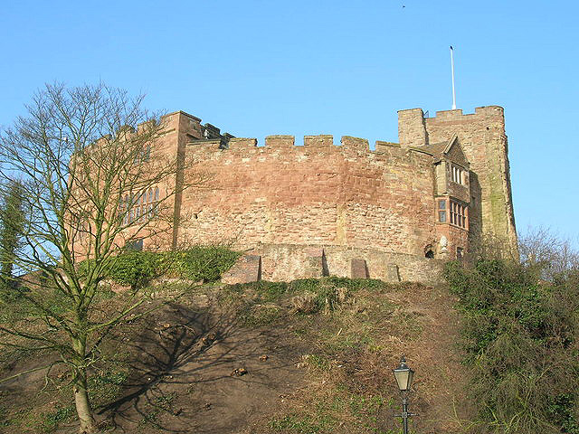

Tamworth, United Kingdom
Tamworth is a town of 81,964 people in England, United Kingdom.
Why visit Tamworth
Townapedia lists 31 museums and landmarks, 33 parks and trails, 165 places to eat, 12 places to stay and 5 attractions in and around town.
Highlights include Tamworth Assembly Rooms, Drayton Manor Zoo, Statfold Barn Railway and Museum and Tamworth Castle.
Weather in Tamworth
Forecast from MET Norway (CC BY 4.0). Full forecast
About Tamworth
Tamworth (, ) is a market town and borough in Staffordshire, England, 14 miles (23 km) north-east of Birmingham. The town borders North Warwickshire to the east and south, and the Lichfield District to the north, southwest and west. The town takes its name from the River Tame, which flows through it. The population of Tamworth borough (2025) was 81,392.
From the Wikipedia article Tamworth, Staffordshire (this version), under CC BY-SA 4.0.
Travel tips from other travellers: Tamworth on Wikivoyage (CC BY-SA 4.0).
Things to do5



Museums and landmarks31

Statfold Barn Railway and Museum
Museum · 2.6 mi
Railway line and museum in Tamworth, Staffordshire, United Kingdom

Tamworth Castle
Monument and historic site
Grade I listed Norman motte and bailey castle and museum in Tamworth, Staffordshire, United Kingdom

Staffordshire Regiment Museum
Museum · 3.9 mi
Military museum in Lichfield, Staffordshire, United Kingdom



Alvecote Priory
Monument and historic site · 2.7 mi
Priory in Shuttington, North Warwickshire, England, UK
19 more on the map.
Parks, trails and playgrounds33

Kingsbury Water Park
Park · 5.0 mi
Country park in North Warwickshire



Middleton Lakes RSPB reserve
Park · 3.2 mi
RSPB nature reserve in the United Kingdom


21 more on the map.
Restaurants and cafes165
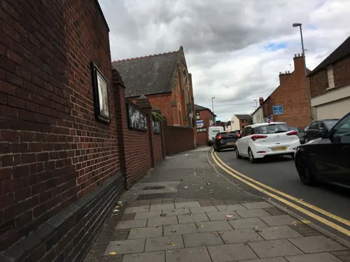
China Palace
Restaurant · Chinese
70 Church Street, Tamworth
Mo-Th 17:00-23:40, Fr-Sa 17:00-01:40, Su 17:00-23:40
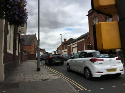
Rainbow Cantonese
Restaurant · Cantonese
71 Church Street
Mo-Th 17:00-00:00, Fr-Sa 17:00-02:00, Su 17:00-23:40
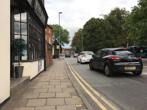
PizzaExpress
Restaurant · Pizza · 0.6 mi
Ventura Court, Tamworth
Mo-Th,Su 11:30-21:00; Fr-Sa 11:30-22:00

Costa
Cafe · Coffee Shop
Part of petrol station
14 George Street
Mo-Sa 07:00-19:00, Su 09:00-17:30

Miah Takeaway
Restaurant · Indian · 0.9 mi
231A Glascote Road, Tamworth
Mo 17:30-23:00; We-Sa 17:30-23:00; Su 17:30-22:30

153 more on the map.
History
When the Romans arrived in Britain, (43–409 CE) the Trent Valley was home to the British Coritani tribe. Evidence of Roman activity in the area of Tamworth consists of fragments of Roman building materials found near Bolebridge Street. Tamworth was near the Roman road, Watling Street and a few miles from the Roman town of Letocetum.
Following the end of Roman rule, the area around the Tame valley was occupied by Anglo-Saxons from northern Germany and Jutland. Stephen Pollington states that the settlers that reached Tamworth were Angles, who left their homelands after rising sea levels flooded much of the land. Britain offered an attractive option as its landscape was similar to their homelands, but was more fertile and had a more moderate climate. The Angles arrived from the north, navigating inland via the River Humber, River Trent and the River Tame.
Read more of the history
The settlers established themselves in "an open meadow by the Tame" which they called Tomworðig. Nearby they established an "enclosed estate" called Tomtun – Tame-town – fortified with a palisade wall. These people called themselves the Tomsaete: Tame-settlers. Tomtun was initially "not much more than a fortified manor". The settlement straddled the River Anker and contained a "large hall for public gatherings" as well as individual homes and agricultural buildings such as stables and granaries. The Lords of Tame-Settlers quickly became wealthy and Tamworth was thus able to be fortified further.
The Tomsaete were a military tribe; however, soldiers eventually reached an age where they retired from military duty and were then allotted parcels of land to farm, manage and defend. Fertile lands surrounding the rivers were allotted first, then the hill lands; this land spreading further and further, spreading the power and influence of the tribes. The Tomsaete were one of countless tribes "all vying for power and influence", however the Lords of the Tomsaete came to control and to "dominate" the area known as English Midlands. The tribes initially ruled through unions and alliances of leading families and there is evidence of contact with families across England and also back in the Anglo-Saxon homelands. However, this "warlord" form of government developed and the Tomsaete's lands became a Kingdom with a single leader.
The Tomsaete lived in the heartland of what by the late 6th century had become the Kingdom of Mercia, the largest of the kingdoms in what is now England. A fortress built by King Creoda would later, under King Penda in the 7th century, become the most powerful. The King was not static and would not have a single residence; instead he travelled round his territories "to be seen by his people, to give legal judgments, to reward loyalty and to try offenders". Tamworth was probably a stopping place on the royal circuit, becoming a royal vill from the seventh century, with an early minster church and river crossing. It was fortified as a burh in the late 8th century, with an earthen rampart and timber palisade surrounded by a ditch.
By the end of the 8th century it had been established by King Offa of Mercia (757–796) as the stable centre of royal power for his expanding political ambitions – more like a capital than had previously been seen anywhere in Anglo-Saxon England. One of the earliest surviving written records mentioning Tamworth dates from Offa's reign; a grant of land to monks at Worcester dating from 781, signed by Offa, King of Mercia, addressed from his royal palace at Tamworthie. Offa built what was described as a Royal palace at Tamworth, however this was almost certainly a timber and thatch construction (as were most buildings in Anglo-Saxon England) which left little physical trace, and so the location of Offa's palace has never been identified, although excavations north of Bolebridge Street in 1968 revealed what appeared to be the outline of a large Saxon building.
Between 790 and 850 Tamworth was the main location for the signature of Mercian royal charters. In 868 the Great Heathen Army invaded England and in 874 they drove out King Burgred, who fled to Rome. Tamworth was then a frontier town between Viking ruled east Mercia and Anglo-Saxon ruled west Mercia until 913, when Æthelflæd, Lady of the Mercians, made Tamworth her capital, and re-fortified the town against Viking attacks. Æthelflæd led a successful military campaign to win back territory from the Danes, driving them back to their stronghold at Derby which was then captured. She died at Tamworth on 6 June 918.
During the reign of Æthelstan (924–939) the Kingdom enjoyed a period of relative peace and prosperity. In Tamworth church in 926, a sister of King Æthelstan, perhaps Saint Edith of Polesworth, was married to Sitric Cáech, the squint-eyed Norse King of York and Dublin. It was during this period that a mint was established at Tamworth producing silver coins, many stamped with the name of a local moneyer called Manna. Many coins produced in Tamworth during this period have appeared in Scandinavian museums, as much of it was used to pay Danegeld, a tribute paid in an attempt to buy off invading Vikings. This however proved fruitless, as following Æthelstan's death in 939, Tamworth was again plundered and devastated by Viking invaders led by Sitric's son Olaf (later called Amlaíb Cuarán). It was soon recovered and rebuilt by Æthelstan's successors, but Tamworth never regained its pre-eminence as a Royal centre.
In the early 10th century the new shires of Staffordshire and Warwickshire were created, and Tamworth was divided between them, with the county border running through the town centre along the streets of Gungate, Church Street, Silver Street and Holloway, with the castle on the Warwickshire side of the border. The reason for this division was probably so that the town would be divided between the two separately administered Hundreds of Offlow and Hemlingford to ensure that sufficient manpower would be available to man the town's defences.
From the History section of Tamworth, Staffordshire on Wikipedia, under CC BY-SA 4.0.
More about Tamworth
Geography
Tamworth is located at the confluence of the rivers Tame and Anker, which meet just south of the town centre. Tamworth is on the southeastern tip of Staffordshire, with the Warwickshire border just 3 miles (4.8 km) east of the town centre. The Derbyshire and Leicestershire borders are 6 miles (9.7 km) to the north-east.
Tamworth's built-up area includes the far smaller town of Fazeley which is to the south-west of Tamworth, on the opposite bank of the River Tame. Fazeley is not part of Tamworth borough, instead it is administered as part of the Lichfield District. The built-up area of Tamworth and Fazeley was recorded as having a population of 81,964 in the 2011 census.
Tamworth is 13 miles (21 km) north-east of Birmingham city centre and 6 miles (9.7 km) from the Lichfield city centre. Other nearby places include Polesworth, Atherstone and Sutton Coldfield, with Nuneaton, Burton upon Trent, Walsall and Rugeley a bit further afield.
Arts and culture
Sir Ernest William Titterton was brought up in Tamworth. He was a research officer for the British Admiralty during World War II before becoming in 1943 a member of the British mission to the U.S. to participate in the Manhattan Project which developed the atomic bomb. He was knighted in 1970.
Former The Teardrop Explodes frontman and solo artist/writer Julian Cope grew up in Tamworth and later lived in nearby Drayton Bassett. Cope recorded three solo albums during his Tamworth years, World Shut Your Mouth (1984), Fried (1984) and Saint Julian (1987), and all three used various locations around Tamworth for their sleeve art and several videos.
The heavy rock band Wolfsbane cut their teeth in the town, before their lead singer Blaze Bayley went on to front Iron Maiden.
Rock guitarist Clem Clempson was born in Tamworth. Bob Catley, the lead singer of rock band Magnum also lives in Tamworth.
Guitarist/vocalist/songwriter/ producer Phil Bates (Trickster, ELO Pt2, Quill and solo artist) was born in Tamworth, and played in local bands the Teenbeats and Source of Power until moving away from the area in 1971. Phil still has strong family and musical connections with Tamworth.
Amington Band are a traditional British brass band based in their own band room. They have been based in the village of Amington since the 1917.
Education
There are five secondary schools in Tamworth, a sixth form centre and a branch of South Staffordshire College along with 27 primary schools.
From the Wikipedia article Tamworth, Staffordshire, under CC BY-SA 4.0.
Notable people from Tamworth
 Erin KellymanBritish actressPhoto: Harald Krichel, CC BY-SA 4.0
 Clem ClempsonEnglish guitaristPhoto: Eckhard Henkel, CC BY-SA 3.0 de
 Stacey Portersoftball playerPhoto: Bidgee, CC BY-SA 3.0 au
 Phil BennionBritish politician (born 1954)Photo: Leila Paul, CC BY-SA 3.0
 Maud Doria HavilandEnglish ornithologist, entomologist, explorer, lecturer, photographer, writer and scientific illustrator (1889-1941)Photo: Unknown author Unknown author, Public domain
 Tony CotonBritish footballer (born 1961)Photo: Skippo10, CC BY-SA 3.0
 Phil BatesBritish musicianPhoto: Alterna2 http://www.alterna2.com, CC BY 2.0
 Gary MasonBritish motorcycle racerPhoto: Stuart Bassil from Norwich, England, CC BY 2.0
- Marc AlbrightonEnglish association football player
- Joe NewellEnglish footballer (born 1993)
- Sue CoeBritish artist (b. 1951)
- Ernest William TittertonBritish-Australian nuclear physicist (1916–1990)
Born in Tamworth, according to Wikidata (CC0). Each name links to its Wikipedia article.
Where to stay12
Churches and places of worship34
Shopping33
Gas and EV charging8
Schools, colleges and libraries42
Healthcare13
Map of Tamworth
250 places. The map loads OpenStreetMap tiles when you open it.
Getting there and nearby towns
Birmingham Airport (BHX) is the nearest airport with scheduled flights listed in OpenStreetMap, 12 miles away.
- Sutton Coldfield 7 mi southwest, about 11 min by car
- Atherstone 7 mi southeast, about 12 min by car
- Streetly 9 mi southwest, about 14 min by car
- Aldridge 9 mi west, about 15 min by car
- Castle Vale 9 mi southwest, about 15 min by car
- Hartshill 9 mi southeast, about 15 min by car
- Burntwood 10 mi west, about 16 min by car
- Brownhills 10 mi west, about 16 min by car
- Swadlincote 11 mi northeast, about 18 min by car
- Birmingham 14 mi southwest, about 22 min by car
Drive times are estimates from straight-line distance, not routes.
Towns near Tamworth


Keep exploring
Local news
Headlines from INDB.
Reviews, tips and questions
Loading what members have shared...
Sources and licences
- GeoNames (CC BY 4.0): population, coordinates, regions and time zone
- Mapillary (see each image): photos
- OpenStreetMap contributors (ODbL 1.0): places, airports, map data
- Wikidata (CC0 1.0): elevation, founding date, time zone, website, landmarks and historic places
- Wikimedia Commons (see each image): photos
- Wikipedia (CC BY-SA 4.0): overview and history text
Photo credits
- Tamworth, Unknown author, CC BY-SA 2.0
- Tamworth - panoramio, Tanya Dedyukhina, CC BY 3.0
- Tamworth - panoramio (21), Tanya Dedyukhina, CC BY 3.0
- Statfold Barn narrow gauge railway by Mike Bardill, Mike Bardill, CC BY-SA 2.0
- Tamworth Castle 343714, Stan, CC BY-SA 2.0
- The Staffordshire Regiment Museum - Exterior, WarMagician at English Wikipedia, CC BY 3.0
- Kingsbury Water park water, Scarfneck, Public domain
- St John the Baptist Church, Middleton, Jimfbleak, CC BY-SA 3.0
- St Chad's Church, Hopwas (2), Mick Malpass, CC BY-SA 2.0
- Landau Forte Academy Amington Side Entrance, Chris' Buet, CC BY-SA 2.0
- The Lamb Ground, Jonesy702 at English Wikipedia, Public domain
- St Matthew's Church at Shuttington, David Rogers, CC BY-SA 2.0
- Staffordshire County Council - Your Library - Tamworth Library - Tamworth (6977653835), Elliott Brown from Birmingham, United Kingdom, CC BY 2.0
- Colin Grazier Memorial, Tamworth - 2022-10-10 - Andy Mabbett, Andy Mabbett, CC BY-SA 4.0
- Edward Farmer memorial, Tamworth - 2022-10-10 - Andy Mabbett - 01, Andy Mabbett, CC BY-SA 4.0
- Tamworth - panoramio (13), Tanya Dedyukhina, CC BY 3.0
- Street-level photo, gness, CC BY-SA 4.0
- Street-level photo, gness, CC BY-SA 4.0
- Street-level photo, petermead, CC BY-SA 4.0
- Street-level photo, gness, CC BY-SA 4.0
- Street-level photo, gness, CC BY-SA 4.0
- Street-level photo, petermead, CC BY-SA 4.0
- Street-level photo, gness, CC BY-SA 4.0
- Street-level photo, petermead, CC BY-SA 4.0
- Street-level photo, petermead, CC BY-SA 4.0
- Street-level photo, petermead, CC BY-SA 4.0
- Street-level photo, adam2, CC BY-SA 4.0


Page built November 10, 2026. Spotted a mistake? Tell us or suggest a place.