


Why visit Portsoy
Townapedia lists 4 museums and landmarks, 2 parks and trails, 8 places to eat and 5 places to stay in and around town.
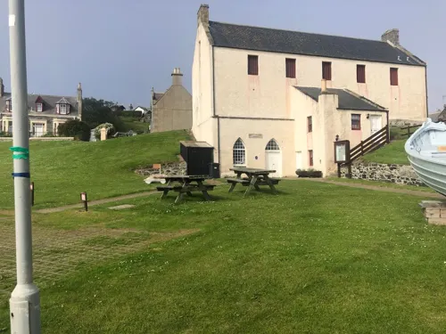
Highlights include Portsoy Salmon Bothy and Boyne Castle.
Weather in Portsoy
Forecast from MET Norway (CC BY 4.0). Full forecast
About Portsoy
Portsoy (Scottish Gaelic: Port Saoidh) is a small town in Aberdeenshire, Scotland. Historically, Portsoy was in Banffshire until 1975. The original name may come from Port Saoithe, meaning "saithe harbour". Portsoy is located on the Moray Firth coast of northeast Scotland, 50 miles (80 km) northwest of Aberdeen and 65 miles (105 km) east of Inverness.
From the Wikipedia article Portsoy (this version), under CC BY-SA 4.0.
Travel tips from other travellers: Portsoy on Wikivoyage (CC BY-SA 4.0).
Museums and landmarks4

Parks, trails and playgrounds2

Restaurants and cafes8

Where to stay5


History
Portsoy became a burgh of barony in 1550, under Sir Walter Ogilvie of Boyne Castle, and the charter was confirmed by parliament in 1581.
From the 16th century until 1975, Portsoy was in the civil and religious parish of Fordyce but was administered by its own Town Council and Banffshire County Council.
Following the commencement of the Local Government (Scotland) Act 1973, on 16 May 1975, lower Banffshire, including Portsoy, became part of Banff & Buchan District Council area which was, in turn, part of the larger Grampian Regional Council area.
A further reorganisation of local government in Scotland came via the Local Government etc. (Scotland) Act 1994. With effect from 1 April 1996, 32 unitary authorities came into existence covering the whole of Scotland, Banff & Buchan District Council and Grampian Regional Council ceased to exist and Portsoy came under the jurisdiction of the Aberdeenshire Council unitary authority.
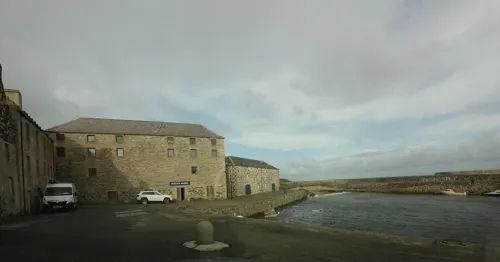
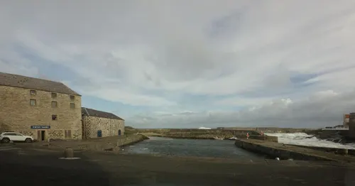
The "old harbour" dates to the 17th century and is the oldest on the Moray Firth. The "new harbour" was built in 1825 for the growing herring fishery, which at its peak reached 57 boats. The Old Town Hall in The Square was completed in 1798.
The following statistics for Portsoy in the years before the First World War were obtained from the annual reports of the Fishery Board.
From the History section of Portsoy on Wikipedia, under CC BY-SA 4.0.
More about Portsoy
Economy
Portsoy is known for local jewellery made from "Portsoy marble" (which is not marble, but rather serpentinite). The annual Scottish Traditional Boat Festival was started in 1993 to celebrate the 300th anniversary of the old harbour.
From the Wikipedia article Portsoy, under CC BY-SA 4.0.
Notable people from Portsoy
 John RichardsonScots-Quebecer and arguably Montreal's leading businessman (died 1831)Photo: Gerrit Schipper, Public domain
- Eoin JessScottish footballer (born 1970)
- Kevin SouterScottish footballer (born 1984)
- William BoydScottish Canadian pathologist (1885–1979)
- Tommy Duncanassociation football player (born 1936)
- William Grant MurrayBritish art teacher, gallery curator and artist (1877–1950)
- Jimmy MacBeathScottish singer
Born in Portsoy, according to Wikidata (CC0). Each name links to its Wikipedia article.
Churches and places of worship6
Old Parish Church of St Talorgan and walled burial ground
Church · 2.5 mi
Shopping2
Schools, colleges and libraries2
Map of Portsoy
29 places. The map loads OpenStreetMap tiles when you open it.
Getting there and nearby towns
RAF Lossiemouth (LMO) is the nearest airport with scheduled flights listed in OpenStreetMap, 24 miles away.
- Rothes 22 mi southwest, about 35 min by car
- Elgin 23 mi west, about 38 min by car
- Fraserburgh 25 mi east, about 40 min by car
- Inverurie 30 mi southeast, about 48 min by car
- Ellon 32 mi southeast, about 51 min by car
- Peterhead 36 mi east, about 57 min by car
- Westhill 40 mi southeast, about 1 h by car
- Aberdeen 43 mi southeast, about 1 h 15 min by car
- Nairn 45 mi west, about 1 h 15 min by car
- Stonehaven 53 mi south, about 1 h 30 min by car
Drive times are estimates from straight-line distance, not routes.
Towns near Portsoy


Keep exploring
Local news
Headlines from INDB.
Reviews, tips and questions
Loading what members have shared...
Sources and licences
- GeoNames (CC BY 4.0): population, coordinates, regions and time zone
- Mapillary (see each image): photos
- OpenStreetMap contributors (ODbL 1.0): places, airports, map data
- Wikidata (CC0 1.0): elevation, founding date, time zone, website, landmarks and historic places
- Wikimedia Commons (see each image): photos
- Wikipedia (CC BY-SA 4.0): overview and history text
Photo credits
- Portsoy Old Harbor - Portsoy Marble and Warehouse, Lee.Klement, CC BY-SA 4.0
- Portsoy - panoramio, tormentor4555, CC BY-SA 3.0
- Portsoy, Old Harbour, Outer Wall, Lee.Klement, CC BY-SA 4.0
- Street-level photo, tallguy, CC BY-SA 4.0
- Street-level photo, tallguy, CC BY-SA 4.0
- Street-level photo, caz440, CC BY-SA 4.0
- Street-level photo, drnoble, CC BY-SA 4.0
- Street-level photo, tallguy, CC BY-SA 4.0
- Street-level photo, hobgoblin, CC BY-SA 4.0
- Street-level photo, toho, CC BY-SA 4.0
- Street-level photo, caz440, CC BY-SA 4.0
- Street-level photo, caz440, CC BY-SA 4.0
- Street-level photo, tallguy, CC BY-SA 4.0
- Street-level photo, caz440, CC BY-SA 4.0
- Street-level photo, hobgoblin, CC BY-SA 4.0
- Street-level photo, hobgoblin, CC BY-SA 4.0
- Street-level photo, hobgoblin, CC BY-SA 4.0
- Street-level photo, toho, CC BY-SA 4.0
- Street-level photo, tallguy, CC BY-SA 4.0
- Street-level photo, tallguy, CC BY-SA 4.0
- Street-level photo, caz440, CC BY-SA 4.0
Page built November 10, 2026. Spotted a mistake? Tell us or suggest a place.