


Why visit Tilbury
Townapedia lists 24 museums and landmarks, 10 parks and trails, 105 places to eat, 1 place to stay and 4 attractions in and around town.
Highlights include State Cinema, Theatre Royal, Gravesend, Milton Chantry and Tilbury Fort.
Weather in Tilbury
Forecast from MET Norway (CC BY 4.0). Full forecast
About Tilbury
Tilbury (or Tilbury Town) is a port town on the north bank of the Thames in the borough of Thurrock in Essex, England. The town was established as separate settlement near East and West Tilbury and Tilbury Fort in the late 19th century, on land that was mainly part of the parish of Chadwell St Mary. The Gravesend–Tilbury Ferry was an ancient and important crossing point. Tilbury is part of the Port of London with a major deep-water port which contributes to the local economy.
From the Wikipedia article Tilbury (this version), under CC BY-SA 4.0.
Things to do4

State Cinema
Cinema and theater · 1.9 mi
Former cinema and theatre in Grays, England
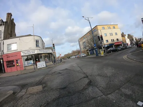
Theatre Royal, Gravesend
Cinema and theater · 1.4 mi
Theatre in the UK

Woodville Halls Theatre
Cinema and theater · 1.6 mi
Theatre in Gravesend, England

Museums and landmarks24


Cable Wharf
Monument and historic site · 1.3 mi
Cable Wharf in Northfleet, Kent, is a riverside housing development overlooking the Thames. Part of the Ebbsfleet Garden City project,...



12 more on the map.
Parks, trails and playgrounds10

Chafford Gorges Nature Park
Park · 3.1 mi
Essex Wildlife Trust Nature reserve

Restaurants and cafes105
Aero Coffee
Cafe · Coffee Shop · 1.5 mi
Rathmore Road, Gravesend
Mo-Fr 06:00-14:00; Sa 07:30-15:00; Su 08:00-15:00
Sie's Pie & Mash
Restaurant · Pie And Mash, British, Dessert, Salad, Brunch · 1.4 mi
1 Kempthorne Street, Gravesend


93 more on the map.
History
Tilbury's history is closely connected with its geographical location (see below). Its counterpart on the south bank of the River Thames, Gravesend, has long been an important communications link, and it was there that a cross-river ferry (see below) was connected, mainly due to the narrowness of the river at this point. In addition, Gravesend and Northfleet (also on the south shore) both became vitally important to shipping on the Thames: the former as the first port of call for foreign shipping bound for London, and the latter as a naval dockyard.
There is archaeological evidence of Roman occupation. At the time, sea-levels had dropped, making the marshes habitable. There may well have been a Roman settlement on the site of what is now Tilbury Docks. In the 12th century the river, which had hitherto consisted of difficult channels with uncharted shoals, was changed by the process of embanking the river and enclosing areas of marsh. This improved the river's flow, and also resulted in improved land resources on the marsh. It was nevertheless an unhealthy place in which to live; Daniel Defoe, who, in 1696, operated a tile and brick factory in the Tilbury marshes and lived in a nearby house, wrote about "the Essex ague".
In 1588 Queen Elizabeth I came ashore here to review her main army at the nearby village of West Tilbury (see Speech to the Troops at Tilbury).
Read more of the history
In 1852 an Act of Parliament had authorised the building of the London Tilbury and Southend Railway (LTSR), with a short spur to take advantage of the ferry over the Thames; a pier nearby was constructed for the steamboat traffic. The station was originally named Tilbury Fort and opened in 1854. The station was renamed Tilbury Riverside railway station in 1936.
A few houses were built for the railway workers, but it was not until the construction of Tilbury Docks (see below) that there was any settlement worthy of a name. Whilst the docks were being built, the thousands of workers were either provided with temporary accommodation or had to commute from surrounding villages and towns. As a result of overcrowding, more permanent housing was built once the docks were completed, including tenement blocks; but these were poorly constructed, and until the formation of Tilbury District Council (see below) the town was in a poor state, as it largely remained until 1918, when government funds were available to better the situation.
The 19th century Tilbury Hotel, a largely wood-built structure by the entrance to the docks, was destroyed by incendiary bombs during raids 3-4 February 1944, with only one fatality amongst the guests.
Tilbury–Gravesend Ferry has operated from very early times. A sketch-map of 1571 shows evidence of two jetties, the one on the north bank leading to a northward road crossing the marsh. There are also houses marked on the marsh itself, which became important for sheep grazing; and there is some evidence to suggest that the ferry was used for the cross-river transport of animals and wool. Although the 17th century drawing might suggest a boat too small for large consignments, the long-established Gravesend market encouraged such traffic, and a contemporary account suggests that one of the boats used was a hoy, a forerunner of the Thames sailing barge.
The curve and narrowness of the river here made it a suitable place to construct forts for the defence of London against foreign invaders. The first permanent fort at Tilbury was a D-shaped blockhouse built in 1539 by Henry VIII and initially called the "Thermitage Bulwark", because it was on the site of a hermitage dissolved in 1536. The Tilbury blockhouse was designed to cross-fire with a similar structure at New Tavern, Gravesend. During the Armada campaign (1588), the fort was reinforced with earthworks and a palisade, and a boom of chains, ships' masts and cables was stretched across the Thames to Gravesend, anchored by lighters. The fort was rebuilt under Charles I and is now owned by English Heritage.
From the History section of Tilbury on Wikipedia, under CC BY-SA 4.0.
More about Tilbury
Geography
Tilbury is on the north bank of the River Thames, where the river's meander has caused it to narrow to approximately 800 yards (730 metres) in width. The area to the north is one-time marshlands; to the north of that there is higher ground, where lie the villages of Chadwell St Mary, West and East Tilbury. The town lies to the north of the London-Southend railway line. Tilbury is located east of the capital of England, London.
The major landmarks are the docks, the cruise-ship landing stage, and the Tilbury Power Station. There are two churches in Tilbury: St John's (Church of England) and Our Lady Star of the Sea (Roman Catholic); there is also a Convent of Mercy. There is, in addition, a synagogue in Dock Road. The educational institutions in Tilbury include primary education, which are Lansdowne Primary School, St Mary's RC Primary School and Tilbury Manor Primary School renamed Tilbury Pioneer Academy when the school was taken over by the Gateway Learning Community, a collective of several schools in the local area. The last serve Infant and Nursery, as well as Junior children. Lying just outside the town is The Gateway Academy, the main secondary school for Tilbury, Chadwell St Mary and the eastern parts of Grays, as well as the adjoining Gateway Primary Free School. USP College (Palmers Campus) is in east Grays near Tilbury.
From the Wikipedia article Tilbury, under CC BY-SA 4.0.
Notable people from Tilbury
- Ernest BurgessAmerican sociologist (1886–1966)
- John Evansfootballer with Liverpool (1929-2004)
- Harry PellEnglish association football player
- Ron FoggEnglish professional footballer (born 1938)
- Derek FordBritish film director (1932-1995)
Born in Tilbury, according to Wikidata (CC0). Each name links to its Wikipedia article.
Where to stay1
Churches and places of worship19
St Thomas Of Canterbury Roman Catholic Church
Church · Catholic · 1.5 mi
16 East Thurrock Road, Grays
St Mary's Church
Church · Anglican · 1.4 mi
Linford Road, Chadwell St Mary
Shopping19
Gas and EV charging2
Schools, colleges and libraries15
Healthcare7
Map of Tilbury
206 places. The map loads OpenStreetMap tiles when you open it.
Getting there and nearby towns
Rochester Airport (RCS) is the nearest airport with scheduled flights listed in OpenStreetMap, 10 miles away.
- Basildon 8 mi northeast, about 14 min by car
- Upminster 8 mi northwest, about 13 min by car
- Bexley 9 mi west, about 15 min by car
- Gillingham 10 mi southeast, about 15 min by car
- Dagenham 10 mi northwest, about 16 min by car
- Wickford 12 mi northeast, about 20 min by car
- Barking 13 mi northwest, about 21 min by car
- Ilford 14 mi northwest, about 22 min by car
- Maidstone 15 mi southeast, about 24 min by car
- Southend-on-Sea 16 mi east, about 26 min by car
Drive times are estimates from straight-line distance, not routes.
Towns near Tilbury


Keep exploring
Local news
Headlines from INDB.
Reviews, tips and questions
Loading what members have shared...
Sources and licences
- GeoNames (CC BY 4.0): population, coordinates, regions and time zone
- Mapillary (see each image): photos
- OpenStreetMap contributors (ODbL 1.0): places, airports, map data
- Wikidata (CC0 1.0): elevation, founding date, time zone, website, landmarks and historic places
- Wikimedia Commons (see each image): photos
- Wikipedia (CC BY-SA 4.0): overview and history text
Photo credits
- Charlestons downstairs bar2, Peter Hammond, Public domain
- St Clements Thurrock, PJDelaney, Public domain
- St Georges Church, Agw19666, CC BY-SA 3.0
- New Tavern Fort magazines exterior, Prioryman, CC BY-SA 4.0
- Milton Chantry, Agw19666, CC BY-SA 3.0
- Gravesend Waterside Chapel (St. Andrew) (48956029503), Hugh Llewelyn from Keynsham, UK, CC BY-SA 2.0
- Gravesend library (33129523660), JuliaC2006 from Rochester, UK, CC BY 2.0
- NorthfleetBevansWM8800, Clem Rutter, Rochester, Kent., CC BY 2.5
- Tilbury Fort, Mervyn Rands, CC BY-SA 4.0
- Cable Wharf in Northfleet, Sunolafjagtenben-hur, CC0
- Gravesend Blockhouse R01, Marc Ryckaert, CC BY-SA 4.0
- Street-level photo, abeorch, CC BY-SA 4.0
- Street-level photo, tallguy, CC BY-SA 4.0
- Street-level photo, abeorch, CC BY-SA 4.0
- Street-level photo, abeorch, CC BY-SA 4.0
- Street-level photo, abeorch, CC BY-SA 4.0
- Street-level photo, RCCL, CC BY-SA 4.0
- Street-level photo, tallguy, CC BY-SA 4.0
- Street-level photo, tallguy, CC BY-SA 4.0
- Street-level photo, tallguy, CC BY-SA 4.0
- Street-level photo, abeorch, CC BY-SA 4.0
- Street-level photo, wasd42, CC BY-SA 4.0
- Street-level photo, tallguy, CC BY-SA 4.0

Page built November 10, 2026. Spotted a mistake? Tell us or suggest a place.