


Sheerness, United Kingdom
Sheerness is a town of 13,249 people in England, United Kingdom.
Why visit Sheerness
Townapedia lists 4 museums and landmarks, 4 parks and trails, 62 places to eat, 5 places to stay and 1 attraction in and around town.
Highlights include Sheppey Little Theatre, SS Richard Montgomery, Garrison Point Fort and Barton's Point Coastal Park.
Weather in Sheerness
Forecast from MET Norway (CC BY 4.0). Full forecast
About Sheerness
Sheerness () is a port town and civil parish beside the mouth of the River Medway on the north-west corner of the Isle of Sheppey in north Kent, England. With a population of 13,249, it is the second largest town on the island after the nearby town of Minster which has a population of 16,738.
From the Wikipedia article Sheerness (this version), under CC BY-SA 4.0.
Things to do1

Museums and landmarks4

SS Richard Montgomery
Monument and historic site · 2.0 mi
WWII American liberty ship


HMS Princess Irene
Monument and historic site · 3.1 mi
1914 ocean liner converted to minelayer
Sluice Gate Headwall and Culvert
Monument and historic site · 0.6 mi
Historic Victorian defensive canal sluice headwall with an A-shaped brick/stone wing wall and two concrete-filled brick culvert cylinders on top.
Parks, trails and playgrounds4

Barton's Point Coastal Park
Park · 1.2 mi
Park in United Kingdom
Marine Parade, Minster-on-Sea
sunrise-sunset


Restaurants and cafes62
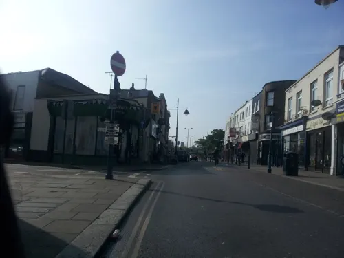
Mem's Mezze
Bar and pub · Turkish · 1.4 mi
Halfway Road, Minster-on-Sea
Mo off; Tu-Th,Su 15:00-22:00; Fr-Sa 15:00-23:00
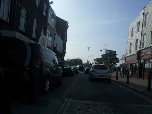
Raise Oriental Buffet
Restaurant · Oriental
10-14 High Street, Sheerness
Mo off; Tu-Th 12:00-15:00, 17:30-21:30; Fr-Su 12:00-15:00, 17:30-22:00

Heights of Alma
Bar and pub · 0.4 mi
A family friendly local pub.
1 Alma Street, Sheerness
Mo-Th, Su 12:00-00:00; Fr, Sa 12:00-01:00
Red Lion
Bar and pub · 0.6 mi
61 High Street, Sheerness
Mo-We,Su 12:00; Th-Sa 12:00-02:00

Miramar Sheerness
Restaurant · Chinese · 0.4 mi
Chinese takeaway
2 Clyde Street, Sheerness
Tu-Th, Su 17:00-23:30; Fr, Sa 17:00-00:00

The Ship on Shore
Bar and pub · 0.9 mi
155 Marine Parade, Sheerness
Mo-Su 08:00-18:00
Dragon Palace
Restaurant · Chinese · 1.4 mi
27-33 Minster Road, Minster-on-Sea
50 more on the map.
History
The first structure in what is now Sheerness was a fort built by order of Henry VIII to prevent enemy ships from entering the River Medway and attacking the naval dockyard at Chatham. In 1666 work began to replace it with a stronger fort. However, before its completion, this second fort was destroyed in 1667 by the Dutch Naval Fleet in their capture of the town, as part of what would be known as the raid on the Medway.
The Secretary to the Admiralty, Samuel Pepys, subsequently ordered the construction of Sheerness Dockyard as an extension to that at Chatham. There was no established settlement in the vicinity of Sheerness, so most of the workers were initially housed in hulks. By 1738, dockyard construction workers had built the first houses in Sheerness, using materials they were allowed to take from the yard. The grey-blue naval paint they used on the exteriors led to their homes becoming known as the Blue Houses. This was eventually corrupted to Blue Town (which is now the name of the north-west area of Sheerness lying just beyond the current dockyard perimeter). The modern town of Sheerness has its origins in Mile Town, which was established later in the 18th century at a mile's distance from the dockyard (Blue Town having by then filled the space available).
In 1797, discontented sailors in the Royal Navy mutinied just off the coast of Sheerness.
Read more of the history
By 1801 the population of the Minster-in-Sheppey parish, which included both Sheerness and the neighbouring town of Minster, reached 5,561. In 1816, one of the UK's first co-operative societies was started in Sheerness, chiefly to serve the dockyard workers and their families. The Sheerness Economical Society began as a co-operative bakery but expanded to produce and sell a range of goods. By the middle of the 20th century, the society had spread across the Isle of Sheppey and had been renamed the Sheerness and District Cooperative Society.
In the early 1820s a fire destroyed the old Blue Houses. New houses and a major redevelopment of the dockyard followed. A high brick wall and a moat were constructed around the yard to serve as a defence measure and remained in place until the end of the 19th century. As the settlement expanded eastwards, away from the dockyard and the Blue Houses, the wider area became known as Sheerness, taking its new name from the brightness or clearness of the water at the mouth of the River Medway. The rebuilt Dockyard contained many groundbreaking new buildings and structures; for example, completed in 1860 and still standing today, the Sheerness Boat Store was the world's first multi-storey building with a rigid metal frame.
In 1904 the RN established a torpedo school in Sheerness, with HMS Actaeon used as training hulk. The school closed in 1922.
From the completion of the dockyard until 1960 Sheerness was one of the bases of the Nore Command of the Royal Navy, which was responsible for protecting British waters in the North Sea. The command was named after the Nore sandbank in the Thames Estuary, about 3 miles (5 km) east of Sheerness.
In 1863, mains water was installed in the town, and the Isle of Sheppey's first railway station opened at the dockyard. Towards the end of the 19th century, Sheerness achieved official town status and formed its own civil parish, separate from Minster-in-Sheppey. The 1901 Census recorded the Sheerness parish as having 18,179 residents and 2,999 houses.
The town's low rainfall and ample sunshine made it popular as a seaside resort, with tourists arriving by steamboat and train. The Sheppey Light Railway opened in 1901, connecting the new Sheerness East station with the rest of the island. However, by 1950, lack of demand led to the railway's closure. The Sheerness and District Tramways, which opened in 1903, only lasted until 1917.
In 1944 the United States cargo ship SS Richard Montgomery ran aground and sank 1 mile (1.6 km) off the coast of Sheerness, with large quantities of explosives on board. Due to the inherent danger and projected expense, the ship and its cargo have never been salvaged; if the wreck were to explode, it would be one of the largest non-nuclear explosions of all time. A 2004 report published in New Scientist warned that an explosion could occur if sea water penetrated the bombs.
During the Second World War the Shoeburyness Boom, which ran across the Thames Estuary to protect shipping from submarine attack, ran from Sheerness to Shoeburyness in Essex. A similar structure was built along the same alignment in the early 1950s to protect against Soviet submarines. The Sheerness end of the boom was demolished in the 1960s. Sheerness was severely affected by the devastating North Sea flood of 1953, which completely flooded the Royal Naval dockyard and the town center.
In March 1960 the Royal Navy ceased operating the Sheerness dockyard and the Medway Port Authority took over the site for commercial use. The dockyard closure led to thousands of job losses, and most of the nearby houses and shops in the Bluetown area were eventually abandoned and demolished. By the 1961 census, the population of Sheerness had fallen to 13,691. The dockyard closure also led to the decline of the Sheerness and District Cooperative Society, as many of its members were dockyard workers. At the time, the society was the island's main retailer, but it has since been reduced to a few shops and been merged with a larger society.
The German writer Uwe Johnson lived in Sheerness for the last decade of his life, from 1974 to 1984, having left East Germany. A monograph by Patrick Wright, The Sea View Has Me Again, was published by Repeater Books in 2020.
From the History section of Sheerness on Wikipedia, under CC BY-SA 4.0.
More about Sheerness
Geography
Sheerness is in the north-west corner of the Isle of Sheppey in North Kent. To the north, sandy beaches run along the coast of the Thames Estuary. To the west, the outlet of the River Medway flows into the Estuary. An area of wetlands known as The Lappel lies between the river and the south-western part of town. Marshland lies to the south and the east. The main rock type of the Isle of Sheppey is London Clay, which covers most of North Kent. Along with most of the Kent coast, the uninhabited coastal areas of the island have been designated Sites of Special Scientific Interest, due to their wildlife and geological features.
The nearest towns to Sheerness are Minster, 1 mile (1.6 kilometres) to the east, and Queenborough, two miles (3.2 km) to the south. The villages of Minster-on-Sea and Halfway Houses are 1 mile (1.6 km) to the south-east, and the village of Grain is 2 mi (3 km) to the west, across the River Medway.
The main commercial and leisure areas of the town dominate the north coast, where there is easy access to the pleasure beach. The industrial areas are in the west, beside the wetlands and the River Medway. The Bluetown industrial area and the Port of Sheerness are in the north-western part of the town. The residential districts of Mile Town and Marine Town are in the central and the eastern areas respectively.
Economy
The Port of Sheerness is a significant feature of the Isle of Sheppey's economy. Covering more than 1.5 million square metres, it is one of the largest foreign car importers in the UK, and it handles thousands of tonnes of fruits and meat products from all over the world. Inexpensive land and good infrastructure, including a rail network that branches off the main passenger line, have attracted industries to the port area, including producers of pharmaceuticals, steel, sausages and garden gnomes.
The major employers are HBC Engineering Solutions, Sheerness Steel, Regis Furniture and The Bond Group - although HBC has closed and the Steel plant is currently closed but is currently being changed and upgraded ready for reopening. The steel mill was established in 1972, designed to recycle scrap steel into rods and coils. It survived a number of closure threats and changes of ownership; from 2003 it was operated by Thamesteel. Thamesteel went into administration in January 2012, with the loss of 350 jobs. Six months later, the plant was bought back by the former owners Al-Tuwairqi Group. As of October 2014 there were plans to reopen the plant as a rolling mill. PeelPort now own the site and are preparing it for reopening as a steel mill. The port has a seafarers' centre, which was refurbished in May 2015, and is operated by Apostleship of the Sea, a seafarers' charity.
Arts and culture
Sheerness's sand and shingle beach was awarded a European Blue Flag for cleanliness and safety. Flower gardens decorate the seafront, and a sea wall forms a promenade along the coast. The Sheppey Leisure Complex located near the beach contains a swimming pool and badminton, squash and tennis courts. Other sports clubs include Sheerness Town Bowls Club, Sheerness East Cricket Club, the Isle of Sheppey Sailing Club, Beachfields Skatepark, Sheerness East Table Tennis Club, Catamaran Yacht Club, and Sheerness Swimming Club and Lifeguard Corps. Sheerness Golf Club was founded in 1906, and has an 18-hole course just to the south-east of town.
The main football club on the island is Sheppey United. The club was formed in 1890 and has played in the Southern League, Kent League, Aetolian League, Greater London League, Metropolitan London League, Kent County League and the Southern Counties East Football League. Since 2022/23 the club has played in the Isthmian League having secured promotion in the 2021/22 season. Sports can be played for free at the town's recreation grounds at Beachfields Park, Festival Playing Field, and Seager Road Sports Ground.
Education
Until September 2009, The Isle of Sheppey was the only area in Kent to still have a middle school system. On the island, primary schools taught pupils from ages 4 to 9, middle schools 9–13 and secondary schools 13–18. Minster College in the neighbouring town of Minster was the only secondary school on the island. Sheerness had one middle school, Isle of sheppey Academy, with 800 pupils, although Danley Middle School and St George's Middle School were found in Halfway and Minster, respectively. In 2006, the Cheyne Middle School's Key Stage 2 performance ranked 322nd among Kent's 386 primary and middle schools. The town's primary schools are Richmond First School, Rose Street Primary School, St Edward's Roman Catholic Primary School and West Minster Primary School, all of which cover ages 4–11. Sheppey College, in Sheerness, is a branch of Canterbury College that provides a range of further education courses.
From the Wikipedia article Sheerness, under CC BY-SA 4.0.
Notable people from Sheerness
 Henry RussellEnglish pianist, baritone singer and composer (1812–1900)Photo: Street, Robert, 1796-1865, lithographer., Public domain
 Herbert PottsEnglish footballer (1878-?)Photo: Unknown author Unknown author, Public domain
 Francis Eustace BakerBritish diplomat, Governor of St. Helena, Ascension and Tristan da Cunha (born 1933)Photo: Peter Neaum, CC BY 2.0
- Edward James ReedBritish politician (1830-1906)
- Ted HarperEnglish footballer (1901-1959)
- Stanley Hookeraircraft engine engineer (1907-1984)
- Richard Carpenterprofessional footballer (born 1972)
- Albert CollinsEnglish footballer (1899-1969)
- Geoff AndersonEnglish footballer (born 1944)
- Owen OliverUK author (1863-1933)
- Gordon BoydEnglish actor (1922–2009)
- Charles Hezletgolfer (1891-1965)
Born in Sheerness, according to Wikidata (CC0). Each name links to its Wikipedia article.
Where to stay5
Sheppey Guest House
Motel and hotel · 1.4 mi
214 Queenborough Road, Minster-on-Sea
Churches and places of worship10
Sheerness Roman Catholic Church St Henry & St Elizabeth
Church · Roman Catholic
Broadway, Sheerness
Kingdom Hall of Jehovah's Witnesses
Church · Jehovahs Witness · 1.1 mi
Power Station Road, Minster-on-Sea
Shopping4
Schools, colleges and libraries8
Healthcare4
Map of Sheerness
102 places. The map loads OpenStreetMap tiles when you open it.
Getting there and nearby towns
London Southend Airport (SEN) is the nearest airport with scheduled flights listed in OpenStreetMap, 9 miles away.
- Southend-on-Sea 7 mi north, about 11 min by car
- Gillingham 10 mi west, about 16 min by car
- Whitstable 13 mi southeast, about 20 min by car
- Stanford-le-Hope 15 mi west, about 25 min by car
- Basildon 16 mi northwest, about 25 min by car
- Maidstone 16 mi southwest, about 26 min by car
- Wickford 16 mi northwest, about 25 min by car
- Snodland 16 mi southwest, about 25 min by car
- Tilbury 17 mi west, about 28 min by car
- Swanscombe 19 mi west, about 31 min by car
Drive times are estimates from straight-line distance, not routes.
Towns near Sheerness


Keep exploring
Local news
Headlines from INDB.
Reviews, tips and questions
Loading what members have shared...
Sources and licences
- GeoNames (CC BY 4.0): population, coordinates, regions and time zone
- Mapillary (see each image): photos
- OpenStreetMap contributors (ODbL 1.0): places, airports, map data
- Wikidata (CC0 1.0): elevation, founding date, time zone, website, landmarks and historic places
- Wikimedia Commons (see each image): photos
- Wikipedia (CC BY-SA 4.0): overview and history text
Photo credits
- Sheerness Clock Tower, Penny Mayes, CC BY-SA 2.0
- Cut Mark at Sheerness, Britannia Hotel, Ray Hutchings, CC BY-SA 4.0
- Bolt at Sheerness, Holy Trinity Church, Ray Hutchings, CC BY-SA 4.0
- Thames Richard Montgomery KC 7722 (Modified), Clem Rutter, Rochester, Kent, CC BY 3.0
- Grain4965, Clem Rutter, Rochester Kent, CC BY-SA 3.0
- Sheerness Medway Garrison Point KC 7646, Clem Rutter, Rochester, Kent, CC BY 3.0
- Street-level photo, paulbiv, CC BY-SA 4.0
- Street-level photo, paulbiv, CC BY-SA 4.0
- Street-level photo, paulbiv, CC BY-SA 4.0
- Street-level photo, paulbiv, CC BY-SA 4.0
- Street-level photo, paulbiv, CC BY-SA 4.0
- Street-level photo, paulbiv, CC BY-SA 4.0
- Street-level photo, paulbiv, CC BY-SA 4.0
- Street-level photo, paulbiv, CC BY-SA 4.0
- Street-level photo, paulbiv, CC BY-SA 4.0
- Street-level photo, paulbiv, CC BY-SA 4.0
- Street-level photo, paulbiv, CC BY-SA 4.0
- Street-level photo, paulbiv, CC BY-SA 4.0
- Street-level photo, paulbiv, CC BY-SA 4.0
- Street-level photo, paulbiv, CC BY-SA 4.0
- Street-level photo, paulbiv, CC BY-SA 4.0
- Street-level photo, paulbiv, CC BY-SA 4.0
Page built November 10, 2026. Spotted a mistake? Tell us or suggest a place.