


Why visit Rowhedge
Townapedia lists 12 museums and landmarks, 15 parks and trails, 32 places to eat, 3 places to stay and 3 attractions in and around town.
Highlights include Mercury Theatre, The Playhouse, Albert Hall and Camulodunum.
Weather in Rowhedge
Forecast from MET Norway (CC BY 4.0). Full forecast
About Rowhedge
Rowhedge is a village in the Colchester borough of Essex, England. It is located just over 3 miles (4.8 km) south-east of Colchester town centre and is part of the civil parish of East Donyland.
From the Wikipedia article Rowhedge (this version), under CC BY-SA 4.0.
Things to do3

Mercury Theatre
Cinema and theater · 3.1 mi
Theatre in Colchester, England

The Playhouse
Cinema and theater · 2.9 mi
Former theatre and cinema in Colchester, Essex, originally a garrison theatre, now a pub
Museums and landmarks12

Albert Hall
Museum · 3.0 mi
Building in Colchester, Essex, England, UK

Camulodunum
Monument and historic site · 2.9 mi
Roman castrum where Colchester, England now stands

Colchester Castle
Museum · 2.9 mi
Norman castle in Colchester, United Kingdom

Firstsite
Museum · 2.8 mi
Contemporary art gallery in Colchester, Essex, England

Hollytrees Museum
Museum · 2.9 mi
Grade I listed local museum in Colchester, Essex, England, UK

The Minories
Museum · 2.8 mi
Building in Colchester, Essex, England, UK
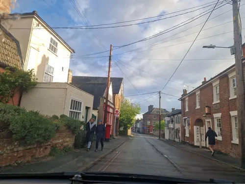
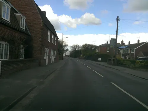
Old Workhouse
Monument and historic site · 1.1 mi
18th century workhouse
Colchester Road


Temple of Claudius in Colchester
Monument and historic site · 2.9 mi
Roman temple dedicated to deified Claudius in Colchester, United Kingdom
Parks, trails and playgrounds15


Bull Meadow
Park · 3.1 mi
1.4 hectare Local Nature Reserve in Colchester in Essex


Colchester Castle Park
Park · 3.1 mi
Park in Colchester, Essex, England, UK

Colne Local Nature Reserve
Park · 0.8 mi
Nature reserve in Essex, England

Salary Brook Local Nature Reserve
Park · 2.0 mi
Park in United Kingdom



3 more on the map.
Restaurants and cafes32
Fusion
Restaurant · Grill, Burger · 1.3 mi
Valley Road, Colchester
Mo-Fr 11:30-22:00; Sa-Su 12:00-22:00
The Rose and Crown
Bar and pub · 0.6 mi
The Quay
Sa-Fr 11:00-23:00; Su 12:00-22:30
Orange Tree Tapas
Restaurant · 0.6 mi
7-9 High Street, Wivenhoe
Mo-We 18:00-22:30; Th 18:00-23:00; Fr-Sa 18:00-23:30


20 more on the map.
History
The history of Rowhedge is connected directly to the River Colne; ship or boat building and the crewing of many vessels go back to the nineteenth century, maritime pursuits in general even further. The Essex earthquake of 22 April 1884, damaged several buildings in the village, even shaking a man off his ladder while he was repairing the village's school clock. Colchester Rowing Club was established in the village in 1896 when the population was about 1,100.
Up till 1918, Rowhedge could boast of its own brewery. A look at the map of the village at the turn of the nineteenth century on page 16 of Margaret Leather's book Saltwater Village (1977) reveals no fewer than six public houses; in 1970 there were four, now (2012), there are just two.
In response to a £1,000 prize being offered by the Daily Mail newspaper for the first Briton to fly a mile, an 'areohydroplane' (the term 'seaplane' was not yet in use), was designed and constructed by Jack Humphrey of Halstead in 1909. Several unsuccessful attempts at flight were made, both from the sea and land, after which the contraption was broken up; its floats ended their days in Rowhedge Ironworks in the Upper Yard.
Many village inhabitants were involved in fishing for oysters and scallops that came from as far afield as the French, Belgian and Dutch coasts and the carrying of salmon and lobster from Ireland and Norway to Britain.
Read more of the history
Fishing for sprats could be a relatively worthless business. If there were too many 'good' catches, the Rowhedge smacks had little choice but to sail to their home village and off-load their fish, which might be sold for just a few pennies for manure in the nearby fields.
One of the pre-First World War village characters was John (Jack) Spitty – salvager (saving goods by removing them from ship-wrecks), pub licensee, fisherman and smuggler. His use of a bedroom in the Royal Oak public house when he was the licensee to hide boxes of Dutch cigars was brought to a halt by his wife. She put her foot down after the pub was unsuccessfully searched by customs men. He would also sometimes swap sprats for coal at sea after a rumbustious verbal exchange with an obliging collier's skipper; the fuel was used in his smack's shrimp boiler.
During the First World War, a bridge was built across the river to enable members of the nearby Colchester garrison to board trains at Wivenhoe when on their way to Gallipoli. It was inspected by King George V in April 1916, but dismantled after the war.
Lifeboats and small oil tankers were constructed and maintained at the two yards, contributing towards the local economy in the 1920s and 30s. Many boats were fabricated in the Upper Yard for contracts in the Sudan. This took kit form; the various parts would be dismantled, crated or wired together, sent out to the African country and reassembled for use on the Nile.
The extraction of sand and gravel near the village began in the 1930s.
Demand for such building materials increased after the Second World War to repair bomb-damaged buildings, particularly in London. During that conflict, various types of construction, apart from ships, including then secret Mulberry Harbour components for the D-Day landings, were also built, both in Rowhedge and Wivenhoe.
There was no apprenticeship scheme in the yards in the 1950s; new staff, usually workers sons, were taken-on on an ad-hoc basis.
The port was at its busiest in the 1980s, being involved in the miners' strike (bringing in imported coal) and also handling anything from fish-meal to granite.
Up to the 1990s, Rowhedge was used for the importation of loads deemed too small for the larger ports or those ships that could not get up the river to Colchester. But with the containerisation of many loads, the writing was on the wall for the port; it closed officially in 2001. More recently, some fishing and leisure sailing are all that remain.
From the History section of Rowhedge on Wikipedia, under CC BY-SA 4.0.
More about Rowhedge
Geography
Rowhedge is on the right (west) bank of the tidal River Colne and is the first settlement downstream from Colchester. The small town of Wivenhoe is on the opposite bank, but slightly farther downstream; Fingringhoe is just to the south, on the opposite bank of the Roman River.
Throughout the 20th century, Rowhedge and Wivenhoe were linked by a ferry. A barrier, similar to the one on the River Thames which shields London, was completed on the Colne in 1994. Rowhedge, Wivenhoe and Colchester all benefit from its protection from flooding.
The main thoroughfare in Rowhedge, the High Street, runs parallel to the Colne. At one time, it connected two areas of ship and boat construction and maintenance – the Upper Yard to the north, and the Lower Yard to the south. These were often known as 'Up Street' and 'Down Street' respectively. With the decline of ship building, housing estates have been built in both areas.
From the Wikipedia article Rowhedge, under CC BY-SA 4.0.
Where to stay3
Churches and places of worship16
Shopping10
Gas and EV charging1
Schools, colleges and libraries11
Fingringhoe Church of England Voluntary Aided Primary School
School · Anglican · 0.8 mi
Church Road, Fingringhoe
Healthcare2
Map of Rowhedge
105 places. The map loads OpenStreetMap tiles when you open it.
Getting there and nearby towns
London Southend Airport (SEN) is the nearest airport with scheduled flights listed in OpenStreetMap, 22 miles away.
- Colchester 3 mi northwest, about 5 min by car
- Boxted 6 mi north, about 10 min by car
- Dedham 7 mi north, about 12 min by car
- Tolleshunt Knights 8 mi southwest, about 13 min by car
- Thorpe le Soken 9 mi east, about 15 min by car
- Clacton-on-Sea 10 mi southeast, about 16 min by car
- Frinton-on-Sea 13 mi east, about 21 min by car
- Witham 14 mi west, about 22 min by car
- Walton-on-the-Naze 14 mi east, about 22 min by car
- Maldon 14 mi southwest, about 23 min by car
Drive times are estimates from straight-line distance, not routes.
Towns near Rowhedge


Keep exploring
Local news
Headlines from INDB.
Reviews, tips and questions
Loading what members have shared...
Sources and licences
- GeoNames (CC BY 4.0): population, coordinates, regions and time zone
- Mapillary (see each image): photos
- OpenStreetMap contributors (ODbL 1.0): places, airports, map data
- Wikidata (CC0 1.0): elevation, founding date, time zone, website, landmarks and historic places
- Wikimedia Commons (see each image): photos
- Wikipedia (CC BY-SA 4.0): overview and history text
Photo credits
- Rowhedge Essex UK - View from River Bank Opposite in Wivenhoe, PeterSouthEast99, CC BY-SA 4.0
- The Roman Town Wall, Head Street to the Balkerne Gate 3, Maria, CC BY-SA 3.0
- Colchester-castle, George Gastin, CC BY-SA 3.0
- Firstsite art gallery in Colchester, Alexis Ip, CC BY-SA 4.0
- Holly Trees (museum) 2013-09-02 23-05-18, Jarry1250, CC BY-SA 3.0
- Wivenhoe Park, Essex, John Constable, Public domain
- Bull Meadow 3, Dudley Miles, CC BY-SA 4.0
- Cockaynes Wood 16, Dudley Miles, CC BY-SA 4.0
- AJM Colchester Castle Park Spring 004-2 April Tulips, Amandajm, CC BY-SA 4.0
- Colne Local Nature Reserve 3, Dudley Miles, CC BY-SA 4.0
- Salary Brook Local Nature Reserve 3, Dudley Miles, CC BY-SA 4.0
- Welsh Wood 9, Dudley Miles, CC BY-SA 4.0
- St James the Great, Colchester, Jarry1250, CC BY-SA 3.0
- Former Church of St Leonard at the Hythe, Maria, CC BY-SA 3.0
- Colchester New Church - Olaf 044, Olaf Hauptmann, Public domain
- Colchester St Martin's Church, Goosta, CC BY-SA 3.0
- University of Essex - Albert Sloman Library, Goosta, CC BY-SA 3.0
- The Church of St Mary, Wivenhoe, Maria, CC BY-SA 3.0
- Outside of Saint Helen's Chapel, CalderRC, CC BY-SA 4.0
- Mercury theatre Building Exterior - Photo by Mercury Theatre, MercuryTheatre, CC BY 4.0
- Albert Hall Building High Street Colchester Essex CO1 1JW, Spudgun67, CC0
- Summerhouse at the Minories, Jarry1250, CC BY-SA 3.0
- Street-level photo, petermead, CC BY-SA 4.0
- Street-level photo, edloach, CC BY-SA 4.0
- Street-level photo, edloach, CC BY-SA 4.0
- Street-level photo, edloach, CC BY-SA 4.0
- Street-level photo, edloach, CC BY-SA 4.0
- Street-level photo, edloach, CC BY-SA 4.0
- Street-level photo, petermead, CC BY-SA 4.0
- Street-level photo, edloach, CC BY-SA 4.0
- Street-level photo, edloach, CC BY-SA 4.0
- Street-level photo, petermead, CC BY-SA 4.0
- Street-level photo, petermead, CC BY-SA 4.0
- Street-level photo, petermead, CC BY-SA 4.0
- Street-level photo, petermead, CC BY-SA 4.0
- Street-level photo, edloach, CC BY-SA 4.0
- Street-level photo, edloach, CC BY-SA 4.0
- Street-level photo, petermead, CC BY-SA 4.0
- Street-level photo, edloach, CC BY-SA 4.0
- Street-level photo, edloach, CC BY-SA 4.0
- Street-level photo, edloach, CC BY-SA 4.0
- Street-level photo, petermead, CC BY-SA 4.0
- Street-level photo, edloach, CC BY-SA 4.0
- Street-level photo, petermead, CC BY-SA 4.0
- Street-level photo, petermead, CC BY-SA 4.0
- Street-level photo, edloach, CC BY-SA 4.0
- Street-level photo, petermead, CC BY-SA 4.0


Page built November 10, 2026. Spotted a mistake? Tell us or suggest a place.