


Saint Osyth, United Kingdom
Saint Osyth is a town of 2,093 people in England, United Kingdom.
Why visit Saint Osyth
Townapedia lists 3 museums and landmarks, 5 parks and trails, 10 places to eat, 5 places to stay and 2 attractions in and around town.
Highlights include West Cliff Theatre, St Osyth Museum, Watershed Studio and Colne Point nature reserve.
Weather in Saint Osyth
Forecast from MET Norway (CC BY 4.0). Full forecast
About Saint Osyth
St Osyth is an English village and civil parish in the Tendring District of north-east Essex, about five miles (eight kilometres) west of Clacton-on-Sea and 12 miles (19 km) southeast of Colchester. It lies on the B1027, Colchester–Clacton road. The village is named after Osgyth, a seventh-century saint and princess. Locally, the name is sometimes pronounced "Toosey".
From the Wikipedia article St Osyth (this version), under CC BY-SA 4.0.
Things to do2
West Cliff Theatre
Cinema and theater · 2.9 mi
Theatre in Clacton-on-Sea, England
Museums and landmarks3

Parks, trails and playgrounds5
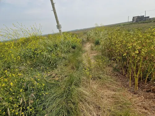
Colne Point nature reserve
Park · 2.4 mi
Essex Wildlife Trust nature reserve in the United Kingdom



Restaurants and cafes10


History
Before being renamed after the Abbey of St Osgyth built there in the 12th century, the village was called Chich (also spelt Chiche or Chick), from an Old English word cic meaning "bend", a reference to St Osyth Creek. Under King Canute/Cnut (reigned 1018–1035), Chich was assumed as part of the royal demesne and granted to Earl Godwin. By him it was given to Christ Church, Canterbury. After the Norman Conquest in 1066 it was transferred to the See of London.
The village is the location of an important medieval abbey, St Osyth's Priory, named after Osgyth, a semi-legendary Saxon princess and martyr. The village was an important mediaeval pilgrimage centre, based on the cult of the saint, and was for a time very wealthy. It has an impressive parish church, St Peter and St Paul, which is a landmark building of the rediscovery of brick as a material in English architecture – its interior is almost entirely built of this material, but to a design resembling earlier stone-built churches.
Thomas Darcy, 1st Baron Darcy of Chiche (1506–1558) is buried in the parish church.
For other historic buildings in St Osyth, see Historic England Archive.
Read more of the history
St Osyth village was created by Joseph Woolf, described as an evil overlord by Channel 4's Time Team programme, "Lost Centuries of St Osyth", (series 12 episode 9, first broadcast in February 2005). The programme sought to uncover the early origins of the village, which is now concentrated around the Priory, the surviving parts of which date from its establishment as an Augustinian ('Austin') monastery in the 12th century. But digging in the churchyard of St Peter and St Paul close to The Bury – the old marketplace – in the current village centre found no evidence of much settlement there before the 14th century, whereas fieldwalking and digging revealed a mass of earlier material along the north bank of St Osyth Creek, about one-half mile (one kilometre) south. The earlier name of the village (Chich – see above) always suggested this might be the case - information the programme failed to give. The programme found evidence that a massive high tide in the 1600s might have ended industrial activity in the original village site along the creek.
The village was a focus for the St Osyth witch persecutions in the 16th and 17th centuries. Fourteen women were tried and ten local women were hanged. In 1921 the skeletons of two women, one in chains, were discovered in the garden of a house in the village. One was claimed to be the witch Ursley Kempe, who was the first to be prosecuted. The skeletons became a local tourist attraction.
In the Napoleonic Wars two Martello Towers were built on the peninsula between the Colne Estuary and Brightlingsea Creek. One, Martello Tower 'A', survives at Stone Point and is now the East Essex Aviation Museum.
The peninsula was cordoned off and used by the Navy and Army in both world wars. Between 1942 and 1944 it was a landing-craft training base called HMS Helder. No 1 Martello Tower was a signal station and minefield control point, linked to the Navy at Brightlingsea.
From the History section of St Osyth on Wikipedia, under CC BY-SA 4.0.
More about Saint Osyth
Geography
St Osyth is claimed to be the driest recorded place in the United Kingdom, with an average annual rainfall of just 507 mm (20 inches).
The modern village lies on the coastward edge of the clay plateau which forms much of the topography of North East Essex, at an altitude of about 20 metres above mean sea level, but extends down towards the tidal St Osyth Creek. It overlooks extensive areas of rough pasture to the south and east - former marshes drained and reclaimed from the 17th century onward, which typically lie only one or two metres above mean sea level (some patches are below, especially near Jaywick). To the north-east the land was formerly heathland, and in common with much or the area around Colchester has been extensively quarried for sand and gravel.
St Osyth parish extends south from the village to the coast and includes the smaller villages of Point Clear and Lee-over-Sands.
Although much of the parish boundary is coastline, which does not need to be "beaten," St Osyth is one parish that keeps up the tradition of beating the bounds on Rogation days.
The Parish is one of the largest (in area) in Essex and extends inland almost to the village of Weeley four miles (six kilometres) northeast.
From the Wikipedia article St Osyth, under CC BY-SA 4.0.
Notable people from Saint Osyth
 William Nassau de Zuylestein, 4th Earl of RochfordBritish diplomatPhoto: Christian Friedrich Zincke, Public domain
Born in Saint Osyth, according to Wikidata (CC0). Each name links to its Wikipedia article.
Where to stay5
Churches and places of worship1
Schools, colleges and libraries1
Healthcare1
Map of Saint Osyth
28 places. The map loads OpenStreetMap tiles when you open it.
Getting there and nearby towns
London Southend Airport (SEN) is the nearest airport with scheduled flights listed in OpenStreetMap, 23 miles away.
- Clacton-on-Sea 3 mi east, about 5 min by car
- Great Bentley 4 mi north, about 6 min by car
- Thorpe le Soken 5 mi northeast, about 8 min by car
- Frinton-on-Sea 7 mi east, about 12 min by car
- Elmstead Market 7 mi northwest, about 11 min by car
- Rowhedge 7 mi northwest, about 11 min by car
- Walton-on-the-Naze 9 mi northeast, about 14 min by car
- Colchester 10 mi northwest, about 16 min by car
- Mistley 10 mi north, about 16 min by car
- Layer de la Haye 10 mi west, about 16 min by car
Drive times are estimates from straight-line distance, not routes.
Towns near Saint Osyth


Keep exploring
Local news
Headlines from INDB.
Reviews, tips and questions
Loading what members have shared...
Sources and licences
- GeoNames (CC BY 4.0): population, coordinates, regions and time zone
- Mapillary (see each image): photos
- OpenStreetMap contributors (ODbL 1.0): places, airports, map data
- Wikidata (CC0 1.0): elevation, founding date, time zone, website, landmarks and historic places
- Wikimedia Commons (see each image): photos
- Wikipedia (CC BY-SA 4.0): overview and history text
Photo credits
- Pickers Ditch Meadow 5, Dudley Miles, CC BY-SA 4.0
- SSPeter&Paul'sChurch StOsyth, JohnArmagh, Public domain
- St osyth 2002, Ronhjones, CC BY-SA 3.0
- Street-level photo, edloach, CC BY-SA 4.0
- Street-level photo, edloach, CC BY-SA 4.0
- Street-level photo, petermead, CC BY-SA 4.0
- Street-level photo, edloach, CC BY-SA 4.0
- Street-level photo, edloach, CC BY-SA 4.0
- Street-level photo, edloach, CC BY-SA 4.0
- Street-level photo, edloach, CC BY-SA 4.0
- Street-level photo, edloach, CC BY-SA 4.0
- Street-level photo, petermead, CC BY-SA 4.0
- Street-level photo, edloach, CC BY-SA 4.0
- Street-level photo, edloach, CC BY-SA 4.0
- Street-level photo, edloach, CC BY-SA 4.0
- Street-level photo, edloach, CC BY-SA 4.0
- Street-level photo, edloach, CC BY-SA 4.0
Page built November 10, 2026. Spotted a mistake? Tell us or suggest a place.