


Elmstead Market, United Kingdom
Elmstead Market is a town of 1,646 people in England, United Kingdom.
Why visit Elmstead Market
Townapedia lists 7 parks and trails, 5 places to eat, 1 place to stay and 2 attractions in and around town.
Highlights include Cockaynes Wood and Colne Local Nature Reserve.
Weather in Elmstead Market
Forecast from MET Norway (CC BY 4.0). Full forecast
About Elmstead Market
Elmstead Market is a village in the civil parish of Elmstead, in the Tendring district of Essex, England. It lies 2+1⁄4 miles (3.6 km) north-east of Wivenhoe and 4+1⁄4 miles (6.8 km) east of Colchester. It is on the A133 road which runs to Clacton-on-Sea to the south-east and Colchester to the west. In 2018 it had an estimated population of 1,684.
From the Wikipedia article Elmstead Market (this version), under CC BY-SA 4.0.
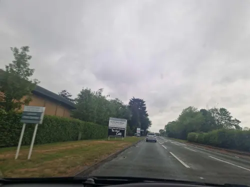
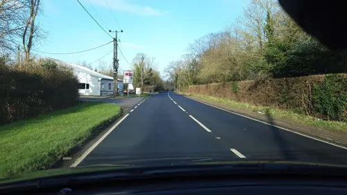
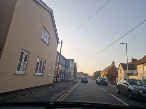
Photos of Elmstead Market


Things to do2
Parks, trails and playgrounds7


Colne Local Nature Reserve
Park · 2.0 mi
Nature reserve in Essex, England

Salary Brook Local Nature Reserve
Park · 2.2 mi
Park in United Kingdom



Restaurants and cafes5

Where to stay1

Churches and places of worship4
Shopping2
Gas and EV charging1
Schools, colleges and libraries3
Map of Elmstead Market
25 places. The map loads OpenStreetMap tiles when you open it.
Getting there and nearby towns
London Southend Airport (SEN) is the nearest airport with scheduled flights listed in OpenStreetMap, 25 miles away.
- Rowhedge 3 mi southwest, about 4 min by car
- Colchester 4 mi west, about 6 min by car
- Great Bentley 4 mi southeast, about 6 min by car
- Dedham 5 mi north, about 9 min by car
- Mistley 6 mi northeast, about 9 min by car
- Boxted 6 mi northwest, about 9 min by car
- Layer de la Haye 6 mi southwest, about 10 min by car
- Eight Ash Green 7 mi west, about 12 min by car
- Thorpe le Soken 8 mi east, about 12 min by car
- Clacton-on-Sea 9 mi southeast, about 15 min by car
Drive times are estimates from straight-line distance, not routes.
Towns near Elmstead Market


Keep exploring
Local news
Headlines from INDB.
Reviews, tips and questions
Loading what members have shared...
Sources and licences
- GeoNames (CC BY 4.0): population, coordinates, regions and time zone
- Mapillary (see each image): photos
- OpenStreetMap contributors (ODbL 1.0): places, airports, map data
- Wikidata (CC0 1.0): elevation, founding date, time zone, website, landmarks and historic places
- Wikimedia Commons (see each image): photos
- Wikipedia (CC BY-SA 4.0): overview and history text
Photo credits
- LWB165 Elmstead Market 261295, kitmasterbloke, CC BY 2.0
- Cockaynes Wood 16, Dudley Miles, CC BY-SA 4.0
- Colne Local Nature Reserve 3, Dudley Miles, CC BY-SA 4.0
- Salary Brook Local Nature Reserve 3, Dudley Miles, CC BY-SA 4.0
- Welsh Wood 9, Dudley Miles, CC BY-SA 4.0
- Wivenhoe Park, Essex, John Constable, Public domain
- Former Church of St Leonard at the Hythe, Maria, CC BY-SA 3.0
- University of Essex - Albert Sloman Library, Goosta, CC BY-SA 3.0
- DC62PAN-YX62FCA-5 030818 CPS (30473453708), Chris Sampson, CC BY 2.0
- DC62PAN-YX62FCA-4 030818 CPS (30473452858), Chris Sampson, CC BY 2.0
- Street-level photo, edloach, CC BY-SA 4.0
- Street-level photo, edloach, CC BY-SA 4.0
- Street-level photo, edloach, CC BY-SA 4.0
- Street-level photo, edloach, CC BY-SA 4.0
- Street-level photo, edloach, CC BY-SA 4.0
- Street-level photo, edloach, CC BY-SA 4.0
- Street-level photo, edloach, CC BY-SA 4.0
- Street-level photo, petermead, CC BY-SA 4.0
- Street-level photo, edloach, CC BY-SA 4.0


Page built November 10, 2026. Spotted a mistake? Tell us or suggest a place.