


Why visit Sale
Townapedia lists 10 museums and landmarks, 47 parks and trails, 142 places to eat, 9 places to stay and 8 attractions in and around town.
Highlights include Media City Footbridge, Salford Quays lift bridge, British Muslim Heritage Centre and Imperial War Museum North.
Weather in Sale
Forecast from MET Norway (CC BY 4.0). Full forecast
About Sale
Sale is a town in the Metropolitan Borough of Trafford of Greater Manchester, England. It lies on the south bank of the River Mersey, 2 miles (3 km) south of Stretford, 3 miles (5 km) north-east of Altrincham and 5 miles (8 km) south-west of Manchester. Sale lies within the historic county boundaries of Cheshire and became part of Greater Manchester in 1974. At the 2021 census, the Sale built-up area, as defined by the Office for National Statistics, had a population of 62,550.
From the Wikipedia article Sale, Greater Manchester (this version), under CC BY-SA 4.0.
Travel tips from other travellers: Sale on Wikivoyage (CC BY-SA 4.0).
Photos of Sale


Things to do8

Media City Footbridge
Bridge · 3.3 mi
Footbridge over the Manchester Ship Canal in the UK


The Lowry
Cinema and theater · 3.3 mi
Arts centre and museum in Salford, England, United Kingdom

Altrincham Garrick
Cinema and theater · 2.4 mi
Theatre in Altrincham, Greater Manchester, England

Museums and landmarks10

British Muslim Heritage Centre
Museum · 3.0 mi
Grade II* listed building in Manchester, UK

Imperial War Museum North
Museum · 3.2 mi
Military museum in Manchester, England

Gravestone of Richard Pankhurst (husband of Suffragette leader Emily Pankhurst)
Monument and historic site · 0.5 mi
Parks, trails and playgrounds47


Sale Water Park
Park · 1.1 mi
Public park in Sale Moor, Greater Manchester

Black Moss Covert Nature Reserve
Park · 3.2 mi
Nature reserve in Greater Manchester, England
Longford Park
Park · 2.1 mi
Park in Stretford, Greater Manchester, England, United Kingdom

35 more on the map.
Restaurants and cafes142
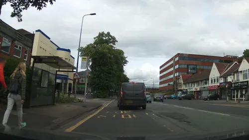
Venizia
Restaurant · Italian
66-68 Washway Road
Mo,We-Th 17:00-22:00; Fr-Sa 17:00-22:30; Su 16:00-21:00
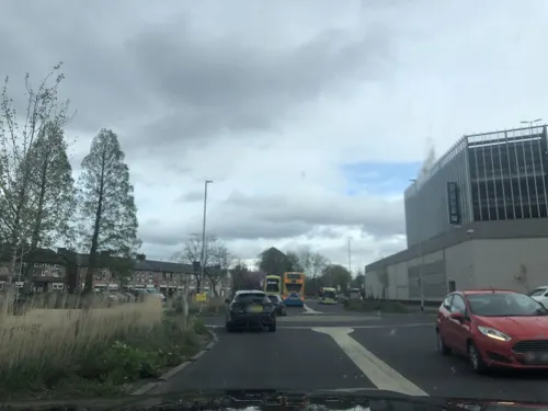

Gonbay
Restaurant · Cantonese · 0.6 mi
8 Brooklands Station Approach, Sale
Mo 10:30-22:00; We-Fr 10:30-22:00; Sa 10:30-23:00; Su 10:30-22:00

Kickback Coffee
Cafe · Coffee Shop · 0.9 mi
170 Northenden Road, Sale
Mo-Sa 08:00-16:00; Su 08:00-15:00
Petisco
Restaurant · Portuguese
Stanley Square, Sale
We-Th 17:00-23:00; Fr-Sa 12:00-23:30; Su 12:00-21:00
Cups Cake & More
Cafe · 0.8 mi
Extended hours start January 2025
41 Green Lane
Mo-Fr 09:00-16:00; Sa-Su 10:00-15:00


130 more on the map.
History
A flint arrowhead discovered in Sale suggests a prehistoric human presence at the location, but there is no further evidence of activity in the area until the Roman period. A 4th-century hoard of 46 Roman coins was discovered in Ashton upon Mersey, one of four known hoards dating from that period discovered within the Mersey basin. Sale lies along the line of the Roman road which runs between the fortresses at Chester (Deva Victrix) and York (Eboracum), via the fort at Manchester (Mamucium); the present-day A56 follows the route of the road through the town.
Some local field and road names, and the name of Sale itself, are Anglo-Saxon in origin, which indicates the town was founded in the 7th or 8th centuries. The Old English salh, from which "Sale" is derived, means "at the sallow tree", and Ashton upon Mersey means "village or farm near the ash trees". Although the townships of Sale and Ashton upon Mersey were not mentioned in the Domesday Book of 1086, that may be because only a partial survey was taken. The first recorded occurrences of Sale and Ashton upon Mersey are in 1199–1216 and 1260 respectively. The settlements were referred to as townships rather than manors, which suggests further evidence of Anglo-Saxon origins as townships were developed by the Saxons.
Read more of the history
The manor of Sale was one of 30 held by William FitzNigel, a powerful 12th century baron in north Cheshire. He divided it between Thomas de Sale and Adam de Carrington, who acted as Lords of the Manor on FitzNigel's behalf. On de Sale's death, his land passed to his son-in-law, John Holt; de Carrington's land passed into the ownership of Richard de Massey, a member of the Masseys who were Barons of Dunham. Sale descended through the Holt and Massey families until the 17th century, when their respective lands were sold. Sale Old Hall was built in about 1603 for James Massey, probably to replace a medieval manor house, and was one of the first buildings in northwest England to be made of brick. It was rebuilt in 1840 and demolished in 1920, but two buildings in its grounds have survived: its dovecote, now in Walkden Gardens, and its lodge, the latter now occupied by Sale Golf Club.
In 1745, Crossford Bridge, which dated back to at least 1367, was torn down. It was one of a series of bridges crossing the River Mersey destroyed by order of the government, to slow the advance of Jacobite forces during the Jacobite rising. The Jacobites repaired the bridge upon reaching Manchester, and used it to send a small force into Sale and Altrincham. Their intention was to deceive the authorities into believing that the Jacobites were heading for Chester. The feint was successful and the main Jacobite army later marched south through Cheadle and Stockport instead.
The extension of the Bridgewater Canal to Runcorn was completed as far as Sale by 1765, and transformed the town's economy by providing a quick and cheap route into Manchester for fresh produce. Farmers who took their wares to market in Manchester brought back night soil to fertilise the fields. Not everyone benefited from the canal however; several yeomen claimed that their crops were damaged by flooding from the Barfoot Bridge aqueduct.
The village of Cross Street was first referred to in 1586 and is believed to have originated around this time. A 1777 map shows Cross Street, on the site of the road now of the same name, divided between the townships of Sale and Ashton upon Mersey. The map also shows that Sale was spread out, mainly consisting of farmhouses around Dane Road, Fairy Lane, and Old Hall Road.
About 300 acres (120 hectares) of "wasteland" known as Sale Moor was enclosed in 1807, to be divided between the landowners in Sale. This was part of a nationwide initiative to begin cultivation of common land to lessen the food shortage caused by the Napoleonic Wars. Records of poor relief in the town start in 1808, a time when the region was in the grip of an economic depression. Poorhouses, where paupers could stay rent-free, were built in the early-19th century, reflecting the poor state of the local economy. In 1829, Samuel Brooks acquired 515 acres (208 hectares) of land in Sale – about a quarter of the township – from George Grey, 6th Earl of Stamford. The area later became known as Brooklands after the land owner.
The Manchester, South Junction and Altrincham Railway opened in 1849, and led to the middle classes using Sale as a commuter town, a residence away from their place of work. This resulted in Sale's population more than tripling by the end of the 19th century. The land in Sale Moor was the cheapest in the town because the soil was poor and difficult to cultivate, which was part of the reason the area was common land until the early 19th century. However, when the railway opened, Sale Moor was close to the station and became the most expensive area in Sale. Villas were built in Sale Moor, and a few in Ashton upon Mersey as the demand for land increased. They were often decorated with stained glass or different coloured bricks in an attempt to make them "mansions in miniature" for the aspiring middle class.
Pressure from an increasing population led to the town being supplied with amenities such as sewers, which were built in 1875–1880; and Sale was connected to the telephone network in 1888. As in the late-19th century, the early-20th century saw a great deal of construction work in Sale. The town's first swimming baths were built in 1914, and its first cinema, the Palace, was opened during the First World War. The end of the war in 1918 resulted in a rush of marriages, which highlighted a shortage of housing. The local councils of Sale and Ashton upon Mersey took the initiative of building council housing, and rented it to the local population at below market rates. By the outbreak of the Second World War in 1939, Sale had 594 council houses. The building programme was interrupted by the start of the war.
From the History section of Sale, Greater Manchester on Wikipedia, under CC BY-SA 4.0.
More about Sale
Geography
At 53°25′29″N 2°19′19″W (53.4246, −2.322), Sale lies to the north and south of the neighbouring towns of Altrincham and Stretford respectively and five miles (eight kilometres) south-west of Manchester city centre. The district of Wythenshawe is to the south-east. Sale is in the Mersey Valley, about 100 feet (30 m) above sea level on generally flat ground. The River Mersey, which runs just north of the town, is prone to flooding during heavy rains, so the Sale Water Park, close to the town's northern boundary, acts as an emergency flood basin.
Sale's local drift geology consists of sand and gravel deposited about 10,000 years ago, during the last ice age. The bedrock is Bunter sandstone in the west and Triassic waterstone in the east. United Utilities obtains the town's drinking water from the Lake District. Sale's climate is generally temperate, like the rest of Greater Manchester. The mean highest and lowest temperatures (13.2 °C (55.8 °F) and 6.4 °C (43.5 °F)) are slightly above the national average, while the annual rainfall (806.6 millimetres (31.76 in)) and average hours of sunshine (1394.5 hours) are respectively above and below the national averages.
Economy
During the medieval period, most of the land was used for growing crops and raising livestock such as cattle. The produce from arable farming would have been sufficient to support the local population, but the cattle would have been sold to the ruling classes. Agriculture provided the main source of employment for Sale's residents until the mid-19th century. Industry was slow to develop in the area, as in most of what would become Trafford. This was partly because of the reluctance of the two main land owners in the area, the Stamfords and the de Traffords, to invest. Although weaving was common in Sale during the late 17th and early 18th century, by 1851 only 4% of the population was employed in that industry.
Along with the rest of the region, Sale's economy during the early-19th century was weak, a state of affairs which persisted until the arrival of the railway in the middle of the century. Despite the dominance of agriculture, there was a growing service industry; Sale and Ashton upon Mersey experienced a growth in numbers employed in retail and domestic services in the first half of the 19th century. By 1901, fewer than 20% of Sale residents were employed in agriculture. Employment was available in workhouses for those who could not find work elsewhere. Sale was part of the Altrincham Union, which ran the nearest work house in Altrincham.
Arts and culture
Sale has three Grade II* listed buildings – two churches (St. Martin and St. John the Divine) and Ashton New Hall – and eighteen Grade II listed buildings. The cenotaph outside the town hall was designed by Ashton upon Mersey sculptor Arthur Sherwood Edwards and is a Grade II listed building. It commemorates the 400 men from Sale who died in the First World War and the 300 who died in the Second World War. The memorial consists of a statue of a mourning Saint George on top of a granite pedestal. Costing £600 (£32,000 as of 2025), it was funded by public subscription and unveiled in May 1925 in front of a crowd of 10,000.
The oldest surviving building in Sale is Eyebrow Cottage. Built around 1670, it was originally a yeoman farmhouse and is one of the earliest brick buildings in the area. Its name is derived from the decorative brickwork above the windows. It was built in Cross Street, which at the time was a separate village from Sale. Of the twenty-one conservation areas in Trafford, two are in Sale: part of Church Lane, Ashton-upon-Mersey, and Brogden Grove.
Education
Sale's first school was built in 1667 and was used until the first half of the 18th century. The second school in Sale was built some time in the 18th century, one of about 30 non-grammar schools founded in Cheshire around this time. By 1831, there were two private schools in Sale and one in Ashton upon Mersey, with the children's parents paying fees for their education. At the same time, there were also four Sunday schools in Sale and one in Ashton upon Mersey, operated by various religious denominations, including Congregationalists, Methodists and Unitarians. The first school-chapel built in Sale as part of a school was constructed by Primitive Methodists in 1839 and still survives. The second school-chapel in the town was St Joseph's Roman Catholic Church, built in 1866, and was replaced by the current school in 1899.
Trafford maintains a selective education system assessed by the 11 plus exam. Sale has one grammar school, two comprehensives and nineteen primary schools:
Sale Grammar School consists of two parts: one for 11- to 16-year-olds and 900 pupils, and the other a sixth form college with 300 students. The school was described in its 2006 Ofsted report as "outstanding with an outstanding sixth form".
From the Wikipedia article Sale, Greater Manchester, under CC BY-SA 4.0.
Notable people from Sale
 Phil JagielkaEnglish association football playerPhoto: Chensiyuan, CC BY-SA 4.0
 Ben MeeEnglish association football playerPhoto: joshjdss, CC BY 2.0
 Andy GoldsworthyBritish sculptor and photographer (born 1956)Photo: Bride of Frankenstein from..., CC BY 2.0
 David GrayBritish singer-songwriterPhoto: ( Kirk Stauffer ), CC BY-SA 3.0
 Eric CampbellBritish actor (1880–1917)Photo: Unknown author Unknown author, Public domain
 Ruth PoratChief financial officer of GooglePhoto: GES 2016, Public domain
 Karl PilkingtonEnglish television personality, social commentator, actor, author and former radio producerPhoto: Karl_Pilkington_2008.jpg : Rick..., CC BY 2.0
 Stanley Orme, Baron OrmeBritish politician (1923-2005)Photo: Jean-Louis Debaize, © European..., CC BY 4.0
 Yvonne FovargueBritish politician (born 1956)Photo: Richard Townshend, CC BY 3.0
 Harold BrakspearBritish architect (1870-1934)Photo: W.T. Pike (d. 1924), Public domain
 Joanne Morleyprofessional golferPhoto: Wojciech Migda ( wmigda ), CC BY-SA 3.0
- Robert BoltEnglish playwright (1924–1995)
Born in Sale, according to Wikidata (CC0). Each name links to its Wikipedia article.
Where to stay9
Churches and places of worship30
Shopping25
Gas and EV charging7
Schools, colleges and libraries33
Healthcare11
Map of Sale
250 places. The map loads OpenStreetMap tiles when you open it.
Getting there and nearby towns
Manchester Airport (MAN) is the nearest airport with scheduled flights listed in OpenStreetMap, 6 miles away.
- Stretford 2 mi north, about 3 min by car
- Timperley 2 mi south, about 3 min by car
- Urmston 2 mi northwest, about 3 min by car
- Hale 3 mi south, about 5 min by car
- Didsbury 4 mi east, about 6 min by car
- Irlam 4 mi west, about 7 min by car
- Salford 5 mi north, about 7 min by car
- Manchester 5 mi northeast, about 8 min by car
- Swinton 5 mi north, about 8 min by car
- Stockport 7 mi east, about 11 min by car
Drive times are estimates from straight-line distance, not routes.
Towns near Sale


Keep exploring
Local news
Headlines from INDB.
Reviews, tips and questions
Loading what members have shared...
Sources and licences
- GeoNames (CC BY 4.0): population, coordinates, regions and time zone
- Mapillary (see each image): photos
- OpenStreetMap contributors (ODbL 1.0): places, airports, map data
- Wikidata (CC0 1.0): elevation, founding date, time zone, website, landmarks and historic places
- Wikimedia Commons (see each image): photos
- Wikipedia (CC BY-SA 4.0): overview and history text
Photo credits
- Arriva NW Dart Paladin in Sale, Quackdave, Public domain
- Bank at Sale light, Sale, Cheshire (4233793294), Adam Bruderer from Manchester, UK, CC BY 2.0
- Bank at Sale, Sale, Cheshire (closed) (4233019685), Adam Bruderer from Manchester, UK, CC BY 2.0
- Ryans Bar, Sale (4233027999), Adam Bruderer from Manchester, UK, CC BY 2.0
- Bulls Head, Sale, Cheshire (4233795108), Adam Bruderer from Manchester, UK, CC BY 2.0
- Former Cinema, Washway Road, Sale, Peter McDermott, CC BY-SA 2.0
- Cross st, Sale - panoramio, jlcwalker, CC BY-SA 3.0
- Sibson road, sale. Friars court on the left(red window frames). - panoramio, jlcwalker, CC BY-SA 3.0
- Side of Sale Town Hall 2008, Paul Whatley, CC BY-SA 2.0
- Salford quays swing bridge, Parrot of Doom, CC BY-SA 3.0
- Salford Quays Manchester, The original uploader was Dpaajones at English Wikipedia ., CC BY-SA 3.0
- LowryArtsCentre, Bernard Randall, CC BY-SA 3.0
- British Muslim Heritage Centre 1, KJP1, CC BY-SA 4.0
- Imperial War Museum 2008cropped, Imperial_War_Museum_2008.jpg : pit-yacker from UK derivative work: IxK85 ( talk ), CC BY-SA 2.0
- Birch Moss covert, Parrot of Doom, CC BY-SA 3.0
- SaleWaterPark640, Malleus Fatuorum at en.wikipedia, Public domain
- Ccwd, Ccwd, CC BY-SA 4.0
- St Margaret’s Church Dunham Rd Altrincham, ArcLight, CC BY-SA 3.0
- Stgeorgeschurch, Dave Smethurst, CC BY-SA 2.0
- Arriva NW Solo 679, Quackdave, Public domain
- Tesco car park top level - panoramio, Fix Computers, CC BY 3.0
- Tesco car park top level - panoramio (1), Fix Computers, CC BY 3.0
- Trafford Council Wards Numbered, The Vintage Feminist, CC BY-SA 4.0
- Walkden Gardens, The Dovecote - panoramio, deepeye, CC BY-SA 3.0
- Street-level photo, southglos, CC BY-SA 4.0
- Street-level photo, southglos, CC BY-SA 4.0
- Street-level photo, southglos, CC BY-SA 4.0
- Street-level photo, southglos, CC BY-SA 4.0
- Street-level photo, southglos, CC BY-SA 4.0
- Street-level photo, southglos, CC BY-SA 4.0
- Street-level photo, southglos, CC BY-SA 4.0
- Street-level photo, southglos, CC BY-SA 4.0
- Street-level photo, laye, CC BY-SA 4.0
- Street-level photo, southglos, CC BY-SA 4.0
- Street-level photo, southglos, CC BY-SA 4.0
- Street-level photo, southglos, CC BY-SA 4.0
- Street-level photo, julianlb, CC BY-SA 4.0
- Street-level photo, julianlb, CC BY-SA 4.0
- Street-level photo, southglos, CC BY-SA 4.0
- Street-level photo, southglos, CC BY-SA 4.0
- Street-level photo, technicalfault, CC BY-SA 4.0


Page built November 10, 2026. Spotted a mistake? Tell us or suggest a place.