


Why visit Urmston
Townapedia lists 4 museums and landmarks, 26 parks and trails, 165 places to eat, 7 places to stay and 7 attractions in and around town.
Highlights include Media City Footbridge, Salford Quays lift bridge, Imperial War Museum North and The Lowry.
Weather in Urmston
Forecast from MET Norway (CC BY 4.0). Full forecast
About Urmston
Urmston is a town in Trafford, Greater Manchester, England, which had a population of 41,731 at the 2021 Census. Historically in Lancashire, it is 5 miles (8.04672 km) southwest of Manchester city centre. The southern boundary is the River Mersey, with Stretford lying to the east and Flixton to the west. Davyhulme lies to the north of the town centre.
From the Wikipedia article Urmston (this version), under CC BY-SA 4.0.
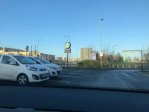
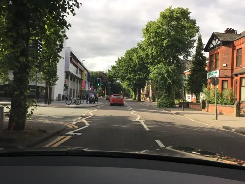
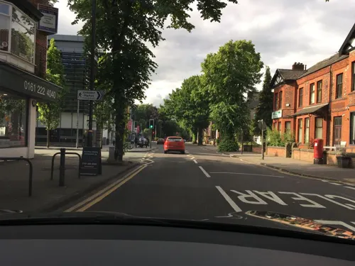
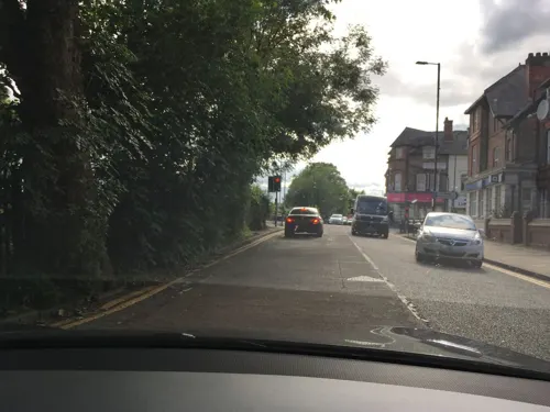
Photos of Urmston


Things to do7

Media City Footbridge
Bridge · 2.7 mi
Footbridge over the Manchester Ship Canal in the UK



Flixton Academy of Perfoming Arts
Cinema and theater · 0.5 mi


Museums and landmarks4

Imperial War Museum North
Museum · 2.7 mi
Military museum in Manchester, England

The Lowry
Museum · 2.8 mi
Arts centre and museum in Salford, England, United Kingdom

Parks, trails and playgrounds26


Longford Park
Park · 2.6 mi
Park in Stretford, Greater Manchester, England, United Kingdom

Sale Water Park
Park · 2.5 mi
Public park in Sale Moor, Greater Manchester




14 more on the map.
Restaurants and cafes165


Cups Cake & More
Cafe · 1.4 mi
Extended hours start January 2025
41 Green Lane
Mo-Fr 09:00-16:00; Sa-Su 10:00-15:00

153 more on the map.
History
In 1986 during an excavation by South Trafford Archaeological Group, fragments of Roman pottery were found in the area now occupied by the cemetery – previously the site of Urmston Old Hall – suggesting that there may have been a Roman settlement on the site. In the early 13th century, Lord Greenhalgh and his family lived at Highfield House (under what is now the M60 motorway).
Shortly after the Norman Conquest of England, between 1069 and 1070, William the Conqueror led a military campaign against the Saxon Earl Edwin, who ruled England north of the River Mersey. On the campaign's successful conclusion, William gave his kinsman Roger de Poictou all of the land between the River Mersey and the River Ribble. Part of this land was in turn given to Albert de Greslet, who towards the end of the 12th century, bestowed as much land as a team of oxen could plough in one-year on Orme Fitz Seward, the son of Edward Aylward. It is probable that the name Urmston is derived from Orme's Easton, or Ormestun, the "tun" or dwelling of Orme Fitz Seward.
Read more of the history
The Manor of Urmston was rented by a family using the local surname. The earliest known member of the Urmston family is Richard de Urmston, who was recorded in 1193–94 as giving 40 shillings "for having the king's good will". Orme Fitz Seward's land passed to Richard de Trafford in the 13th century. The de Trafford family later lost the land, but won it back as the result of a duel.
Urmston Old Hall was the home of the manorial lord, and a centre of power in the area during the Middle Ages. The Old Hall was completely rebuilt in brick and timber in the late 16th century. New Croft Hall, also in Urmston, was the residence of a wealthy freeman and may have been moated. Urmston was only one of three manors in Trafford to have had two medieval halls, the others being Hale and Timperley. Neither of the halls has survived to the present day. The modern-day descendants of the original inhabitants are still living locally, Both Lord M Gatward Snr and Jnr still reside in the area and can often be seen on horseback riding through their land close to the centre.
Farming was the main occupation in Urmston until the early 19th century, when weaving became a significant source of employment, although this later declined due to competition from large industry. In 1848, the population was recorded as being 771, with around 80% of the land being farmed. The opening of the Cheshire Lines Railway in 1873 allowed the town to grow as a commuter town: between 1871 and 1901 the population grew by over 650%, from 996 to 6,594. By 1901, farming had virtually died out, and the town became a residence for the middle classes.
In 1948 the Minister for Health, Aneurin Bevan, conducted the symbolic inauguration of the National Health Service at Davyhulme's Park Hospital, now renamed Trafford General Hospital.
The area was home to the first District heating system in England. In operation by 1948, a boiler house supplied hot water to 200 homes on a newly built housing estate.
The water was heated with low-grade fuels such as peat and coke, with houses built in groups of four for better efficiency.
A blue plaque commemorating the birth of the NHS on 5 July 1948 can be found on display at the hospital entrance. It was unveiled in 2018 by the Mayor of Greater Manchester and Andy Burnham to mark 70 years of the NHS.
From the History section of Urmston on Wikipedia, under CC BY-SA 4.0.
More about Urmston
Geography
Urmston occupies an area of 7.5 square miles (19.4 km2), at 53°26′55″N 2°22′29″W (53.4487, −2.3747); it is approximately 137 feet (42 m) above sea level at its highest point. The land is relatively flat, sloping gently from north to south. Urmston's climate is generally temperate, with few extremes of temperature or weather. The mean temperature is slightly above average for the United Kingdom. Annual rainfall and average amount of sunshine are both slightly below the average for the UK.
Urmston borders Davyhulme, Dumplington and Flixton, with the River Mersey forming the southern boundary. The most southerly part of Urmston lies within the flood plain of the River Mersey, an area known as Urmston Meadows, part of the Mersey Valley. Much work was carried out in the 1970s to canalise the Mersey, in an effort to speed up the flow of floodwater and thus reduce the risk of flooding. Upstream emergency floodbasins such as Sale Water Park, lying just to the east of Urmston, have also been constructed. The M60 Manchester orbital motorway passes through the northern half of Urmston, from southeast to northwest, and the M62 motorway lies just to the west. The Thirlmere Aqueduct also passes through the Urmston area.
Economy
The Trafford Centre, a large shopping and leisure complex, is at Dumplington. Some locals felt that it brought about the decline of Urmston Precinct, the town's central shopping area – dating back to the 1960s – where many units closed or became "pound shops". Beginning in 2007, Urmston Precinct was demolished and a £45 million redevelopment of the site got underway, to include 140,000 square feet (13,000 m2) of retail and leisure space and 144 apartments. This redevelopment project is now known as Eden Square, open between 2009 and 2012 and includes several chain stores long with independent retailers.
As of the 2001 UK census, Urmston had a possible workforce of approximately 32,996 people. The economic activity of residents in Urmston was 46.1% in full-time employment, 12.6% in part-time employment, 6.9% self-employed, 2.1% unemployed, 2.5% students with jobs, 3.0% students without jobs, 14.7% retired, 4.5% looking after home or family, 5.4% permanently sick or disabled and 2.2% economically inactive for other reasons. Urmston has a low rate of unemployment (2.1%) compared with Trafford (2.7%) and England (3.3%). The Office for National Statistics estimated that during the period of April 2001 to March 2002 the average gross weekly income of households in Urmston was £504 (£26,209 per year).
Arts and culture
Urmston Musical Theatre was formed as the Urmston and District Operatic Society in 1911. Its current president is actor Matthew Kelly, who was born in Urmston. It performs an adult main show in October with rehearsals running from June to October and a pantomime in January/February with rehearsals running from November to the date of the show. Both shows are performed at the Poolside Theatre within the Urmston Leisure Centre. Its youth section performs a show in May at St Antony's Catholic College in Urmston.
Canterbury Players is a local amateur dramatic society. Performances are given on stage at the Davyhulme (Wesley) Methodist Church located in Brook Road, Flixton.
In the mid-20th century there were 20 cinemas in Trafford, of which the only survivor is the New Curzon, in Princess Road. It opened in 1931 as the Curzon. It was converted to a twin cinema and bingo club in the 1970s, and re-opened under its present name of the New Curzon in 1980, after a £100,000 conversion. Since 2003, the building has been shared with Flixton Dance Studio. Recently, due to financial reasons, the New Curzon has been forced to close down.
Education
Along with the rest of Trafford, Urmston maintains a selective education system assessed by the 11-plus examination.
There are four primary, infant or junior schools in Urmston, including Urmston Primary School, together with an independent prep school, Abbotsford Preparatory School, in addition to four secondary schools, Urmston Grammar School, St Antony's Roman Catholic School, Wellacre Academy and Flixton Girls' School.
Urmston Grammar School is a specialist science and language college; the school was assessed as "outstanding" in its February 2006 Ofsted report. St Antony's Catholic College is a specialist Business and Enterprise College. In its October 2005 Ofsted report the school was assessed as "a good and improving school with some outstanding features".
From the Wikipedia article Urmston, under CC BY-SA 4.0.
Notable people from Urmston
 Robert ByrneBritish Roman Catholic bishop born 1956Photo: Fr James Bradley from Southampton, UK, CC BY 2.0
- Michael JohnsonEnglish footballer (1988-)
- David Whiteassociation football player from England (born 1967)
- Lynda BaronEnglish actress
- Frank BuckleyEnglish footballer and manager (1883-1964)
- Tony Youngformer English footballer (1952-2024)
- Stephanie WaringEnglish actress
- Eileen DerbyshireEnglish actress
- Judy LoeBritish actress
- Nick HaughtonFootballer (born 1994)
- Chris BuckleyEnglish footballer (1886-1973)
- Debbie MooreBritish model and business woman
Born in Urmston, according to Wikidata (CC0). Each name links to its Wikipedia article.
Where to stay7
Churches and places of worship30
Shopping29
Gas and EV charging10
Schools, colleges and libraries30
Healthcare13
Map of Urmston
250 places. The map loads OpenStreetMap tiles when you open it.
Getting there and nearby towns
Manchester Airport (MAN) is the nearest airport with scheduled flights listed in OpenStreetMap, 7 miles away.
- Irlam 3 mi west, about 5 min by car
- Timperley 3 mi south, about 6 min by car
- Salford 4 mi northeast, about 6 min by car
- Swinton 4 mi north, about 6 min by car
- Manchester 5 mi northeast, about 9 min by car
- Walkden 5 mi north, about 8 min by car
- Hale 5 mi south, about 8 min by car
- Didsbury 6 mi southeast, about 9 min by car
- Kearsley 6 mi north, about 10 min by car
- Tyldesley 6 mi northwest, about 10 min by car
Drive times are estimates from straight-line distance, not routes.
Towns near Urmston


Keep exploring
Local news
Headlines from INDB.
Reviews, tips and questions
Loading what members have shared...
Sources and licences
- GeoNames (CC BY 4.0): population, coordinates, regions and time zone
- Mapillary (see each image): photos
- OpenStreetMap contributors (ODbL 1.0): places, airports, map data
- Wikidata (CC0 1.0): elevation, founding date, time zone, website, landmarks and historic places
- Wikimedia Commons (see each image): photos
- Wikipedia (CC BY-SA 4.0): overview and history text
Photo credits
- Kobella Beauty Salon & Coral Bookmakers, Flixton Road Shops, Urmston, Anthony Shaw, Public domain
- Walsh's Barber Shop & Paul Birtles Estate Agents, Flixton Road Shops, Urmston, Anthony Shaw, Public domain
- Flixton Road Shops, Urmston, Anthony Shaw, Public domain
- Crofts Bank Road Shops, Urmston, Anthony Shaw, Public domain
- Urmston Rail Station, Roberturmston at English Wikipedia, Public domain
- Proost & The Cheese Court, Crofts Bank Road, Urmston, Anthony Shaw, Public domain
- Goodness Zero Waste, 10 Crofts Bank Road, Urmston, Anthony Shaw, Public domain
- Flixton Road Shops, Urmston - 52464724761, Anthony Shaw, Public domain
- Urmston railway station, Dave Smethurst, CC BY-SA 2.0
- Coming soon...Syriana (Levantine Cuisine), Crofts Bank Road, Urmston, Anthony Shaw, Public domain
- Syriana, 24 Crofts Bank Road, Urmston, Anthony Shaw, Public domain
- Higher Road Convenience Store, Million Dollar Nails & The Royal, Higher Road Shops, Urmston, Anthony Shaw, Public domain
- Santorini, Higher Road, Urmston (ceased trading), Anthony Shaw, Public domain
- Haldi Indian Restaurant, Victoria Parade, Urmston, Anthony Shaw, Public domain
- Locate Estate Agents, House of Finess & Kara's Cakes and Cafe, Victoria Parade, Urmston, Anthony Shaw, Public domain
- Salford quays swing bridge, Parrot of Doom, CC BY-SA 3.0
- Salford Quays Manchester, The original uploader was Dpaajones at English Wikipedia ., CC BY-SA 3.0
- Imperial War Museum 2008cropped, Imperial_War_Museum_2008.jpg : pit-yacker from UK derivative work: IxK85 ( talk ), CC BY-SA 2.0
- LowryArtsCentre, Bernard Randall, CC BY-SA 3.0
- Birch Moss covert, Parrot of Doom, CC BY-SA 3.0
- SaleWaterPark640, Malleus Fatuorum at en.wikipedia, Public domain
- All saints church urmston, Parrot of Doom, CC BY-SA 3.0
- St marys parish church eccles greater manchester, Parrot of Doom, CC BY-SA 3.0
- St georges church carrington greater manchester, Parrot of Doom, CC BY-SA 3.0
- St Luke's church, Salford, Plucas58, CC BY-SA 3.0
- St martins ashton upon mersey, Parrot of Doom, CC BY-SA 3.0
- Church of St Michael, Flixton, Greater Manchester, Parrot of Doom, CC BY-SA 3.0
- TraffordCentresat, Photograph: NASA, Public domain
- Barton Clough Primary School, Trafford, Marnanel, CC BY-SA 4.0
- Main Entrance of The Trafford Centre 05, No more horses, CC0
- Chill Factore2, Pit-yacker, CC BY-SA 3.0
- Entrance to Longford Park Stadium, David Dixon, CC BY-SA 2.0
- Walkden Gardens, The Dovecote - panoramio, deepeye, CC BY-SA 3.0
- Brownfield Site by Trafford Golf Centre, Stretford, Anthony Shaw, Public domain
- Abbotsfield Park Tennis Courts, Urmston, Anthony Shaw, Public domain
- Street-level photo, spatialphil, CC BY-SA 4.0
- Street-level photo, spatialphil, CC BY-SA 4.0
- Street-level photo, julianlb, CC BY-SA 4.0
- Street-level photo, julianlb, CC BY-SA 4.0
- Street-level photo, julianlb, CC BY-SA 4.0
- Street-level photo, spatialphil, CC BY-SA 4.0
- Street-level photo, julianlb, CC BY-SA 4.0
- Street-level photo, spatialphil, CC BY-SA 4.0
- Street-level photo, technicalfault, CC BY-SA 4.0
- Street-level photo, tonys999, CC BY-SA 4.0
- Street-level photo, southglos, CC BY-SA 4.0


Page built November 10, 2026. Spotted a mistake? Tell us or suggest a place.