


Stretford, United Kingdom
Stretford is a town of 41,953 people in England, United Kingdom.
Why visit Stretford
Townapedia lists 42 museums and landmarks, 57 parks and trails, 235 places to eat, 24 places to stay and 33 attractions in and around town.
Highlights include Blackfriars Bridge, Broughton Suspension Bridge, Ordsall Hall and Imperial War Museum North.
Weather in Stretford
Forecast from MET Norway (CC BY 4.0). Full forecast
About Stretford
Stretford is a market town in Trafford, in Greater Manchester, England, sited on flat ground between the River Mersey and the Manchester Ship Canal; the Bridgewater Canal bisects the town. The town is located 4 miles (6.4 km) south of central Manchester, 3 miles (4.8 km) south of Salford and 4 miles (6.4 km) north-east of Altrincham. Stretford borders Chorlton-cum-Hardy to the east, Moss Side and Whalley Range to the south-east, Hulme to the north-east, Urmston to the west, Salford to the north and Sale to the south. In 2011 it had a population of 46,910.
From the Wikipedia article Stretford (this version), under CC BY-SA 4.0.
Photos of Stretford


Things to do33

Blackfriars Bridge
Bridge · 3.7 mi
19th-century bridge in Greater Manchester, United Kingdom


Contact Theatre
Cinema and theater · 3.6 mi
Theatre in Manchester, England

Dancehouse Theatre
Cinema and theater · 3.5 mi
Dance theatre in Manchester, England, formerly a cinema

Gaiety Theatre, Manchester
Cinema and theater · 3.5 mi
Former theatre in Manchester, England (1884-1959)

Granada Studios Tour
Monument and historic site · 3.1 mi
Former theme park in Manchester, UK


Hulme Hippodrome
Cinema and theater · 2.9 mi
Theatre in Hulme, Manchester, England

Manchester Academy
Cinema and theater · 3.6 mi
Music venue in Manchester, England

Manchester Opera House
Cinema and theater · 3.3 mi
Theater in Quay Street, Manchester, England

Media City Footbridge
Bridge · 1.6 mi
Footbridge over the Manchester Ship Canal in the UK

Corporation Street Bridge
Bridge · 3.8 mi
Covered footbridge which crosses Corporation Street in Manchester city center, England
21 more on the map.
Museums and landmarks42

Ordsall Hall
Monument and historic site · 2.1 mi
322 Ordsall Lane, Salford
Mo-Th 10:00-16:00; Su 13:00-16:00

Imperial War Museum North
Museum · 1.5 mi
Military museum in Manchester, England
Trafford Wharf Road, Manchester
Mo-Su 10:00-17:00; Dec 24-26 off

The Lowry
Museum · 1.7 mi
Arts centre and museum in Salford, England, United Kingdom
Pier 8 The Quays, Salford

British Muslim Heritage Centre
Museum · 2.2 mi
Grade II* listed building in Manchester, UK


Chetham's Library
Museum · 3.9 mi
Library and museum in Manchester, United Kingdom

Cornerhouse
Museum · 3.5 mi
Former arts centre (gallery, cinemas) in Manchester, England

Deansgate railway station
Monument and historic site · 3.2 mi
Railway station in Manchester, England, UK

Great Northern Warehouse
Monument and historic site · 3.4 mi
Building in Manchester, England

Cube Gallery
Museum · 3.6 mi
Former architecture museum in Manchester, England
Lancashire Mining Museum
Museum · 2.8 mi
Mining museum in Greater Manchester, United Kingdom
30 more on the map.
Parks, trails and playgrounds57

Longford Park
Park · 1.1 mi
Park in Stretford, Greater Manchester, England, United Kingdom

Alexandra Park, Manchester
Park · 2.8 mi
Park in Whalley Range, United Kingdom


Peel Park
Park · 3.2 mi
Urban park in Salford, Greater Manchester, England, UK


Sale Water Park
Park · 1.4 mi
Public park in Sale Moor, Greater Manchester


Buile Hill Park
Park · 2.9 mi
Park in Seedley, Salford, Greater Manchester, England, UK
45 more on the map.
Restaurants and cafes235
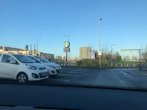

The Sedge Lynn
Bar and pub · 1.6 mi
21A Manchester Road, Manchester
Su-We 08:00-23:00, Th-Sa 08:00-24:00
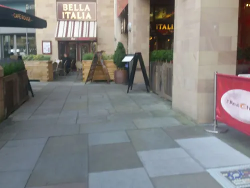
Banana Tree
Restaurant · Indonesian, Vietnamese, Malaysian, Thai · 1.7 mi
The Quays, Salford
Mo-Th,Su 12:00-22:00; Fr-Sa 12:00-23:00
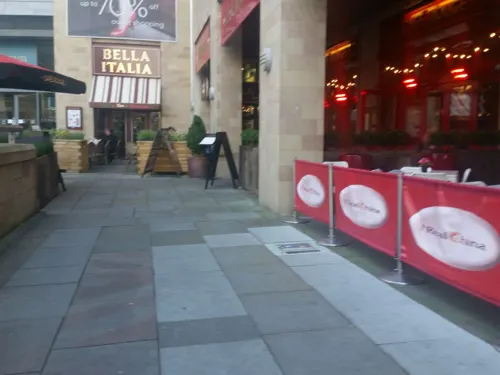
Brewski's Big Tray BBQ
Restaurant · Grill · 1.7 mi
The Quays, Salford
Mo-Th,Su 12:00-22:00; Fr-Sa 12:00-24:00
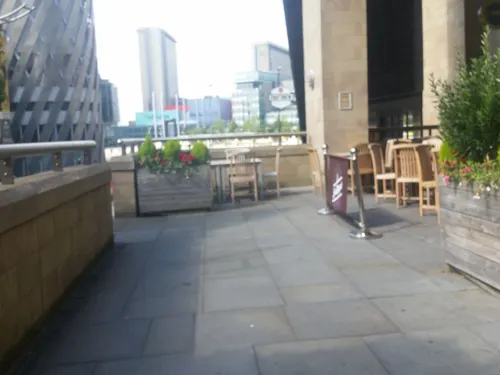
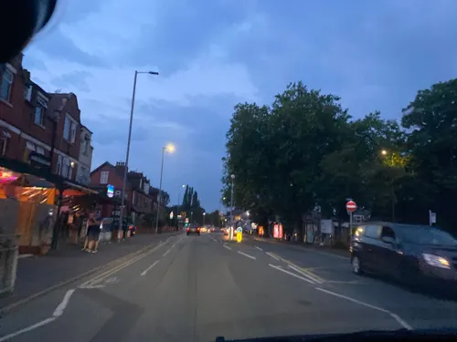
Off The Grid
Restaurant · Bar And Grill · 1.9 mi
366 Barlow Moor Road, Manchester
Tu-Th 18:00-23:00; Fr-Sa 17:00-23:00; Su 17:00-22:00
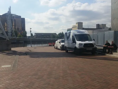
PizzaExpress
Restaurant · Pizza · 1.7 mi
The Quays, Salford
Mo-We 11:30-21:00; Th-Su 11:30-21:30; Fr-Sa 11:30-23:00
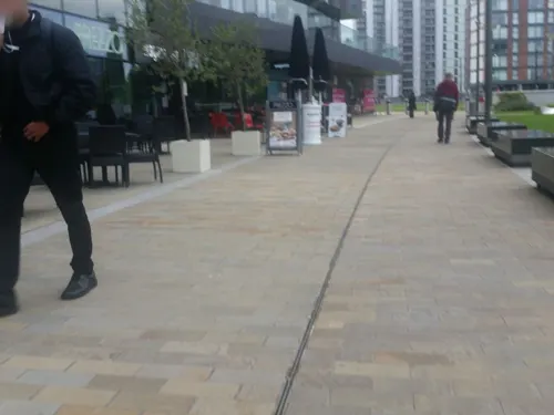

Blue Nile Café
Restaurant · Ethiopian · 0.8 mi
289 Talbot Road, Stretford
Tu-Fr 11:00-14:00; Tu 16:00-18:00; We-Fr 16:00-21:00; Sa-Su 11:00-21:00
Petisco
Restaurant · Portuguese · 1.8 mi
Stanley Square, Sale
We-Th 17:00-23:00; Fr-Sa 12:00-23:30; Su 12:00-21:00
223 more on the map.
History
The origin of the name Stretford is "street" (Old English strǣt) on a ford across the River Mersey. The principal road through Stretford, the A56 Chester Road, follows the line of the old Roman road from Deva Victrix (Chester) to Mamucium (Manchester), crossing the Mersey into Stretford at Crossford Bridge, built at the location of the ancient ford.
The earliest evidence of human occupation around Stretford comes from Neolithic stone axes found in the area, dating from about 2000 BC. Stretford was part of the land occupied by the Celtic Brigantes tribe before and during the Roman occupation, and lay on their border with the Cornovii on the southern side of the Mersey. By 1212, there were two manors in the area now called Stretford. The land in the south, close to the River Mersey, was held by Hamon de Mascy, while the land in the north, closer to the River Irwell, was held by Henry de Trafford. In about 1250, a later Hamon de Mascy gave the Stretford manor to his daughter, Margery. She in turn, in about 1260, granted Stretford to Richard de Trafford at a rent of one penny. The de Mascy family shortly afterwards released all rights to their lands in Stretford to Henry de Trafford, the Trafford family thus acquiring the whole of Stretford, since when the two manors descended together.
Read more of the history
The de Trafford family leased out large parts of the land, much of it to tenants who farmed at subsistence levels. Although there is known to have been a papermill operating in 1765, the area remained largely rural until the early 20th-century development of Trafford Park in the Old Trafford district north of the town. Until then Stretford "remained in the background of daily life in England", except for a brief cameo role during the Jacobite rising of 1745, when Crossford Bridge was destroyed to prevent a crossing by Bonnie Prince Charlie's army during its abortive advance on London; the bridge was quickly rebuilt.
Until the 1820s one of Stretford's main cottage industries was the hand-weaving of cotton. There were reported at one time to have been 302 handlooms operating in Stretford, providing employment for 780 workers, but by 1826 only four were still in use, as the mechanised cotton mills of nearby Manchester replaced handlooms. As Manchester continued to grow, it offered a good and easily accessible market for Stretford's agricultural products, in particular rhubarb, once known locally as Stretford beef. By 1836 market gardening had become so extensive around Stretford that one writer described it as the "garden of Lancashire"; in 1845 more than 500 tons of vegetables were being produced for the Manchester market each week. Stretford also became well known for its pig market and the production of black puddings, leading to the village being given the nickname of Porkhampton. A local dish, known as Stretford goose, was made from pork stuffed with sage and onions. During the 1830s, between 800 and 1,000 pigs a week were being slaughtered for the Manchester market.
Situated on the border with Manchester, Stretford became a fashionable place to live in the mid-19th century. Large recreation areas were established, such as the Royal Botanical Gardens, opened in 1831. The gardens were sited in Old Trafford on the advice of scientist John Dalton, because the prevailing southwesterly wind kept the area clear of the city's airborne pollution. In 1857, the gardens hosted the Art Treasures Exhibition, the largest art exhibition ever held in the United Kingdom. A purpose-built iron and glass building was constructed at a cost of £38,000 to house the 16,000 exhibits. The gardens were also chosen as a site for the Royal Jubilee Exhibition of 1887, celebrating Queen Victoria's 50-year reign. The exhibition ran for more than six months and was attended by more than 4.75 million visitors. The gardens were converted into an entertainment resort in 1907, and hosted the first speedway meeting in Greater Manchester on 16 June 1928. There was also greyhound racing from 1930, and an athletics track. The complex was demolished in the late 1980s, and all that remains is the entrance gates, close to what is now the White City Retail Park. The gates were designated a Grade II listed structure in 1987. The gates are not in their original position but were dismantled and turned through ninety degrees when the White City Retail Park was built.
The arrival of the Manchester Ship Canal in 1894, and the subsequent development of the Trafford Park industrial estate in the north of the town – the first planned industrial estate in the world – had a substantial effect on Stretford's growth. The population in 1891 was 21,751, but by 1901 it had increased by 40% to 30,436 as people were drawn to the town by the promise of work in the new industries at Trafford Park.
During the Second World War Trafford Park was largely turned over to the production of matériel, including the Avro Manchester heavy bomber, and the Rolls-Royce Merlin engines used to power both the Spitfire and the Lancaster. That resulted in Stretford being the target for heavy bombing, particularly during the Manchester Blitz of 1940. On the nights of 22/23 and 23/24 December 1940 alone, 124 incendiaries and 120 high-explosive bombs fell on the town, killing 73 people and injuring many more. Among the buildings damaged or destroyed during the war were Manchester United's Old Trafford football ground, All Saints' Church, St Hilda's Church, and the children's library in King Street. Smoke generators were set up in the north of the town close to Trafford Park in an effort to hide it from enemy aircraft, and 11,900 children were evacuated to safer areas in Lancashire, Cheshire, Derbyshire, and Staffordshire, along with their teachers and supervisors. A memorial to those residents who lost their lives in the bombing was erected in Stretford Cemetery in 1948, over the communal grave of the 17 unidentified people who were killed in the blitz of December 1940.
From the History section of Stretford on Wikipedia, under CC BY-SA 4.0.
More about Stretford
Geography
Stretford occupies an area of 4.1 square miles (10.6 km2), just north of the River Mersey, at 53°26′48″N 2°18′31″W (53.4466, −2.3086). The area is generally flat, sloping slightly southwards towards the river valley, and is approximately 150 feet (46 m) above sea level at its highest point. The most southerly part of Stretford lies within the flood plain of the River Mersey, and so has historically been prone to flooding. A great deal of flood mitigation work has been carried out in the Mersey Valley since the 1970s, with the stretch of the Mersey through Stretford canalised to speed up the passage of floodwater. Emergency floodbasins have also been constructed, Sale Water Park being a prominent local example, lying immediately to the south of Stretford.
Stretford comprises the local areas of Old Trafford, Firswood, Gorse Hill, and Trafford Park and represents the northeastern tip of Trafford. Its climate is generally temperate, with few extremes of temperature or weather. The mean temperature is slightly above average for the United Kingdom. Annual rainfall and average amount of sunshine are both slightly below the average for the UK.
Economy
Until the end of the 19th century Stretford was a largely agricultural village. The development of the Trafford Park industrial estate in the north of the town, beginning in the late 19th century, had a significant effect on Stretford's subsequent development. At its peak in 1945 the park employed an estimated 75,000 workers; housing and other amenities had to be constructed on what had previously been agricultural land. Trafford Park is still a very significant source of employment, containing an estimated 1,400 companies and employing about 44,000 people.
The main shopping centre was Stretford Mall in the commercial centre of Stretford, previously known as Stretford Arndale. It was opened in 1969 and changed its name in 2003. It is still (as of 2022) referred to as the "Stretford Arndale" on local bus timetables and recorded announcements. It closed on 28 Feb 2026, and is scheduled for demolition, to be replaced by a new King Street. Stretford Mall was built on the site of the original shopping centre in the former King Street. The Trafford Centre, a large shopping and leisure complex opened in September 1998, lies to the northwest of Stretford about 2.5 miles (4.0 km) away.
Arts and culture
Although Stretford town centre is busy during the day, there is very little in the way of a night-time economy. There are few restaurants and other entertainments except for a number of public houses and members-only social clubs. There are two public libraries: Greatstone Library, part of Stretford Sports Village, and Stretford Library, both run by Trafford Council.
The Stretford Pageant is an annual Rose Queen festival held on the last Saturday of June; the inaugural pageant was staged in 1919. There is a procession of decorated floats through the streets, collecting money for local charities and ending at Longford Park, where the Rose Queen is crowned. The tradition of the Rose Queen derives from an earlier event organised by St Peter's Church from 1909 until the pageant began in 1919. Various other entertainments are provided in the park on the day of the pageant, such as a fun fair and a car boot sale. Stretford Pageant, along with similar events in other parts of Trafford, is under threat because of the council's proposals to reduce funding and support for such events in the future.
Education
Along with the rest of Trafford, Stretford maintains a selective education system assessed by the 11-plus examination.
The proportion of pupils leaving Stretford Grammar School with five or more GCSEs at grades A*–C in 2006, was 98.3%, compared to an average of 66.7% for all secondary schools in Trafford and a national UK average of 61.3%. The proportion of students from minority ethnic backgrounds, and for whom English is an additional language, is much higher than the average. Stretford Grammar was awarded specialist Science College status in September 2005. The school was assessed as "good" in its April 2015 Ofsted report.
From the Wikipedia article Stretford, under CC BY-SA 4.0.
Notable people from Stretford
 Jay KayEnglish musicianPhoto: Raph_PH, CC BY 2.0
 John AlcockBritish captain in the Royal Navy and the Royal Air Force (1892-1919)Photo: Unknown author Unknown author, Public domain
 Walter Baldwin SpencerEnglish-Australian biologist and anthropologist. (1860–1929)Photo: Unknown author Unknown author, Public domain
 Tony LloydBritish Labour politician (1950–2024)Photo: ©House of Commons / Roger Harris, CC BY 3.0
 Martin FryEnglish singerPhoto: Photo by Christie Goodwin, CC BY-SA 4.0
 Neil WoodEnglish footballer (born 1983)Photo: Bryan Berlin, CC BY-SA 4.0
 Curtis ObengEnglish association football player (born 1989)Photo: Mattythewhite, CC BY-SA 3.0
 Joseph BancroftBritish surgeon (1836-1894)Photo: Unknown author Unknown author, Public domain
 John ComerBritish actor (1924-1984)Photo: RexGregorian, CC BY-SA 4.0
 Frances LennonBritish artist (1912-2015)Photo: RexGregorian, Public domain
- Ian CurtisBritish musician (1956–1980)
- L. S. LowryBritish visual artist (1887–1976)
Born in Stretford, according to Wikidata (CC0). Each name links to its Wikipedia article.
Where to stay24
Churches and places of worship71
Shopping80
Gas and EV charging23
Schools, colleges and libraries63
Healthcare25
Rosamund Street Medical Centre
Clinic and pharmacy · 1.5 mi
Rosamund Street, Weatherfield
Map of Stretford
250 places. The map loads OpenStreetMap tiles when you open it.
Getting there and nearby towns
Manchester Airport (MAN) is the nearest airport with scheduled flights listed in OpenStreetMap, 7 miles away.
- Urmston 2 mi west, about 2 min by car
- Salford 3 mi north, about 5 min by car
- Manchester 4 mi northeast, about 6 min by car
- Timperley 4 mi south, about 6 min by car
- Swinton 4 mi north, about 6 min by car
- Didsbury 4 mi southeast, about 7 min by car
- Irlam 4 mi west, about 7 min by car
- Hale 5 mi south, about 8 min by car
- Walkden 6 mi northwest, about 9 min by car
- Prestwich 6 mi north, about 10 min by car
Drive times are estimates from straight-line distance, not routes.
Towns near Stretford


Keep exploring
Local news
Headlines from INDB.
Reviews, tips and questions
Loading what members have shared...
Sources and licences
- GeoNames (CC BY 4.0): population, coordinates, regions and time zone
- Mapillary (see each image): photos
- OpenStreetMap contributors (ODbL 1.0): places, airports, map data
- Wikidata (CC0 1.0): elevation, founding date, time zone, website, landmarks and historic places
- Wikimedia Commons (see each image): photos
- Wikipedia (CC BY-SA 4.0): overview and history text
Photo credits
- Trafford-town-hall3, Parrot of Doom, CC BY-SA 3.0
- Former Fairburn House and Blackfriars Bridge, Manchester, Stephen Richards, CC BY-SA 2.0
- Broughton bridge, Richerman, CC BY-SA 3.0
- Contact Theatre 2009, Pit-yacker, CC BY-SA 3.0
- Dancehouse, Pit-yacker at English Wikipedia ( Original text: en:User:Pit-yacker ), CC BY-SA 2.5
- Gaiety Theatre, Arthur Derbyshire (1839-1908), Public domain
- Granada Studios, Pit-yacker at English Wikipedia ( Original text: en:User:Pit-yacker ), CC BY-SA 2.5
- Hanging Bridge 1892, Unknown author Unknown author, Public domain
- Hulme Hippodrome, Warwick Street. From the corner., No essential nature, CC BY-SA 3.0
- Manchester Academy 3, Photograph by Mike Peel ( www.mikepeel.net )., CC BY-SA 4.0
- Opera House (Manchester), Tim Green from Bradford, CC BY 2.0
- Salford quays swing bridge, Parrot of Doom, CC BY-SA 3.0
- Imperial War Museum 2008cropped, Imperial_War_Museum_2008.jpg : pit-yacker from UK derivative work: IxK85 ( talk ), CC BY-SA 2.0
- LowryArtsCentre, Bernard Randall, CC BY-SA 3.0
- British Muslim Heritage Centre 1, KJP1, CC BY-SA 4.0
- Castlefield Gallery, Manchester, Marnanel, CC BY-SA 4.0
- Chetham's Library 2015 1, Photograph by Mike Peel ( www.mikepeel.net )., CC BY-SA 4.0
- Cornerhouse 2009, Pit-yacker, CC BY-SA 3.0
- Great Northern Warehouse from Quay street, Marc A Gibbs, CC BY-SA 4.0
- Alexandra Park, Manchester, Pit-yacker, CC BY-SA 3.0
- Birch Moss covert, Parrot of Doom, CC BY-SA 3.0
- Peel Park (1), Marnanel, CC BY-SA 3.0
- Costume Museum from Plattfields Park, Rusholmeruffian, CC BY-SA 3.0
- SaleWaterPark640, Malleus Fatuorum at en.wikipedia, Public domain
- All saints church urmston, Parrot of Doom, CC BY-SA 3.0
- Salford rc Cathedral, The_Cathedral_Church_of_St_John_the_Evangelist,_Chapel_Street,_Salford.jpg : Ian Roberts derivative work: Rabanus Flavus, CC BY-SA 2.0
- Ccwd, Ccwd, CC BY-SA 4.0
- Benkid77 St George's Church, Manchester 250709, Rept0n1x, CC BY-SA 3.0
- St marys parish church eccles greater manchester, Parrot of Doom, CC BY-SA 3.0
- Church of St Mary, Hulme, Julie Anne Workman, CC BY-SA 3.0
- Lancashire county cricket club entrance, Parrot of Doom, CC BY-SA 3.0
- TraffordCentresat, Photograph: NASA, Public domain
- Ordsall Hall 2014 01, Photograph by Mike Peel ( www.mikepeel.net )., CC BY-SA 4.0
- Hotel Football, Old Trafford, a Tribute Portfolio Hotel, Vanbasten 23, CC BY-SA 3.0
- The Sedge Lynn, Chorlton-cum-Hardy, Bill Boaden, CC BY-SA 2.0
- Holiday Inn Manchester-Mediacityuk, an Ihg Hotel, Vanbasten 23, CC BY-SA 3.0
- AC Hotel, Salford Quays, Marnanel, CC BY 4.0
- 2023 07 31 arne mueseler 00060-Verbessert-RR (53106651455), Arne Müseler from Salzburg, AT, CC BY-SA 2.0
- Main Entrance of The Trafford Centre 05, No more horses, CC0
- Imperial War Museum North view 9, Photograph by Mike Peel ( www.mikepeel.net )., CC BY-SA 4.0
- Deansgate railway station in 2008, George Groutas from Idalion, Cyprus, CC BY 2.0
- Entrance to Longford Park Stadium, David Dixon, CC BY-SA 2.0
- Piccadilly Gardens, Manchester, Unknown author, Public domain
- Walkden Gardens, The Dovecote - panoramio, deepeye, CC BY-SA 3.0
- Street-level photo, technicalfault, CC BY-SA 4.0
- Street-level photo, spatialphil, CC BY-SA 4.0
- Street-level photo, southglos, CC BY-SA 4.0
- Street-level photo, mappo2, CC BY-SA 4.0
- Street-level photo, technicalfault, CC BY-SA 4.0
- Street-level photo, matth81, CC BY-SA 4.0
- Street-level photo, matth81, CC BY-SA 4.0
- Street-level photo, matth81, CC BY-SA 4.0
- Street-level photo, matth81, CC BY-SA 4.0
- Street-level photo, matth81, CC BY-SA 4.0
- Street-level photo, southglos, CC BY-SA 4.0
- Street-level photo, southglos, CC BY-SA 4.0
- Street-level photo, southglos, CC BY-SA 4.0
- Street-level photo, southglos, CC BY-SA 4.0
- Street-level photo, southglos, CC BY-SA 4.0
- Street-level photo, southglos, CC BY-SA 4.0
- Street-level photo, technicalfault, CC BY-SA 4.0
- Street-level photo, mappo2, CC BY-SA 4.0
- Street-level photo, matth81, CC BY-SA 4.0
- Street-level photo, julianlb, CC BY-SA 4.0
- Street-level photo, julianlb, CC BY-SA 4.0
- Street-level photo, julianlb, CC BY-SA 4.0


Page built November 10, 2026. Spotted a mistake? Tell us or suggest a place.