


Sandbank, United Kingdom
Sandbank is a town of 1,380 people in Scotland, United Kingdom.
Why visit Sandbank
Townapedia lists 11 museums and landmarks, 4 parks and trails, 3 places to eat, 2 places to stay and 6 attractions in and around town.
Highlights include Burgh Hall, Hafton House, Drybridge, Akka and Lazaretto Point War Memorial.
Weather in Sandbank
Forecast from MET Norway (CC BY 4.0). Full forecast
About Sandbank
Sandbank (Scottish Gaelic: an Oitir or Taigh a' Chladaich) is a village in Argyll and Bute, Scotland. It is located 2.5 miles (4 kilometres) north of Dunoon on the coastal A815 (low road) or the inland A885 (high road). It sits on the southern shore of the Holy Loch, a sea loch of the Firth of Clyde.
From the Wikipedia article Sandbank, Argyll (this version), under CC BY-SA 4.0.
Things to do6

Burgh Hall
Cinema and theater · 2.3 mi
Theatre and arts centre in Dunoon, Scotland

Hafton House, Drybridge
Bridge · 1.0 mi
Cast iron footbridge in Argyll and Bute, Scotland, UK, across a sunken driveway

Kilbride Bridge
Bridge · 2.5 mi
Bridge in Argyll and Bute, Scotland, UK, carries a minor road across Balgie Burn

Museums and landmarks11

Akka
Monument and historic site · 3.0 mi
Swedish cargo ship and Scottish dive site
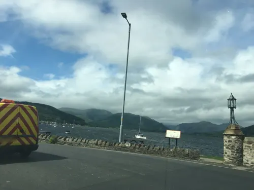
Lazaretto Point War Memorial
Monument and historic site · 0.7 mi
War memorial in the UK

Parks, trails and playgrounds4

Holy Loch Marina
Marina and boat launch
VHF Channel: 80/37(M) "Holy Loch Marina"
Rankin's Brae, Dunoon

Restaurants and cafes3


History
Alexander Robertson started repairing boats in a small workshop at Sandbank in 1876, and Alexander Robertson & Sons went on to become one of the foremost wooden boat builders on the River Clyde. The 'golden years' of Robertson's yard were in the early 1900s, when they started building classic 12- and 15-metre racing yachts. Robertsons was well known for the quality of its workmanship and was chosen to build the first 15-metre yacht designed by William Fife (Shimna, 1907). More than 55 boats were built by Robertsons in preparation for the World War I, and the yard remained busy even during the Great Depression in the 1930s, as many wealthy businessmen developed a passion for yacht racing on the Clyde. During World War II, the yard was devoted to Admiralty work, producing a wide range of large high-speed Fairmile Marine motor boats.
Sandbank was the site of the shore facilities of the U.S. Navy submarine base in the Holy Loch from 1961 to 1992, part of the U.S. Atlantic Fleet. It was, for thirty years, until the end of the Cold War, the home port of the U.S. Navy's Submarine Squadron 14. As of 2024, part of the old navy complex that was the former location of Morris & Lorimer's boat building yard, is a timber loading berth and marina.
From the History section of Sandbank, Argyll on Wikipedia, under CC BY-SA 4.0.
Where to stay2
Churches and places of worship9
Schools, colleges and libraries1
Map of Sandbank
36 places. The map loads OpenStreetMap tiles when you open it.
Getting there and nearby towns
Glasgow Airport (GLA) is the nearest airport with scheduled flights listed in OpenStreetMap, 21 miles away.
- Gourock 5 mi east, about 9 min by car
- Greenock 8 mi east, about 12 min by car
- Helensburgh 9 mi east, about 14 min by car
- Port Glasgow 11 mi east, about 17 min by car
- Largs 13 mi south, about 21 min by car
- Vale of Leven 14 mi east, about 23 min by car
- Dumbarton 15 mi east, about 24 min by car
- Johnstone 20 mi southeast, about 32 min by car
- Erskine 20 mi east, about 32 min by car
- Paisley 23 mi southeast, about 36 min by car
Drive times are estimates from straight-line distance, not routes.
Towns near Sandbank


Keep exploring
Local news
Headlines from INDB.
Reviews, tips and questions
Loading what members have shared...
Sources and licences
- GeoNames (CC BY 4.0): population, coordinates, regions and time zone
- Mapillary (see each image): photos
- OpenStreetMap contributors (ODbL 1.0): places, airports, map data
- Wikidata (CC0 1.0): elevation, founding date, time zone, website, landmarks and historic places
- Wikimedia Commons (see each image): photos
- Wikipedia (CC BY-SA 4.0): overview and history text
Photo credits
- Loading up, Sandbank, Richard Webb, CC BY-SA 2.0
- Burgh Hall Dunoon, Thomas Nugent, CC BY-SA 2.0
- Hafton House, william craig, CC BY-SA 2.0
- Bridge on Kilbride Road, Thomas Nugent, CC BY-SA 2.0
- Akka (1942) River Scheldt AS.1968.001.2355, Claes, Louis (fotograaf), Public domain
- Kilmunchurch, David Kelly, CC BY-SA 3.0
- Street-level photo, hobgoblin, CC BY-SA 4.0
- Street-level photo, joostjakob, CC BY-SA 4.0
- Street-level photo, ccbb7766, CC BY-SA 4.0
- Street-level photo, joostjakob, CC BY-SA 4.0
- Street-level photo, hobgoblin, CC BY-SA 4.0
- Street-level photo, ccbb7766, CC BY-SA 4.0
- Street-level photo, idzn, CC BY-SA 4.0
- Street-level photo, ccbb7766, CC BY-SA 4.0
- Street-level photo, ccbb7766, CC BY-SA 4.0
Page built November 10, 2026. Spotted a mistake? Tell us or suggest a place.