


Dumbarton, United Kingdom
Dumbarton is a town of 19,950 people in Scotland, United Kingdom.
Why visit Dumbarton
Townapedia lists 25 museums and landmarks, 6 parks and trails, 38 places to eat, 2 places to stay and 4 attractions in and around town.
Highlights include Dumbarton Rock, Overtoun Bridge, Dumbarton Castle and Langbank West, Crannog.
Weather in Dumbarton
Forecast from MET Norway (CC BY 4.0). Full forecast
About Dumbarton
Dumbarton (; Scottish Gaelic: Dùn Breatann [t̪um ˈpɾʲɛht̪ən̪ˠ]) is a town in West Dunbartonshire, Scotland, on the north bank of the River Clyde where the River Leven flows into the Clyde estuary. In 2006, it had an estimated population of 19,990.
From the Wikipedia article Dumbarton (this version), under CC BY-SA 4.0.
Travel tips from other travellers: Dumbarton on Wikivoyage (CC BY-SA 4.0).
Things to do4


Overtoun Bridge
Bridge · 1.8 mi
Road bridge in West Dunbartonshire, Scotland, UK, carries an estate driveway across Overtoun Burn

Museums and landmarks25

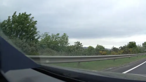

9th Battalion (The Dunbartonshire) Argyll and Sutherland Highlanders WW1 Memorial
Monument and historic site · 0.7 mi
13 more on the map.
Parks, trails and playgrounds6



Restaurants and cafes38
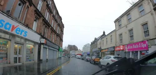
The Captain James Lang
Bar and pub
97-99 High Street, Dumbarton
Mo,Tu,We,Th,Su 08:00-24:00; Fr,Sa 08:00-25:00
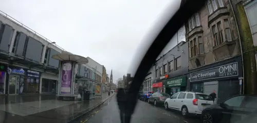
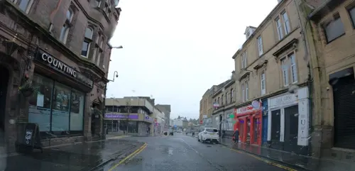

Costa
Cafe · Coffee Shop · 0.9 mi
Lomondgate Roundabout
Mo-Sa 07:00-21:00, Su 07:30-21:00

Brewers Fayre
Bar and pub · British · 1.0 mi
Mo-Fr 06:30-11:00,12:00-23:00; Sa 07:00-11:00,12:00-23:00; Su...

26 more on the map.
History
Dumbarton history goes back at least as far as the Iron Age and probably much earlier. It has been suggested that in Roman times Dumbarton was the "place of importance" named as Alauna in Ptolemy's historic map. Dumbarton is also sometimes associated with the little-known, and hard to place, Roman province of Valentia. However, more recent studies favour locations in England or Wales for this province. In post-Roman times the settlement at Dumbarton was known as Alcluith, there is a record in Irish chronicles of the death of Guret, rex Alo Cluathe ("king of Clyde Rock"), in AD 658.
Read more of the history
Rhydderch son of Tudwal was a powerful Christian King who reigned at Dumbarton in the late sixth century. He is recorded as fighting against the heathen Angles in Northumbria, and was the patron of St. Kentigern, "apostle of Strathclyde and founder of the bishopric of Glasgow". The fortress of Dumbarton was the stronghold of the kingdom of Alclud, and the centre of Breton power in northern Britain, for more than two centuries from the mid-seventh century, until the Vikings destroyed the fortress after a four-month siege in 870. The loss of the British power base led to the emergence of the new kingdom of Strathclyde, or Cumbria, with a major centre at Govan. The title "king of the Britons of Srath Clúade" was first used in 872. Dumbarton was later the county town of the county of Dunbartonshire, formerly known as Dumbartonshire. The name comes from the Scottish Gaelic Dùn Breatainn meaning "fort of the Brythons (Britons)", and serves as a reminder that the earliest historical inhabitants of Clydesdale spoke an early form of the Welsh language.
In September 1605 Chancellor Dunfermline reported to King James VI that inundations of the sea were likely to destroy and take away the whole town. It was estimated that the flood defences would cost 30,000 pounds Scots, the cost being levied nationwide.
A bridge over the River Leven had been proposed in 1682. The Old Dumbarton Bridge was eventually built in 1765 by John Brown of Dumbarton, at the site of a ferry crossing. It was constructed at the behest of the Duke of Argyll, who was anxious to obtain access to Glasgow from his estate at Rosneath. The bridge, with five segmental arches with rounded cutwaters, resulted in the extension of Dumbarton to West Bridgend. The bridge was substantially developed in 1884 and 1934. It is now B-listed and was refurbished in 2006.
During World War II Dumbarton was heavily bombed by the German air force. The Germans were targeting the shipyards, and the area in the vicinity of the yards was consequently hit, with Clyde and Leven Street being severely damaged. In an attempt to lure the German aircraft away from the shipyards, decoy lights were routinely placed on the Kilpatrick hills above the town, lights were set out on reservoirs to mimic those of the shipyards reflecting on the waters of the Leven and Clyde. The ploy was sometimes successful in diverting the bombers and many bombs fell harmlessly onto the moors and lochs. The Auchenreoch Muir 'Starfish' site above Dumbarton was part of a system of decoy fires operated by the RAF that used pyrotechnics to simulate the appearance of the incendiaries dropped by the German pathfinder aircraft, thereby diverting the bombers from their intended targets. 23 bomb craters are still identifiable in the area around the surviving control bunker as evidence of the success of the diversion.
The one time village and estate of Dumbuck now lie partly within the boundary of Dumbarton, while the remaining portion comprising the associated Dumbuck Hill and its large incorporated quarry (Dumbuck Quarry) are treated here together with the neighbouring village of Milton, as the next adjacent generally recognised locality today. In the Dumbarton portion, the Category B-listed Dumbuck House, originally constructed for Colonel Andrew Geils, was the original estate house and was converted into a hotel in the 20th century. It was destroyed in a fire in 2024 and subsequently demolished. For additional information regarding the Dumbuck estate, including mention of the somewhat bizarre Kosmoid Company that occupied the estate for a short while, refer the article on Andrew Geils. Information on the well known "Dumbuck Crannog" archaeological feature is presently included in the Wikipedia article for Milton Island.
Dumbarton Castle sits on Dumbarton Rock, a volcanic plug dating back 334 million years, at the east bank mouth of the River Leven, where it flows into the Clyde estuary.
The Castle has an illustrious history and many well-known figures from Scottish and British history have visited it. The castle was a royal fortress long before Dumbarton became a royal burgh; its ownership went from Scottish to English and back again. The castle was an important place during the Wars of Independence and was used to imprison William Wallace for a short time after his capture by the English. It was from here that Mary, Queen of Scots, was conveyed to France for safety as a child. Mary was trying to reach Dumbarton Castle when she suffered her final defeat at Langside. In later times, Queen Victoria and Queen Elizabeth II visited the castle.
Today, Dumbarton Rock and the castle are a scheduled monument; it has legal protection in order to maintain and conserve the site for the future. As such any sort of work on the rock is strictly regulated by the Scottish Government and activities such as climbing on the rock are forbidden. From the top of the castle can be seen both the River Clyde and Leven Grove Park.
Levengrove Park was developed in 1885 on grounds of the former Levengrove Estate by the Denny and McMillan families who owned shipbuilding companies with yards located adjacent to the Castle, and gifted to the town.
From the History section of Dumbarton on Wikipedia, under CC BY-SA 4.0.
More about Dumbarton
Geography
From 1975 Dumbarton lent its name to a local government district in the Strathclyde region of Scotland. In 1996 the administrative functions of this district transferred to the West Dunbartonshire and Argyll and Bute unitary councils (see Subdivisions of Scotland). West Dunbartonshire Council is based in modern offices within the old Dumbarton Burgh Hall in Church Street.
There is a Dumbarton constituency of the Scottish Parliament and a former Dumbarton constituency of the House of Commons.
Economy
From the mid 18th century to the early 19th century Dumbarton's main industry was glassmaking. As the glass industry declined the town became a major centre for shipbuilding and remained so well into the 20th century. There were many shipbuilding yards, although a number of them were later absorbed by larger yards. A great many ships were built in the town, the most famous of which is probably the Cutty Sark which was built by Scott & Linton, she was one of the final Tea Clippers to be built, and one of the fastest. The ship is the last survivor of its type and can be seen today at dry dock in Greenwich, London.
The last major Dumbarton shipyard was William Denny and Brothers which closed in 1963, and the remaining smaller yards followed over the next few decades. Until recently, the old Denny's shipyard tender The Second Snark was still in use on the Firth of Clyde as a passenger ferry and cruise boat. Denny's was an innovative company that had a reputation for research and development; high-pressure turbines and hull stabilisation were two areas where they were highly respected. They even built an early design of helicopter in 1909 and in their final years they were involved in hovercraft development in the form of the Denny D2 Hoverbus. A film clip of this vessel on its maiden trip to Oban exists in the Scottish Film Archive.
Arts and culture
There were at one stage two league football clubs from the town, Dumbarton Harp F.C and Dumbarton F.C (Also known as 'Sons of the Rock'). Dumbarton F.C. are the only league club in Dumbarton still in operation, playing in the Scottish Professional Football League at Scottish League Two level.
Dumbarton F.C play home games at the Dumbarton Football Stadium (known since 2018 as the C&G Systems Stadium for sponsorship reasons) adjacent to Dumbarton Rock. They won the 1882–83 Scottish Cup and are five times runners-up.
The Scottish League was formed in 1890 with Dumbarton as founding members. The first championship was shared between Dumbarton and Rangers, in the absence of a goal-difference rule to act as a tiebreaker.
There are seven bowling clubs in Dumbarton: Brock Bowling Club, Dixon BC, Dumbarton BC, Dumbuck BC, Eastfield BC, Rock BC and Townend BC.
The town is the birthplace of the motor-racing driver Sir Jackie Stewart OBE. He competed in Formula One between 1965 and 1973, winning three World Drivers' Championships. The Stewart Family owned and ran the garage at Dumbuck in Milton to the East of the town, the Garage later being taken over by Jackie's close friend John Lindsay.
Scottish poet Robert Burns was made freeman of Dumbarton. He refers to Dumbarton in a letter written on 7 July 1787.
Education
Two secondary schools are located in Dumbarton, namely Dumbarton Academy and Our Lady & St Patrick's High School. The town is also served by eight primary schools; Aitkenbar Primary, St. Michael's Primary, Knoxland Primary, Braehead Primary, St. Peter's Primary, St. Patrick's Primary and Dalreoch Primary.
From the Wikipedia article Dumbarton, under CC BY-SA 4.0.
Notable people from Dumbarton
 Jackie StewartScottish racing driverPhoto: David Merrett from Daventry, England, CC BY 2.0
 David ByrneScottish-American musician (born 1952)Photo: Raph_PH, CC BY 2.0
 Mountstuart ElphinstoneGovernor of Bombay, Scottish historian (1779-1859)Photo: Unknown author Unknown author, Public domain
 Matthew Stewart, 4th Earl of LennoxGrandfather of James VI and I, Regent of ScotlandPhoto: anonymous, Public domain
 Jimmy McCullochScottish musician (1953–1979)Photo: Cropped version by Howcheng ;..., CC BY-SA 3.0
 Scott DuncanScottish footballer and manager (1888-1976)Photo: Unknown author Unknown author, Public domain
 William StrangBritish artist and printmaker (1859–1921)Photo: William Strang, Public domain
 Marcus CampbellBritish snooker playerPhoto: DerHexer, CC BY-SA 4.0
- AneirinBrythonic (Welsh) poet; author of the Gododdin.
- Evan WilliamsScottish footballer (1943–2025)
- Jake MaddenScottish football player and coach (1865–1948)
- John Tait RobertsonScottish football player and manager (1877-1935)
Born in Dumbarton, according to Wikidata (CC0). Each name links to its Wikipedia article.
Where to stay2
Churches and places of worship11
St Michael's RC Church
Church · Roman Catholic · 0.6 mi
7 Cardross Road, Dumbarton
St Peter's RC Church
Church · Roman Catholic · 1.2 mi
(52) Howatshaws Road, Dumbarton
Dalreoch United Free Church of Scotland
Church · United Free Church Of Scotlan · 1.2 mi
155 Hawthornhill Road, Dumbarton
The Church of Jesus Christ of Latter-day Saints
Church · Latter Day Saints · 1.0 mi
Shopping6
Gas and EV charging2
Schools, colleges and libraries9
Healthcare5
Map of Dumbarton
108 places. The map loads OpenStreetMap tiles when you open it.
Getting there and nearby towns
Glasgow Airport (GLA) is the nearest airport with scheduled flights listed in OpenStreetMap, 7 miles away.
- Port Glasgow 5 mi west, about 7 min by car
- Greenock 7 mi west, about 12 min by car
- Helensburgh 7 mi northwest, about 12 min by car
- Johnstone 8 mi south, about 13 min by car
- Renfrew 9 mi southeast, about 14 min by car
- Paisley 9 mi southeast, about 15 min by car
- Milngavie 10 mi east, about 15 min by car
- Gourock 10 mi west, about 16 min by car
- Glasgow 13 mi southeast, about 21 min by car
- Newton Mearns 15 mi southeast, about 24 min by car
Drive times are estimates from straight-line distance, not routes.
Towns near Dumbarton


Keep exploring
Local news
Headlines from INDB.
Reviews, tips and questions
Loading what members have shared...
Sources and licences
- GeoNames (CC BY 4.0): population, coordinates, regions and time zone
- Mapillary (see each image): photos
- OpenStreetMap contributors (ODbL 1.0): places, airports, map data
- Wikidata (CC0 1.0): elevation, founding date, time zone, website, landmarks and historic places
- Wikimedia Commons (see each image): photos
- Wikipedia (CC BY-SA 4.0): overview and history text
Photo credits
- Dumbarton Municipal Buildings and College Bow, AlasdairW, CC BY-SA 3.0
- Dumbarton Castle 20090607 south entrance, Otter, CC BY 3.0
- Scotland Dumbarton Castle bordercropped, Unknown author, CC BY-SA 3.0
- Dumbarton Rock (31047103734), Tom Parnell from Scottish Borders, Scotland, CC BY-SA 2.0
- Street-level photo, hobgoblin, CC BY-SA 4.0
- Street-level photo, hobgoblin, CC BY-SA 4.0
- Street-level photo, hobgoblin, CC BY-SA 4.0
- Street-level photo, southglos, CC BY-SA 4.0
- Street-level photo, southglos, CC BY-SA 4.0
- Street-level photo, IpswichEdits, CC BY-SA 4.0
- Street-level photo, hobgoblin, CC BY-SA 4.0
- Street-level photo, hobgoblin, CC BY-SA 4.0
- Street-level photo, southglos, CC BY-SA 4.0
- Street-level photo, hobgoblin, CC BY-SA 4.0
- Street-level photo, hobgoblin, CC BY-SA 4.0
- Street-level photo, smsm1, CC BY-SA 4.0
- Street-level photo, laye, CC BY-SA 4.0
- Street-level photo, southglos, CC BY-SA 4.0
- Street-level photo, southglos, CC BY-SA 4.0
- Street-level photo, smsm1, CC BY-SA 4.0
- Street-level photo, hobgoblin, CC BY-SA 4.0
- Street-level photo, southglos, CC BY-SA 4.0
- Street-level photo, southglos, CC BY-SA 4.0
- Street-level photo, southglos, CC BY-SA 4.0
- Street-level photo, southglos, CC BY-SA 4.0
- Street-level photo, hobgoblin, CC BY-SA 4.0
- Street-level photo, southglos, CC BY-SA 4.0
- Street-level photo, IpswichEdits, CC BY-SA 4.0
Page built November 10, 2026. Spotted a mistake? Tell us or suggest a place.