


Why visit Scholes
Townapedia lists 9 museums and landmarks, 25 parks and trails, 74 places to eat, 1 place to stay and 1 attraction in and around town.
Highlights include Crawshaw Woods (Shippen House Farm) Bridge, Hul4/20, Temple Newsam, Aberford Dykes and Roundhay Park.
Weather in Scholes
Forecast from MET Norway (CC BY 4.0). Full forecast
About Scholes
Scholes-in-Elmet is a village in Leeds, West Yorkshire, England. Its name is a plural of Old Norse skáli meaning "temporary shed".
From the Wikipedia article Scholes, Leeds (this version), under CC BY-SA 4.0.
Things to do1

Crawshaw Woods (Shippen House Farm) Bridge, Hul4/20
Bridge · 1.6 mi
Bridge in Leeds, West Yorkshire, England, UK
Museums and landmarks9

Temple Newsam
Museum · 3.0 mi
Grade I listed historic house museum in Leeds, United Kingdom, United Kingdom

Aberford Dykes
Monument and historic site · 2.6 mi
Series of archaeological earthworks
Parks, trails and playgrounds25

Roundhay Park
Park · 2.9 mi
Park in Roundhay, Leeds, West Yorkshire, England, UK

Tropical World
Park · 3.3 mi
Butterfly house and animal attraction in England


St. Lukes Community Garden and Orchard
Park · 0.8 mi
Www.facebook.com/stlukescommunitygardenLS14/


13 more on the map.
Restaurants and cafes74


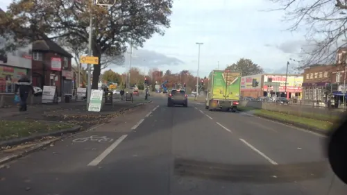

Crossgates and District Recreational Hall
Bar and pub · 1.4 mi
Poplar Avenue, Leeds
Mo-Sa 12:00-23:00; Su 12:00-22:30


62 more on the map.
History
In the 1800s, Colonel Frederick Trench-Gascoigne (of Parlington Hall, Aberford) owned and rented out a large number of houses, mines, woodlands and farming land in the areas of Scholes, Swarcliffe, Barnbow, Garforth, Barwick-in-Elmet, Cross Gates, and Whinmoor.
In the mid-1880s, a previous occupant of the Seacroft windmill, Isaac Chippindale, started the Scholes Brick and Tile Works on Wood Lane, on the border to Swarcliffe. The company's quarry produced high-quality bricks with which many houses in the surrounding area were built. Its kilns and house were demolished in the early 1980s, leaving two small fishing lakes, but is still known as "Chippy's Quarry".
From the History section of Scholes, Leeds on Wikipedia, under CC BY-SA 4.0.
Where to stay1
Churches and places of worship18
Shopping13
Gas and EV charging2
Schools, colleges and libraries15
Healthcare7
The Whinmoor Pharmacy - Pharma Nord
Clinic and pharmacy · 1.5 mi
46B White Laithe Approach, Leeds
Map of Scholes
165 places. The map loads OpenStreetMap tiles when you open it.
Getting there and nearby towns
Leeds Bradford Airport (LBA) is the nearest airport with scheduled flights listed in OpenStreetMap, 10 miles away.
- Garforth 3 mi southeast, about 5 min by car
- Thorner 3 mi north, about 4 min by car
- Shadwell 3 mi northwest, about 5 min by car
- Scarcroft 3 mi north, about 5 min by car
- Aberford 4 mi east, about 6 min by car
- Leeds 5 mi west, about 8 min by car
- Chapel Allerton 5 mi west, about 7 min by car
- Kippax 5 mi southeast, about 7 min by car
- Bramham 5 mi northeast, about 8 min by car
- East Keswick 5 mi north, about 8 min by car
Drive times are estimates from straight-line distance, not routes.
Towns near Scholes


Keep exploring
Local news
Headlines from INDB.
Reviews, tips and questions
Loading what members have shared...
Sources and licences
- GeoNames (CC BY 4.0): population, coordinates, regions and time zone
- Mapillary (see each image): photos
- OpenStreetMap contributors (ODbL 1.0): places, airports, map data
- Wikidata (CC0 1.0): elevation, founding date, time zone, website, landmarks and historic places
- Wikimedia Commons (see each image): photos
- Wikipedia (CC BY-SA 4.0): overview and history text
Photo credits
- Main Street, Scholes, Leeds 002, Mtaylor848, CC BY-SA 3.0
- Temple Newsam House from the grounds, Sirenuk, CC BY-SA 3.0
- Tropical World, Frombowen, CC BY-SA 4.0
- Epiphany Gipton, Chemical Engineer, Public domain
- St. Mary's, Whitkirk, Barkendeavour, CC BY-SA 3.0
- St. Mary's Church, Garforth, Rcsprinter123, CC BY 3.0
- St Peter Church and Yard, Thorner, Tim Green, CC BY 2.0
- Seacroft parish church, User:Gunnar Larsson, CC BY-SA 3.0
- The Cricketers Arms, Seacroft (21814873178), Tim Green from Bradford, CC BY 2.0
- Scholes Library (29769119571), Libraries Taskforce, CC BY 2.0
- Whinmoor Library (29224608314), Libraries Taskforce, CC BY 2.0
- Black Swan, Barwick-in-Elmet (25036457442), Tim Green from Bradford, UK, CC BY 2.0
- Scholes The Buffers 03 May 2017, Chemical Engineer, CC BY-SA 4.0
- John Smeaton Academy, Flrobbo, CC BY-SA 4.0
- The Castle, Roundhay Park, Stevekraken, CC BY-SA 4.0
- Street-level photo, lvl5, CC BY-SA 4.0
- Street-level photo, mapz4lolz, CC BY-SA 4.0
- Street-level photo, lvl5, CC BY-SA 4.0
- Street-level photo, lvl5, CC BY-SA 4.0
- Street-level photo, lamaar639, CC BY-SA 4.0
- Street-level photo, lvl5, CC BY-SA 4.0
- Street-level photo, lamaar639, CC BY-SA 4.0


Page built November 10, 2026. Spotted a mistake? Tell us or suggest a place.