


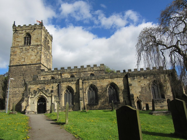
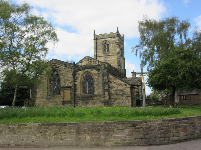

Wath upon Dearne, United Kingdom
Wath upon Dearne is a town of 16,964 people in England, United Kingdom.
Why visit Wath upon Dearne
Townapedia lists 8 museums and landmarks, 12 parks and trails, 18 places to eat, 1 place to stay and 1 attraction in and around town.
Highlights include Hoober Stand, Elsecar Heritage Centre, The Rockingham Mausoleum and Phoenix Park.
Weather in Wath upon Dearne
Forecast from MET Norway (CC BY 4.0). Full forecast
About Wath upon Dearne
Wath upon Dearne (shortened to Wath or often hyphenated) is a town south of the River Dearne in the Metropolitan Borough of Rotherham, South Yorkshire, England, 5 miles (8 km) north of Rotherham and almost midway between Barnsley and Doncaster. It had a population of 11,816 at the 2011 census. It is twinned with Saint-Jean-de-Bournay in France.
From the Wikipedia article Wath upon Dearne (this version), under CC BY-SA 4.0.
Things to do1

Hoober Stand
Monument and historic site · 2.2 mi
Tower in Wentworth, South Yorkshire, England, UK
Museums and landmarks8

Elsecar Heritage Centre
Museum · 3.1 mi
Living history museum in Elsecar, England

The Rockingham Mausoleum
Monument and historic site · 2.7 mi
Grade I listed building in Wentworth, South Yorkshire, England, UK



Greasbrough War Memorial And Railed Enclosure
Monument and historic site · 3.4 mi
War memorial in Rotherham, South Yorkshire, England, UK
Parks, trails and playgrounds12

Phoenix Park
Park · 3.1 mi
Park in Thurnscoe, South Yorkshire, England, UK


Pottery Pond
Park · 1.3 mi
A small park and wooded area featuring a small duck pond and an old Pottery Kiln, which are all that remain of the old pottery...




Restaurants and cafes18


6 more on the map.
History
Wath can be traced to Norman times. It appears in the 1086 Domesday Book as Wad and Waith. It remained for some centuries a rural settlement astride the junction of the old Doncaster–Barnsley and Rotherham–Pontefract roads, the latter a branch of Ryknield Street. North of the town was a ford across the River Dearne. The name has been linked to the Latin vadum and the Old Norse vath (ford or wading place). The town received a royal charter in 1312–1313 entitling it to a weekly Tuesday market and an annual two-day fair, but these were soon discontinued. The market was revived in 1814.
Until local government reorganisation in 1974, Wath was in the historic county of the West Riding of Yorkshire. Until the mid-19th century the town had a racecourse of regional importance, linked to the estate at nearby Wentworth. This fell into disuse, but traces of it can be seen between Wath and Swinton and it is remembered in street names. There was a pottery at Newhill, close to deposits of clay, but it was overshadowed by the nearby Rockingham Pottery in Swinton. About the turn of the 19th century, the poet and newspaper editor James Montgomery, resident at the time, called it "the Queen of Villages". This rural character changed rapidly in the 19th and 20th centuries, as coal mining developed. From 1892 to 1974 Wath Hall served as the local seat of government for Wath upon Dearne.
Read more of the history
The town lies over the South Yorkshire coalfield, where high-quality bituminous coal was dug from outcrops and near-surface seams in primitive bell pits for several centuries. Several high-grade seams are close to the surface, including the prolific Barnsley and Parkgate. The rising demand for coal arose from rapid local industrialisation in the 19th and early 20th century. The population swelled and local infrastructure developed round the coal-mining, but this reliance on one industry led to future problems.
The Dearne and Dove Canal opened in stages from 1798 to 1804 to access the collieries on the south side of the Dearne Valley. It passed through the town on an embankment just north of the High Street and then turned north into the valley. This wide section was known locally as the "Bay of Biscay". The canal closed in 1961 after many years of disuse and poor repair. Much of the canal line has since been used for roads, one of them called Biscay Way.
By the 20th century, heavy industry was evident, with many large collieries – Wath Main and Manvers Main were the two usually mentioned. After the Second World War, the collieries clustered around Manvers developed into a complex, also covering coal preparation, coal products and a coking plant, which was not only visible, but polluted the air for miles around.
Rail took over coal transportation from the canal. Wath upon Dearne became a rail-freight centre of national importance. Wath marshalling yard, built north of the town in 1907, was one of the biggest and for its time one of the most modern railway marshalling yards in the country, as one of the eastern ends of the trans-Pennine Manchester–Sheffield–Wath electrified railway (also known as the Woodhead Line), a project that spanned the Second World War and partly responded to the need to move large amounts of Wath coal to customers in North-West England.
Wath once had three railway stations: Wath Central in Moor Road, Wath (Hull and Barnsley) and Wath North both in Station Road. Wath North, the most distant, was the last to close in 1968, under the Beeching Axe. There has been talk of opening a station on the Sheffield–Wakefield–Leeds line at Manvers, roughly a mile from the town centre.
The local coal industry succumbed to a dramatic decline in the British coal-mining industry precipitated by a change in government economic policy in the early 1980s. This had knock-on effects on many subsidiary local industries and caused local hardship.
The 1985 miners' strike was sparked by the impending closure of Cortonwood Colliery in Brampton Bierlow, a neighbouring village often seen as part of Wath. Along with the whole of the Dearne Valley, Wath was classified as an impoverished area and received public money, including European funds. These were put to regenerating the area from the mid-1990s onwards, causing a degree of economic revival. It made the area more rural, as much land to the north of the town once used by collieries and marshalling yards was returned to scrubland and countryside, dotted with light industrial and commercial office parks. This regeneration of what was still classified as brownfield land has involved building it over with industrial and commercial parks. Large housing developments have also been started.
From the History section of Wath upon Dearne on Wikipedia, under CC BY-SA 4.0.
More about Wath upon Dearne
Education
The four primary schools for ages 3–11 are Our Lady and St Joseph's Catholic Primary, Wath Central Primary, Wath C of E Primary and Wath Victoria Primary. The two secondary schools are Saint Pius X Catholic High School (for ages 11–16 ) and the larger Wath Academy, which has a sixth form and covers 11–18-year-olds, which was the result of an amalgamation between the Wath Grammar School and the Wath (Park Road) Secondary Modern School in January 1964. Both take students from a wider area.
A large further education college, Dearne Valley College, based in Wath, has a main campus at Manvers and a smaller one near the town centre.
From the Wikipedia article Wath upon Dearne, under CC BY-SA 4.0.
Notable people from Wath upon Dearne
 Daisy Makeig-JonesBritish artist (1881–1945)Photo: Josiah Wedgwood / Daisy Makeig-Jones, Public domain
- Cyril GrantEnglish footballer (1920-2002)
- Jack EdwardsEnglish footballer born 1921
- Jack WilkinsonFootballer born 1902
- John SwinburneEnglish cricketer (born 1939)
- Clement SmithEnglish footballer (1910-1970)
- Frank Hydeassociation football player (1927-2004)
- Amos HillEnglish football player
- Harold Watsonassociation football player (1908-1982)
- Cliff Thorleyfootballer (1916-2006)
- Paul HealdEnglish footballer (born 1968)
- Rob DawberBritish screenwriter (1956–2001)
Born in Wath upon Dearne, according to Wikidata (CC0). Each name links to its Wikipedia article.
Where to stay1
Holiday Inn Express Rotherham North
Motel and hotel · 0.5 mi
Manvers Way, Rotherham
Churches and places of worship12
Shopping4
Gas and EV charging2
Schools, colleges and libraries14
Our Lady and St Joseph's Catholic Primary School
School · Roman Catholic
Fitzwilliam Street, Rotherham
Saint Pius X Catholic High School A Specialist School in Humanities
School · Roman Catholic · 0.9 mi
Wath Wood Road, Rotherham
Healthcare1
Map of Wath upon Dearne
73 places. The map loads OpenStreetMap tiles when you open it.
Getting there and nearby towns
Leeds Bradford Airport (LBA) is the nearest airport with scheduled flights listed in OpenStreetMap, 28 miles away.
- Wombwell 2 mi northwest, about 4 min by car
- Rotherham 5 mi south, about 8 min by car
- Doncaster 9 mi east, about 14 min by car
- Sheffield 10 mi southwest, about 16 min by car
- Wakefield 14 mi northwest, about 22 min by car
- Chesterfield 18 mi south, about 29 min by car
- Huddersfield 21 mi northwest, about 33 min by car
- Leeds 22 mi north, about 35 min by car
- Bradford 26 mi northwest, about 42 min by car
- Mansfield 26 mi south, about 42 min by car
Drive times are estimates from straight-line distance, not routes.
Towns near Wath upon Dearne


Keep exploring
Local news
Headlines from INDB.
Reviews, tips and questions
Loading what members have shared...
Sources and licences
- GeoNames (CC BY 4.0): population, coordinates, regions and time zone
- Mapillary (see each image): photos
- OpenStreetMap contributors (ODbL 1.0): places, airports, map data
- Wikidata (CC0 1.0): elevation, founding date, time zone, website, landmarks and historic places
- Wikimedia Commons (see each image): photos
- Wikipedia (CC BY-SA 4.0): overview and history text
Photo credits
- Church House, Wath upon Dearne, Ian S, CC BY-SA 2.0
- Wath upon Dearne - Wet Moor, Christopher Thomas, CC BY-SA 2.0
- Overlooking-Mining-Monument, Jonathan Thacker, CC BY-SA 2.0
- All saints church, Darfield, ChicXulub, CC BY-SA 4.0
- ChurchofStAndrewTheApostleinBoltonUponDearne - 04052015, ChicXulub, CC BY-SA 4.0
- Old Rockingham pottery kiln, BENKEV, CC BY-SA 4.0
- Mausoleum, Newhill Park, Wath upon Dearne, Neil Theasby, CC BY-SA 2.0
- RSPB Dearne Valley Old Moor, Jimfbleak, CC BY-SA 3.0
- Brampton Brierlow - Hoober Stand, Christopher Thomas, CC BY-SA 2.0
- Elsecar Heritage Centre Sentinel Elizabeth locomotive - November 2017, Neil Turner, CC BY-SA 2.0
- Rockingham Mausoleum, MarinerBuckley, CC BY-SA 4.0
- Pottery pond part of Rockingham pottery works at swinton south Yorkshire, BENKEV, CC BY-SA 4.0
- Street-level photo, lvl5, CC BY-SA 4.0
- Street-level photo, lvl5, CC BY-SA 4.0
- Street-level photo, lvl5, CC BY-SA 4.0
Page built November 10, 2026. Spotted a mistake? Tell us or suggest a place.