


Southowram, United Kingdom
Southowram is a town of 2,003 people in England, United Kingdom.
Why visit Southowram
Townapedia lists 13 museums and landmarks, 15 parks and trails, 141 places to eat, 8 places to stay and 7 attractions in and around town.
Highlights include Brighouse Bridge, North Bridge, Halifax, Shibden Hall and Eureka! The National Children's Museum.
Weather in Southowram
Forecast from MET Norway (CC BY 4.0). Full forecast
About Southowram
Southowram is a village and former civil parish in Calderdale, West Yorkshire, England. It stands on hill top between Halifax and Brighouse, on the south side of the Shibden Valley. Northowram is on the northern side of the valley. Southowram falls within the Town ward of Calderdale Council.
From the Wikipedia article Southowram (this version), under CC BY-SA 4.0.
Photos of Southowram


Things to do7


North Bridge, Halifax
Bridge · 1.6 mi
Bridge in West Yorkshire, England


Victoria Theatre
Cinema and theater · 1.5 mi
Theatre in Halifax, England


Museums and landmarks13

Shibden Hall
Museum · 1.3 mi
Historic house museum. in West Yorkshire, England, United Kingdom
Lister's Road, Halifax
Mo-Fr 10:00-17:00; Sa-Su 11:00-17:00

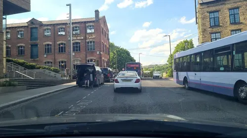
Calderdale Industrial Museum
Museum · 1.3 mi
Museum in Halifax, West Yorkshire, England, United Kingdom

Bankfield Museum
Museum · 2.0 mi
Textiles gallery, historic house museum, regimental museum. in West Yorkshire, England, United Kingdom




1 more on the map.
Parks, trails and playgrounds15

People's Park
Park · 1.8 mi
Park in Halifax, West Yorkshire, England, UK

Savile Park
Park · 1.7 mi
Open space in Halifax, West Yorkshire, England, UK



3 more on the map.
Restaurants and cafes141
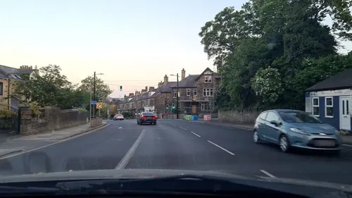
Kaya's Grill
Restaurant · Turkish · 1.1 mi
Huddersfield Road, Halifax
Tu-We 17:00-21:00; Th-Sa 17:00-22:20; Su 17:00-21:00



Mamil Cafe Bar Halifax
Cafe · Brunch, Coffee Shop, Sandwich, Cake · 1.5 mi
24-26 Commercial Street, Halifax
Su-Th 10:00-20:00; Fr-Sa 10:00-23:00

Caffè Nero
Cafe · Coffee Shop · 1.4 mi
12-16 Southgate, Halifax
Mo-Fr 07:00-18:30; Sa 07:30-18:30; Su 08:00-17:30
Social by Distinct Coffee
Cafe · Coffee Shop, Bagel, Sandwich, Cake · 1.4 mi
371 Skircoat Green Road, Halifax
Mo-Sa 08:00-15:00; Su 09:00-15:00
Costa
Cafe · Coffee Shop · 1.4 mi
8 Woolshops, Halifax
Mo-Sa 06:30-19:00; Su 08:30-18:00
129 more on the map.
History
The name Owram derives from the plural form of the Old English ofer meaning 'a flat topped ridge'.
Southowram was historically a township in the ancient parish of Halifax. By 1866 part of the township was included in the borough boundaries of Halifax. In 1866 the remainder of the township was declared to be a local government district, administered by a local board. Later that year the whole township was made a civil parish.
In 1894 local boards were reconstituted as urban district councils under the Local Government Act 1894, which also said that parishes could not straddle district boundaries. The part of Southowram parish within Halifax borough was therefore transferred to that parish, leaving a reduced Southowram parish covering just the urban district. In 1931 the parish had a population of 2,570.
The parish and urban district of Southowram was abolished on 1 April 1937, with most of the area, including the village itself, being added to the parish and municipal borough of Brighouse and a smaller part going to Elland. Brighouse Municipal Borough was abolished on 31 March 1974, becoming part of the Metropolitan Borough of Calderdale. No successor parish was created for the former borough and so Southowram is directly administered by Calderdale Metropolitan Borough Council.
Read more of the history
Parts of Southowram's village centre were demolished and rebuilt in the 1970s and 1980s, but many older buildings remain, as do the ancient stocks on Towngate. Old buildings were lost on New Street and were replaced by council housing. More such housing is to be found in the lower part of the village. Southowram retains in the main, however, a mixture of older historic and new housing, council owned and private housing.
A number of old halls and farms which survived until the 1940s and 1950s were lost in subsequent decades.
From the History section of Southowram on Wikipedia, under CC BY-SA 4.0.
More about Southowram
Education
The local school, Withinfields Primary School, is in the centre of the village, on Law Lane and is a feeder school for Brighouse High School. The school was relocated and re-built in 1997 when the old school, being inadequate for modern needs, was demolished. The former school site is now part of a housing estate. The new school has been built so that it can easily be expanded if and when the village should expand.
"The Shoulder of Mutton" on Cain Lane was a popular public house, currently empty. The Pack Horse public house, also on Cain Lane, at the centre of the village, was in 2016 converted to an Indian restaurant, but in 2017 reverted to a public house.
From the Wikipedia article Southowram, under CC BY-SA 4.0.
Notable people from Southowram
 William Swinden BarberBritish architectPhoto: David Wilkie Wynfield, Public domain
Born in Southowram, according to Wikidata (CC0). Each name links to its Wikipedia article.
Where to stay8
Churches and places of worship23
St Alban's Catholic Church
Church · Roman Catholic · 1.1 mi
Abbey Walk South, Halifax
Shopping28
Gas and EV charging6
Schools, colleges and libraries17
Healthcare6
Map of Southowram
250 places. The map loads OpenStreetMap tiles when you open it.
Getting there and nearby towns
Leeds Bradford Airport (LBA) is the nearest airport with scheduled flights listed in OpenStreetMap, 13 miles away.
- Halifax 1 mi northwest, about 1 min by car
- Elland 2 mi south, about 3 min by car
- Brighouse 2 mi east, about 3 min by car
- Rastrick 2 mi southeast, about 3 min by car
- Barkisland 4 mi southwest, about 7 min by car
- Huddersfield 5 mi southeast, about 7 min by car
- Cleckheaton 5 mi east, about 8 min by car
- Liversedge 6 mi east, about 9 min by car
- Mirfield 6 mi southeast, about 10 min by car
- Bradford 7 mi northeast, about 11 min by car
Drive times are estimates from straight-line distance, not routes.
Towns near Southowram


Keep exploring
Local news
Headlines from INDB.
Reviews, tips and questions
Loading what members have shared...
Sources and licences
- GeoNames (CC BY 4.0): population, coordinates, regions and time zone
- Mapillary (see each image): photos
- OpenStreetMap contributors (ODbL 1.0): places, airports, map data
- Wikidata (CC0 1.0): elevation, founding date, time zone, website, landmarks and historic places
- Wikimedia Commons (see each image): photos
- Wikipedia (CC BY-SA 4.0): overview and history text
Photo credits
- Shoulder of Mutton, Southowram (5556270790), Tim Green from Bradford, UK, CC BY 2.0
- Brighouse Bridge by Richard Kay, Richard Kay, CC BY-SA 2.0
- North bridges, Halifax, Charlesdrakew, Public domain
- Brighouse bridge 019, Linda Spashett Storye book, CC BY 3.0
- Bankfield Museum 099, Linda Spashett Storye_book, CC BY 3.0
- Halifax Parish Church, Jwholdsworth, CC BY-SA 3.0
- All Souls church, Halifax, Plucas58, Public domain
- All Saints Church Elland SE1020, Humphrey Bolton, CC BY-SA 2.0
- Square Chapel (3322822759), Tim Green from Bradford, CC BY 2.0
- Halifax Victoria Theatre, Charlesdrakew, Public domain
- Halifax Borough Market, Charlesdrakew, Public domain
- Eureka! exterior, Sospot, CC BY-SA 3.0
- Old Cock, new management (6473393357), Tim Green from Bradford, CC BY 2.0
- Royal Oak, Wards End, Halifax (5367458027), Tim Green from Bradford, CC BY 2.0
- All Saints, Dudwell Lane, Halifax (16660196286), Tim Green from Bradford, CC BY 2.0
- Skircoat Library, Richard Kay, CC BY-SA 2.0
- Duke of Wellington's Regimental Memorial, Tim Green, CC BY 2.0
- Plummet Line (3375850671), Tim Green from Bradford, CC BY 2.0
- Exterior of Eureka! The National Children's Museum, Sospot, CC BY-SA 4.0
- Borough Market, Halifax (2305922796), Tim Green from Bradford, CC BY 2.0
- Savile Park and St Jude (44757646135), Tim Green from Bradford, UK, CC BY 2.0
- Shibden Hall (6448838033), Tim Green from Bradford, CC BY 2.0
- Piece Hall (40159874632), Tim Green from Bradford, UK, CC BY 2.0
- Halifax Cenotaph, Tim Green, CC BY 2.0
- Hercules, People's Park, Halifax, Tim Green, CC BY 2.0
- Shroggs Park 2 (4815677431), Tim Green from Bradford, CC BY 2.0
- Street-level photo, mappo2, CC BY-SA 4.0
- Street-level photo, mappo2, CC BY-SA 4.0
- Street-level photo, mappo2, CC BY-SA 4.0
- Street-level photo, mappo2, CC BY-SA 4.0
- Street-level photo, mappo2, CC BY-SA 4.0
- Street-level photo, mappo2, CC BY-SA 4.0
- Street-level photo, lvl5, CC BY-SA 4.0
- Street-level photo, mappo2, CC BY-SA 4.0
- Street-level photo, mappo2, CC BY-SA 4.0
- Street-level photo, humez, CC BY-SA 4.0
- Street-level photo, mappo2, CC BY-SA 4.0


Page built November 10, 2026. Spotted a mistake? Tell us or suggest a place.