


Stourbridge, United Kingdom
Stourbridge is a town of 56,950 people in England, United Kingdom.
Why visit Stourbridge
Townapedia lists 29 museums and landmarks, 23 parks and trails, 105 places to eat and 3 places to stay in and around town.
Highlights include Bonded Warehouse, The Lace Guild Museum, Mary Stevens Park and Buckpool and Fens Pool Local Nature Reserve.
Weather in Stourbridge
Forecast from MET Norway (CC BY 4.0). Full forecast
About Stourbridge
Stourbridge () is a market town in the Metropolitan Borough of Dudley in the West Midlands, England. Situated on the River Stour, the town lies around 11 miles (18 kilometres) west of Birmingham,
From the Wikipedia article Stourbridge (this version), under CC BY-SA 4.0.
Travel tips from other travellers: Stourbridge on Wikivoyage (CC BY-SA 4.0).
Photos of Stourbridge


Museums and landmarks29


Red House Glass Cone
Museum · 1.5 mi
Glass cone in Wordsley, West Midlands, England, UK
High Street, Stourbridge
Stourbridge Glass Museum
Museum · 1.5 mi
High Street, Stourbridge
Apr 01-Oct 31: Tu-Sa 10:30-16:30; Nov 01-Mar 31: Th-Sa 10:30-16:30

Brierley Hill War Memorial
Monument and historic site · 1.7 mi
Memorial in Dudley, West Midlands, England, UK

Hagley Hall
Museum · 2.4 mi
Grade I listed historic house museum in Hagley, United Kingdom

Wychbury Obelisk
Monument and historic site · 1.9 mi
Obelisk in Hagley, Bromsgrove District, England, UK
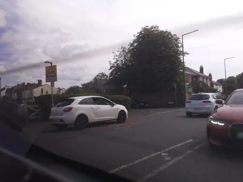
Battle of Stourbridge Heath (1644)
Monument and historic site · 0.5 mi
Approximate location for the site of the Battle of Stourbridge Heath in 1644, during the First English Civil War between Royalists (Sir...

Broadfield House Glass Museum
Museum · 2.7 mi
Art, craft and social history museum in Kingswinford, West Midlands
Haden Hill House Museum
Museum · 3.3 mi
Historic house museum, United Kingdom

17 more on the map.
Parks, trails and playgrounds23


Buckpool and Fens Pool Local Nature Reserve
Park · 2.5 mi
Park in Pensnett, United Kingdom



11 more on the map.
Restaurants and cafes105



The Mayfair Club
Bar and pub · 1.3 mi
Wedgbury Way, Brierley Hill
Mo-Fr 17:00-24:00; Sa-Su 12:00-02:00

93 more on the map.
Where to stay3


History
Stourbridge was listed in the 1255 Worcestershire assize roll as Sturbrug or Sturesbridge. The medieval township was named for a bridge which crossed the River Stour. The settlement was originally known as Bedcote and was likely Anglo-Saxon in origin. It lay within the manor of Swynford or Suineford (now Oldswinford), which appears in William the Conqueror's Domesday Book of 1086.
Pigot and Co.'s National Commercial Directory for 1828-9 describes Stourbridge as a "populous, wealthy, and flourishing market town" and gives its population in 1821 as 5,090.
In 1966, the Stourbridge border between Worcestershire and Staffordshire, which for centuries had been marked by the River Stour, was moved a couple of miles north when Amblecote was incorporated into the Borough of Stourbridge. Following the Local Government Act 1972, Stourbridge was amalgamated into the Metropolitan Borough of Dudley and became part of the wider West Midlands county in 1974.
Read more of the history
The town gives its name to local glass production, which has been manufactured since the early 1600s. The local clay proved particularly suitable for the industry, taken up predominantly after the immigration of French coal miners in the Huguenot diaspora. However, most of the glass industry was actually located in surrounding areas including Wordsley, Amblecote and Oldswinford. The rich natural resources of coal and fireclay for lining furnaces made it the perfect location for the industry. Glass making peaked in the 19th century, encouraged by the famous glass-making family, the Jeavons.
The 1861 census identified that 1,032 residents of Stourbridge were involved in the glass trade in some way. Of these, 541 were glass workers - an increase from 409 in 1851, believed to be partly caused by the collapse of the glass industry in nearby Dudley in the 1850s. The vast majority of those involved in the glass trade came from Staffordshire, Warwickshire, Worcestershire and Shropshire. 9% came from other parts of England and 0.2% had come from abroad. Of particular note are glass cutters, as 8.1% had come from Ireland, believed to be as a result of the decline of the Irish glasscutting industry in the first half of the 1800s. The houses inhabited by glassworkers were of a much better quality in comparison to the slums in which the nailmakers of Lye and Wollescote lived. However, only a few glassworkers owned their own houses.
The Red House Cone, thought to be the only complete remaining glass cone of its kind, stands on the Stourbridge Canal at Wordsley. It is the site of the Red House Glass Museum and there are regular demonstrations of traditional glass blowing.
The town centre has seen major regeneration in recent years. In 2014, Lion Health medical centre opened in the renovated former foundry of Foster, Rastrick and Company – where the Stourbridge Lion locomotive was manufactured. The next phase of regeneration on the foundry site will create parkland next to Stourbridge Canal with a "heritage and community hub" named Riverside House.
Crown Centre Shopping Mall at the bottom of Stourbridge High Street opened in 2013 at the site of the old Crown Centre and Bell Street multi-storey car park, which were demolished between 2012 and 2013. Costing £50m, the new mall is home to a 60,000 sq ft (5,600 m2) Tesco anchor store, a two-level underground car park, six retail stores and a central food court. Stourbridge Bus Station underwent substantial redevelopment and re-opened as Stourbridge Interchange in April 2012.
In 2010, Stourbridge was awarded Fairtrade Town status. Stourbridge Farmers' and Craft Market takes place on the first and third Saturday of every month in the Clock Square. Throughout the summer, Mary Stevens Park hosts outdoor live music.
In August 2026, Stourbridge was heavily affected by wildfires with the Stourbridge golf course and local homes being destroyed. West Midlands Fire Service said the fires caused "extensive devastation".
From the History section of Stourbridge on Wikipedia, under CC BY-SA 4.0.
More about Stourbridge
Geography
Stourbridge is about 10 miles (16 kilometres) west of Birmingham. It is part of the Metropolitan Borough of Dudley at the southwestern edge of the Black Country and the West Midlands conurbation, Stourbridge includes the villages and suburbs of Amblecote, Lye, Norton, Oldswinford, Pedmore, Stambermill, Stourton, Wollaston, Wollescote and Wordsley.
Much of Stourbridge consists of residential streets interspersed with green spaces. Mary Stevens Park, opened in 1931, has a lake, a bandstand, a cafe, and open spaces. There are two other large parks also gifted to Stourbridge people by the Stevens family, one in Lye/Wollescote and the other in Quarry Bank.
Bordered by green belt land, Stourbridge is close to countryside with the Clent Hills to the south and southwest Staffordshire and Kinver Edge to the west.
Arts and culture
The International Festival of Glass is held at Ruskin Mill in Stourbridge every two years. The British Glass Biennale is the festival's flagship exhibition, featuring contemporary work by glass makers in the UK.
In the late-1980s and early 1990s, three Stourbridge indie bands – The Wonder Stuff, Pop Will Eat Itself and Ned's Atomic Dustbin – all had chart success, selling millions of albums between them and gracing the covers of NME and Melody Maker. Pop Will Eat Itself's former frontman Clint Mansell has since composed musical scores for films including Black Swan and Requiem for a Dream.
The 80s metal bands Diamond Head, Witchfinder General and 80s pop band Kayran Dache also came from Stourbridge and Led Zeppelin's Robert Plant once attended King Edward VI College (then King Edward VI Grammar School for Boys).
Stourbridge is covered by these newspapers: the Stourbridge News (weekly), and the Stourbridge Chronicle (weekly).
From the 1860s until the early 1980s, Stourbridge was covered by the County Express newspaper. The archives are now on microfilm in Stourbridge Library.
Historical records about Stourbridge are held in multiple archives across the Black Country and Worcestershire, due to Stourbridge historically being a part of Worcestershire.
Education
There is one college in Stourbridge. King Edward VI College was founded in 1552, becoming a sixth form college in 1976. Stourbridge College, south of the town centre, was formed in 1958 and specialised in art and design, but was closed in 2019.
There is also a sixth form at Old Swinford Hospital school, which was founded in 1667 by the Stourbridge-born politician Thomas Foley. In 2018, the boarding school was named the best secondary school in Dudley, closely followed by Redhill School, an academy also in Stourbridge.
Elmfield Rudolf Steiner School is an independent school which follows the international Steiner Waldorf Education curriculum.
From the Wikipedia article Stourbridge, under CC BY-SA 4.0.
Notable people from Stourbridge
 Jude BellinghamEnglish footballer (born 2003)Photo: Bryan Berlin, CC BY-SA 4.0
 Jobe BellinghamEnglish footballer (born 2005)Photo: Struway2, CC BY-SA 4.0
 Joseph BacheEnglish footballer (1880-1960)Photo: Albert Wilkes, Public domain
 Matt NealBritish racing driverPhoto: Cs-wolves, CC BY-SA 4.0
 Kay DaviesBritish geneticist and anatomist; educatorPhoto: Dannysmiricky, CC BY-SA 3.0
 Lydia ThompsonBritish rugby union player (1992-)Photo: Stefano Delfrate, CC BY-SA 2.0
 Alf Bishopfootballer (1886-1938)Photo: Jcjbishop, CC BY-SA 4.0
- Kathleen BoothBritish computer scientist (1922–2022)
- Terry DavisBritish politician (1938–2024)
- S. J. Watsonauthor
- Tony MarshBritish racing driver (1931-2009)
- Sam FieldEnglish association football player (born 1998)
Born in Stourbridge, according to Wikidata (CC0). Each name links to its Wikipedia article.
Churches and places of worship23
Shopping15
Gas and EV charging9
Schools, colleges and libraries29
Healthcare7
Map of Stourbridge
243 places. The map loads OpenStreetMap tiles when you open it.
Getting there and nearby towns
Birmingham Airport (BHX) is the nearest airport with scheduled flights listed in OpenStreetMap, 17 miles away.
- Brierley Hill 2 mi northeast, about 3 min by car
- Kingswinford 3 mi north, about 5 min by car
- Dudley 4 mi northeast, about 6 min by car
- Tipton 6 mi northeast, about 10 min by car
- Wombourne 6 mi north, about 9 min by car
- Bartley Green 6 mi east, about 10 min by car
- Oldbury 6 mi northeast, about 10 min by car
- West Bromwich 8 mi northeast, about 12 min by car
- Wednesbury 8 mi northeast, about 13 min by car
- Wolverhampton 9 mi north, about 14 min by car
Drive times are estimates from straight-line distance, not routes.
Towns near Stourbridge


Keep exploring
Local news
Headlines from INDB.
Reviews, tips and questions
Loading what members have shared...
Sources and licences
- GeoNames (CC BY 4.0): population, coordinates, regions and time zone
- Mapillary (see each image): photos
- OpenStreetMap contributors (ODbL 1.0): places, airports, map data
- Wikidata (CC0 1.0): elevation, founding date, time zone, website, landmarks and historic places
- Wikimedia Commons (see each image): photos
- Wikipedia (CC BY-SA 4.0): overview and history text
Photo credits
- Stourbridge Interchange - bus - National Express West Midlands (8694306590), Elliott Brown from Birmingham, United Kingdom, CC BY 2.0
- Stourbridge Interchange - automatic doors (8693191903), Elliott Brown from Birmingham, United Kingdom, CC BY 2.0
- Stourbridge Interchange - bus station - National Express West Midlands buses (8693045649), Elliott Brown from Birmingham, United Kingdom, CC BY 2.0
- Stourbridge Interchange - bus station (8693044149), Elliott Brown from Birmingham, United Kingdom, CC BY 2.0
- Flower beds in Spring - St John's Road, Stourbridge - Foster Road station entrance, Elliott Brown, CC BY 2.0
- Stourbridge Town Station, Matthew Black from London, UK, CC BY-SA 2.0
- Statue - Stourbridge Interchange bus station, Elliott Brown, CC BY 2.0
- Statue - Stourbridge Interchange bus station 2, Elliott Brown, CC BY 2.0
- Stourbridge Town railway station MMB 07, mattbuck ( category ), CC BY-SA 3.0
- 55003 at Stourbridge Town, Tutenkhamun Sleeping, CC BY 2.0
- Redhouseglasscone, Nozza, Public domain
- Sea of poppies helps commemorate war memorial centenary (51669043932), Dudley Council from England, CC BY 2.0
- Hagley Hall June 2011, Hagley Hall, CC BY-SA 3.0
- Hagley Monument 1 (5677005590), Tony Hisgett from Birmingham, UK, CC BY 2.0
- Stourbridge Mary Stevens Park Bandstand, Brianboru100, CC BY-SA 3.0
- Fens Pools Middle Pool 3, Oosoom, CC BY-SA 3.0
- Hagley Hall from Milton's Seat, Philip Halling, CC BY-SA 2.0
- Netherton Church of St Andrew, Oosoom, CC BY-SA 3.0
- Cradley Heath Baptist Church 01, R J Higginson, CC BY-SA 3.0
- Stourbridge Old Winsford Hospital, Brianboru100, CC BY-SA 3.0
- Parish Church of St Mary Stourbridge, Tony Hisgett, CC BY 2.0
- Stourbridge Talbot Inn, Brianboru100, CC BY-SA 3.0
- Shopping for Graffiti (434165041), Lee Jordan, CC BY-SA 2.0
- Stourbridge Town Arm - Canal Street, Stourbridge - The Bonded Warehouse (8704930952), Elliott Brown from Birmingham, United Kingdom, CC BY 2.0
- Street-level photo, southglos, CC BY-SA 4.0
- Street-level photo, adam2, CC BY-SA 4.0
- Street-level photo, adam2, CC BY-SA 4.0
- Street-level photo, adam2, CC BY-SA 4.0
- Street-level photo, adam2, CC BY-SA 4.0
- Street-level photo, southglos, CC BY-SA 4.0
- Street-level photo, adam2, CC BY-SA 4.0
- Street-level photo, southglos, CC BY-SA 4.0
- Street-level photo, southglos, CC BY-SA 4.0
- Street-level photo, southglos, CC BY-SA 4.0
- Street-level photo, adam2, CC BY-SA 4.0
- Street-level photo, adam2, CC BY-SA 4.0
- Street-level photo, adam2, CC BY-SA 4.0
- Street-level photo, southglos, CC BY-SA 4.0
- Street-level photo, southglos, CC BY-SA 4.0
- Street-level photo, southglos, CC BY-SA 4.0


Page built November 10, 2026. Spotted a mistake? Tell us or suggest a place.