


Brierley Hill, United Kingdom
Brierley Hill is a town of 28,000 people in England, United Kingdom.
Why visit Brierley Hill
Townapedia lists 19 museums and landmarks, 39 parks and trails, 156 places to eat, 2 places to stay and 6 attractions in and around town.
Highlights include Dudley Hippodrome, Opera House, Brierley Hill War Memorial and Black Country Living Museum.
Weather in Brierley Hill
Forecast from MET Norway (CC BY 4.0). Full forecast
About Brierley Hill
Brierley Hill is a town and electoral ward in the Metropolitan Borough of Dudley, West Midlands (originally in Staffordshire), England. It is located three miles (five kilometres) south of Dudley and one mile (1.5 kilometres) north of Stourbridge. Part of the Black Country and in a heavily industrialised area, it had a population of 13,935 at the 2011 census. It is best known for glass and steel manufacturing, although the industry has declined considerably since the 1970s.
From the Wikipedia article Brierley Hill (this version), under CC BY-SA 4.0.
Things to do6

Dudley Hippodrome
Cinema and theater · 2.9 mi
Former theatre in Dudley, England, later used as a bingo hall
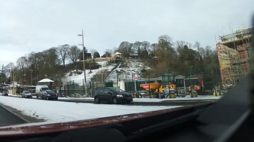
Opera House
Cinema and theater · 2.9 mi
Former theatre in Dudley, England (1899-1936)


Museums and landmarks19

Brierley Hill War Memorial
Monument and historic site
Memorial in Dudley, West Midlands, England, UK

Black Country Living Museum
Museum · 3.3 mi
Open-air museum of manufacturing history in Dudley, West Midlands, England, United Kingdom

Dudley Castle
Monument and historic site · 2.9 mi
Grade I listed castle in Dudley, United Kingdom

Red House Glass Cone
Museum · 1.6 mi
Glass cone in Wordsley, West Midlands, England, UK

Wychbury Obelisk
Monument and historic site · 3.4 mi
Obelisk in Hagley, Bromsgrove District, England, UK

Mushroom Green Chainshop
Museum · 1.3 mi
19th century chainshop which is open to the public
Apr-Oct: Su
Broadfield House Glass Museum
Museum · 2.1 mi
Art, craft and social history museum in Kingswinford, West Midlands
Haden Hill House Museum
Museum · 2.5 mi
Historic house museum, United Kingdom

Blue Plaque: Alfred Marsh
Monument and historic site
Blue Plaque for businessman and butcher Alfred Marsh located on the building of one of his former butcher shops at 70 High St, Brierley Hill
Blue Plaque: Dolly Allen
Monument and historic site
Blue Plaque for comedian Dolly Allen located inside Brierley Hill Civic Hall above the box office counter.
Blue Plaque: Technical Institute & Free Library
Monument and historic site
Blue Plaque marking the building once occupied by the Brierley Hill Technical Institute & Free Library
7 more on the map.
Parks, trails and playgrounds39

Buckpool and Fens Pool Local Nature Reserve
Park · 0.8 mi
Park in Pensnett, United Kingdom


Haden Hill Park
Park · 2.7 mi
Public park in Cradley Heath, Sandwell, England


Priory Park, Dudley
Park · 2.9 mi
Public park in Dudley, West Midlands, England, UK

Barrow Hill Local Nature Reserve
Park · 1.7 mi
Park in Pensnett, Dudley, West Midlands, England
Bumble Hole Local Nature Reserve
Park · 2.2 mi
Nature reserve in the West Midlands of England
27 more on the map.
Restaurants and cafes156
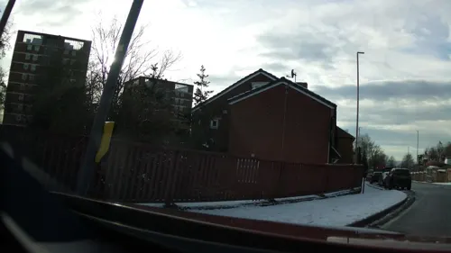
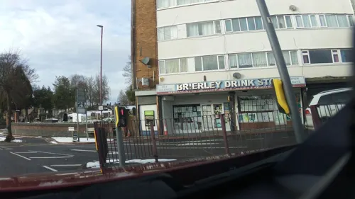


The Mayfair Club
Bar and pub · 0.8 mi
Wedgbury Way, Brierley Hill
Mo-Fr 17:00-24:00; Sa-Su 12:00-02:00

144 more on the map.
History
Largely a product of the Industrial Revolution, Brierley Hill has a relatively recent history, with the first written records of the town dating back to the 17th century. Originally established as a settlement in the woodland of Pensnett Chase, it began expanding rapidly following the chase's enclosure in 1748; it was first recorded on a map in 1785 after the mapping of the Stourbridge Canal.
Brierley Hill had become heavily industrialised by the beginning of the 19th century, with several quarries, collieries, glass works and iron works emerging. Pigot and Co.'s National Commercial Directory for 1828-9 describes Brierley Hill as a hamlet with extensive iron works manufacturing rod, bar and sheet iron, tanks, and boilers.
A National School was opened in the town in 1835 and a market area had developed along the High Street.
By the start of the 20th century, the raw material deposits had become depleted, leading to the closure of many of the industries in the area. The decline in manufacturing resulted in an unemployment rate of 25% in Brierley Hill by the early 1980s, with the closure of the Round Oak Steelworks in December 1982 resulting in a further 1,300 redundancies. The steelworks site, along with the adjacent Merry Hill Farm, were subsequently designated as an Enterprise Zone and were redeveloped to create the Merry Hill Shopping Centre and The Waterfront business park.
Read more of the history
In recent years, proposals have been drawn up by the local authority to regenerate Brierley Hill, with the Brierley Hill Regeneration Partnership formed to improve the town over 10 years, by investing in the infrastructure and increasing the number of homes and job opportunities.
Brierley Hill is home to the renowned Bathams brewery on Delph Road.
Brierley Hill became a chapelry in the parish of Kingswinford, Staffordshire, on 31 December 1894. It became a separate civil parish, being formed from the part of Kingswinford parish in Brierley Hill urban district, under the Local Government Act 1894; previously, it had been an urban sanitary authority. The urban district expanded greatly in 1934, after taking in most of the Kingswinford and Quarry Bank districts and made a failed bid to obtain borough status in 1952. On 1 April 1966, the district was abolished and merged with the County Borough of Dudley, Seisdon Rural District, Municipal borough of Stourbridge; part also went to form the County Borough of Warley.
The parish was also abolished on 1 April 1966 and merged with Dudley and Stourbridge; part also went to form Warley. In 1961, the parish had a population of 56,075. It became part of the Dudley Metropolitan Borough in 1974.
From the History section of Brierley Hill on Wikipedia, under CC BY-SA 4.0.
More about Brierley Hill
Geography
Amblecote is in the Stourbridge Constituency and became part of Brierley Hill postcode, because Stourbridge has a small postal sorting office and couldn’t keep up with demand when new housing was built on Peters Hill. Historically Amblecote, is part of Stourbridge ( Worcestershire )
Brockmoor is situated to the immediate north of the town centre. On the border with Wordsley was the Bottle and Glass Inn, erected on the bank of the Dudley Canal in about 1800 as The Bush. It remained here until 1980, when it was transferred to the Black Country Living Museum as a centrepiece of the then-new village.
St John's Church, Brockmoor, is Grade II listed. It was built in 1844–1845 to designs by Thomas Smith and was made predominantly using Staffordshire blue bricks.
It is also home to Brockmoor Primary School, which has existed at its current site in Belle Isle since 1994. The original school was built in the late 19th century, as an infant school for 5 to 7 year-olds and a junior school for 7 to 11 year-olds; it became a first school for 5–8 year-olds and a middle school for 8 to 12 year-olds in September 1972. However, the two schools merged in September 1989 to form Brockmoor Primary School and a year later the age range was altered to 5 to 11.
Pensnett is situated more than one mile (1.5 kilometres) of the town centre and borders the townships of Sedgley, Kingswinford and Dudley.
Education
The town currently has 10 primary schools and one secondary school. Thorns Community College and The Crestwood School are now the town's only secondary schools, due to the closure of Pensnett High School.
Brierley Hill runs a system of infant (ages 5 to 7), junior (7 to 11) and secondary schools (11 to 16), in line with the rest of the Dudley borough and the majority of schools in other areas.
Pensnett High School, closed in July 2010, stayed open until July 2012 as a learning centre for the oldest two age groups in the school. It has since been demolished apart from a special school, Pens Meadow School, which occupies part of the site.
From the Wikipedia article Brierley Hill, under CC BY-SA 4.0.
Notable people from Brierley Hill
 Danny BatthEnglish association football playerPhoto: Timmy96, CC0
 Trevor SmithEnglish footballer (1936–2003)Photo: Eskil Malmberg, Public domain
- Paul Cooperfootballer (born 1953)
- Angela MarsonsBritish crime fiction writer (born 1968)
- Sammy BrooksFootballer (1890-1960)
- Noah ShakespeareCanadian politician
- Billy GuestEnglish footballer (1914-1994)
- Arthur HooperEnglish footballer (1888-1963)
- Freddie BrownEnglish footballer (1878-1939)
- Dennis BreakwellEnglish cricketer (born 1948)
- Thomas ClareEnglish cricketer (1883-1940)
- Jimmy LeeEnglish footballer (1892-1955)
Born in Brierley Hill, according to Wikidata (CC0). Each name links to its Wikipedia article.
Where to stay2
Churches and places of worship32
Church of Saint Augustine of Hippo
Church · Anglican · 1.4 mi
Hallchurch Road, Dudley
Shopping30
Gas and EV charging6
Schools, colleges and libraries32
Healthcare16
Murray's Healthcare
Clinic and pharmacy · 1.0 mi
37-38 High Street, Brierley Hill
Map of Brierley Hill
250 places. The map loads OpenStreetMap tiles when you open it.
Getting there and nearby towns
Birmingham Airport (BHX) is the nearest airport with scheduled flights listed in OpenStreetMap, 16 miles away.
- Dudley 2 mi northeast, about 3 min by car
- Kingswinford 2 mi northwest, about 4 min by car
- Wombourne 4 mi northwest, about 7 min by car
- Oldbury 5 mi east, about 7 min by car
- West Bromwich 6 mi northeast, about 10 min by car
- Wednesbury 6 mi northeast, about 10 min by car
- Wolverhampton 7 mi north, about 12 min by car
- Birmingham 9 mi east, about 15 min by car
- Walsall 9 mi northeast, about 15 min by car
- Codsall 11 mi north, about 17 min by car
Drive times are estimates from straight-line distance, not routes.
Towns near Brierley Hill


Keep exploring
Local news
Headlines from INDB.
Reviews, tips and questions
Loading what members have shared...
Sources and licences
- GeoNames (CC BY 4.0): population, coordinates, regions and time zone
- Mapillary (see each image): photos
- OpenStreetMap contributors (ODbL 1.0): places, airports, map data
- Wikidata (CC0 1.0): elevation, founding date, time zone, website, landmarks and historic places
- Wikimedia Commons (see each image): photos
- Wikipedia (CC BY-SA 4.0): overview and history text
Photo credits
- Hippodrome, LivingInMediocrity, CC BY-SA 3.0
- Sea of poppies helps commemorate war memorial centenary (51669043932), Dudley Council from England, CC BY 2.0
- Blackcountrystreet, Jack1956, Public domain
- Dudley Castle Courtyard 2 (5511627203), Tony Hisgett from Birmingham, UK, CC BY 2.0
- Redhouseglasscone, Nozza, Public domain
- Hagley Monument 1 (5677005590), Tony Hisgett from Birmingham, UK, CC BY 2.0
- Fens Pools Middle Pool 3, Oosoom, CC BY-SA 3.0
- Dudley Zoo entrance, pic 2, England, Brian Clift, CC BY-SA 2.0
- Haden Hill Park 070110 009 (4292823109), Sandwell Council, CC BY-SA 2.0
- Stourbridge Mary Stevens Park Bandstand, Brianboru100, CC BY-SA 3.0
- Dudley - Saint Edmund King and Martyr Church, Dave Bevis, CC BY-SA 2.0
- St James the Great's Church, Church Street, Lower Gornal (NHLE Code 1270306) (August 2025) (4), User:Hassocks5489, CC0
- Cradley Heath Baptist Church 01, R J Higginson, CC BY-SA 3.0
- Netherton Church of St Andrew, Oosoom, CC BY-SA 3.0
- Merry Hill entrance, Wikical14, CC BY-SA 4.0
- Dudley Priory Park Stag, Brianboru100, CC BY-SA 4.0
- Street-level photo, southglos, CC BY-SA 4.0
- Street-level photo, southglos, CC BY-SA 4.0
- Street-level photo, southglos, CC BY-SA 4.0
- Street-level photo, southglos, CC BY-SA 4.0


Page built November 10, 2026. Spotted a mistake? Tell us or suggest a place.