


Swillington, United Kingdom
Swillington is a town of 3,088 people in England, United Kingdom.
Why visit Swillington
Townapedia lists 5 museums and landmarks, 14 parks and trails, 18 places to eat, 2 places to stay and 1 attraction in and around town.
Highlights include Crawshaw Woods (Shippen House Farm) Bridge, Hul4/20, Temple Newsam, Gateway 45 and St Aidan's.
Weather in Swillington
Forecast from MET Norway (CC BY 4.0). Full forecast
About Swillington
Swillington is a village and civil parish near Leeds, West Yorkshire, England, in the City of Leeds metropolitan borough. It is situated 5 miles (8 km) east from Leeds city centre, north of the River Aire, and is surrounded by streams including Fleakingley Beck. In 2001, Swillington had a population of about 3,530, reducing to 3,381 at the 2011 Census.
From the Wikipedia article Swillington (this version), under CC BY-SA 4.0.
Things to do1

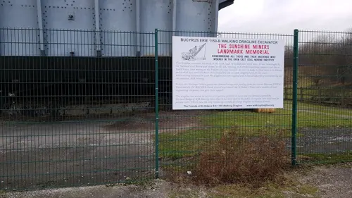
Crawshaw Woods (Shippen House Farm) Bridge, Hul4/20
Bridge · 2.4 mi
Bridge in Leeds, West Yorkshire, England, UK
Museums and landmarks5

Temple Newsam
Museum · 2.0 mi
Grade I listed historic house museum in Leeds, United Kingdom, United Kingdom

Parks, trails and playgrounds14

Gateway 45
Park · 2.6 mi
Mixed use business park in Leeds, West Yorkshire, England

St Aidan's
Park · 1.4 mi
Country Park and RSPB reserve between Leeds and Castleford in West Yorkshire, England




2 more on the map.
Restaurants and cafes18
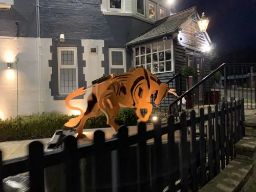

The Two Pointers
Bar and pub · Burger · 1.4 mi
69 Church Street, Leeds
Mo-Su 12:00-23:30

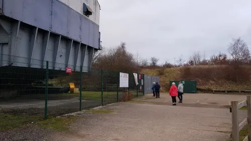




Simply Grilled
Fast food · Greek, Kebab · 1.5 mi
14 Church Street, Leeds
Su, Tu-Th 16:30-22:30; Fr-Sa 16:30-22:45
6 more on the map.
More about Swillington
Economy
Swillington sits at the centre of an agricultural community, and includes Leventhorpe Vineyard and an organic farm.
Leventhorpe Vineyard, established in 1986, is near the village, and has been recommended by Rick Stein. It was until recently the most northerly commercial vineyard in Britain—there is now one further north, near Malton.
The Soil Association-certified organic farm on the former Lowther estate has been frequented by celebrity chefs, and has produce voted the 'Best Meat In Yorkshire' in 2007.
Education
The local school, Swillington Primary School has about 270 pupils. Swillington does not have its own secondary school, consequently pupils typically attend Garforth Academy or Brigshaw High School.
YEDL, the local electricity distribution company, has its overhead line school at Swillington where it trains its apprenticed and qualified linesmen in techniques required to work on the electricity network throughout its licence area.
From the Wikipedia article Swillington, under CC BY-SA 4.0.
Notable people from Swillington
 James LowtherBritish politician (1840-1904)Photo: Leslie Ward, Public domain
 John DobsonDean of Ripon; British Anglican priestPhoto: The Diocese of York, CC BY-SA 2.0
- Albert KeatingEnglish footballer (1902-1984)
Born in Swillington, according to Wikidata (CC0). Each name links to its Wikipedia article.
Where to stay2
Churches and places of worship8
Shopping1
Gas and EV charging1
Schools, colleges and libraries3
Healthcare2
Map of Swillington
55 places. The map loads OpenStreetMap tiles when you open it.
Getting there and nearby towns
Leeds Bradford Airport (LBA) is the nearest airport with scheduled flights listed in OpenStreetMap, 12 miles away.
- Kippax 2 mi east, about 3 min by car
- Garforth 2 mi northeast, about 4 min by car
- Methley 3 mi south, about 5 min by car
- Castleford 4 mi southeast, about 6 min by car
- Lofthouse 4 mi southwest, about 7 min by car
- Scholes 4 mi north, about 6 min by car
- Aberford 5 mi northeast, about 8 min by car
- Leeds 6 mi west, about 9 min by car
- Chapel Allerton 6 mi northwest, about 10 min by car
- Wakefield 7 mi southwest, about 11 min by car
Drive times are estimates from straight-line distance, not routes.
Towns near Swillington


Keep exploring
Local news
Headlines from INDB.
Reviews, tips and questions
Loading what members have shared...
Sources and licences
- GeoNames (CC BY 4.0): population, coordinates, regions and time zone
- Mapillary (see each image): photos
- OpenStreetMap contributors (ODbL 1.0): places, airports, map data
- Wikidata (CC0 1.0): elevation, founding date, time zone, website, landmarks and historic places
- Wikimedia Commons (see each image): photos
- Wikipedia (CC BY-SA 4.0): overview and history text
Photo credits
- TheOldChurchSchoolSwillington(MickMelvin)Aug2005, Mick Melvin, CC BY-SA 2.0
- Church of St Mary Swillington, Wdhill2, CC BY-SA 3.0
- Temple Newsam House from the grounds, Sirenuk, CC BY-SA 3.0
- St. Mary's, Whitkirk, Barkendeavour, CC BY-SA 3.0
- St. Mary's Church, Garforth, Rcsprinter123, CC BY 3.0
- St Aidan's Nature Reserve1, Richard Avery, CC BY-SA 4.0
- GapingGooseGarforth, Chemical Engineer, Public domain
- Two Pointers, Woodlesford (4731092116), Tim Green from Bradford, UK, CC BY 2.0
- Temple Green Park and Ride, The joy of all things, CC BY-SA 4.0
- Street-level photo, gmc, CC BY-SA 4.0
- Street-level photo, humez, CC BY-SA 4.0
- Street-level photo, humez, CC BY-SA 4.0
Page built November 10, 2026. Spotted a mistake? Tell us or suggest a place.