


Castleford, United Kingdom
Castleford is a town of 45,106 people in England, United Kingdom.
Why visit Castleford
Townapedia lists 10 museums and landmarks, 21 parks and trails, 175 places to eat, 2 places to stay and 2 attractions in and around town.
Highlights include Tickle Cock Bridge, Vue, Lagentium and Pontefract Castle.
Weather in Castleford
Forecast from MET Norway (CC BY 4.0). Full forecast
About Castleford
Castleford is a town within the City of Wakefield district, West Yorkshire, England. It had a population of 45,106 at a 2021 population estimate. Historically in the West Riding of Yorkshire, to the north of the town centre the River Calder joins the River Aire and the Aire and Calder Navigation. It is located north east of Wakefield, north of Pontefract and south east of Leeds.
From the Wikipedia article Castleford (this version), under CC BY-SA 4.0.
Photos of Castleford

Things to do2

Tickle Cock Bridge
Bridge · 0.5 mi
Pedestrian underpass in Castleford, West Yorkshire, England

Museums and landmarks10

Pontefract Castle
Museum · 3.2 mi
Castle in West Yorkshire, England, UK
Pontefract Museum
Museum · 3.1 mi
Museum in Pontefract, West Yorkshire, United Kingdom
Queen's Mill
Museum · 0.4 mi
Historic flour mill in Castleford, West Yorkshire, UK



Allerton Bywater War Memorial
Monument and historic site · 1.4 mi
War memorial for all those that served and died from Allerton Bywater in the World Wars
Parks, trails and playgrounds21

St Aidan's
Park · 2.5 mi
Country Park and RSPB reserve between Leeds and Castleford in West Yorkshire, England

OneBore Stadium
Sports field and stadium · 0.9 mi
Wheldon Road, Castleford


Fairburn Ings RSPB reserve
Park · 2.0 mi
RSPB nature reserve in the United Kingdom


9 more on the map.
Restaurants and cafes175
Battye's Fish and Chips
Restaurant · Fish And Chips · 0.9 mi
131a Leeds Road, Castleford
Mo-We 11:00-20:00; Th-Sa 11:00-21:00; Su 12:00-19:00
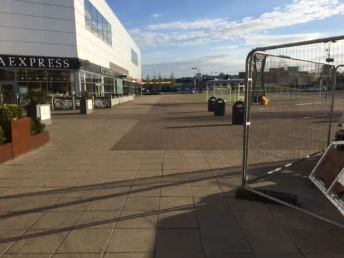
Bella Italia
Restaurant · Italian · 1.4 mi
Colorado Way, Castleford
Mo-Th 11:30-21:30; Fr 11:30-22:00; Sa 11:00-22:00; Su 11:00-21:00
Frankie & Benny's
Diner · American · 1.4 mi
Colorado Way, Castleford
Mo-Th 09:00-21:00; Fr-Sa 09:00-22:00; Su 09:00-21:00

Coffee Boy
Cafe · Coffee Shop · 1.1 mi
Willowbridge Lane, Castleford
Mo-Fr 07:00-17:00; Sa 08:00-15:00; Su 09:00-15:00


Costa
Cafe · Coffee Shop · 1.0 mi
Thunderhead Ridge, Castleford
Mo-Fr 05:30-22:00; Sa-Su 05:30-21:30
163 more on the map.
History
Castleford's history dates back to Roman times, archaeological evidence points to modern day Castleford being built upon a Roman army settlement which was called Lagentium (thought to mean 'The Place of the Swordsmen'). Roman funeral urns have been found in modern-day Castleford, giving further evidence to this theory. A Roman milestone was unearthed in Beancroft Road, now believed to be in Leeds City Museum.
Queen's Park in Castleford provides evidence of Roundhouses used by the Anglo Saxons. This was a strategic area due to the views of the entire settlement. The history of the area includes Oliver Cromwell's encampment in nearby Knottingley and Ferrybridge (originally thought to be in Castleford itself) whilst his forces laid siege to Pontefract Castle.
In the 19th century, Castleford became a boomtown with the population growing from 1,000 to 14,000 as collieries opened around the town; however, these collieries closed in the 20th century. Ferrybridge Power Station and Kellingley Colliery have also closed (in 2015 and 2016 respectively) and used to employ Castleford residents. The newer warehouses and distribution centres in Glasshoughton have brought in many new jobs to the area.
Read more of the history
Grand Designs presenter Kevin McCloud and Channel 4 led a community regeneration scheme, the Big Town Plan, broadcast in 2008, to help Castleford's redevelopment. Projects included a new footbridge across the River Aire, designed by McDowell+Benedetti architects and opened in 2008.
In February 2017 Castleford Swimming Pool closed. A new modern leisure facility including a swimming pool is proposed for nearby Pontefract Park.
Built in 1890 the underpass/bridge made by Deborah Saunt called the Tickle Cock Bridge was established and was refurbished in 2003 and was closed around Christmas 2005, but was completed in 2008. Also known by its original name The Tittle Cot bridge but was later changed To Tickle Cock and still has a controversial stance.
From the History section of Castleford on Wikipedia, under CC BY-SA 4.0.
More about Castleford
Economy
Castleford had potteries from the early 18th century until 1961, notably the Castleford Pottery (1790–1820) of David Dunderdale, which gave its name to "Castleford-type" stonewares.
Burberry, the retailer and designer label, has a factory in the town, plans were proposed to close this once a new facility was built in Leeds. However these plans were put on hold in 2016 and the factory is due to remain in the town for the foreseeable future. A large Nestlé factory, which produced Toffee Crisp and After Eights for 40 years, closed in 2012 and demolition starting in 2014 to make way for housing. Castleford has previously been home to Dunsford and Wesley Textiles, which at peak business times had three factories in Castleford which have all since ceased production. TEVA also have their UK headquarters here.
Education
The town's primary schools are Wheldon Infant School, Castleford Park Junior, Smawthorne Henry Moore, Townville Infant School, Airedale Juniors, Oyster Park Primary, Fairburn View Primary, Three Lane Ends Academy, Ackton Pastures, Saint Joseph's Catholic Primary and Half Acres.
Castleford's secondary schools for children aged 11–16 are Castleford Academy and Airedale Academy.
The town has a small further and higher education college in Glasshoughton which was originally the Castleford campus of Wakefield College. Rebuilt in 2009, it is now known as Castleford College, one of three separate institutions within the Heart of Yorkshire Education Group along with Wakefield College and Selby College.
From the Wikipedia article Castleford, under CC BY-SA 4.0.
Notable people from Castleford
 Henry MooreEnglish sculptor (1898–1986)Photo: Allan warren, CC BY 3.0
 Peter RobinsonCanadian crime writer (1950–2022)Photo: Georges Seguin ( Okki ), CC BY-SA 3.0
 Daryl ClarkGB & England international rugby league footballerPhoto: Gerard Barrau, CC BY-SA 3.0
 Richard StokerBritish composer (1938–2021)Photo: Gill Stoker, CC BY-SA 4.0
 Greg EdenEnglish professional rugby league footballerPhoto: Fleets, CC BY-SA 4.0
 John KearEnglish rugby league footballer and coachPhoto: Fleets, CC BY-SA 4.0
 Reginald SoarBritish flying acePhoto: Anonymous Unknown author, Public domain
 Mark AstonEnglish rugby league footballer and coachPhoto: Fleets, CC BY-SA 4.0
- Martyn WoolfordEnglish association football player (born 1985)
- Sonia BurgessBritish immigration lawyer
- Mark BaileyEnglish historian and rugby union footballer (born 1960)
- Daryl PeachEnglish pool player
Born in Castleford, according to Wikidata (CC0). Each name links to its Wikipedia article.
Where to stay2
Churches and places of worship22
Trinity Methodist Church
Church · Methodist
Powell Street, Castleford
Shopping43
Gas and EV charging11
Schools, colleges and libraries12
Healthcare7
Map of Castleford
250 places. The map loads OpenStreetMap tiles when you open it.
Getting there and nearby towns
Leeds Bradford Airport (LBA) is the nearest airport with scheduled flights listed in OpenStreetMap, 16 miles away.
- Kippax 3 mi north, about 5 min by car
- Pontefract 3 mi southeast, about 5 min by car
- Featherstone 3 mi south, about 5 min by car
- Knottingley 5 mi east, about 7 min by car
- Garforth 5 mi north, about 7 min by car
- Lofthouse 5 mi west, about 9 min by car
- Wakefield 6 mi southwest, about 10 min by car
- Leeds 9 mi northwest, about 14 min by car
- Ossett 9 mi west, about 15 min by car
- Morley 10 mi west, about 16 min by car
Drive times are estimates from straight-line distance, not routes.
Towns near Castleford


Keep exploring
Local news
Headlines from INDB.
Reviews, tips and questions
Loading what members have shared...
Sources and licences
- GeoNames (CC BY 4.0): population, coordinates, regions and time zone
- Mapillary (see each image): photos
- OpenStreetMap contributors (ODbL 1.0): places, airports, map data
- Wikidata (CC0 1.0): elevation, founding date, time zone, website, landmarks and historic places
- Wikimedia Commons (see each image): photos
- Wikipedia (CC BY-SA 4.0): overview and history text
Photo credits
- Carlton Street, Castleford, Mtaylor848, CC BY-SA 3.0
- Tickle Cock Bridge April 2017, Chemical Engineer, CC BY-SA 4.0
- Pontefract Castle, Unknown author, Public domain
- St Aidan's Nature Reserve1, Richard Avery, CC BY-SA 4.0
- All Saints Church Normanton, Jonobass, CC BY 3.0
- All Saints, Pontefract (27364027412), Tim Green from Bradford, CC BY 2.0
- Micklegate Methodist Church, Pontefract (1), Rept0n1x, CC BY-SA 3.0
- All Saints, Castleford (27394684630), Tim Green from Bradford, CC BY 2.0
- Wakefield College, Frombowen, CC BY-SA 4.0
- Wheldonroadmainstand, Me677 ( talk ), Public domain
- Castleford Library (1st June 2020), Mtaylor848, CC BY-SA 4.0
- Roman Bath House, Castleford, Lajmmoore, CC BY-SA 4.0
- Wakefield College with new Heart of Yorkshire Education Group branding, October 2022, BNC85, CC BY-SA 4.0
- Street-level photo, humez, CC BY-SA 4.0
- Street-level photo, humez, CC BY-SA 4.0
- Street-level photo, humez, CC BY-SA 4.0
- Street-level photo, humez, CC BY-SA 4.0
- Street-level photo, gmc, CC BY-SA 4.0
- Street-level photo, cuttlebug, CC BY-SA 4.0
- Street-level photo, cuttlebug, CC BY-SA 4.0
- Street-level photo, humez, CC BY-SA 4.0
- Street-level photo, cuttlebug, CC BY-SA 4.0
- Street-level photo, cuttlebug, CC BY-SA 4.0
- Street-level photo, cuttlebug, CC BY-SA 4.0
- Street-level photo, cuttlebug, CC BY-SA 4.0
- Street-level photo, cuttlebug, CC BY-SA 4.0
- Street-level photo, cuttlebug, CC BY-SA 4.0
- Street-level photo, gmc, CC BY-SA 4.0
- Street-level photo, humez, CC BY-SA 4.0
- Street-level photo, cuttlebug, CC BY-SA 4.0
- Street-level photo, gmc, CC BY-SA 4.0
- Street-level photo, gmc, CC BY-SA 4.0
- Street-level photo, gmc, CC BY-SA 4.0
- Street-level photo, gmc, CC BY-SA 4.0


Page built November 10, 2026. Spotted a mistake? Tell us or suggest a place.