


Why visit Tayport
Townapedia lists 12 museums and landmarks, 10 parks and trails, 55 places to eat, 6 places to stay and 7 attractions in and around town.
Highlights include Tay Road Bridge, Tayport Low Light, Broughty Castle and Broughty Castle Museum.
Weather in Tayport
Forecast from MET Norway (CC BY 4.0). Full forecast
About Tayport
Tayport, also known as Ferry-Port-on-Craig, is a town in Fife, Scotland. It lies on the Firth of Tay opposite Broughty Ferry, a suburb of Dundee. The two were linked by a ferry service until 1939. To the east of Tayport is the vast Tentsmuir Nature Reserve, an area of forested dunes edged by wide sands that continue all the way round to the mouth of the River Eden.
From the Wikipedia article Tayport (this version), under CC BY-SA 4.0.
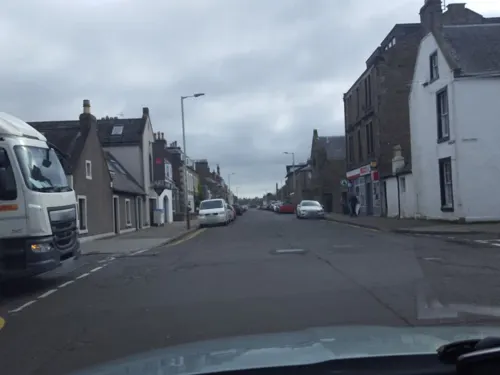
Photos of Tayport


Things to do7

Tay Road Bridge
Bridge · 2.6 mi
Bridge between Dundee and Fife, Scotland, UK, carries the A92 road across the Firth of Tay




Museums and landmarks12

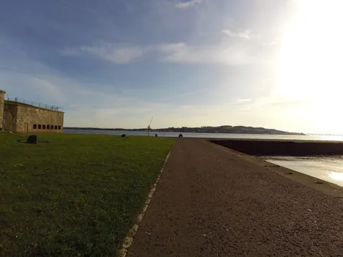
Broughty Castle
Monument and historic site · 1.2 mi
Castle and museum in Dundee City, Scotland, United Kingdom
Castle Approach, Dundee
Dundee Museum of Transport
Museum · 3.0 mi
Transport museum in Dundee, Scotland, United Kingdom
V&A Dundee
Museum · 3.4 mi
Museum of design in Dundee, Scotland, a branch of the Victoria and Albert Museum of London

Dundee International Submarine Memorial
Monument and historic site · 3.0 mi
Memorial in Dundee, Scotland, UK
Parks, trails and playgrounds10



Restaurants and cafes55
Jolly's Hotel
Bar and pub · 1.3 mi
43a Gray Street, Dundee
Mo,Tu,We,Th,Su 07:00-24:00; Fr,Sa 07:00-25:00

Caffè Nero
Cafe · Coffee Shop · 1.4 mi
209 Brook Street, Dundee
Mo-Fr 07:30-18:30; Sa 08:00-18:30; Su 08:00-17:30
Maison Dieu Coffee Roasters
Cafe · Coffee Shop · 1.4 mi
195 Brook Street, Dundee
Mo-Fr 08:00-16:00; Sa 09:00-16:00; Su 10:00-16:00

Forgan's Broughty Ferry
Restaurant · 1.4 mi
234 Brook Street, Dundee
Fr-Sa 12:00-23:00; We-Th, Su 12:00-21:00

Costa
Cafe · Coffee Shop · 1.4 mi
210 Brook Street, Dundee
Mo-Sa 07:00-18:00; Su 08:00-17:30
Gracie's
Cafe · Coffee Shop · 1.4 mi
175 Brook Street, Dundee
09:00-17:00
The Kitchen Table
Cafe · Coffee Shop, Cake · 1.4 mi
327A Brook Street, Dundee
Mo-Sa 08:00-15:00; Su closed
43 more on the map.
History
A ferry service across the Tay was already well established when these lands were granted to the newly formed Arbroath Abbey about 1180. The abbey constructed shelter and lodgings for pilgrims making the trip between St Andrews and Arbroath via the ferry and this formed the core of a settlement that steadily grew over the centuries.
A chapel was built in the early 13th century, possibly more of an abbey than chapel. The site was excavated in the 1930s or earlier. The harbour at Tayport was distinguished by Tayport castle, which was built around 1450, but later demolished.
Ferry-Port-on-Craig saw a dramatic increase in population at the end of the 18th century when tenants displaced by agricultural improvement and clearances, came to take advantage of jobs in the town's textile and shipbuilding industries. Leisure opportunities also increased. Golf came early to Ferry-Port-on-Craig, with a course laid out in 1817, despite the efforts of a local farmer, who twice ploughed up the course.
Read more of the history
A road to Newport-on-Tay, three miles to the west, with its less weather-prone and better used ferry service to Dundee meant that Ferry-Port-on-Craig was intermittently without a ferry during the first half of the 19th century. By the 1840s a steam ferry service had resumed between the community and Broughty Ferry. This was acquired, in 1851, by the Edinburgh, Perth and Dundee Railway which used the route for a railway ferry service from Edinburgh to Aberdeen.
The rail ferry ceased operation in 1878 with the opening of the Tay Rail Bridge, only to resume operations the following year when the bridge collapsed. With the opening of the replacement bridge in 1887 Tayport returned to a passenger-only ferry, which continued to run from the town to Broughty Ferry until 1939.
The opening of the Tay Road Bridge in 1966 put Tayport within a few minutes' drive of the centre of Dundee, and it has since evolved into a dormitory town for that city. Some industry remains, but the harbour is now given over almost wholly to leisure craft, and new housing has been built where once railway carriages were manoeuvered onto ferries.
Reminders of Tayport's earlier life and identity remain. In the centre of the town is Ferry-Port-on-Craig Church, established in 1607 and rebuilt in 1794 and again in 1825, though Protestant worship now takes place in Tayport Parish Church, built in 1843 as Ferry-Port-on-Craig Free Church. There is also a Catholic church (part of the Diocese of Dunkeld), named Our Lady, Star of the Sea in the community.
From the History section of Tayport on Wikipedia, under CC BY-SA 4.0.
Notable people from Tayport
 Douglas YoungScottish classical scholar and politician (1913-1973)Photo: Unknown author Unknown author, Public domain
- Agnes Husbandpolitician (1852-1929)
- Nicolas VilantScottish mathematician (1737-1807)
- John Buchan RossRoyal Air Force officer
Born in Tayport, according to Wikidata (CC0). Each name links to its Wikipedia article.
Where to stay6
Churches and places of worship14
Broughty Ferry Presbyterian Church
Church · Presbyterian · 1.4 mi
343 Brook Street, Dundee
St Margaret of Scotland Episcopal Church
Church · Scottish Episcopal
Queen Street, Tayport
Shopping9
Schools, colleges and libraries3
Healthcare4
Map of Tayport
120 places. The map loads OpenStreetMap tiles when you open it.
Getting there and nearby towns
Leuchars Station (ADX) is the nearest airport with scheduled flights listed in OpenStreetMap, 5 miles away.
- Dundee 4 mi northwest, about 6 min by car
- Invergowrie 7 mi west, about 11 min by car
- Carnoustie 8 mi northeast, about 12 min by car
- Saint Andrews 8 mi south, about 13 min by car
- Arbroath 14 mi northeast, about 22 min by car
- Forfar 14 mi north, about 22 min by car
- Ladybank 15 mi southwest, about 24 min by car
- Crail 16 mi southeast, about 26 min by car
- Methil 19 mi south, about 30 min by car
- Glenrothes 21 mi southwest, about 33 min by car
Drive times are estimates from straight-line distance, not routes.
Towns near Tayport


Keep exploring
Local news
Headlines from INDB.
Reviews, tips and questions
Loading what members have shared...
Sources and licences
- GeoNames (CC BY 4.0): population, coordinates, regions and time zone
- Mapillary (see each image): photos
- OpenStreetMap contributors (ODbL 1.0): places, airports, map data
- Wikidata (CC0 1.0): elevation, founding date, time zone, website, landmarks and historic places
- Wikimedia Commons (see each image): photos
- Wikipedia (CC BY-SA 4.0): overview and history text
Photo credits
- 07801 Tayport Church of Scotland, Tayport 003, WeeHolly, CC BY-SA 4.0
- 07801 Tayport Church of Scotland, Tayport 004, WeeHolly, CC BY-SA 4.0
- 07801 Tayport Church of Scotland, Tayport 007, WeeHolly, CC BY-SA 4.0
- 07801 Tayport Church of Scotland, Tayport 008, WeeHolly, CC BY-SA 4.0
- 07801 Tayport Church of Scotland, Tayport 006, WeeHolly, CC BY-SA 4.0
- 07801 Tayport Church of Scotland, Tayport 002, WeeHolly, CC BY-SA 4.0
- 07801 Tayport Church of Scotland, Tayport 001, WeeHolly, CC BY-SA 4.0
- 07801 Tayport Church of Scotland, Tayport 005, WeeHolly, CC BY-SA 4.0
- Tay Road Bridge April 2026, Lucas Kendall, CC BY-SA 4.0
- Broughty Castle (2), TimVickers, Public domain
- Dundee lighthouse, Andy Wright from Sheffield, UK, CC BY 2.0
- Tayport Pile Lighthouse, Brian Forbes from Kinross, Scotland, CC BY-SA 2.0
- Dundee City - St Jamess Church & Hall, 5 Fort Street, Broughty Ferry, Dundee - 20240918183521, Delane13, CC BY-SA 4.0
- Orange moon - panoramio, jmcleod, CC BY-SA 3.0
- Street-level photo, smsm1, CC BY-SA 4.0
- Street-level photo, hobgoblin, CC BY-SA 4.0
- Street-level photo, southglos, CC BY-SA 4.0
- Street-level photo, xdTAGCLAN, CC BY-SA 4.0
- Street-level photo, toho, CC BY-SA 4.0
- Street-level photo, southglos, CC BY-SA 4.0
- Street-level photo, hobgoblin, CC BY-SA 4.0
- Street-level photo, hobgoblin, CC BY-SA 4.0
- Street-level photo, hobgoblin, CC BY-SA 4.0
- Street-level photo, hobgoblin, CC BY-SA 4.0

Page built November 10, 2026. Spotted a mistake? Tell us or suggest a place.