


Why visit Tow Law
Townapedia lists 9 museums and landmarks, 2 parks and trails, 10 places to eat and 1 place to stay in and around town.
Highlights include Harperley POW Camp 93, Inkerman Beehive Coke Ovens and Stanley Moss.
Weather in Tow Law
Forecast from MET Norway (CC BY 4.0). Full forecast
About Tow Law
Tow Law is a town and civil parish in County Durham, England. It is situated a few miles to the south of Consett and 5 miles to the north west of Crook.
From the Wikipedia article Tow Law (this version), under CC BY-SA 4.0.
Museums and landmarks9

Harperley POW Camp 93
Monument and historic site · 2.2 mi
World War 2 prisoner of war camp in England

Parks, trails and playgrounds2

Restaurants and cafes10
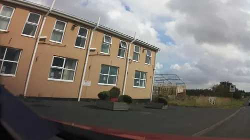
Golden Fry
Fast food · Fish And Chips
82 High Street, Bishop Auckland
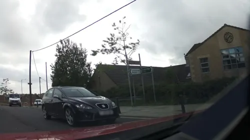
New Dans Castle Chinese Takeaway
Fast food · Chinese
6 Dan's Castle, Bishop Auckland



Where to stay1
History
The name "Tow Law" is from the Old English tot hlaw meaning "lookout mound," the name of a house which stood there before the iron works and the village were built.
St Philip & St James' Church Tow Law, designed by C. Hodgson Fowler, was completed in 1869.
There was rapid growth in the mid 19th century after the Weardale Iron and Coal Company was established here in 1845. Blast furnaces were built and collieries were opened; the population was about 2000 in 1851, and 5000 in 1881.
Since December 2001 the town has had a 2.3 Megawatt wind farm consisting of three 50 m (160 ft)-high wind-powered turbines. During the 2001 foot and mouth crisis, MAFF buried diseased animals at the former Inkerman Pit site. This was an emotive issue for local residents, who were disturbed by vehicle movements and smells from the pit. Many protesters attended the site every day for six months but had no effect and Defra continued to keep the site operational until the spring of 2002.
From the History section of Tow Law on Wikipedia, under CC BY-SA 4.0.
Notable people from Tow Law
- Alan MilburnBritish politician (born 1958)
- Bert HobsonEnglish footballer (1890-1963)
- Albert Ernest HillaryBritish politician (1868-1954)
- Joe McAninlyEnglish footballer (1913-1989)
- Jimmy SmailesEnglish footballer (born 1907)
- John KeersEnglish footballer (1901-1963)
- Harry RawEnglish footballer (born 1903)
Born in Tow Law, according to Wikidata (CC0). Each name links to its Wikipedia article.
Churches and places of worship4
Shopping1
Gas and EV charging1
Schools, colleges and libraries2
Healthcare1
Map of Tow Law
31 places. The map loads OpenStreetMap tiles when you open it.
Getting there and nearby towns
Newcastle International Airport (NCL) is the nearest airport with scheduled flights listed in OpenStreetMap, 21 miles away.
- Hunwick 6 mi southeast, about 9 min by car
- Consett 8 mi north, about 12 min by car
- Bishop Auckland 8 mi southeast, about 13 min by car
- Annfield Plain 8 mi north, about 13 min by car
- Witton Gilbert 8 mi northeast, about 13 min by car
- Stanhope 8 mi west, about 13 min by car
- Spennymoor 9 mi east, about 15 min by car
- Evenwood 9 mi south, about 14 min by car
- Durham 10 mi east, about 16 min by car
- Stanley 10 mi northeast, about 16 min by car
Drive times are estimates from straight-line distance, not routes.
Towns near Tow Law


Keep exploring
Local news
Headlines from INDB.
Reviews, tips and questions
Loading what members have shared...
Sources and licences
- GeoNames (CC BY 4.0): population, coordinates, regions and time zone
- Mapillary (see each image): photos
- OpenStreetMap contributors (ODbL 1.0): places, airports, map data
- Wikidata (CC0 1.0): elevation, founding date, time zone, website, landmarks and historic places
- Wikimedia Commons (see each image): photos
- Wikipedia (CC BY-SA 4.0): overview and history text
Photo credits
- Tow Law High Street, Ian Porter, CC BY-SA 3.0
- Tow Law (branch surgery) now cafe, Victuallers, CC BY-SA 4.0
- Tow Law (branch surgery), Victuallers, CC BY-SA 4.0
- War Memorial, Tow Law. County Durham, Ataffo, CC BY-SA 4.0
- Harperley looking West, Rolyat29, CC BY-SA 3.0
- Gate Piers And Gates To West Of Church Of St Philip And St James, Victuallers, CC BY-SA 4.0
- Street-level photo, victuallers, CC BY-SA 4.0
- Street-level photo, southglos, CC BY-SA 4.0
- Street-level photo, southglos, CC BY-SA 4.0
- Street-level photo, southglos, CC BY-SA 4.0
- Street-level photo, victuallers, CC BY-SA 4.0
- Street-level photo, southglos, CC BY-SA 4.0
- Street-level photo, southglos, CC BY-SA 4.0
- Street-level photo, stevenhorner, CC BY-SA 4.0
- Street-level photo, stevenhorner, CC BY-SA 4.0
- Street-level photo, victuallers, CC BY-SA 4.0
- Street-level photo, southglos, CC BY-SA 4.0
Page built November 10, 2026. Spotted a mistake? Tell us or suggest a place.