


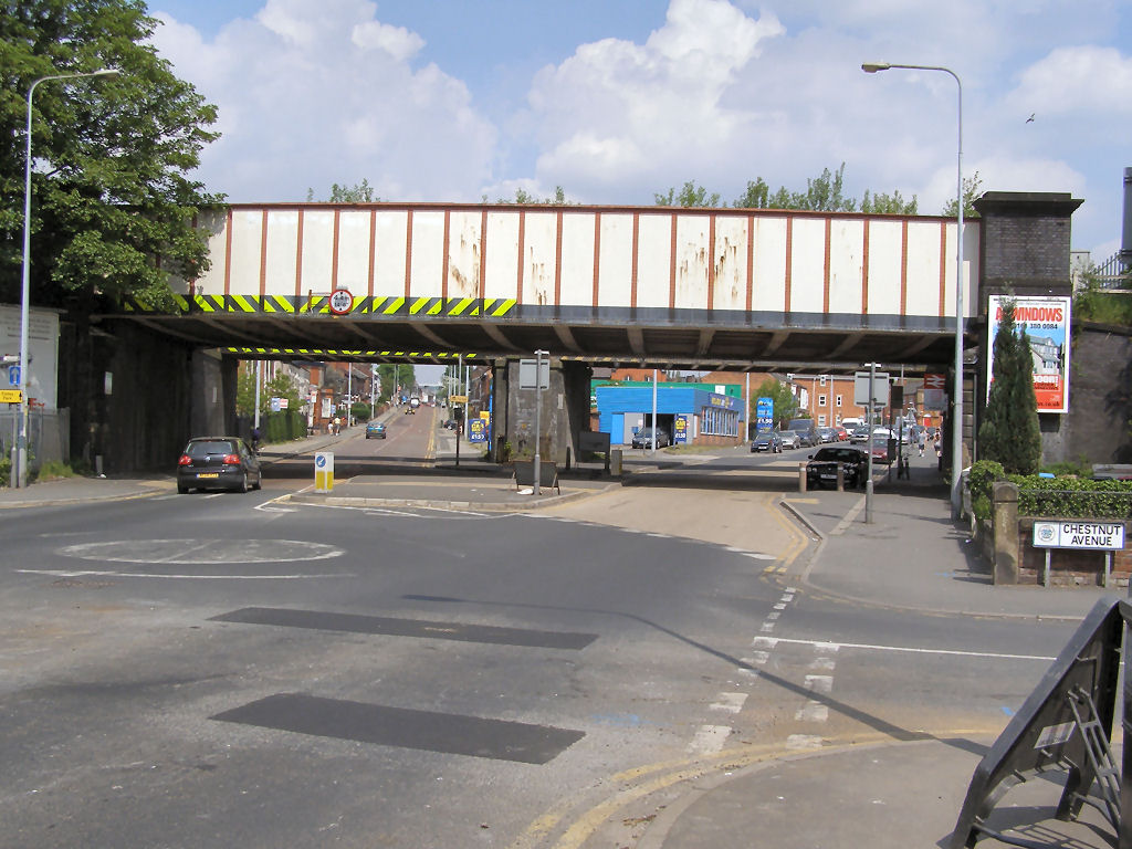
Why visit Walkden
Townapedia lists 12 museums and landmarks, 35 parks and trails, 134 places to eat, 4 places to stay and 6 attractions in and around town.
Highlights include Clifton Aqueduct, Clifton Viaduct, Lancashire Mining Museum and New Hall moated site.
Weather in Walkden
Forecast from MET Norway (CC BY 4.0). Full forecast
About Walkden
Walkden is a town in the City of Salford in Greater Manchester, England, six miles (ten kilometres) northwest of central Salford, and seven miles (eleven kilometres) of Manchester.
From the Wikipedia article Walkden (this version), under CC BY-SA 4.0.
Travel tips from other travellers: Walkden on Wikivoyage (CC BY-SA 4.0).
Photos of Walkden


Things to do6

Clifton Aqueduct
Bridge · 3.5 mi
Grade II listed bridge in the United Kingdom

Clifton Viaduct
Bridge · 3.6 mi
Grade II listed bridge in Greater Manchester, England, UK

Outwood Viaduct
Bridge · 3.9 mi
Grade II listed footbridge in Bury, Greater Manchester, England, UK

Ringley Old Bridge
Bridge · 2.5 mi
Grade II* listed bridge in Bolton, Greater Manchester, England, UK
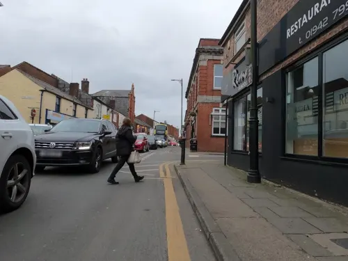
Tyldesley Little Theatre
Cinema and theater · 2.9 mi
Theatre in Tyldesley, England

Museums and landmarks12

Lancashire Mining Museum
Museum · 2.4 mi
Mining museum in Greater Manchester, United Kingdom

New Hall moated site
Monument and historic site · 2.4 mi
Scheduled monument in Tyldesley, Greater Manchester, England, UK
Polly's Grave
Monument and historic site · 0.6 mi
"Polly first made it into the press in 1899 and by this time she had produced 164 piglets... This outstanding feat was also reported in...
Waldken Memorial
Monument and historic site · 0.5 mi
The impressive structure was erected in memory of the Countess of Ellesmere, Lady Harriet Egerton. It was moved to its current home next...
Gateposts for access to Bridgewater Colliery Railway
Monument and historic site · 1.1 mi
Parks, trails and playgrounds35


Blackleach Country Park
Park · 1.1 mi
Country park in Walkden, Greater Manchester, England

Clifton Country Park
Park · 2.6 mi
Nature reserve in Greater Manchester, England

Moses Gate Country Park
Park · 2.6 mi
Park in Moses Gate, United Kingdom



Philips Park
Park · 4.0 mi
Area of parkland in Prestwich, Greater Manchester, UK
23 more on the map.
Restaurants and cafes134

Coal & Cotton
Bar and pub · 1.3 mi
Formerly Victorian 'Greyhound Farm', and a village pub run by the Crompton family in the 19th century, now revamped with gin distillery...
44 Leigh Road, Manchester
"From breakfast"

The Bull's Head Hotel
Bar and pub · 0.5 mi
12 High Street, Manchester
Mo,Tu,We,Th,Su 08:00-24:00; Fr,Sa 08:00-25:00
The John Gilbert
Bar and pub · 1.2 mi
Worsley Brow, Manchester
Mo-Th 11:00-23:00; Fr-Sa 11:00-24:00; Su 11:00-22:00

122 more on the map.
History
The name Walkden or Walkeden derives from the Old English denu, a valley, belonging to a man possibly called Wealca (fuller), an Old English personal name. It has been in existence since at least the 13th century. The name was recorded in documents dating to 1246.
A Roman road crossed the area roughly on the line of the present A6 road through Walkden and Little Hulton. In 1313, in a dispute involving land, a jury decided that Walkden was too small to be considered a hamlet or a town but was "only a place in Farnworth".
In the 15th century Walkden appears to have covered a wider area than at present, spreading into Farnworth and Little Hulton.
In 1765 "Walkden Moor" was the subject of a parliamentary inclosure act (5 Geo. 3. c. 60 Pr.). The Duke of Bridgewater was the biggest landowner in 1786, owning over half the land. At one time Walkden was dominated by coal mines and textile manufacturing.
Walkden's industrial history links are mainly to coal mining, but also to cotton mills. There were many shafts for small collieries sunk to the shallow coal seams of the Worsley Four Foot mine on land owned by the Egertons, the Lords of the Manor of Worsley which included Walkden.
Read more of the history
Named shafts were, Speakman's, Edge Fold, Lloyd's and Hey's Field before 1770, Turnpike Lime, Barlow Fold, Scowcroft's, and Crippin's Croft before 1780, Pin Fold, Parr Fold and Tub Engine before 1790 and Grundy's Field, Stone, Windmill, Charlton's, and the Inclined Plane Pit all before 1800.
The Worsley Navigable Levels linked many of the mines to the Bridgewater Canal at Worsley. The levels were used to transport coal from the mines of the Bridgewater Collieries in Walkden until railways were used as an improved form of transportation.
After 1800 Urmston's Meadow, Moss Hill Top, Parkinson's and Sawney, Atkin's Croft, Barrack's, Magnall's, Ashton's Field and the Ellesmere were sunk but were independent of the levels. Walkden Yard or NCB Central Workshops was situated south of High Street, close to Ellesmere Colliery was partly in Little Hulton.
It was built 1878 by the Bridgewater Trustees as a central works depot providing engineering services for their collieries and colliery railways. On the site there was a Drafting Office, Machine and Fitting workshop, Pump Shop, Joiners Shop, Electricians shop, Paint Shop, Blacksmith and Tinsmith Shop, Welders Shop, Locomotive Overhaul and Repair Shop, Waggon sheds and Waggon machine shop and a Conveyor Belt Repair Shop. The yard closed as a British Coal workshop in 1986 and is now a housing estate.
From the History section of Walkden on Wikipedia, under CC BY-SA 4.0.
More about Walkden
Geography
Walkden has two main parks in the town, namely Blackleach Country Park and Parr Fold Park. Parr Fold Park is a Victorian park.
Blackleach Country Park covers 50 hectares half-mile north of the town centre. The site is a designated local nature reserve. The reservoir was originally used by factories.
The formerly derelict and badly polluted site at Blackleach was next to a chemical waste tip, and was crossed by a disused railway line. It was reclaimed and restored after a community campaign.
A one tonne glacial erratic limestone boulder can be found in Parr Fold Park, indicated by an information sign. It is thought the provenance of the rock is linked to formations in the Lake District or South West Scotland, having been transported South to Walkden by melting ice 18,000 years ago.
Both of the parks have been recognised in the Green Flag Awards.
A small, gated angling pond can be found next to the Walkden Town Centre car park and can only be accessed by members. The site regularly holds fishing matches.
Education
Walkden has several primary schools, two high schools and a sixth form college which include Co-op Academy Walkden and The Lowry Academy. Until 2014 Walkden had three high schools, before the closure of St. George's RC High School in July 2014.
An Ofsted inspection at Co-op Walkden Academy in July 2023 found that the school was rated as 'Good' in all areas.
In February 2024, an Ofsted inspection at The Lowry Academy also resulted in a 'Good' rating, noting that the school had undergone a “positive transformation”.
A number of the town's primary schools are church schools. They include: St Paul's, Crompton Street, and St Paul's, Heathside, which are both Church of England schools. Christ the King RC Primary School is the Roman Catholic primary school for Walkden, Worsley and Roe Green.
In addition there are three county primary schools - they are North Walkden Primary School in the north of the town and Mesne Lea Primary School and James Brindley Primary School in south Walkden.
Worsley College, a post-16 vocational college which was previously known as Salford College, has a campus located in Walkden on Walkden Road, close to the railway station. The site underwent a significant renovation in 2023/24, adding a brand new café facility.
From the Wikipedia article Walkden, under CC BY-SA 4.0.
Notable people from Walkden
 Jamie MooreBritish boxerPhoto: Christophe95, CC BY-SA 3.0
- David BamberEnglish actor (born 1954)
- William BradleyEnglish racing cyclist
- Alan HalsallBritish actor
- Carol KleinEnglish gardening expert and TV presenter
- Fred HowardFootballer (1891-?)
- Kay HawkeEnglish footballer (born 1983)
- Bob SmithEnglish professional footballer (born 1923)
- Ernie MachinFootballer (1944-2012)
- Cecil BurgessCanadian architect (1888-1956)
- Lawrence CunliffeBritish politician (born 1929)
- Jason Doneactor
Born in Walkden, according to Wikidata (CC0). Each name links to its Wikipedia article.
Where to stay4
Worsley Park Marriott Hotel & Country Club
Motel and hotel · 0.8 mi
Walkden Road, Manchester
Churches and places of worship50
Shopping19
Gas and EV charging12
Schools, colleges and libraries42
Healthcare15
Little Hulton Health Centre
Clinic and pharmacy · 1.2 mi
Longshaw Drive, Little Hulton
Map of Walkden
250 places. The map loads OpenStreetMap tiles when you open it.
Getting there and nearby towns
Manchester Airport (MAN) is the nearest airport with scheduled flights listed in OpenStreetMap, 12 miles away.
- Little Hulton 1 mi northwest, about 2 min by car
- Kearsley 1 mi northeast, about 2 min by car
- Farnworth 2 mi north, about 4 min by car
- Swinton 2 mi southeast, about 4 min by car
- Little Lever 3 mi north, about 5 min by car
- Atherton 4 mi west, about 6 min by car
- Radcliffe 4 mi northeast, about 7 min by car
- Bolton 5 mi north, about 8 min by car
- Salford 5 mi southeast, about 8 min by car
- Whitefield 5 mi northeast, about 8 min by car
Drive times are estimates from straight-line distance, not routes.
Towns near Walkden


Keep exploring
Local news
Headlines from INDB.
Reviews, tips and questions
Loading what members have shared...
Sources and licences
- GeoNames (CC BY 4.0): population, coordinates, regions and time zone
- Mapillary (see each image): photos
- OpenStreetMap contributors (ODbL 1.0): places, airports, map data
- Wikidata (CC0 1.0): elevation, founding date, time zone, website, landmarks and historic places
- Wikimedia Commons (see each image): photos
- Wikipedia (CC BY-SA 4.0): overview and history text
Photo credits
- Walkden war memorial, David Dixon Originally uploaded to en.wikipedia by Doh5678 in April 2011 ( file log )., CC BY-SA 2.0
- Parr Fold Park in Walkden South, InvestWalkden, CC BY-SA 4.0
- The glacial erratic in Parr Fold Park, Walkden, InvestWalkden, CC BY-SA 4.0
- The Ellesmere, Walkden, Anthony Parkes, CC BY-SA 2.0
- Walkden disused railway, David Dixon, CC BY-SA 2.0
- Bridge at Walkden station, David Dixon Originally uploaded to en.wikipedia by Doh5678 in April 2011 ( file log )., CC BY-SA 2.0
- Walkden Station (6865352716), Craig Sunter from Manchester, UK, CC BY 2.0
- Walkden Roof Tops (7011944415), Craig Sunter from Manchester, UK, CC BY 2.0
- Walkden Roof Tops (6865830976), Craig Sunter from Manchester, UK, CC BY 2.0
- Walkden Roof Tops (6865829414), Craig Sunter from Manchester, UK, CC BY 2.0
- Walkden Station (6865353092), Craig Sunter from Manchester, UK, CC BY 2.0
- Walkden Station (6865350820), Craig Sunter from Manchester, UK, CC BY 2.0
- Walkden Station (6865352386), Craig Sunter from Manchester, UK, CC BY 2.0
- Clifton Aqueduct aerial shot, Parrot of Doom, CC BY-SA 4.0
- Clifton viaduct looking north, Parrot of Doom, CC BY-SA 3.0
- Outwood viaduct from river irwell, Parrot of Doom, CC BY-SA 4.0
- Ringley old bridge, Parrot of Doom, CC BY-SA 3.0
- Moses gate 002, Original uploader was Geotek at en.wikipedia, Public domain
- Victoria Park, Swinton (8179908674), Craig Sunter from Manchester, UK, CC BY 2.0
- All saints church urmston, Parrot of Doom, CC BY-SA 3.0
- Chowbent Chapel, J3Mrs ( talk ), CC BY-SA 3.0
- St marys parish church eccles greater manchester, Parrot of Doom, CC BY-SA 3.0
- St Anne's Church, Atherton, Margaret Clough, CC BY-SA 2.0
- St George, Tyldesley, north, J3Mrs ( talk ), CC BY-SA 3.0
- St John Farnworth, Plucas58, Public domain
- RHS Bridgewater (51294729810), Amanda Slater from Coventry, West Midlands, UK, CC BY-SA 2.0
- Irwell Sculpture Trail Lookout, Parrot of Doom, Public domain
- Blackleach Country Park 01, SG2012, CC BY 2.0
- Street-level photo, davidsong, CC BY-SA 4.0
- Street-level photo, southglos, CC BY-SA 4.0
- Street-level photo, tonys999, CC BY-SA 4.0
- Street-level photo, tonys999, CC BY-SA 4.0
- Street-level photo, tonys999, CC BY-SA 4.0


Page built November 10, 2026. Spotted a mistake? Tell us or suggest a place.