


Tyldesley, United Kingdom
Tyldesley is a town of 35,932 people in England, United Kingdom.
Why visit Tyldesley
Townapedia lists 17 museums and landmarks, 14 parks and trails, 89 places to eat and 1 attraction in and around town.
Highlights include Tyldesley Little Theatre, Damhouse, OldBankStudio and Blackleach Country Park.
Weather in Tyldesley
Forecast from MET Norway (CC BY 4.0). Full forecast
About Tyldesley
Tyldesley () is a market town in the Metropolitan Borough of Wigan in Greater Manchester, England. Within the boundaries of the historic county of Lancashire, it is north of Chat Moss near the foothills of the West Pennine Moors, eight miles (13 kilometres) southeast of Wigan and nine miles (14 kilometres) northwest of Manchester. At the 2001 United Kingdom census, the Tyldesley built-up area subdivision, excluding Shakerley, had a population of 16,142.
From the Wikipedia article Tyldesley (this version), under CC BY-SA 4.0.
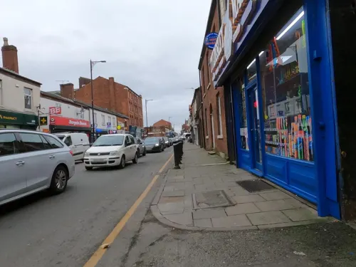
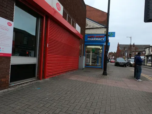
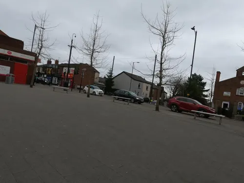
Photos of Tyldesley

Things to do1

Museums and landmarks17

Damhouse
Monument and historic site · 0.8 mi
Damhouse is a grade II listed manor house set in 17 acres of woodland. The 16th Century manor house boasts extensive grounds, and is...

Lancashire Mining Museum
Museum · 1.5 mi
Mining museum in Greater Manchester, United Kingdom

New Hall moated site
Monument and historic site · 0.8 mi
Scheduled monument in Tyldesley, Greater Manchester, England, UK
Bedford Colliery
Monument and historic site · 1.3 mi
Former main site for Bedford Colliery.
Bedford Colliery/Gin Pit Colliery
Monument and historic site · 0.9 mi
Exact boundaries unknown at time of adding, area was larger than what i have mapped from the data i can find. Would appreciate...
Lancashire Boiler
Monument and historic site · 1.5 mi
Same type as 16 that used to power the mine
5 more on the map.
Parks, trails and playgrounds14

Blackleach Country Park
Park · 3.3 mi
Country park in Walkden, Greater Manchester, England




2 more on the map.
Restaurants and cafes89

Lizhi
Restaurant · Chinese · 1.3 mi
Unit 4 Ann Lane, Manchester
Tu-Th 16:00-22:00; Fr-Sa 16:00-23:00; Su 14:00-22:00


Noir Brasserie & Wine Bar
Bar and pub · 1.1 mi
Tearoom & Wine Bar serving luxury afternoon teas, a choice of alcoholic and non-alcoholic drinks, freshly cooked meals and signature...
1 Coach Road, Tyldesley
77 more on the map.
History
Tyldesley, meaning "Tilwald's clearing", is derived from the Old English (OE) personal name Tīlwald and leăh a "wood, clearing", suggesting that what is now open land was once covered with forest. The name was recorded as Tildesleiha in 1210. Alternative spellings include Tildeslei, Tildeslege, Tildeslegh and Tildesley. Tyldesley is situated at the edge of the Lancashire Plain north of Chat Moss, and the Banks is a sandstone ridge where the foothills of the Pennines begin and gave the town its early name of Tildsley Banks. The land rises from 100 feet (30 m) at the foot of the banks to 250 feet (76 m) at the highest point. Tyldesley is pronounced "Til-slee", and locally known as "Bongs". In local pronunciation "Banks" was corrupted to "Bongs". The old name for Mosley Common was
the "Hurst" or "Tyldesleyhurst"; the suffix "hyrst" means a wooded hill (OE).
The remains of a Roman road serving camps at Coccium (Wigan) and Mamucium (Manchester) passed through the area. It ran from Keeper Delph in Boothstown crossing Mort Lane north west of Cleworth Hall and south of Shakerley Old Hall. The road continued towards the Valley at Atherton where coins have been found, and on towards Gibfield and Wigan.
Read more of the history
In 1947, two urns containing about 550 Roman bronze coins, minted between AD 259 and AD 278, were found near the old Tyldesley–Worsley border. The coins are in the British Museum. After the end of Roman rule in Britain and into the history of Anglo-Saxon England, nothing was written about Tyldesley. Evidence for the presence of Saxons is provided by place names incorporating the Old English suffix leah, such as Tyldesley, Shakerley, and Astley.
The manor house was Astley Hall which, in 1212, was home to Hugh Tyldesley, Lord of the manors of Astley and Tyldesley. It is just inside the Tyldesley boundary but has been associated with Astley since the death of Henry Tyldesley in 1301, when the manor was divided among three sons. The Tyldesleys had a "reputation for lawlessness and who had frequent disputes with their neighbours". One exception was Hugh Tyldesley, Hugh the Pious, who endowed Cockersand Abbey with land in Shakerley before his death in 1226. The moated New Hall in the Park of Tyldesley, close to the old manor house was in existence before 1422 when it belonged to Thomas Tyldesley.
The new manor, known as the Garrett, was owned by John Tyldesley in 1505. The timber-framed Garrett Hall remained with the Tyldesleys until 1652 when Lambert Tyldesley died leaving no heir. The new owners, the Stanleys, leased it to tenant farmers. In 1732 it was sold to Thomas Clowes who also leased the property to tenants. In 1829 the estate was bought by the Bridgewater Trustees.
The township had several other significant houses. Generations of the Shakerley family lived in Shakerley Old Hall, close to the Shakerley Brook and Roman road. In medieval times they paid rent to Cockersand Abbey and dues of "one pair of white gloves at the feast of Easter" to Adam Tyldesley. Chaddock Hall was home to a family of yeomen farmers. Its name was variously recorded as Chaydok, Chaidoke and Chaidok, the last syllable probably meaning "oak". It was surrounded by a hamlet in the east of the township. The Chaddocks, like the Tyldesleys and Shakerleys, had a reputation for lawlessness.
The tenants of the Tyldesley, Shakerley and Chaddock lands were summoned for military service. Archers from Chaddock fought at Crécy in 1346 and at the Battle of Agincourt in 1415. In 1360, William Chaddock was described as an archer on foot, "potens de corpore et bonis". A muster roll described Hugh Tyldesley as an archer on horseback and Hugh Chaddock and Richard Tyldesley were foot-archers drawing daily pay for service from 22 July to 21 October 1391.
Cleworth Hall, recorded as Cluworth in 1333, was part of the Tyldesley lands on higher ground north of the high road. It passed to Nicholas Starkie of Huntroyde by his marriage to Anne Parr in 1578 and in 1594 was associated with witchcraft. Two children, John and Anne Starkie became "possessed of evil spirits". A well-known "conjurer" or wise man, Edmund Hartley, was asked to cure them, which he apparently did before demanding money which was refused. Hartley threatened trouble and Starkie denounced him and Hartley was taken for trial to Lancaster Castle in 1597 where he was tried and found guilty of witchcraft. He was hanged, twice, as the rope broke at the first attempt.
In the early 18th century Tyldesley was a collection of cottages and farms around the halls scattered across the township with no church or inn. Thomas Johnson, a Bolton merchant bought the Banks Estate in 1728, land from the Stanleys of Garrett Hall in 1742 and Davenports in the west of the township in 1752. He died in 1764 leaving his estate to his grandson with the same name. Thomas "Squire" Johnson developed the town of Tildsley Banks. His name lives on in Squires Lane and Johnson Street. The last quarter of the 18th century marked the beginning of a building boom and the grid plan of the town centre is from this date.
John Aikin described the area in 1795 in his book A Description of the Countryside from 30 to 40 Miles around Manchester:
The Banks of Tildesley, in the Parish of Leigh, are about one mile and a half in length, and command a most beautiful prospect into seven counties: the springs remarkably clear and most excellently adapted to the purposes of bleaching. The land is rich, but mostly in meadow and pastures, for milk, butter, and the noted Leigh cheese. The estate had, in the year 1780, only two farm houses and eight or nine cottages, but now contains 162 houses, a neat chapel, and 976 inhabitants, who employ 325 looms in the cotton Manufactories ...
From the History section of Tyldesley on Wikipedia, under CC BY-SA 4.0.
More about Tyldesley
Geography
At 53°30′59″N 2°28′0″W (53.5166°, −2.4668°), Tyldesley is situated eight miles (13 kilometres) east-southeast of Wigan and nine miles (14 kilometres) west-northwest of Manchester, and at the eastern end of the Metropolitan Borough of Wigan. Tyldesley and Shakerley cover 2,490 acres (1,010 hectares) Topographically Tyldesley is situated the edge of the Lancashire Plain just to the north of Chat Moss and the Banks of Tyldesley are where the foothills of the Pennines begin. The land rises from about 100 ft (30 m) at the foot of the banks to 250 ft (76 m) at the highest point. The banks, a sandstone escarpment with the scarp slope facing south and the gentler dip to the north, are about one and a half miles long. The underlying rocks are the coal measures of the Manchester Coalfield covered with boulder clay. Streams drain the area including the Shakerley and Hindsford Brooks which flow towards the Glaze Brook a tributary of the River Mersey.
Heavily industrialised during the 19th century, Tyldesley has become a residential area since the demise of the coal industry and closure of its cotton mills. The main road through Tyldesley is the A577 which runs on the high ground along the ridge on which the town centre is situated.
Economy
According to the 2001 United Kingdom census, the industry of employment of residents aged 16–74 was 18.1% retail and wholesale, 16.5% manufacturing, 12.1% property and business services, 10.9% health and social work, 7.4% education, 7.1% transport and communications, 7.6% construction, 5.8% public administration, 5.0% finance, 4.1% hotels and restaurants, 0.8% energy and water supply, 0.5% agriculture, 0.1% mining, and 4.2% other. Compared with national figures, the town had a relatively low percentage working in agriculture. The census recorded the economic activity of residents aged 16–74, 2.6% students were with jobs, 3.2% students without jobs, 4.7% looking after home or family, 6.7% permanently sick or disabled, and 2.1% economically inactive for other reasons.
The main concentrations of employment are at Chaddock Lane between Astley and Mosley Common and at Parr Brow to the north of Mosley Common.
Arts and culture
Tyldesley's wealth as an industrial town resulted in outlets for the entertainment of its population, including cinemas and public houses. Films were shown in Tyldesley Miners' Hall from 1908. Three cinemas were built in the town, the Theatre Royal in John Street opened in 1909, the Carlton on Johnson Street in 1911, and the Majestic in Castle Street in 1923. In 1902 the council acquired land for a public park on Astley Street. A public library was built in 1908 with the aid of an Andrew Carnegie grant, on the site of the old Temperance Hall and Mechanics Institute on Stanley Street built in 1851.
Founded in 1877, Tyldesley Good Templars Band was the town's first brass band. Tyldesley Band is a member of the North West Brass Band Association and meets in the chapel on Milk Street. Tyldesley Little Theatre in Lemon Street is home to an amateur dramatic society, members of the Greater Manchester Drama Federation. The auditorium is a small 150-seat theatre with a traditional proscenium arch stage, stalls and balcony seating. The town's industrial landscape was recorded in the 1960s and 1970s in the paintings and prints of artist Roger Hampson.
In March 2022, Tyldesley saw its 1st community radio station set up with the formation of Radio M29
Education
George Ormerod gave a site for a national school near St George's Church, it catered for all age groups when it opened in 1827. A day school was opened in the old Wesley Chapel in 1856 and in 1864 was replaced by new school which lasted until 1912. A church school opened in Johnson Street in 1872 and closed the 1960s. The British School in Upper George Street opened in 1902. Its premises are now the Community Life Centre. The Mission School or Central C of E School in Darlington Street opened in 1892. A board school opened in Lower Elliott Street in 1913 which was used for girls' secondary education after 1935. Garrett Hall Boys' Secondary School opened in 1935.
St George's Central Primary School, built in the late 1990s is an amalgamation of the historical St George's C of E and Central C of E School. Other primary schools are Tyldesley Primary School and Garrett Hall Primary. Until 2007 there was a school in Shakerley but this has closed. Kingshill Special School occupying the old girls' secondary school, has closed.
The main school for secondary education in Tyldesley is Fred Longworth High School, which was awarded Arts College status in 1998. Children in Tyldesley also attend other high schools in the area including, St Mary's Catholic High School in Astley, the only Catholic high school and sixth form in the area.
From the Wikipedia article Tyldesley, under CC BY-SA 4.0.
Notable people from Tyldesley
 Ella TooneEnglish association football playerPhoto: James Boyes from UK, CC BY 2.0
 Reginald Francis Arthur HobbsBritish Army officer (1878-1953)Photo: Bassano Ltd, Public domain
 Tom CannonBritish wrestlerPhoto: Reporter for The Saint Paul Globe, Public domain
- Frederick NorrisBritish long-distance runner (1921-2006)
- Alex MarrowEnglish footballer (born 1990)
- Lord James BlearsBritish-American professional wrestler (1923–2016)
- Peter CowperEnglish footballer (1902-1962)
- Bernard Cooke DixonBritish Army general
- Addin TyldesleyBritish swimmer
- Wayne FosterEnglish footballer (born 1963)
- Jack EllisEnglish footballer (1908-1994)
- Mark LanginBritish biathlete
Born in Tyldesley, according to Wikidata (CC0). Each name links to its Wikipedia article.
Churches and places of worship30
Chowbent Unitarian Chapel
Church · Unitarian · 1.0 mi
Alderfold Street, Manchester
Shopping13
Gas and EV charging3
Schools, colleges and libraries23
St Richard's Roman Catholic Primary School
School · Roman Catholic · 1.5 mi
Flapper Fold Lane, Manchester
Healthcare6
Map of Tyldesley
196 places. The map loads OpenStreetMap tiles when you open it.
Getting there and nearby towns
Manchester Airport (MAN) is the nearest airport with scheduled flights listed in OpenStreetMap, 14 miles away.
- Atherton 1 mi northwest, about 2 min by car
- Little Hulton 2 mi northeast, about 4 min by car
- Walkden 3 mi east, about 4 min by car
- Westhoughton 3 mi northwest, about 5 min by car
- Farnworth 4 mi northeast, about 6 min by car
- Kearsley 4 mi east, about 6 min by car
- Bolton 5 mi north, about 8 min by car
- Hindley 5 mi west, about 8 min by car
- Swinton 5 mi east, about 8 min by car
- Little Lever 5 mi northeast, about 8 min by car
Drive times are estimates from straight-line distance, not routes.
Towns near Tyldesley


Keep exploring
Local news
Headlines from INDB.
Reviews, tips and questions
Loading what members have shared...
Sources and licences
- GeoNames (CC BY 4.0): population, coordinates, regions and time zone
- Mapillary (see each image): photos
- OpenStreetMap contributors (ODbL 1.0): places, airports, map data
- Wikidata (CC0 1.0): elevation, founding date, time zone, website, landmarks and historic places
- Wikimedia Commons (see each image): photos
- Wikipedia (CC BY-SA 4.0): overview and history text
Photo credits
- Elliot Street, Tyldesley, Dave Green, CC BY-SA 2.0
- 5 Patchett Street Tyldesley, HRowntree, CC0
- St Anne's Church, Atherton, Margaret Clough, CC BY-SA 2.0
- Christ Church, Pennington, David Dixon, CC BY-SA 2.0
- St George, Tyldesley, north, J3Mrs ( talk ), CC BY-SA 3.0
- St James' Church, Daisy Hill, David Long, CC BY-SA 2.0
- St John's Mosley Common, J3Mrs, CC BY-SA 3.0
- Ellenbrook Chapel, Tony Smith, CC BY-SA 2.0
- St Mary's Church, Leigh, SMJ, CC BY-SA 2.0
- Chowbent Chapel, J3Mrs ( talk ), CC BY-SA 3.0
- The Dam House, Astley, Wigan, Plucas58, CC BY-SA 3.0
- Damhouse or Astley Hall, J3Mrs ( talk ), CC BY-SA 3.0
- Blackleach Country Park 01, SG2012, CC BY 2.0
- Street-level photo, tonys999, CC BY-SA 4.0
- Street-level photo, tonys999, CC BY-SA 4.0
- Street-level photo, tonys999, CC BY-SA 4.0
- Street-level photo, tonys999, CC BY-SA 4.0
- Street-level photo, tonys999, CC BY-SA 4.0
- Street-level photo, tonys999, CC BY-SA 4.0
- Street-level photo, tonys999, CC BY-SA 4.0
- Street-level photo, tonys999, CC BY-SA 4.0


Page built November 10, 2026. Spotted a mistake? Tell us or suggest a place.