


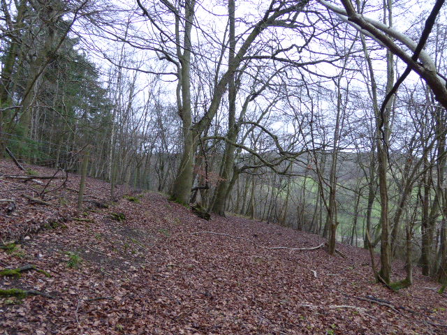


West Horsley, United Kingdom
West Horsley is a town of 1,276 people in England, United Kingdom.
Why visit West Horsley
Townapedia lists 18 museums and landmarks, 10 parks and trails, 21 places to eat, 4 places to stay and 4 attractions in and around town.
Highlights include Hatchlands Park, Clandon Park, Sheepleas and Colekitchen Down.
Weather in West Horsley
Forecast from MET Norway (CC BY 4.0). Full forecast
About West Horsley
West Horsley is a semi-rural village between Guildford and Leatherhead in Surrey, England. It lies on the A246, and south of the M25 and the A3. Its civil parish ascends to an ancient woodland Sheepleas Woods which are on the northern downslopes of the ridge of hills known as the North Downs in the extreme south of the village, and cover about a tenth of its area, 255 acres (1 km2). The bulk of its land is north of the Surrey Hills AONB; the rest is within it.
From the Wikipedia article West Horsley (this version), under CC BY-SA 4.0.
Things to do4



Millennium Viewpoint
Scenic view · 0.7 mi
Https://viewsoflondon.uk/Sheepleas.html
Museums and landmarks18

Hatchlands Park
Monument and historic site · 0.7 mi
Grade I listed historic house museum in East Clandon, Surrey, United Kingdom (National Trust property)

Clandon Park
Museum · 2.4 mi
Country house and museum in Surrey, England, UK

Polesden Lacey
Museum · 3.6 mi
Country house in Great Bookham, Surrey, England, UK

West Horsley Place
Monument and historic site · 0.7 mi
Epsom Road, Leatherhead
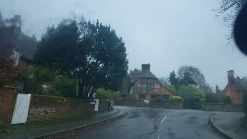
The Tithe Barn
Monument and historic site · 1.2 mi
Barn is listed in the Domesday book

6 more on the map.
Parks, trails and playgrounds10



Papercourt Marshes
Park · 3.5 mi
Site of Special Scientific Interest in Surrey, England, UK



Restaurants and cafes21
Bolo & Brew Cafe Bar
Cafe · Breakfast, Coffee Shop, Brunch, Cake, Pastry · 1.6 mi
Station Approach, Leatherhead
Merry House Takeaway
Restaurant · Fish And Chips · 1.4 mi
Ockham Road South, Leatherhead

9 more on the map.
History
West Horsley appears in the Domesday Book of 1086 as Orselei held by Walter, son of Othere. Its Domesday assets were: 8 hides; 1 church, 8 ploughs, woodland worth 20 hogs. It rendered £6 each year to its lords of the manor. Both Horsleys were burnt to the ground during the Norman Conquest of 1066 since its Saxon thane, Brixsi, was brother-in-law to King Harold and refused to submit. The village was part of the lands given to the Norman, Walter Fitz Otha, the new constable of Windsor Castle.
The population fell dramatically during the Black Death and the land was given over to grazing, since the peasant population was insufficient for farming.
In 1636, during a court case concerning a tithe dispute, a witness called Henry Mabbinck testified that he played cricket "in the Parke" at West Horsley, one of the sport's earliest references.
Helen Allingham painted an image of the village, "Children on a Path Outside A Thatched Cottage, West Horsley, Surrey".
Maartje Tamboezer, the second murder victim of John Duffy and David Mulcahy (branded the 'Railway Killers'), was killed in West Horsley in 1986, although Horsley railway station itself is in East Horsley.
The bulk of West Horsley parish is north of the Surrey Hills AONB, the rest is within it.
From the History section of West Horsley on Wikipedia, under CC BY-SA 4.0.
Notable people from West Horsley
- David OgilvyBritish advertising executive (1911-1999)
- Johnny ByrneEnglish footballer (1939-1999)
- David MalletBritish music video director
- George Wallerrecipient of the Victoria Cross
Born in West Horsley, according to Wikidata (CC0). Each name links to its Wikipedia article.
Where to stay4
Churches and places of worship6
Shopping4
Gas and EV charging1
Schools, colleges and libraries5
Map of West Horsley
73 places. The map loads OpenStreetMap tiles when you open it.
Getting there and nearby towns
London Gatwick Airport (LGW) is the nearest airport with scheduled flights listed in OpenStreetMap, 14 miles away.
- Great Bookham 4 mi east, about 6 min by car
- Guildford 5 mi west, about 9 min by car
- Cobham 5 mi north, about 8 min by car
- Woking 6 mi northwest, about 10 min by car
- Leatherhead 6 mi northeast, about 9 min by car
- Dorking 6 mi east, about 9 min by car
- Ashtead 8 mi northeast, about 12 min by car
- Weybridge 8 mi north, about 12 min by car
- Addlestone 8 mi north, about 13 min by car
- Esher 8 mi northeast, about 14 min by car
Drive times are estimates from straight-line distance, not routes.
Towns near West Horsley


Keep exploring
Local news
Headlines from INDB.
Reviews, tips and questions
Loading what members have shared...
Sources and licences
- GeoNames (CC BY 4.0): population, coordinates, regions and time zone
- Mapillary (see each image): photos
- OpenStreetMap contributors (ODbL 1.0): places, airports, map data
- Wikidata (CC0 1.0): elevation, founding date, time zone, website, landmarks and historic places
- Wikimedia Commons (see each image): photos
- Wikipedia (CC BY-SA 4.0): overview and history text
Photo credits
- Clandon House, Murraypaul at English Wikipedia, Public domain
- Polesden lacey, Martyn Davies, CC BY-SA 2.0
- Colekitchen Down (4), Dudley Miles, CC BY-SA 4.0
- Old St Peter and Paul Albury view from south-east, BabelStone, CC BY-SA 4.0
- HatchlandsPark front, Martinvl, CC BY-SA 4.0
- West Horsley Place, Colin Smith, CC BY-SA 2.0
- St Martin's Church, Ockham Road South, East Horsley (May 2014) (3), Hassocks5489, CC0
- Cowslip Meadow, Sheepleas, AndyScott, CC BY-SA 4.0
- Nomad Theatre, East Horsley, Surrey - May 2025 - 02, Mertbiol, CC0
- Street-level photo, richardc, CC BY-SA 4.0
- Street-level photo, southglos, CC BY-SA 4.0
- Street-level photo, richardc, CC BY-SA 4.0
- Street-level photo, richardc, CC BY-SA 4.0
- Street-level photo, richardc, CC BY-SA 4.0
- Street-level photo, richardc, CC BY-SA 4.0
- Street-level photo, richardc, CC BY-SA 4.0
- Street-level photo, richardc, CC BY-SA 4.0
- Street-level photo, richardc, CC BY-SA 4.0
- Street-level photo, richardc, CC BY-SA 4.0
- Street-level photo, 4004, CC BY-SA 4.0
- Street-level photo, 4004, CC BY-SA 4.0
- Street-level photo, 4004, CC BY-SA 4.0
- Street-level photo, richardc, CC BY-SA 4.0
- Street-level photo, richardc, CC BY-SA 4.0
- Street-level photo, richardc, CC BY-SA 4.0
- Street-level photo, richardc, CC BY-SA 4.0
- Street-level photo, 4004, CC BY-SA 4.0
- Street-level photo, richardc, CC BY-SA 4.0
- Street-level photo, richardc, CC BY-SA 4.0
- Street-level photo, richardc, CC BY-SA 4.0

Page built November 10, 2026. Spotted a mistake? Tell us or suggest a place.