


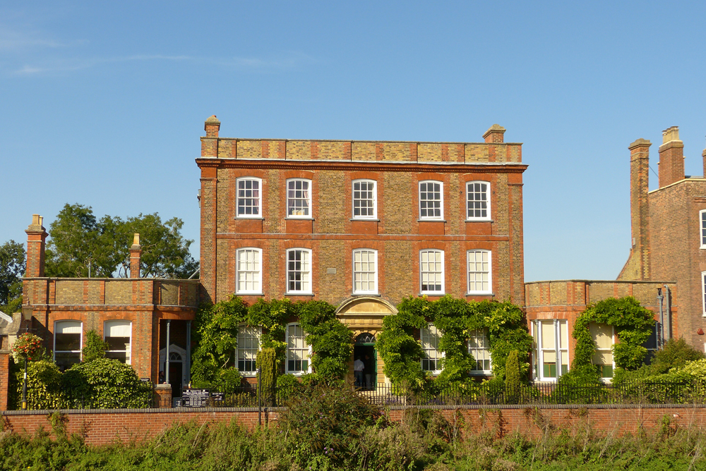
West Walton, United Kingdom
West Walton is a town of 1,731 people in England, United Kingdom.
Why visit West Walton
Townapedia lists 16 museums and landmarks, 5 parks and trails, 55 places to eat, 3 places to stay and 4 attractions in and around town.
Highlights include Angles Theatre, Peckover House & Gardens, Clarkson Memorial and The Spinney Wisbech Adventure Playground.
Weather in West Walton
Forecast from MET Norway (CC BY 4.0). Full forecast
About West Walton
West Walton is a village and civil parish in the King's Lynn and West Norfolk District of Norfolk, England.
From the Wikipedia article West Walton (this version), under CC BY-SA 4.0.
Things to do4

Angles Theatre
Cinema and theater · 2.4 mi
Theatre in Wisbech, Cambridgeshire, England, UK

Museums and landmarks16


Clarkson Memorial
Monument and historic site · 2.4 mi
Monument in Wisbech, United Kingdom
Peckover House and Garden
Museum · 2.4 mi
Historic house museum in Wisbech, Cambridgeshire, England, UK

Wisbech and Fenland Museum
Museum · 2.4 mi
Museum in Cambridgeshire, England, United Kingdom

4 more on the map.
Parks, trails and playgrounds5



Restaurants and cafes55




43 more on the map.
History
The name West Walton is thought by James Rye to derive from the Old English meaning of the 'settlement by the wall' which refers to the village's proximity to a Roman sea wall or defence.
West Walton was established by the time of the Norman Conquest. The village's population, land ownership and productive resources were detailed in its entry in the Domesday Book of 1085. In the great book West Walton is recorded by the name 'Waltuna'. The parish was held by William de Warenne with the Abbot of St Peter and St Paul, Cluny from him, The Abbot of Ely before and after 1066, and Oder from Ralph de Beufour. The survey mentions ½ church, 38 salt houses and 1100 sheep. The survey also records the presence of a fishery. In the Domesday survey fractions were used to indicate that the entry, in this case the church, was situated within more than one parish.
From the History section of West Walton on Wikipedia, under CC BY-SA 4.0.
More about West Walton
Geography
The village and parish of West Walton is in the western part of the county of Norfolk. The western flank of the parish is also the county border between Norfolk and Cambridgeshire and is also the course of the River Nene. On the southern flank is the parish of Walsoken. To the north is Walpole and to the east is Marshland St James.
The village is 47 miles (80 km) west-north-west of Norwich, 10 miles (20 km) west-south-west of King's Lynn and 80 miles (100 km) north of London and its location makes it, along with Walsoken, the most westerly village in Norfolk. The nearest town is Wisbech which is 2 miles (3.2 km) south of the village. The nearest railway station is at Watlington, Norfolk for the Fen Line which runs between King's Lynn and Cambridge. The nearest airport is Norwich International Airport.
From the Wikipedia article West Walton, under CC BY-SA 4.0.
Where to stay3
Churches and places of worship14
Shopping16
Gas and EV charging2
Schools, colleges and libraries10
Healthcare6
Map of West Walton
131 places. The map loads OpenStreetMap tiles when you open it.
Getting there and nearby towns
RAF Marham (KNF) is the nearest airport with scheduled flights listed in OpenStreetMap, 16 miles away.
- Wisbech 2 mi south, about 4 min by car
- King's Lynn 10 mi east, about 16 min by car
- March 11 mi south, about 17 min by car
- Downham Market 11 mi southeast, about 17 min by car
- Spalding 15 mi northwest, about 24 min by car
- Whittlesey 16 mi southwest, about 26 min by car
- Chatteris 17 mi south, about 28 min by car
- Peterborough 20 mi southwest, about 32 min by car
- Boston 21 mi northwest, about 34 min by car
- Ely 21 mi south, about 34 min by car
Drive times are estimates from straight-line distance, not routes.
Towns near West Walton


Keep exploring
Local news
Headlines from INDB.
Reviews, tips and questions
Loading what members have shared...
Sources and licences
- GeoNames (CC BY 4.0): population, coordinates, regions and time zone
- OpenStreetMap contributors (ODbL 1.0): places, airports, map data
- Wikidata (CC0 1.0): elevation, founding date, time zone, website, landmarks and historic places
- Wikimedia Commons (see each image): photos
- Wikipedia (CC BY-SA 4.0): overview and history text
Photo credits
- St Mary's church West Walton, Chris Stafford, CC BY-SA 2.0
- West Walton Doorway May 1993, Sludge G, CC BY-SA 2.0
- West Walton Doorway, Sludge G, CC BY-SA 2.0
- St Mary the Virgin West Walton 20080721-01, Hans A. Rosbach, CC BY-SA 3.0
- Angles Theatre, Wisbech, Bearas, CC BY-SA 4.0
- Peckover-house-wisbech, Theyellowtulip, CC BY-SA 3.0
- Šv. Petro bažnyčia Visbičas (Wisbech), Bearas, CC BY-SA 4.0
- Wisbech-clarkson-memorial--, Theyellowtulip, CC BY-SA 3.0

Page built November 10, 2026. Spotted a mistake? Tell us or suggest a place.