


Why visit Ely
Townapedia lists 14 museums and landmarks, 20 parks and trails, 88 places to eat, 14 places to stay and 8 attractions in and around town.
Highlights include Hawk Bridge, Cineworld, Oliver Cromwell's House and Ely Museum.
Weather in Ely
Forecast from MET Norway (CC BY 4.0). Full forecast
About Ely
Ely is a cathedral city and civil parish in the district of East Cambridgeshire in Cambridgeshire, England. It lies 14 miles (23 km) north-east of Cambridge, 24 miles (39 km) south-east of Peterborough, and 80 miles (130 km) from London. As well as the built up area itself, the parish also covers surrounding rural areas including the settlements of Chettisham, Prickwillow, Mile End, Queen Adelaide, and Stuntney. At the 2021 census the built up area had a population of 19,185 and the parish had a population of 20,574.
From the Wikipedia article Ely, Cambridgeshire (this version), under CC BY-SA 4.0.
Travel tips from other travellers: Ely on Wikivoyage (CC BY-SA 4.0).
Photos of Ely

Things to do8

Hawk Bridge
Bridge · 1.4 mi
Railway bridge across the Great River Ouse, near Ely, Cambridgeshire, UK



Museums and landmarks14

Oliver Cromwell's House
Monument and historic site
Cromwell's family home in Ely, Cambridgeshire, England, UK
29 St Mary's Street, Ely
Apr 01-Oct 31 10:00-17:00; Nov 01-Mar 31 11:00-16:00; Dec 25 off;...

Stained Glass Museum
Museum
National museum of stained glass in Ely, England, United Kingdom



2 more on the map.
Parks, trails and playgrounds20


Little Downham Local Nature Reserve
Park · 2.2 mi
Park in United Kingdom





8 more on the map.
Restaurants and cafes88


The Old Fire Engine House
Restaurant
25 St Mary's Street, Ely
Tu-Sa 10:30-11:30,12:15-14:00,15:45-17:15,18:30-20:15; Su...
The Royal Standard
Bar and pub
24 Fore Hill, Ely
Mo-Th 07:00-22:00; Fr 07:00-23:00; Sa 08:00-23:00; Su 08:00-22:00
Tony's Coffee Shop & Cocktail Bar
Cafe · Coffee Shop
1 High Street, Ely
Su 11:00-20:00; Mo off; Tu 11:00-22:00; We-Sa 11:00-20:00
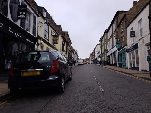
Indian Edge
Restaurant · Curry, Indian
9A Broad Street, Ely
Mo-Fr 17:30-22:00; Sa-Su 12:00-14:30,17:00-22:00
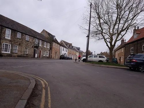
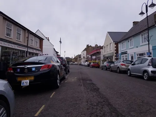
Sushi & Salad
Restaurant · Japanese
9 High Street Passage, Ely
Tu-Th 12:00-21:00; Fr,Sa 12:00-22:00; Su 12:00-17:00


76 more on the map.
History
Roswell Pits are a palaeontologically significant Site of Special Scientific Interest (SSSI) one mile (1.6 km) northeast of the city. The Jurassic Kimmeridge Clays were quarried in the 19th and 20th centuries for the production of pottery and for maintenance of river embankments. Many specimens of ammonites, belemnites and bivalves were found during quarrying, in addition to an almost complete specimen of a pliosaur.
There is some scattered evidence of Late Mesolithic to Bronze Age activity in Ely such as Neolithic flint tools, a Bronze Age axe and spearhead. There is slightly denser Iron Age and Roman activity with some evidence of at least seasonal occupation. For example, a possible farmstead, of the late Iron Age to early Roman period, was discovered at West Fen Road and some Roman pottery was found close to the east end of the cathedral on The Paddock. There was a Roman settlement, including a tile kiln built over an earlier Iron Age settlement, in Little Thetford, three miles (5 km) to the south.
Read more of the history
The city's origins lay in the foundation of an abbey in 673, one mile (1.6 km) to the north of the village of Cratendune on the Isle of Ely, under the protection of Saint Etheldreda, daughter of King Anna. St Etheldreda (also known as Æthelthryth) was a queen, founder and abbess of Ely. She built a monastery in 673 AD, on the site of what is now Ely Cathedral.[1] This first abbey was destroyed in 870 by Danish invaders and rededicated to Etheldreda in 970 by Ethelwold, Bishop of Winchester. The abbots of Ely then accumulated such wealth in the region that in the Domesday survey (1086) it was the "second richest monastery in England". The first Norman bishop, Simeon, started building the cathedral in 1083. The octagon was rebuilt by sacrist Alan of Walsingham between 1322 and 1328 after the collapse of the original nave crossing on 22 February 1322. Ely's octagon is considered "one of the wonders of the medieval world". Architectural historian Nikolaus Pevsner believes the octagon "is a delight from beginning to end for anyone who feels for space as strongly as for construction" and is the "greatest individual achievement of architectural genius at Ely Cathedral". This gave the cathedral its distinctive shape, earning it the moniker, "The Ship of the Fens".[2] Building continued until the dissolution of the abbey in 1539 during the Reformation. The cathedral was sympathetically restored between 1845 and 1870 by the architect George Gilbert Scott. As the seat of a diocese, Ely has long been considered a city; in 1974, city status was granted by royal charter.
Cherry Hill is the site of Ely Castle which is of Norman construction and is a United Kingdom scheduled monument. Of similar construction to Cambridge Castle, the 250-foot (76 m) diameter, 40 feet (12 m) high citadel-type motte and bailey is thought to be a royal defence built by William the Conqueror following submission of the Isle from rebels such as the Earl Morcar and the folk-hero Hereward the Wake from the Ely Rebellion. This would date the first building of the castle to c. 1070.
Henry III of England granted a market to the Bishop of Ely using letters close on 9 April 1224 although Ely had been a trading centre prior to this. Present weekly market days are Thursday and Saturday and seasonal markets are held monthly on Sundays and Bank Holiday Mondays from Easter to November.
Following the accession of Mary I of England to the throne in 1553, the papacy made its first effective efforts to enforce the Pope Paul III-initiated Catholic reforms in England. During this time, which became known as the Marian Persecutions, two men from Wisbech, constable William Wolsey and painter Robert Pygot, "were accused of not ... believing that the body and blood of Christ were present in the bread and wine of the sacrament of mass". For this Christian heresy they were condemned by the bishop's chancellor, John Fuller, on 9 October 1555. On 16 October 1555 they were burnt at the stake "probably on the Palace Green in front of Ely Cathedral". In The Book of Ely published in 1990, Blakeman writes that "permission was not given" for a memorial to the martyrs to be placed on Palace Green. In 2011, a plaque recording this martyrdom event was erected on the northeast corner of Palace Green by the City of Ely Perspective. The plaque is located 2 inches from the pavement floor in an obscure, easily missed corner.
Oliver Cromwell lived in Ely from 1636 to 1646 after inheriting St Mary's vicarage, a 16th-century property — now known as Oliver Cromwell's House — from his mother's brother, Sir Thomas Steward. The house is now open to the public. During this time Cromwell was a tax collector, though was also one of the governors of Thomas Parsons' Charity, which dates back to 1445 and was granted a Royal Charter by Charles I of England. The Charity still provides grants and housing to deserving local applicants.
There was a form of early workhouse in 1687, perhaps at St Mary's, which may have been part of an arrangement made between the Ely people and a Nicholas Wythers of Norwich in 1675. He was paid £30 per annum to employ the poor to "spin jersey" and was to pay them in money not goods. A purpose-built workhouse was erected in 1725 for 35 inmates on what is now St Mary's Court. Four other workhouses existed, including Holy Trinity on Fore Hill for 80 inmates (1738–1956) and the Ely Union workhouse, built in 1837, which housed up to 300 inmates. The latter became Tower Hospital in 1948 and is now a residential building, Tower Court. Two other former workhouses were the Haven Quayside for unmarried mothers and another on the site of what is now the Hereward Hall in Silver Street.
From the History section of Ely, Cambridgeshire on Wikipedia, under CC BY-SA 4.0.
More about Ely
Geography
The west of Cambridgeshire is made up of limestones from the Jurassic period, whilst the east Cambridgeshire area consists of Cretaceous (upper Mesozoic) chalks known locally as clunch. In between these two major formations, the high ground forming the Isle of Ely is from a lower division Cretaceous system known as Lower Greensand which is capped by Boulder Clay; all local settlements, such as Stretham and Littleport, are on similar islands. These islands rise above the surrounding flat land which forms the largest plain of Britain from the Jurassic system of partly consolidated clays or muds. Kimmeridge Clay beds dipping gently west underlie the Lower Greensand of the area exposed, for example, about one mile (2 km) south of Ely in the Roswell Pits. The Lower Greensand is partly capped by glacial deposits forming the highest point in East Cambridgeshire, rising to 85 feet (26 m) above sea level in Ely.
Economy
As an island surrounded by marshes and meres, the fishing of eels was important as both a food and an income for the abbot and his nearby tenants. For example, to the abbot of Ely in 1086, Stuntenei was worth 24,000 eels, Litelport 17,000 eels and even the small village of Liteltetford was worth 3,250 eels. Prior to the extensive and largely successful drainage of the fens during the seventeenth century, Ely was a trade centre for goods made out of willow, reeds and rushes and wild fowling was a major local activity. Peat in the form of "turf" was used as a fuel and in the form of "moor" as a building material. Ampthill Clay was dug from the local area for the maintenance of river banks and Kimmeridge Clay at Roswell Pits for the making of pottery wares. In general, from a geological perspective, "The district is almost entirely agricultural and has always been so. The only mineral worked at the present time is gravel for aggregate, although chalk, brick clay (Ampthill and Kimmeridge clays), phosphate (from Woburn Sands, Gault and Cambridge Greensand), sand and gravel, and peat have been worked on a small scale in the past".
Arts and culture
Annual fairs have been held in Ely since the twelfth century. Saint Audrey's (Etheldreda's) seven-day fair, held either side of 23 June, was first granted officially by Henry I to the abbot and convent on 10 October 1189. At this fair, cheap necklaces, made from brightly coloured silk, were sold—these were called "tawdry lace". "Tawdry", a corruption of "Saint Audrey", now means "pertaining to the nature of cheap and gaudy finery". Two other fairs, the 15‑day festival of St Lambert, first granted in 1312 and the 22‑day fair beginning on the Vigil of the Ascension, first granted in 1318. The festival of St Lambert had stopped by the eighteenth century. St Etheldreda's and the Vigil of the Ascension markets still continue, although the number of days have been considerably reduced and the dates have changed.
Education
King's Ely is a coeducational boarding school which was granted a royal charter in 1541 by Henry VIII. King's Ely claims to have beginnings in the re-foundation of St Etheldreda's monastery in 970 by the Benedictine order. The wealthy sent their sons to such places to learn how to read and translate Latin texts. Edward the Confessor may have been educated at Ely between c. 1005 and 1010. "The teaching of grammar continued in the cloisters [of Ely] and this tradition was the forerunner of the Cathedral Grammar School, today known as The King's School Ely".
Needham's Charity School was founded in 1740 in Back Hill by Mrs Catherine Needham "for the education, clothing and apprenticement of poor children". There were originally 24 free scholars aged 9 to 14 years of age. After a period in St Mary's Street, Needham's School relocated to a new building in Downham Road adjacent to Ely High School in 1969. The original building on Back Hill is now part of King's Ely.
The National School for boys was located in Silver Street. There was a National School for Girls in Market Street. Both National Schools received bursaries from the Parson's Charity. The Broad Street School was erected in 1858. In later years the Silver Street and Broad Street schools operated as St Mary's Junior School with one year group (Y5) in Broad Street.
From the Wikipedia article Ely, Cambridgeshire, under CC BY-SA 4.0.
Notable people from Ely
 Guy PearceAustralian actor (born 1967)Photo: LucaFazPhoto, CC BY-SA 4.0
 Andrew EldritchBritish singerPhoto: Sven Mandel, CC BY-SA 4.0
 Jack HulbertBritish actor (1892-1978)Photo: Allan warren, CC BY-SA 3.0
 Clive WoodwardEnglish rugby union coach and former playerPhoto: Doha Stadium Plus Qatar from Doha, Qatar, CC BY 2.0
 Tom Millerassociation football player (born 1990)Photo: Mattythewhite, CC BY-SA 4.0
 Tom HuntBritish politician and Conservative MPPhoto: David Woolfall, CC BY 3.0
 Ken WallisLeading exponent of autogyrosPhoto: No machine-readable author provided...., Public domain
 Glenn TorpyRoyal Air Force air marshalPhoto: Mike Paussic, U.S. Air Force, Public domain
- Simon MacCorkindaleBritish actor (1952–2010)
- Julie CoxBritish actress
- Nicola BarkerEnglish novelist
- Stephen ConroyAustralian politician (born 1963)
Born in Ely, according to Wikidata (CC0). Each name links to its Wikipedia article.
Where to stay14
Churches and places of worship33
Shopping26
Gas and EV charging4
Schools, colleges and libraries21
Healthcare4
Map of Ely
232 places. The map loads OpenStreetMap tiles when you open it.
Getting there and nearby towns
RAF Mildenhall (MHZ) is the nearest airport with scheduled flights listed in OpenStreetMap, 10 miles away.
- Mildenhall 11 mi east, about 18 min by car
- Newmarket 12 mi southeast, about 20 min by car
- March 13 mi northwest, about 21 min by car
- Cambridge 15 mi southwest, about 24 min by car
- Saint Ives 15 mi west, about 24 min by car
- Wisbech 19 mi north, about 30 min by car
- Huntingdon 20 mi west, about 31 min by car
- Whittlesey 20 mi northwest, about 32 min by car
- Thetford 21 mi east, about 33 min by car
- Peterborough 25 mi northwest, about 40 min by car
Drive times are estimates from straight-line distance, not routes.
Towns near Ely


Keep exploring
Local news
Headlines from INDB.
Reviews, tips and questions
Loading what members have shared...
Sources and licences
- GeoNames (CC BY 4.0): population, coordinates, regions and time zone
- Mapillary (see each image): photos
- OpenStreetMap contributors (ODbL 1.0): places, airports, map data
- Wikidata (CC0 1.0): elevation, founding date, time zone, website, landmarks and historic places
- Wikimedia Commons (see each image): photos
- Wikipedia (CC BY-SA 4.0): overview and history text
Photo credits
- Ely-071, Tilman2007, CC BY-SA 4.0
- TheLambEly, Gwendraith, CC BY-SA 3.0
- Reformation Martyrs plaque Minster Place Ely Cambridgeshire, Spudgun67, CC BY-SA 4.0
- Ely, UK - panoramio (2), tictac, CC BY-SA 3.0
- Ely-Cambridgeshire-21, Keith Evans, CC BY-SA 2.0
- Ely Cathedral 106, Simon Burchell, CC BY-SA 4.0
- Ely Cathedral 105, Simon Burchell, CC BY-SA 4.0
- ElyRailwayHawkBridgeRiverGreatOuse, Andy F, CC BY 3.0
- Oliver Cromwell House Ely, Oxyman, CC BY 2.5
- Chettisham Meadow 2, Dudley Miles, CC BY-SA 4.0
- Little Downham Local Nature Reserve 6, Dudley Miles, CC BY-SA 4.0
- Roswell Pits, Fractal Angel, CC BY-SA 2.0
- Doghouse Grove 5, Dudley Miles, CC BY-SA 4.0
- St Peter-in-Ely (west end), Kevinsims158, CC BY-SA 4.0
- St Mary's Church, Ely (2), Harry Mitchell, CC BY-SA 3.0
- Church of St Etheldreda in Ely, Cambridgeshire, UK, Perferens, CC BY-SA 3.0
- St Georges Church 5-01-2003, John McCullough, CC BY-SA 2.0 uk
- St James' Church Stretham 17-08-2010, John McCullough, CC BY 3.0
- Ely - The Stained Glass Museum, Sumit Surai, CC BY-SA 4.0
- Ely Cathedral February 2018 021, Bs0u10e01, CC BY-SA 4.0
- Old Fire Engine House, Ely, Dave.Dunford, CC BY-SA 4.0
- Ely Library, Magnus Manske, CC BY-SA 3.0
- Countess Free Church, Ely, Abbzziiee, Public domain
- Ely Cathedral from Quanea Drove F, Verbcatcher, CC BY-SA 4.0
- Ely, The Bishop's Palace East Cambridgeshire 1296856 20230825 0335, Tilman2007, CC BY-SA 4.0
- The Maltings Ship Lane Ely Cambridgeshire CB7 4BB, Spudgun67, CC BY-SA 4.0
- Street-level photo, adam2, CC BY-SA 4.0
- Street-level photo, cyclestreets, CC BY-SA 4.0
- Street-level photo, adam2, CC BY-SA 4.0
- Street-level photo, adam2, CC BY-SA 4.0
- Street-level photo, cyclestreets, CC BY-SA 4.0
- Street-level photo, cyclestreets, CC BY-SA 4.0
- Street-level photo, cyclestreets, CC BY-SA 4.0
- Street-level photo, cyclestreets, CC BY-SA 4.0
- Street-level photo, cyclestreets, CC BY-SA 4.0
- Street-level photo, adam2, CC BY-SA 4.0
- Street-level photo, adam2, CC BY-SA 4.0
- Street-level photo, adam2, CC BY-SA 4.0
- Street-level photo, adam2, CC BY-SA 4.0
- Street-level photo, cyclestreets, CC BY-SA 4.0
- Street-level photo, cyclestreets, CC BY-SA 4.0
- Street-level photo, IpswichEdits, CC BY-SA 4.0
- Street-level photo, IpswichEdits, CC BY-SA 4.0
- Street-level photo, cyclestreets, CC BY-SA 4.0
- Street-level photo, cyclestreets, CC BY-SA 4.0
- Street-level photo, cyclestreets, CC BY-SA 4.0
- Street-level photo, adam2, CC BY-SA 4.0
- Street-level photo, cyclestreets, CC BY-SA 4.0
- Street-level photo, adam2, CC BY-SA 4.0
- Street-level photo, IpswichEdits, CC BY-SA 4.0
- Street-level photo, IpswichEdits, CC BY-SA 4.0
- Street-level photo, IpswichEdits, CC BY-SA 4.0
- Street-level photo, adam2, CC BY-SA 4.0
- Street-level photo, adam2, CC BY-SA 4.0
- Street-level photo, cyclestreets, CC BY-SA 4.0
- Street-level photo, IpswichEdits, CC BY-SA 4.0
- Street-level photo, cyclestreets, CC BY-SA 4.0


Page built November 10, 2026. Spotted a mistake? Tell us or suggest a place.