


Winsford, United Kingdom
Winsford is a town of 30,259 people in England, United Kingdom.
Why visit Winsford
Townapedia lists 7 museums and landmarks, 19 parks and trails, 67 places to eat, 2 places to stay and 1 attraction in and around town.
Highlights include Hartford Bridge, Cheshire, Boer War Memorial, Winsford, Moulton War Memorial and Polar Palace Ltd..
Weather in Winsford
Forecast from MET Norway (CC BY 4.0). Full forecast
About Winsford
Winsford is a town and civil parish in the unitary authority of Cheshire West and Chester and the ceremonial county of Cheshire, England. It is on the River Weaver, south of Northwich and west of Middlewich. It grew around the salt mining industry after the river was canalised in the 18th century, allowing freight to be conveyed northwards to the Port of Runcorn on the River Mersey. At the 2021 census the built up area had a population of 32,530 and the parish had a population of 33,547.
From the Wikipedia article Winsford (this version), under CC BY-SA 4.0.
Photos of Winsford


Things to do1
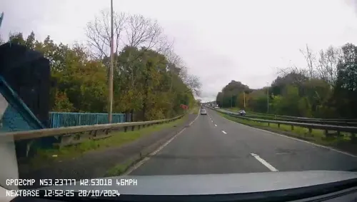
Hartford Bridge, Cheshire
Bridge · 3.2 mi
Bridge near Hartford, Cheshire, United Kingdom
Museums and landmarks7

Boer War Memorial, Winsford
Monument and historic site
War memorial in Winsford, Cheshire, England, UK
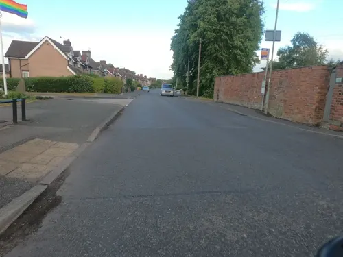
Moulton War Memorial
Monument and historic site · 2.2 mi
War memorial in Cheshire, England, UK

Roman Middlewich
Monument and historic site · 3.4 mi
Roman site in Cheshire, United Kingdom

Parks, trails and playgrounds19
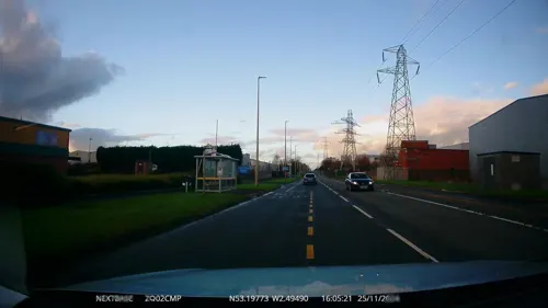



Wharton Allotments
Park · 0.6 mi
Allotments established 2015; managed by Winsford Town Council
7 more on the map.
Restaurants and cafes67



55 more on the map.
History
The name Winsford is of uncertain origin, but is thought to derive from a personal name Wain or Wynne and ford, referencing a crossing point of the River Weaver.
The Norman Earls of Chester had a hunting lodge or summer palace at Darnhall in Over parish. There was an enclosed area where deer and wild boar were kept to be hunted by the Earl and his guests. King Henry III annexed the title and its lands, spending time at Darnhall. In 1270 at the behest of his son, Henry III gave the estate to the Cistercians, who built Darnhall Abbey in 1274. However, the land was not suitable for the grand scale of building envisaged, and the locals were not co-operative, so the monks left Darnhall to found Vale Royal Abbey in Whitegate in 1281.
A charter to hold a Wednesday market and an annual fair at Over was granted on 24 November 1280 by Edward I to the Abbot and convent of Vale Royal Abbey. From this charter can be traced the origins of the market that is still held in the town.
Read more of the history
Winsford began to significantly expand after 1721, when Parliament gave permission for locks and other improvements on the River Weaver to go ahead which allowed sea-going vessels to reach Winsford from the port of Liverpool. At first, this was the closest that barges carrying china clay from Cornwall could get to the Potteries district of north Staffordshire. Locally produced salt was also transported to the Potteries, for use in the manufacture of salt-glazed stoneware. Finished ceramics from the Potteries were brought back to Winsford, for export through the Port of Liverpool. That trade ended in the 1780s when the Trent and Mersey Canal opened and carried the goods through Middlewich, bypassing Winsford. The canalised River Weaver was the inspiration for the Duke of Bridgewater's canals and later the engineer for the Weaver Navigation, Edwin Leader Williams, designed and built the Manchester Ship Canal.
Railways came relatively early to Winsford, with the opening of Winsford station on the Grand Junction Railway in 1837. In his guide to the line, published that year, Arthur Freeling wrote: "There is so little worth attention in this village, that it is not even noticed in Parliamentary Population Returns."
From the 1830s, salt became important to Winsford, partly because the salt mines under Northwich had begun to collapse and another source of salt near the River Weaver was needed. A new source was discovered in Winsford, leading to the development of a salt industry along the course of the River Weaver, where many factories were established. As a result, a new town developed within 1 mi (2 km) of the old Borough of Over which had been focused on Delamere Street. Most of the early development took place on the other side of the river, with new housing, shops, pubs, chapels and a new church being built in the former hamlet of Wharton. Many of the buildings built in the 19th century were built using timber frame construction because of the risk of salt subsidence.
Winsford Urban District Council came into being in 1894, administering the areas of Over and Wharton.
By the Second World War, employment in the salt trade had declined as one company took control of all the salt works and introduced methods of manufacture that needed much less labour. Slum clearance started in the 1930s and, by the 1950s three new housing estates had been built on both sides of the river to replace sub-standard homes. However, even in the 1960s, Winsford could be described as "one long line of mainly terraced houses from the station to Salterswall."
The town experienced a major expansion in the late 1960s and 1970s, with its designation as an expanded town under the Town Development Act 1952 to take excess 'overspill' population from Liverpool. This saw the development of two new industrial areas on both sides of the town, new estates of council and private housing and a new shopping centre with a library, sports centre, civic hall and doctors' surgeries. However, the town's population did not grow as much as planned, so the new civic buildings were too large for the population.
Vale Royal Borough Council was formed in 1974, covering Winsford, Northwich and a large rural area of mid-Cheshire. In 1991, the council moved its main office from Northwich to a purpose-built headquarters in Winsford, which since April 2009 has been used by its successor authority Cheshire West and Chester Council. The same building also houses Winsford Town Council. Since then, both Cheshire Fire Service (in 1997) and Cheshire Police (in 2003) have moved headquarters from the county town of Chester to Winsford.
From the History section of Winsford on Wikipedia, under CC BY-SA 4.0.
More about Winsford
Geography
A small area in the south of the civil parish falls within the Weaver Valley Area of Special County Value.
Winsford's climate is temperate with few extremes. The average temperature is slightly above the average for the United Kingdom, as is the average amount of sunshine. The average annual rainfall is slightly below the average for the United Kingdom. On an annual basis, there are few days when snow lies on the ground, although there are some days of air frost.
Economy
The United Kingdom's largest rock salt (halite) mine is in Winsford. It is one of only three places where rock salt is commercially mined in the United Kingdom; the others are at Boulby Mine, North Yorkshire, and Kilroot, near Carrickfergus, Northern Ireland.
Rock salt was laid down in this part of North West England 220 million years ago, during the Triassic geological period. Sea water moved inland from an open sea, creating a chain of shallow salt lakes across what is today the Cheshire Basin. As the lakes evaporated, deep deposits of rock salt were formed.
Extraction began at Winsford in the 17th century. At first it was used only as salt licks for animals, and to strengthen weak brine. In 1844, Winsford Rock Salt Mine was opened and is claimed by its operator, Salt Union Ltd., to be "Britain's oldest working mine". Salt Union Ltd. is part of the US-owned group of companies Compass Minerals. Today, rock salt is quarried from a depth of more than 150 metres, producing salt (commonly known as grit) for use as a de-icing agent on roads. The mine produces one million tonnes of rock salt annually and has a network of over 160 mi (260 km) of tunnels over several square miles underneath the area between Winsford and Northwich.
Education
Fourteen schools in Winsford work together as part of the Winsford Education Partnership where they share resources and co-ordinate planning.
The Winsford Academy; established via the amalgamation of Verdin High School and Woodford Lodge High School in September 2010
From the Wikipedia article Winsford, under CC BY-SA 4.0.
Notable people from Winsford
 Danny Foxassociation football player (born 1986)Photo: Nottingham Forest F.C., CC0
 Sandy MacIverEnglish association football player (born 1998)Photo: Steffen Prößdorf, CC BY-SA 4.0
 Nicky MaynardEnglish association football playerPhoto: Egghead06, CC BY-SA 3.0
 Charlie KirkBritish footballer (born 1997)Photo: Paul W, CC BY-SA 4.0
 Stan WoodEnglish footballer (1905-1967)Photo: Wood.ben11, CC BY-SA 4.0
- Clare CalbraithEnglish actress
- Alan OakesFootballer (born 1942)
- Simon DaviesWelsh association football player (born 1974)
- Jack AbbottBritish association football player (1943-2002)
- Glyn PardoeEnglish footballer (1946-2020)
- Richard FoxBritish-born, Australian slalom canoeist
- Tom BrittletonEnglish footballer (1882-1955)
Born in Winsford, according to Wikidata (CC0). Each name links to its Wikipedia article.
Where to stay2
Churches and places of worship18
Shopping8
Gas and EV charging1
Schools, colleges and libraries18
Healthcare7
Map of Winsford
148 places. The map loads OpenStreetMap tiles when you open it.
Getting there and nearby towns
Manchester Airport (MAN) is the nearest airport with scheduled flights listed in OpenStreetMap, 15 miles away.
- Warrington 14 mi north, about 23 min by car
- Newcastle under Lyme 18 mi southeast, about 29 min by car
- Stoke-on-Trent 19 mi southeast, about 31 min by car
- Woolton 19 mi northwest, about 31 min by car
- St Helens 20 mi northwest, about 32 min by car
- Stockport 21 mi northeast, about 34 min by car
- Manchester 23 mi northeast, about 37 min by car
- Salford 23 mi northeast, about 36 min by car
- Liverpool 24 mi northwest, about 39 min by car
- Birkenhead 25 mi northwest, about 40 min by car
Drive times are estimates from straight-line distance, not routes.
Towns near Winsford


Keep exploring
Local news
Headlines from INDB.
Reviews, tips and questions
Loading what members have shared...
Sources and licences
- GeoNames (CC BY 4.0): population, coordinates, regions and time zone
- Mapillary (see each image): photos
- OpenStreetMap contributors (ODbL 1.0): places, airports, map data
- Wikidata (CC0 1.0): elevation, founding date, time zone, website, landmarks and historic places
- Wikimedia Commons (see each image): photos
- Wikipedia (CC BY-SA 4.0): overview and history text
Photo credits
- War Memorial Winsford, Peter Turner, CC BY-SA 2.0
- Winsford library (23919856853), Libraries Taskforce, CC BY 2.0
- Christ Church, Wharton, Winsford, Graham Shaw, CC BY-SA 2.0
- United Reformed Church, Over, Cheshire, Peter I. Vardy, Public domain
- St Mary's Church, Whitegate2, Peter I. Vardy, Public domain
- Middlewich - St Michaels2, User:Salinae, CC BY-SA 3.0
- Little Budworth St Peter 2, Peter I. Vardy, Public domain
- Boer War Memorial, Winsford, Rept0n1x, CC BY-SA 2.0
- St Chad's Church, Over 2, Peter I. Vardy, Public domain
- St John's Church, Over, Peter I. Vardy, Public domain
- Christ Church Wharton, Winsford, Rept0n1x, CC BY-SA 2.0
- Middlewich - Harbutts Field, Unknown author, CC BY-SA 3.0
- Paramount Bedford small coach, Quackdave, CC BY-SA 3.0
- Arriva NWW Plaxton Centro 2, Quackdave, CC BY-SA 3.0
- Street-level photo, mapillarygelec, CC BY-SA 4.0
- Street-level photo, rossa, CC BY-SA 4.0
- Street-level photo, rossa, CC BY-SA 4.0
- Street-level photo, mapillarygelec, CC BY-SA 4.0
- Street-level photo, rossa, CC BY-SA 4.0
- Street-level photo, mapillarygelec, CC BY-SA 4.0
- Street-level photo, laye, CC BY-SA 4.0
- Street-level photo, mapillarygelec, CC BY-SA 4.0


Page built November 10, 2026. Spotted a mistake? Tell us or suggest a place.