



Newcastle under Lyme, United Kingdom
Newcastle under Lyme is a city of 127,727 people in England, United Kingdom.
Why visit Newcastle under Lyme
Townapedia lists 23 museums and landmarks, 17 parks and trails, 140 places to eat, 6 places to stay and 7 attractions in and around town.
Highlights include New Victoria Theatre, New Vic Theatre, Brampton Museum and Potteries Museum & Art Gallery.
Weather in Newcastle under Lyme
Forecast from MET Norway (CC BY 4.0). Full forecast
About Newcastle under Lyme
Newcastle-under-Lyme is a market town and the administrative centre of the Borough of Newcastle-under-Lyme in Staffordshire, England. It is adjacent to the city of Stoke-on-Trent. At the 2021 census, the population was 75,082.
From the Wikipedia article Newcastle-under-Lyme (this version), under CC BY-SA 4.0.
Things to do7

New Vic Theatre
Cinema and theater · 1.4 mi
Theatre in Newcastle-under-Lyme, England

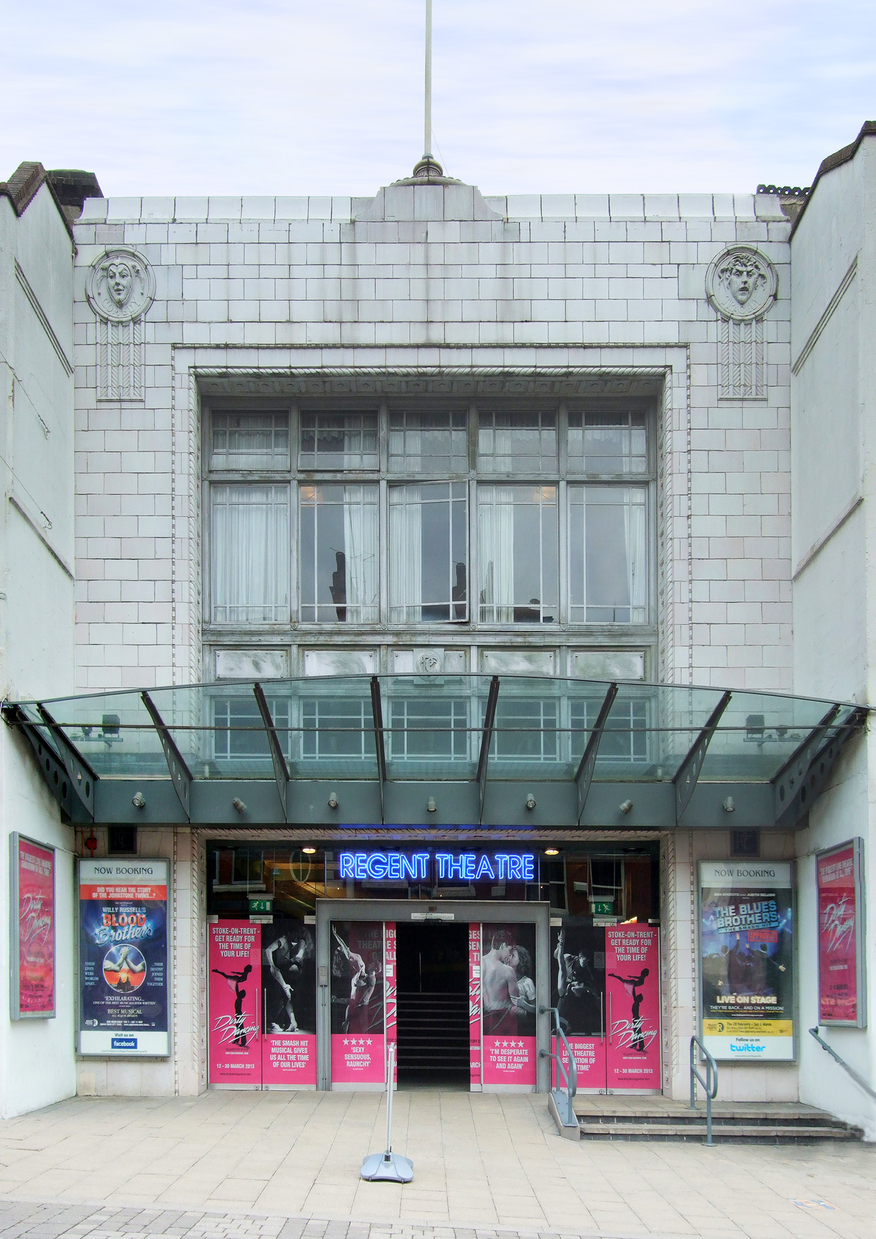
Regent Theatre
Cinema and theater · 2.9 mi
Theatre and former cinema in Stoke-on-Trent, England

Repertory Theatre, Stoke-on-Trent
Cinema and theater · 2.7 mi
Theatre in Leek Road, Stoke-on-Trent, England

Gaumont Stoke-on-Trent
Cinema and theater · 2.1 mi
Former cinema in Stoke-on-Trent, England
Theatre Royal, Hanley
Cinema and theater · 2.9 mi
Former theatre in Hanley, Stoke-on-Trent, England, now a pub
Museums and landmarks23


Potteries Museum & Art Gallery
Museum · 2.8 mi
Art museum & local museum in Stoke-on-Trent, United Kingdom


Etruria Industrial Museum
Museum · 2.1 mi
Museum in Staffordshire, England, United Kingdom

Trentham Mausoleum
Monument and historic site · 2.7 mi
Grade I listed mausoleum in Trentham, Stoke-on-Trent, Staffordshire, England, UK
Whitmore Hall
Museum · 3.0 mi
Grade I listed historic house museum in Whitmore, Newcastle-under-Lyme, Staffordshire, England, UK
Brampton Park Miniature Railway
Monument and historic site · 1.2 mi
by appointment
11 more on the map.
Parks, trails and playgrounds17


Apedale Community Country Park
Park · 2.7 mi
Country park in Staffordshire, England


Lyme Valley Stadium
Sports field and stadium · 0.8 mi
Lillishall Road, Newcastle-under-Lyme

5 more on the map.
Restaurants and cafes140

Greyhound Inn
Bar and pub · 1.5 mi
6 Manor Court Street, Stoke-on-Trent
Mo-We 12:00-23:00; Th-Sa 12:00-24:00, Su 12:00-23:00


Amore
Restaurant · Italian · 0.8 mi
5 Pepper Street, Newcastle-under-Lyme
Th-Fr 18:00-24:00; Sa 12:00-24:00
Anasma Greek Bakery
Restaurant · Greek, Pastry · 0.9 mi
7 Queens Parade, Newcastle-under-Lyme
Tu-Sa 10:00-20:00
Art of Siam
Restaurant · Thai · 0.8 mi
30-32 High Street, Newcastle-under-Lyme
Mo off; Tu 17:00-22:30; We-Th 12:00-14:30, 17:00-22:30; Fr-Sa...
Asha Tandoori
Restaurant · Indian · 0.6 mi
22A Higherland, Newcastle-under-Lyme
Mo-Th,Su 17:00-23:30; Fr-Sa 17:00-24:00
Basmati Restaurant
Restaurant · Indian · 1.0 mi
13 Brunswick Street, Newcastle-under-Lyme
Mo-Th,Su 18:00-23:00; Fr-Sa 18:00-23:30
Bauhinia
Restaurant · Chinese · 0.9 mi
2 Lyme Drive, Stoke-on-Trent
Tu-Th 17:30-22:30; Fr-Sa 12:00-15:00, 17:30-23:00; Su 12:00-22:30
Breeze Bowls
Restaurant · Smoothie, Coffee Shop, Acai, Matcha, Brazilian · 0.9 mi
52 Ironmarket, Newcastle-under-Lyme
Mo-Fr 09:00-17:00; Sa 09:00-16:30; Su 09:00-16:00
Caffe Java
Cafe · Coffee Shop, Tea, Sandwich · 0.9 mi
24 Ironmarket, Newcastle-under-Lyme
Mo-Sa 09:00-16:30; Su 10:30-15:30
Cappello Lounge
Cafe · Coffee Shop, Tea · 0.8 mi
57-58 Ironmarket, Newcastle-under-Lyme
Mo-Th,Su 09:00-22:00; Fr-Sa 09:00-23:00
Mado Cafe
Cafe · Breakfast, Sandwich · 0.8 mi
40 High Street, Newcastle-under-Lyme
Mo-Sa 09:00-16:00; Su off
128 more on the map.
History
Newcastle was not recorded in the 1086 Domesday Book, as it grew up around a 12th-century castle built during the 1140s, but it must have gained rapid importance, as a charter, known solely through a reference in another charter to Preston, was given to the town by Henry II in 1173. The new castle superseded an older fortress at Chesterton, about 2 miles (3 km) to the north, whose ruins were visible up to the end of the 16th century.
In 1235 Henry III turned the town into a free borough, granting a guild merchant and other privileges. In 1251 he leased it under a fee farm grant to the burgesses. In 1265 Newcastle was granted by the Crown to Simon de Montfort and later to Edmund Crouchback, through whom it passed to Henry IV. In John Leland's time the castle had disappeared "save one great Toure".
Newcastle did not feature much in the English Civil War, except as a victim of Royalist plundering. However, it was the home town of Major General Thomas Harrison, a Cromwellian army officer and leader of the Fifth Monarchy Men.
Read more of the history
The Newcastle-under-Lyme, &c. Inclosure Act 1816 (56 Geo. 3. c. 33 Pr.) enclosed the common lands of the borough, and removed their common rights. They were thereafter held in trust for the burgesses of the borough. The Newcastle under Lyme Burgess Lands charity continues to exist, with entitlement to benefits going to those who would have been burgesses before the reforms of 1835: either the son of someone entitled to the trust, who was resident or occupying property within the borough's boundaries.
The Municipal Corporations Act 1835 reformed the borough, creating a new governing charter, repealing the previous charters of 1590 and 1664. The unreformed corporation prior to 1835 had been styled the "Mayor, Bailiffs and Burgesses of Newcastle-under-Lyme", but that act changed the style to "Mayor, Aldermen and Burgesses of Newcastle-under-Lyme".
In 1835, the admission of new burgesses was forbidden by section 13 of the Municipal Corporations Act 1835 under any criteria except that of being a ratepayer. This only affected the creation of borough burgesses, and not the entitlement rules of the Burgess Lands Trust, which continued on the historic burgess criteria.
Newcastle sent two members to Parliament from 1355 to 1885, then lost one of its seats.
When Stoke-on-Trent was formed by the 1910 amalgamation of the "six towns" (Stoke, Hanley, Fenton, Longton, Burslem and Tunstall), Newcastle remained separate.
Despite its close proximity, it was not directly involved in the pottery industry and it strongly opposed attempts to join the merger in 1930, with a postcard poll showing residents opposing the Stoke-on-Trent Extension Bill by a majority of 97.4 per cent. Although passed by the House of Commons, the bill was rejected by the House of Lords.
After the Local Government Act 1972, Newcastle became the principal settlement of the Borough of Newcastle-under-Lyme.
The Newcastle-under-Lyme Gas Act 1819 (59 Geo. 3. c. cvii) established the Newcastle-under-Lyme Gas Light Company, who built a gasworks off Goose Street (53°00′28″N 2°13′35″W). The Newcastle-under-Lyme Gaslight Act 1855 (18 & 19 Vict. c. lxxvii) extended its area of supply beyond Newcastle-under-Lyme to supply gas to Trentham, Stoke-upon-Trent, Keele, Wolstanton, Silverdale, Knutton, Chatterley, and Chesterton. The company was bought by Newcastle-under-Lyme Corporation under the Newcastle-under-Lyme Corporation Act 1877 (40 & 41 Vict. c. clxxii). The council operated the gasworks until it became part of the West Midlands Gas Board under the Gas Act 1948. The site is now occupied by a Morrisons supermarket.
Newcastle-under-Lyme Corporation was authorised to supply electricity by the Newcastle-under-Lyme Electric Supply Order 1899, confirmed by the Electric Lighting Orders Confirmation (No. 12) Act 1899 (62 & 63 Vict. c. cxxxvii). A power station (53°00′29″N 2°13′37″W) was built adjacent to the gasworks, and after 1910 supplies were also obtained from Stoke-on-Trent power station. The power station used diesel generators, supplying DC power. In 1921 it had a capacity of 650 kW. The electricity undertaking was acquired by the Midlands Electricity Board under the Electricity Act 1947. After nationalisation, the power station was only used for peak-loads in the winter, and it was decommissioned in the mid-1950s, before finally being demolished in the 1990s.
Like neighbouring Stoke-on-Trent, Newcastle's early economy was based around the hatting trade, silk and cotton mills. Later coal mining, brick manufacture, iron casting and engineering rose to prominence. Fine red earthenware and soft-paste porcelain tableware (the first such production in Staffordshire) was produced in Newcastle at Samuel Bell's factory in Lower Street in 1724–1754, when production ceased. Except for a failed enterprise in 1790–1797, which then switched to brewing, there was no further commercial production of pottery within the town. Production of earthenware tiles, however, continued at several locations in the borough. Manufacture of fine bone china was re-established in the borough in 1963 by Mayfair Pottery at Chesterton.
The manufacture in the borough of clay tobacco-smoking pipes started about 1637 and grew rapidly, until it was second only to hatting as an industry. Nationally, the town ranked with Chester, York and Hull as the four major pipe producers. The industry continued until the mid-19th century, when decline set in rapidly, so that by 1881 it had only one tobacco-pipe maker left.
In the 17th, 18th and 19th centuries, the town had a flourishing felt hat manufacturing industry, probably at its peak locally in the 1820s, when a third of the town's population were involved in over 20 factories, but by 1892 there was only one still in production.
In 1944, the Rolls-Royce Derwent engine for the Gloster Meteor fighter was made in the borough.
From the History section of Newcastle-under-Lyme on Wikipedia, under CC BY-SA 4.0.
More about Newcastle under Lyme
Geography
Situated in a valley alongside the Lyme Brook, the town is just west of the city of Stoke-on-Trent, its suburbs running together. Newcastle town centre is less than 4 miles (6 km) from Stoke-on-Trent City Centre, about 17 miles (27 km) north of Stafford and 5 miles (8 km) south of the Cheshire county border and 10 miles (16 km) from the Shropshire county border.
Newcastle and Stoke form the main urban area at the centre of the Stoke-on-Trent Green Belt, which is an environmental and planning area that regulates the rural space in Staffordshire, to prevent urban sprawl and minimise convergence with outlying settlements. First defined in 1967, most of the area extends into the wider borough, but some landscape features and places of interest within that are covered or surrounded. They include the Michelin Sports Facility, Newcastle golf course, Keele University, Apedale Winding Wheel, Watermills Chimney and Bignall Hill. The West Coast Main Line forms the western boundary of the green belt.
Arts and culture
The New Vic Theatre is a theatre in the round. Just outside the town centre, it offers a programme that includes modern and classic plays and concert performances.
The Borough Museum and Art Gallery (Brampton Museum) depicts the civic history of the Borough and an authentic, life-size Victorian street-scene. The art gallery hosts work by local and national artists, and travelling exhibitions.
Notable residents who contributed to the arts and entertainment include Philip Astley, founder of the modern circus. Jackie Trent, the singer and songwriter, was born in the town. Arnold Bennett, the novelist, playwright, and essayist, completed his schooling at the Middle School, and called the town Oldcastle in his Clayhanger trilogy of novels. Dinah Maria Mulock, who wrote under her married name of Mrs Craik, lived in the town (in Lower Street and Mount Pleasant) and attended Brampton House Academy.
E. S. Turner, social commentator, was educated in the town. Newcastle was home to Dr Philip Willoughby-Higson (1933–2012), poet, translator, historian, and author of 33 books. He founded and was president (1974–1992) of the Chester Poets, the oldest poetry group in the North-West. He was also President of the Baudelaire Society of France from 1992 to 2012 – the only Englishman ever to hold that position.
Education
The town has a private school: Newcastle-under-Lyme School, which was established in the 17th century, whose alumni includes T. E. Hulme, John Wain and William Watkiss Lloyd. It has a number of primary and secondary schools in the state-funded sector. The latter include Newcastle Community Academy, Clayton Hall Academy, St John Fisher Catholic College, Sir Thomas Boughey Academy and The Orme Academy (formerly Wolstanton High School). There is a private Edenhurst Preparatory School, founded in 1961.
The town's largest sixth-form college is Newcastle-under-Lyme College, which was established in 1966.
Keele University main campus is situated 3 miles (5 km) from the centre of the town.
From the Wikipedia article Newcastle-under-Lyme, under CC BY-SA 4.0.
Notable people from Newcastle under Lyme
 Daniel BighamEnglish cyclistPhoto: Nicola, CC BY-SA 4.0
 Karen BradleyBritish politician (born 1970)Photo: Chris McAndrew, CC BY 3.0
 Eddie HallBritish strongmanPhoto: Quejaytee, CC BY-SA 4.0
 Dan CrollEnglish singer-songwriterPhoto: © Alexander Kellner, CC BY-SA 4.0
 Anne Marsh-CaldwellEnglish novelist (1791-1874)Photo: Samuel Stillman Osgood, Public domain
 Paul FarrellyBritish politician (born 1962)Photo: Chris McAndrew, CC BY 3.0
- Vera BrittainEnglish writer (1893-1970)
- Robbie EarleJamaican footballer (born 1965)
- Adrian HeathEnglish footballer and manager (born 1961)
- Philip AstleyEnglish equestrian, circus owner, and inventor, regarded as being the "father of the modern circus"
- Eva MorrisBritish supercentenarian (1885–2000)
- Charlotte SaltBritish actress
Born in Newcastle under Lyme, according to Wikidata (CC0). Each name links to its Wikipedia article.
Where to stay6
Brampton Him House
Motel and hotel · 1.0 mi
17a Hanover Street, Newcastle-under-Lyme
Churches and places of worship44
Bright Education and Cultural Association
Place of worship · Sunni · 0.9 mi
Castle Hill Road, Newcastle-under-Lyme
Our Lady of the Angels and St Peter in Chains Church, Stoke-on-Trent
Church · 1.9 mi
Shopping30
Gas and EV charging7
Schools, colleges and libraries31
Our Lady and St Werburgh's Catholic Primary School
School · Roman Catholic · 0.8 mi
Seabridge Lane, Newcastle-under-Lyme
St John Fisher Catholic College
School · Roman Catholic · 1.1 mi
Ashfields New Road, Newcastle-under-Lyme
St Mary's Catholic Primary School
School · Roman Catholic · 0.8 mi
Silverdale Road, Newcastle-under-Lyme
St. Giles' and St. George's CofE Academy
School · Anglican · 0.7 mi
Saint Paul's Road, Newcastle-under-Lyme
Healthcare22
Map of Newcastle under Lyme
250 places. The map loads OpenStreetMap tiles when you open it.
Getting there and nearby towns
Manchester Airport (MAN) is the nearest airport with scheduled flights listed in OpenStreetMap, 24 miles away.
- Stoke-on-Trent 2 mi east, about 3 min by car
- Stockport 28 mi north, about 46 min by car
- Wolverhampton 29 mi south, about 47 min by car
- Walsall 30 mi south, about 49 min by car
- Warrington 31 mi northwest, about 49 min by car
- Salford 34 mi north, about 54 min by car
- Sutton Coldfield 35 mi southeast, about 56 min by car
- West Bromwich 35 mi south, about 56 min by car
- Birmingham 38 mi south, about 1 h by car
- Oldham 38 mi north, about 1 h by car
Drive times are estimates from straight-line distance, not routes.
Towns near Newcastle under Lyme


Keep exploring
Local news
Headlines from INDB.
Reviews, tips and questions
Loading what members have shared...
Sources and licences
- GeoNames (CC BY 4.0): population, coordinates, regions and time zone
- Mapillary (see each image): photos
- OpenStreetMap contributors (ODbL 1.0): places, airports, map data
- Wikidata (CC0 1.0): elevation, founding date, time zone, website, landmarks and historic places
- Wikimedia Commons (see each image): photos
- Wikipedia (CC BY-SA 4.0): overview and history text
Photo credits
- A34 road Newcastle-under-Lyme, Linda Mellor, CC BY-SA 2.0
- Regent Theatre, Stoke-on-Trent, Futurilla, CC BY 2.0
- Stoke-on-Trent Repertory Theatre, Rept0n1x, CC BY-SA 2.0
- Potteries museum & art gallery, Leereyno at English Wikipedia, CC BY-SA 3.0
- Westport Lake - panoramio, Andrew Woodvine (awo…, CC BY 3.0
- Bethesda, Stoke-on-Trent 2, Exterior Frontage, Stepped, CC BY-SA 3.0
- Christ Church, Fenton, from south-east, AtticTapestry, CC BY-SA 4.0
- St Luke's Church 1, Silverdale, AtticTapestry, CC BY-SA 4.0
- St Margaret's Church Spire 2004, User:Barlow, CC BY 2.5
- St Mark's Church, Boul22435, CC BY-SA 4.0
- Bethel Chapel, Burslem, AtticTapestry, CC BY-SA 4.0
- Keele University Library, Jonathan Hutchins, CC BY-SA 2.0
- Royal Stoke University Hospital from above, Gkbediako, CC BY-SA 4.0
- New Vic Theater newcastle under lyme, Geni, CC BY-SA 4.0
- The Brampton Museum and Art Gallery - panoramio, Andrew Woodvine (awo…, CC BY 3.0
- Hanley Park - panoramio (3), Tanya Dedyukhina, CC BY 3.0
- Street-level photo, swinetown, CC BY-SA 4.0
- Street-level photo, adam2, CC BY-SA 4.0
- Street-level photo, adam2, CC BY-SA 4.0
- Street-level photo, adam2, CC BY-SA 4.0
- Street-level photo, adam2, CC BY-SA 4.0
- Street-level photo, adam2, CC BY-SA 4.0
- Street-level photo, adam2, CC BY-SA 4.0


Page built November 10, 2026. Spotted a mistake? Tell us or suggest a place.