

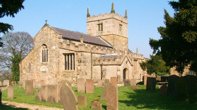


Bolsover, United Kingdom
Bolsover is a town of 11,754 people in England, United Kingdom.
Why visit Bolsover
Townapedia lists 5 museums and landmarks, 3 parks and trails, 22 places to eat and 1 attraction in and around town.
Highlights include Doe Lea Viaduct, Stainsby Mill, Bolsover Cundy House and Poolsbrook Country Park.
Weather in Bolsover
Forecast from MET Norway (CC BY 4.0). Full forecast
About Bolsover
Bolsover is a market town and the administrative centre of the Bolsover district, in Derbyshire, England. It lies 18 miles (29 km) from Sheffield, 26 miles (42 km) from Nottingham and 27 miles (43 km) from Derby. Old Bolsover is the civil parish, including the town, the New Bolsover model village, Hillstown, Carr Vale, Shuttlewood, Stanfree, Oxcroft and Whaley. Its population at the 2011 UK Census was 11,673.
From the Wikipedia article Bolsover (this version), under CC BY-SA 4.0.
Travel tips from other travellers: Bolsover on Wikivoyage (CC BY-SA 4.0).
Things to do1

Museums and landmarks5

Stainsby Mill
Museum · 3.4 mi
Grade II listed watermill in Stainsby, Ault Hucknall, Bolsover, England, UK


Parks, trails and playgrounds3

Poolsbrook Country Park
Park · 3.2 mi
Park in Staveley, United Kingdom


Restaurants and cafes22

Mason's little Café
Cafe
6 Town End, Chesterfield
Mo-Su 08:00-14:00

10 more on the map.
History
Bolsover is mentioned in Domesday Book in 1086, named as Belesovre, where it is described as the property of William Peverel (or "Peveril"). The description refers to the villans, the ploughs, eight acres (32,000 m2)) of meadow and woodland pasture, which is given as two leagues by a league. Bolsover became the seat of the Peverel family and in the 12th century a keep was built. The present castle was erected in 1613.
In 1657, the leading Royalist William Cavendish, 1st Marquess of Newcastle, published his book La Methode et Invention nouvelle de dresser les Chevaux, written in exile in Antwerp during the Cromwellian Protectorate. This was translated in 1743 to A General System of Horsemanship in All its Branches. It covered the dressage of horses, at his 'Bolsouer', Welbeck Abbey, and Antwerp stables and contains engravings attributed to Abraham van Diepenbeeck showing Newcastle on a horse ('Monsieur le Marquis a Cheval') and views of his estates, including Bolsover.
The district of Bolsover is notable for three sites of historical importance:
Bolsover Castle: an early-17th century castle, which lies on the earthworks and ruins of the 12th-century medieval castle
Creswell Crags, home to Britain's only known Palaeolithic cave art
Creswell Model Village, an example of early-20th century design from the model village movement.
Read more of the history
St Mary and St Laurence's Church is a notable historic building. Bolsover also has a Methodist Church, part of the Derbyshire North East Methodist Circuit, which opened in 1896.
In chronostratigraphy, the British sub-stage (formerly 'stage') of the Carboniferous period, the 'Bolsovian' derives its name from a geological exposure at the River Doe Lea, Bolsover.
Bolsover Hospital was completed in 1988, but closed in spring 2019.
The town sought city status in the Platinum Jubilee Civic Honours, but the bid was unsuccessful.
Two railway lines once served the town, but both were early casualties of closure programmes:
The Midland Railway (later part of the London, Midland & Scottish Railway), arrived first with their north–south running Doe Lea branch line from Staveley Town to Pleasley East, opened in September 1890 and thus enabled a through service between Chesterfield and Mansfield to be operated. Bolsover Castle served the town on this line. Services were withdrawn in September 1930.
The other line was the highly ambitious west–east running Lancashire, Derbyshire and East Coast Railway, later part of the Great Central Railway and subsequently the London & North Eastern Railway. Only the middle section from Chesterfield to Lincoln was ever built, opening in March 1897. Bolsover South served the town on this line. The section between Chesterfield and Shirebrook was brought to a premature demise in December 1951 by the deteriorating state of its biggest engineering feature, the 2,624 yards (2,399 m) Bolsover Tunnel, which ran beneath the limestone ridge on which stands the castle. The tunnel was mostly filled in with colliery waste in 1966–67 and both ends were sealed off. Today, both portals are visible; the eastern portal at the end of an unusually deep sheer-sided cutting in the village of Scarcliffe and the western portal just to the south east side of Bolsover.
From the History section of Bolsover on Wikipedia, under CC BY-SA 4.0.
More about Bolsover
Economy
The major industry of the area was coal mining, but this has declined throughout Great Britain. The two main collieries closed in 1993:
Bolsover Colliery, one of the five mines owned by the Bolsover Colliery Company closed on 7 May. It was an original member of the FT 30 list of companies.
The other main employer was the Coalite and Chemical Company, which produced smokeless fuel and chemicals from coke and was founded in 1937; it moved its main headquarters from London to Bolsover in 1952. It was closed in 2004 after a decline in demand for solid fuel, which had left the company and its many subsidiaries deeply in debt. Its production of chemicals used to produce Agent Orange in the Vietnam War; its environmental impact on surrounding communities of Duckmanton, Shuttlewood, New Bolsover and Bolsover itself had rendered it a controversial company.
Another significant local employer was The Bolsover Hosiery Company Ltd, which was established in 1951 by Bolsover Urban District Council. The main factory site on Oxcroft Lane employed approximately 500 people at its peak in the late 1990s. It underwent a succession of takeovers, becoming part of Courtauld's Textiles; it was later taken over by the Sara Lee conglomerate and the factory was closed in 2000, with the loss of approximately 350 jobs.
From the Wikipedia article Bolsover, under CC BY-SA 4.0.
Notable people from Bolsover
 Peter FidlerCanadian explorer (1769–1822)Photo: SriMesh (Julia Adamson), CC BY-SA 3.0
 Annie Seymour PearsonBritish suffragettePhoto: LSE Library, No restrictions
- Charlie ElliottEnglish sportsman (1912-2004)
- Stan Worthingtoncricket player from Britain (1905-1973)
- Derek HallEnglish cricketer (1932-1983)
- George ClarkeEnglish footballer (1900-1977)
- Eric MarshEnglish cricketer (1920-2003)
- Bob HigginsEnglish footballer (born 1958)
- Tom RevillFootballer & Cricketer (1892-1979)
- George YatesBritish cricketer (1858-1933)
- Bill LeiversEnglish footballer and manager (born 1932)
- Eric SykesEnglish cricketer (1906-1989)
Born in Bolsover, according to Wikidata (CC0). Each name links to its Wikipedia article.
Churches and places of worship8
Shopping3
Gas and EV charging1
Schools, colleges and libraries7
Healthcare1
Map of Bolsover
51 places. The map loads OpenStreetMap tiles when you open it.
Getting there and nearby towns
Nottingham City Airport (NQT) is the nearest airport with scheduled flights listed in OpenStreetMap, 23 miles away.
- Staveley 4 mi northwest, about 6 min by car
- Shirebrook 4 mi southeast, about 6 min by car
- Chesterfield 5 mi west, about 9 min by car
- Mansfield Woodhouse 6 mi southeast, about 10 min by car
- Mansfield 8 mi southeast, about 12 min by car
- Kirkby in Ashfield 9 mi south, about 15 min by car
- Dronfield 9 mi northwest, about 15 min by car
- Pinxton 10 mi south, about 15 min by car
- Dinnington 10 mi north, about 17 min by car
- Sheffield 13 mi northwest, about 21 min by car
Drive times are estimates from straight-line distance, not routes.
Towns near Bolsover


Keep exploring
Local news
Headlines from INDB.
Reviews, tips and questions
Loading what members have shared...
Sources and licences
- GeoNames (CC BY 4.0): population, coordinates, regions and time zone
- Mapillary (see each image): photos
- OpenStreetMap contributors (ODbL 1.0): places, airports, map data
- Wikidata (CC0 1.0): elevation, founding date, time zone, website, landmarks and historic places
- Wikimedia Commons (see each image): photos
- Wikipedia (CC BY-SA 4.0): overview and history text
Photo credits
- Poolsbrook Country Park, Frombowen, CC BY-SA 4.0
- Ault Hucknall St John the Baptist Church 043249 9500fe0c, Alan Walker, CC BY-SA 2.0
- St-Laurence-Bolsover-2, Immanuel Giel, CC BY-SA 3.0
- Stainsby Mill, John Fielding, CC BY-SA 2.0
- Bolsover Cundy House (28284530351), Amanda Slater from Coventry, West Midlands, UK, CC BY-SA 2.0
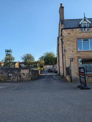
- Street-level photo, jayturnr, CC BY-SA 4.0
- Street-level photo, jayturnr, CC BY-SA 4.0
- Street-level photo, jayturnr, CC BY-SA 4.0
- Street-level photo, jayturnr, CC BY-SA 4.0
- Street-level photo, jayturnr, CC BY-SA 4.0
- Street-level photo, jayturnr, CC BY-SA 4.0
- Street-level photo, jayturnr, CC BY-SA 4.0
- Street-level photo, jayturnr, CC BY-SA 4.0
Page built November 10, 2026. Spotted a mistake? Tell us or suggest a place.