




Beighton, United Kingdom
Beighton is a town of 10,914 people in England, United Kingdom.
Why visit Beighton
Townapedia lists 5 museums and landmarks, 10 parks and trails, 59 places to eat and 1 place to stay in and around town.
Highlights include Renishaw Hall, Rother Valley Country Park and Gulliver's Valley Resort.
Weather in Beighton
Forecast from MET Norway (CC BY 4.0). Full forecast
About Beighton
Beighton is a village located approximately 6½ miles south-east of Sheffield city centre, now classed as a historic township of the city. Following significant expansion, the village became part of Sheffield in 1967 and was transferred from Derbyshire to the newly created county of South Yorkshire, England. From the late 17th to the 19th centuries, Beighton was noted for its edge-tool manufacturing industry, with the Thomas Staniforth & Co. sickle works based nearby at Hackenthorpe. The village is also notable for its ice hockey team, the Beighton Bombers.
From the Wikipedia article Beighton, South Yorkshire (this version), under CC BY-SA 4.0.
Museums and landmarks5

Renishaw Hall
Museum · 2.2 mi
Grade I listed historic house museum in North East Derbyshire, England, UK

Parks, trails and playgrounds10

Rother Valley Country Park
Park · 0.6 mi
Country park in South Yorkshire, England


Rother Valley Golf Centre
Golf course · 1.2 mi
18 hole Par 72 Blue Monster Course & 9 hole Pitch & Putt
Mansfield Road, Sheffield

Restaurants and cafes59

The Belfry
Bar and pub · 0.4 mi
Eckington Road, Sheffield
Mo-Th 11:00-23:00, Fr-Sa 11:00-00:00, Su 11:00-10:30


Dolly's Sandwich Shop
Restaurant · Sandwich, Dessert · 1.0 mi
57 High Street, Sheffield
Mo-Sa 07:30-14:00; Su 08:00-13:00
47 more on the map.
Where to stay1

Mosborough Hall Hotel
Motel and hotel · 1.3 mi
High Street, Sheffield
History
The first mention of the village comes from 9th century Anglo Saxon records of Derbyshire land owners. The village was then known as Bectune. The then hamlet stood on the edges of the 'Great Forest' which stood in the area where the Rother Valley Country Park stands today and extended to areas of Derbyshire, Nottinghamshire, West Yorkshire and Lincolnshire. Today the only remnants of the 'Great Forest' is Sherwood Forest.
The area was settled by the British invaders known as the Angles. The invasions took place at the end of the Romanic period around 500 AD. Prior to these invasions the area was part of the Kingdom of Mercia, the local Shire Brook formed the border with the neighbouring kingdom of Northumbria. Being so close to the border meant the hamlet was prone to invasions.
The Sheffield Museum contains a number of bones and flint tools unearthed in the area during the 19th century, dating back to the Neolithic period, this shows the area was inhabited long before the Angles settled.
The village was noted as having 15 households in the Domesday book in 1086, with the land being owned by Roger the Poitevin. A moated castle was said to be evident in the village, with a reference from the 13th century describing 'the tower of the former castle ' being evident in a field named Castle Mead, however no evidence remains.
Read more of the history
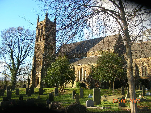
The parish church of St. Mary's dates back to c1150. The first documented mention of the church is in an undated deed written during the reign of Edward I (1272–1307).
Prior to the 20th century, farming and smithing were the primary forms of employment, however this shifted towards mining towards the end of the 19th century, with numerous mines being opened in the area, most notably Brookhouse Colliery and Birley Collieries. The Ochre Dyke stream was used to power grinding and water wheels during this time period.
The village was served by Beighton railway station until its closure in 1954.
Due to the villages location close to the River Rother, a number of major flooding events have occurred, notably in 1940, 1954 and 1960.
In 1961 the civil parish had a population of 23,056. On 1 April 1967 the parish was abolished and merged with Sheffield, Eckington, "Aston cum Aughton", Wales and Killamarsh. It is now in the unparished area of Sheffield.
From the History section of Beighton, South Yorkshire on Wikipedia, under CC BY-SA 4.0.
Churches and places of worship16
Shopping13
Schools, colleges and libraries15
Emmanuel Anglican/Methodist Junior School
School · Anglican, Methodist · 0.8 mi
Thorpe Drive, Sheffield
Healthcare4
Map of Beighton
123 places. The map loads OpenStreetMap tiles when you open it.
Getting there and nearby towns
Nottingham City Airport (NQT) is the nearest airport with scheduled flights listed in OpenStreetMap, 30 miles away.
- Staveley 5 mi south, about 7 min by car
- Sheffield 6 mi northwest, about 10 min by car
- Dinnington 6 mi northeast, about 10 min by car
- Dronfield 6 mi west, about 10 min by car
- Chesterfield 7 mi southwest, about 11 min by car
- Rotherham 7 mi north, about 11 min by car
- Bolsover 7 mi south, about 12 min by car
- Maltby 8 mi northeast, about 13 min by car
- Rawmarsh 9 mi north, about 14 min by car
- Fulwood 9 mi west, about 15 min by car
Drive times are estimates from straight-line distance, not routes.
Towns near Beighton


Keep exploring
Local news
Headlines from INDB.
Reviews, tips and questions
Loading what members have shared...
Sources and licences
- GeoNames (CC BY 4.0): population, coordinates, regions and time zone
- OpenStreetMap contributors (ODbL 1.0): places, airports, map data
- Wikidata (CC0 1.0): elevation, founding date, time zone, website, landmarks and historic places
- Wikimedia Commons (see each image): photos
- Wikipedia (CC BY-SA 4.0): overview and history text
Photo credits
- 47555 Beighton Jct, Phil Sangwell, CC BY 2.0
- Renishaw Hall 2, DAVID M GOODWIN, CC BY-SA 2.0
- Ridgeway 119086 547e64f2, Andrew Loughran, CC BY-SA 2.0
- St Marys Church Handsworth Sheffield, Wikityke, CC BY-SA 1.0
- Melasis buprestoides (Linnè, 1761) Male (25956354516), Udo Schmidt from Deutschland, CC BY-SA 2.0
Page built November 10, 2026. Spotted a mistake? Tell us or suggest a place.