


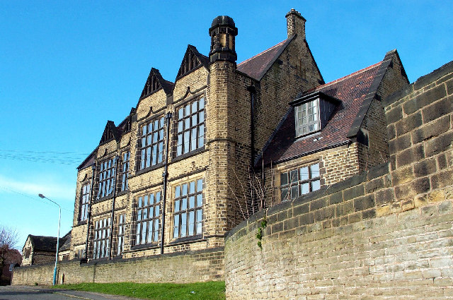
Staveley, United Kingdom
Staveley is a town of 25,719 people in England, United Kingdom.
Why visit Staveley
Townapedia lists 2 museums and landmarks, 3 parks and trails, 28 places to eat, 3 places to stay and 1 attraction in and around town.
Highlights include Doe Lea Viaduct, Bolsover Castle, Renishaw Hall and Poolsbrook Country Park.
Weather in Staveley
Forecast from MET Norway (CC BY 4.0). Full forecast
About Staveley
Staveley is a town and civil parish in the Borough of Chesterfield, Derbyshire, England, along the banks of the River Rother (5 miles) northeast of Chesterfield, (5 miles) west of Clowne, (5 miles) northwest of Bolsover, (11 miles) southwest of Worksop and (13 miles) southeast of Sheffield.
From the Wikipedia article Staveley, Derbyshire (this version), under CC BY-SA 4.0.
Things to do1

Museums and landmarks2


Renishaw Hall
Museum · 2.5 mi
Grade I listed historic house museum in North East Derbyshire, England, UK
Parks, trails and playgrounds3

Poolsbrook Country Park
Park · 0.5 mi
Park in Staveley, United Kingdom


Restaurants and cafes28

Double Top
Bar and pub · 1.1 mi
Inkersall Green Road, Chesterfield
Mo-Su,PH 12:00-23:00

16 more on the map.
History
The name Staveley derives from the Old English stæflēah meaning 'stave' or 'staff wood or clearing'.
Staveley was formerly a mining town with several large coal mines in and around the area, the closest being Ireland Pit (Ireland Colliery Brass Band is named after the colliery). However, the pit has closed, along with the others in the area.
Staveley Miners Welfare on Market Street was built in 1893 as an indoor market hall by Charles Paxton Markham, for a time owner of Markham & Co. At that time, it was called Markham Hall in memory of his father. Markham played a large role in the industrial development of the area around Staveley. Through his company Markham & Co. and its successor Staveley Coal and Iron Company, Markham owned ironstone quarries, several coal mines (including Markham Colliery), chemical works, ironworks and an engineering works specialising in mining and tunnelling equipment.
Read more of the history
Other major local industries in recent history have included Staveley Works foundry and Staveley Chemicals. The nationwide decline in industry has meant that Staveley Chemicals and Staveley Works have now almost entirely closed, with the only section of the chemical plant remaining being the P-aminophenol plant (a key component to making Paracetamol), which is run by American/Irish company Covidien. Notice has been served on the plant, earmarked for closure around June 2012, this closure will mark the end of over 100 yrs. of chemical production at Staveley..
It is also the home town of the Townes Brewery. Modern industry includes a plastic pipe moulding factory for Brett Martin plc. There was also a wood wool production unit on Staveley works.
The New Markham Vale Loop Road has been completed and opens up the former Markham coal field areas to development, linking the town to a new junction (29A) on the M1 motorway, this junction opened in early July 2008. This is part funded by European Union regeneration money. The scheme also reinstates part of the former Chesterfield Canal which crosses the route. There is a long-term project to reinstate the canal from Chesterfield to Kiveton where it currently terminates. Sections from Chesterfield to Brimington were reinstated as part of previous stages of the Chesterfield Bypass and opencast schemes on part of the former Staveley Coal and Iron Company site which was part of British Steel Corporation following Nationalisation. The new Staveley Town Basin was officially opened on 30 June 2012 and forms the centre piece of the imaginative redevelopment of the Chesterfield Canal in Staveley. The basin is designed to provide facilities to enable the economic development of the isolated section in advance of full restoration. It will provide secure short- and long-term moorings, slipway, car parking, cycle racks, toilets and showers as well as a large open play area which can also be used for major waterway events and festivals.
As part of the Markham Vale scheme to regenerate the site of the former Markham Colliery site there was a proposal to build a "Solar Pyramid" to form the world's largest functional timepiece. This project has now been cancelled. However, on the site near Poolsbrook Country Park, a caravan site for tourists has now been built boosting numbers to the country park. The area has several trails for walkers and mountain bikers along former pit railway lines.
From the History section of Staveley, Derbyshire on Wikipedia, under CC BY-SA 4.0.
Notable people from Staveley
 Chris SpeddingEnglish rock and roll and jazz guitaristPhoto: Jean-Luc, CC BY-SA 2.0
- Leslie LievesleyEnglish footballer and manager (1911-1949)
- George HayEnglish cricketer for Derbyshire (1861-1913)
- Harry LilleyEnglish footballer (1868-1900)
- Stephen DoughtyEnglish cricketer (1855-1929)
- Thomas Rawson BirksBritish priest and academic (1810–1883)
- Billy GoodwinEnglish footballer (1892-1951)
- Alan StevensonEnglish footballer (born 1950)
- Edwin SmithBritish metallurgist (1931-2010)
- Abel LeeEnglish footballer (1884-1929)
- Gary PollardBritish footballer (born 1959)
- William YoungEnglish cricketer, born 1861
Born in Staveley, according to Wikidata (CC0). Each name links to its Wikipedia article.
Where to stay3
Churches and places of worship7
Shopping3
Schools, colleges and libraries12
St Joseph's Catholic and CofE (VA) Primary School
School · Anglican, Roman Catholic · 0.6 mi
Calver Crescent, Chesterfield
Healthcare1
Map of Staveley
60 places. The map loads OpenStreetMap tiles when you open it.
Getting there and nearby towns
Nottingham City Airport (NQT) is the nearest airport with scheduled flights listed in OpenStreetMap, 27 miles away.
- Chesterfield 3 mi southwest, about 5 min by car
- Sheffield 9 mi northwest, about 15 min by car
- Mansfield 11 mi southeast, about 18 min by car
- Rotherham 11 mi north, about 18 min by car
- Wath upon Dearne 16 mi north, about 26 min by car
- Wombwell 18 mi north, about 29 min by car
- Stocksbridge 18 mi northwest, about 29 min by car
- Doncaster 20 mi northeast, about 32 min by car
- Nottingham 23 mi south, about 37 min by car
- Derby 24 mi south, about 39 min by car
Drive times are estimates from straight-line distance, not routes.
Towns near Staveley


Keep exploring
Local news
Headlines from INDB.
Reviews, tips and questions
Loading what members have shared...
Sources and licences
- GeoNames (CC BY 4.0): population, coordinates, regions and time zone
- Mapillary (see each image): photos
- OpenStreetMap contributors (ODbL 1.0): places, airports, map data
- Wikidata (CC0 1.0): elevation, founding date, time zone, website, landmarks and historic places
- Wikimedia Commons (see each image): photos
- Wikipedia (CC BY-SA 4.0): overview and history text
Photo credits
- Staveley - Miners Welfare, Dave Bevis, CC BY-SA 2.0
- Site of Staveley GC loco sheds (7669597314), Phil Sangwell from United Kingdom, CC BY 2.0
- 7 and 8 Church Street, Staveley, Dave Bevis, CC BY-SA 2.0
- Renishaw Hall 2, DAVID M GOODWIN, CC BY-SA 2.0
- Poolsbrook Country Park, Frombowen, CC BY-SA 4.0
- NetherthorpeSchool, Philip Thompson, CC BY-SA 2.0
- Bolsover Castle - panoramio, PJMarriott, CC BY 3.0
- Street-level photo, endszbrxns, CC BY-SA 4.0
- Street-level photo, endszbrxns, CC BY-SA 4.0
- Street-level photo, endszbrxns, CC BY-SA 4.0
- Street-level photo, endszbrxns, CC BY-SA 4.0
- Street-level photo, endszbrxns, CC BY-SA 4.0
- Street-level photo, endszbrxns, CC BY-SA 4.0
- Street-level photo, endszbrxns, CC BY-SA 4.0
- Street-level photo, endszbrxns, CC BY-SA 4.0
- Street-level photo, endszbrxns, CC BY-SA 4.0
- Street-level photo, endszbrxns, CC BY-SA 4.0
- Street-level photo, endszbrxns, CC BY-SA 4.0
Page built November 10, 2026. Spotted a mistake? Tell us or suggest a place.