


Nantwich, United Kingdom
Nantwich is a town of 17,226 people in England, United Kingdom.
Why visit Nantwich
Townapedia lists 10 museums and landmarks, 11 parks and trails, 77 places to eat, 2 places to stay and 3 attractions in and around town.
Highlights include Nantwich Bridge, Cheerbrook Food, Dorfold Hall and Churche's Mansion.
Weather in Nantwich
Forecast from MET Norway (CC BY 4.0). Full forecast
About Nantwich
Nantwich is a market town and civil parish in the unitary authority of Cheshire East in Cheshire, England. It has among the highest concentrations of listed buildings in England, with notably good examples of Tudor and Georgian architecture. At the 2021 census, the parish had a population of 14,045 and the built up area had a population of 18,740.
From the Wikipedia article Nantwich (this version), under CC BY-SA 4.0.
Travel tips from other travellers: Nantwich on Wikivoyage (CC BY-SA 4.0).
Photos of Nantwich

Things to do3

Nantwich Bridge
Bridge
Grade II listed bridge in Nantwich, Cheshire East, Cheshire, England, UK


Museums and landmarks10

Dorfold Hall
Museum · 1.0 mi
Country house in Acton, Cheshire, England, UK




Boer War Memorial, Crewe
Monument and historic site · 2.9 mi
Grade II listed war memorial in Crewe, Cheshire East, Cheshire, England, UK
Parks, trails and playgrounds11

Queen's Park, Crewe
Park · 2.9 mi
Park in Crewe, Cheshire, England, UK



Restaurants and cafes77
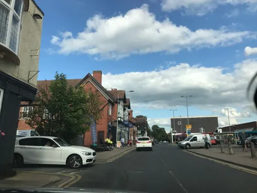
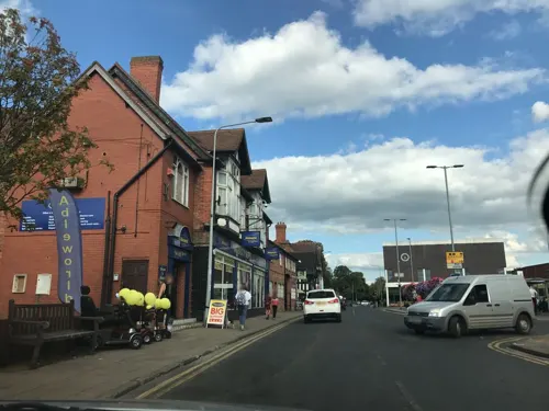
Bench Bistro Bar
Bar and pub
35 Beam Street
Mo,We-Th 12:00-22:00; Tu off; Fr-Sa 12:00-24:00; Su 12:00-20:00

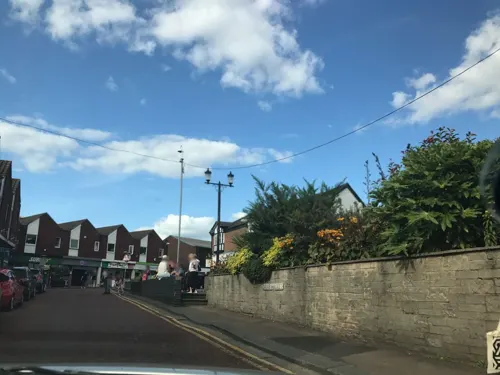



Ginger and Pickles Bakehouse
Bakery
3a Mill Street
Mo-Th 09:00-16:00; Fr-Sa 09:00-17:00; Su 10:00-16:00


Nine Mill Street
Restaurant
9 Mill Street, Nantwich
Th 17:00-23:00; Fr 17:00-24:00; Sa 12:00-01:00; Su 12:00-20:00
The Peacock
Bar and pub · 1.0 mi
221 Crewe Road
Mo 12:00-22:00; Tu-Th 12:00-23:00; Fr-Sa 09:00-23:00; Su 09:00-22:00
Akin Thai Restaurant
Restaurant · Thai
15 Pillory Street
Tu-Fr 12:00-14:00,17:00-22:00; Sa 12:00-22:00; Su 17:00-21:00; Mo off
65 more on the map.
History
The origins of the settlement date to Roman times, when salt from Nantwich was used by the Roman garrisons at Chester (Deva Victrix) and Stoke-on-Trent as a preservative and a condiment. Salt has been used in the production of Cheshire cheese and in the tanning industry, both products of the dairy industry based in the Cheshire Plain around the town. Nant comes from the Welsh for brook or stream. Wich and wych are names used to denote brine springs or wells. In 1194 there is a reference to the town as being called Nametwihc, which would indicate it was once the site of a pre-Roman Celtic nemeton or sacred grove.
In the Domesday Book of 1086, Nantwich is recorded as having eight salt houses. It had a castle and was the capital of a barony of the earls of Chester, and of one of the seven hundreds of medieval Cheshire. Nantwich is one of the few places in Cheshire to be marked on the Gough Map, which dates from 1355 to 1366. It was first recorded as an urban area at the time of the Norman Conquest, when the Normans burnt the town to the ground, leaving only one building standing.
Read more of the history
Nantwich Castle was built at the crossing of the Weaver before 1180, probably near where the Crown Inn now stands. Although nothing remains of the castle above ground, it affected the town's layout. During the medieval period, Nantwich was the most important salt town and probably the second most important settlement in the county after Chester. By the 14th century, it was holding a weekly cattle market at the end of what is now Beam Street, and it was also important for its tanning industry centred in Barker Street.
A fire in December 1583 destroyed most of the town to the east of the Weaver. Elizabeth I contributed funds to the town's rebuilding and made an England-wide appeal for support for the rebuilding fund which thereby received funds from many successful medieval towns, including Bury St Edmunds in Suffolk. The rebuilding occurred rapidly and followed the plan of the destroyed town. Beam Street was so renamed to reflect the fact that timber (including wood from Delamere Forest) to rebuild the town was transported along it. A plaque marking the 400th anniversary of the fire and of Nantwich's rebuilding was unveiled by the Duke of Gloucester on 20 September 1984.
From the time of the Henrician Reformation, the town had trouble finding good Protestant preachers. An example of the problem was Stephen Jerome, a puritanical preacher, who in 1625 nonetheless tried to rape one of his maidservants, Margaret Knowsley. Rumours of this spread across the town, eventually leading to Knowsley's imprisonment and public shaming in 1627. A few years later, Jerome went to Ireland to continue his preaching career.
During the English Civil War Nantwich declared for Parliament and was besieged several times by Royalist forces. A final six-week siege was lifted after a Parliamentary victory in the Battle of Nantwich on 26 January 1644. This has been re-enacted as "Holly Holy Day" on every anniversary since 1973 by Sealed Knot, an educational charity. The name is taken from commemorative sprigs of holly worn by townsfolk in caps or on clothing in the years after the battle.
The salt industry peaked in the mid-16th century, with about 400 salt houses in 1530, but had almost died out by the end of the 18th century; the last salt house closed in the mid-19th century. Nikolaus Pevsner considered the salt-industry decline to have been critical in preserving the town's historic buildings. The last tannery closed in 1974. The town's location on the London–Chester road meant that Nantwich began to serve the needs of travellers in medieval times. This trade declined in the 19th century with the opening of Telford's road from London to Holyhead, which offered a faster route to Wales, and later with the Grand Junction Railway, which bypassed the town.
The presence of a watermill south of Nantwich Bridge was noted in 1228 and again about 1363, through the cutting of a mill race or leat and creation of an upstream weir. The resulting Mill Island was ascribed to the 16th century, possibly after the original mill was destroyed in the 1583 Great Fire of Nantwich.
In the mid-17th century, the mill was acquired by local landowners, the Cholmondeleys, who retained it until the 1840s. Originally a corn mill, it became a cotton mill (Bott's Mill) from 1789 to 1874, but reverted to being a corn mill and was recorded as such on the Ordnance Survey First Edition map of Nantwich in 1876. A turbine was installed in about 1890 to replace the water wheel.
The mill was demolished in the 1970s after a fire and then landscaped, with further stabilisation of the mill foundations in 2008. Today it forms part of a riverside park area. Proposals, so far unfollowed, have been made for small-scale hydropower generation using the mill race. Nantwich Mill Hydro Generation Ltd was incorporated in April 2009, but dormant in December 2016.
Nantwich's brine springs were used for spa or hydrotherapy purposes at two locations: the central Snow Hill swimming pool inaugurated in 1883, where the open-air brine pool is still in use, and the Brine Baths Hotel, standing in 70 acres (28 ha) of parkland south of the town from the 1890s to the mid-20th century. The hotel was originally a mansion, Shrewbridge Hall, built for Michael Bott (owner of Nantwich Mill) in 1828. It was bought by Nantwich Brine and Medicinal Baths Company in 1883, extended and opened as a hotel in 1893, with "a well-appointed suite of brine and medicinal baths," – also described as the "strongest saline baths in the world". These were used to treat patients with ailments that included gout, rheumatism, sciatica and neuritis, using two suites of baths.
The hotel's grounds included gardens, tennis courts, a nine-hole golf course and a bowling green. The last survives today as the Nantwich Park Road Bowling Club founded in 1906.
From the History section of Nantwich on Wikipedia, under CC BY-SA 4.0.
More about Nantwich
Geography
Nantwich is on the Cheshire Plain, on the banks of the River Weaver. The Shropshire Union Canal runs to the west of the town on an embankment, crossing the Acton lane on the western boundary of the town via an iron aqueduct. There is a basin nearby which is a frequent mooring for visitors to the town. It joins the Llangollen Canal at Hurleston to the north. The town is some four miles (six kilometres) southwest of Crewe, 20 mi (32 km) southeast of Chester and 22 mi (35 km) east of Wrexham. The town is served by a by-pass to the north and west into which, directly or indirectly, the A51, A500, A529, A530 and A534 roads all feed.
The stretch of A534 from Nantwich to the Welsh border is seen as one of the ten worst stretches of road in England for road safety.
The tower of St Mary's Church was the origin (meridian) of the 6-inch and 1:2500 Ordnance Survey maps of Cheshire.
Education
The town has eight primary schools (Highfields Community, Willaston Primary Academy, Millfields, Pear Tree, St Anne's (Catholic), Stapeley Broad Lane (Church of England), The Weaver and Nantwich Primary Academy) and two secondary schools, Brine Leas School and Malbank School and Sixth Form College. Reaseheath College runs further education and higher education courses in conjunction with Harper Adams University and the University of Chester. A sixth-form college at Brine Leas opened in September 2010.
For the London 2012 Olympic Games, Malbank School and Sixth Form College was nominated to represent the North West.
From the Wikipedia article Nantwich, under CC BY-SA 4.0.
Notable people from Nantwich
 Ashley WestwoodEnglish footballer (born 1990)Photo: Bryan Berlin, CC BY-SA 4.0
 Sir William Bowman, 1st Baronetsurgeon, histologist, anatomist (1816-1892)Photo: Unknown author, Public domain
 Wilfred WhiteBritish equestrian (1904–1995)Photo: photographer of IOC, Public domain
 Stuart GrahamBritish motorcycle road racerPhoto: Jan Voets for Anefo, CC0
 Janusz BugajskiAmerican political consultantPhoto: Hotnews.ro, CC BY 3.0
 Joe Piggottassociation football player (born 1998)Photo: Dominic Nelson, CC BY-SA 4.0
 Mārtiņš RītiņšLatvian chef of British birth (1949-2022)Photo: Kārlis Dambrāns, CC BY 2.0
- John GerardEnglish botanist (c. 1545–1612)
- William AndersonBritish ice hockey player (1901–1983)
- Norman Hughesfield hockey player
- Walter CartwrightEnglish footballer
- Hayley JonesBritish sprinter
Born in Nantwich, according to Wikidata (CC0). Each name links to its Wikipedia article.
Where to stay2
Churches and places of worship17
Shopping19
Gas and EV charging1
Schools, colleges and libraries14
Healthcare5
Map of Nantwich
159 places. The map loads OpenStreetMap tiles when you open it.
Getting there and nearby towns
Hawarden Airport (CEG) is the nearest airport with scheduled flights listed in OpenStreetMap, 21 miles away.
- Winsford 8 mi north, about 14 min by car
- Sandbach 8 mi northeast, about 14 min by car
- Whitchurch 10 mi southwest, about 16 min by car
- Newcastle under Lyme 13 mi east, about 21 min by car
- Stoke-on-Trent 15 mi east, about 24 min by car
- Stone 19 mi southeast, about 30 min by car
- Wilmslow 22 mi northeast, about 35 min by car
- Newport 22 mi south, about 35 min by car
- Warrington 23 mi north, about 36 min by car
- Speke 23 mi northwest, about 37 min by car
Drive times are estimates from straight-line distance, not routes.
Towns near Nantwich


Keep exploring
Local news
Headlines from INDB.
Reviews, tips and questions
Loading what members have shared...
Sources and licences
- GeoNames (CC BY 4.0): population, coordinates, regions and time zone
- Mapillary (see each image): photos
- OpenStreetMap contributors (ODbL 1.0): places, airports, map data
- Wikidata (CC0 1.0): elevation, founding date, time zone, website, landmarks and historic places
- Wikimedia Commons (see each image): photos
- Wikipedia (CC BY-SA 4.0): overview and history text
Photo credits
- Nantwich - view down Welsh Row, Jonathanawhite, Public domain
- Cafe at Nantwich - panoramio, Andrew Woodvine (awo…, CC BY 3.0
- Nantwich Shops - panoramio, Andrew Woodvine (awo…, CC BY 3.0
- Nantwich Bridge Welsh Row, Espresso Addict, CC BY 2.5
- Dorfold Hall Exterior Front, DorfoldHall, CC BY-SA 4.0
- Queens park crewe towards pavilion, FREON101, CC BY-SA 3.0
- Congregational Chapel, Nantwich, Espresso Addict, CC BY-SA 3.0
- Poole Chapel, Cheshire, Espresso Addict, CC BY-SA 3.0
- St Barnabas' Church, Crewe, Margaret Sutton, CC BY-SA 2.0
- St Michaels Baddiley, Mike Grose, CC BY-SA 2.0
- Methodist Church Hospital St Nantwich, Espresso Addict, CC BY-SA 4.0
- St Marys Church Acton Cheshire, Espresso Addict, CC BY-SA 4.0
- St Marys, Nantwich, Espresso Addict, CC BY-SA 3.0
- Malbank School Nantwich, Espresso Addict, CC BY-SA 3.0
- Cheshire Cat, Welsh Row, Nantwich 2, Steven Manning, CC BY-SA 4.0
- Black Lion, Welsh Row, Nantwich, Steven Manning, CC BY-SA 4.0
- Nantwich War Memorial (2), Rept0n1x, CC BY-SA 3.0
- St Mary's church, Nantwich (13), Rept0n1x, CC BY-SA 3.0
- Reaseheath Hall, nr Nantwich, Bill Pearson, CC BY-SA 2.0
- Churches Mansion left, Espresso Addict, CC BY-SA 3.0
- Street-level photo, rossa, CC BY-SA 4.0
- Street-level photo, rossa, CC BY-SA 4.0
- Street-level photo, rossa, CC BY-SA 4.0
- Street-level photo, rossa, CC BY-SA 4.0
- Street-level photo, rossa, CC BY-SA 4.0
- Street-level photo, rossa, CC BY-SA 4.0
- Street-level photo, rossa, CC BY-SA 4.0
- Street-level photo, ricorico, CC BY-SA 4.0
- Street-level photo, rossa, CC BY-SA 4.0
- Street-level photo, rossa, CC BY-SA 4.0
- Street-level photo, rossa, CC BY-SA 4.0
- Street-level photo, rossa, CC BY-SA 4.0


Page built November 10, 2026. Spotted a mistake? Tell us or suggest a place.