


Why visit Wrington
Townapedia lists 15 museums and landmarks, 7 places to eat, 3 places to stay and 3 attractions in and around town.
Highlights include Bow Bridge, Cleeve Toot Camp and Boundary Stone No 16 Manor of Congresbury.
Weather in Wrington
Forecast from MET Norway (CC BY 4.0). Full forecast
About Wrington
Wrington is a village and a civil and ecclesiastical parish on the north slopes of the Mendip Hills in North Somerset, England. Both include nearby Redhill. Wrington lies in the valley of the Congresbury Yeo river, about 9 miles (14 km) east of Weston-super-Mare and 3 miles (4.8 km) south-east of Yatton. Its population was 2,633 at the 2011 Census.
From the Wikipedia article Wrington (this version), under CC BY-SA 4.0.
Things to do3
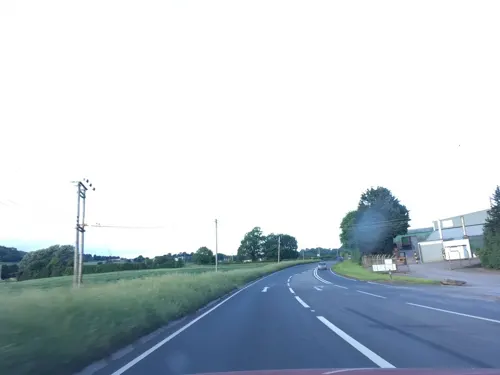

Bow Bridge
Bridge · 1.2 mi
Bridge in Iwood, Congresbury, Somerset, England, UK

Museums and landmarks15

Cleeve Toot Camp
Monument and historic site · 1.9 mi
Hillfort in North Somerset, England, UK
Boundary Stone No 15 Manor of Congresbury adjacent to Boundary Stone TW
Monument and historic site · 1.5 mi
3 more on the map.
Restaurants and cafes7
The Mother Hen Coffee And Gifts
Cafe · Coffee Shop
Mo-Sa 10:00-16:00



Where to stay3

History
The village was inhabited in Roman times and there is evidence of Saxon occupation as well. Historically it was part of the hundred of Brent-cum-Wrington.
Wrington Cottage Hospital opened in 1864, initially for 24 patients. The first surgeon was Horace Swete, author of the Handy Book of Cottage Hospitals, to which Florence Nightingale also referred in 1869.
Wrington had a railway station between 1901 and 1963, on the Wrington Vale Light Railway that ran from Congresbury to Blagdon.
From the History section of Wrington on Wikipedia, under CC BY-SA 4.0.
Notable people from Wrington
 John LockeEnglish philosopher and physician (1632-1704)Photo: Godfrey Kneller, Public domain
 Robert Carr, 1st Earl of SomersetBritish nobleman and politician (1587–1645)Photo: John Hoskins (died 1670), Public domain
 Samuel BudgettBritish businessmanPhoto: Unknown author Unknown author, Public domain
 Richard WhitingEnglish abbotPhoto: Me.Autem.Minui, CC0
- George HowellBritish trade unionist and politician
- Godfrey FirbankEnglish cricketer (1895-1947)
Born in Wrington, according to Wikidata (CC0). Each name links to its Wikipedia article.
Churches and places of worship14
Shopping2
Schools, colleges and libraries2
Healthcare1
Map of Wrington
47 places. The map loads OpenStreetMap tiles when you open it.
Getting there and nearby towns
Bristol Airport (BRS) is the nearest airport with scheduled flights listed in OpenStreetMap, 2 miles away.
- Churchill 2 mi southwest, about 3 min by car
- Yatton 3 mi northwest, about 5 min by car
- Blagdon 3 mi southeast, about 5 min by car
- Shipham 4 mi southwest, about 6 min by car
- Nailsea 5 mi north, about 8 min by car
- Winford 5 mi east, about 7 min by car
- Clevedon 7 mi northwest, about 11 min by car
- Locking 7 mi west, about 11 min by car
- Chew Magna 7 mi east, about 11 min by car
- Bristol 10 mi northeast, about 16 min by car
Drive times are estimates from straight-line distance, not routes.
Towns near Wrington


Keep exploring
Local news
Headlines from INDB.
Reviews, tips and questions
Loading what members have shared...
Sources and licences
- GeoNames (CC BY 4.0): population, coordinates, regions and time zone
- Mapillary (see each image): photos
- OpenStreetMap contributors (ODbL 1.0): places, airports, map data
- Wikidata (CC0 1.0): elevation, founding date, time zone, website, landmarks and historic places
- Wikimedia Commons (see each image): photos
- Wikipedia (CC BY-SA 4.0): overview and history text
Photo credits
- Wringtonschool, FollowMeChaps, CC BY-SA 2.0
- Wringtonhighstreet, FollowMeChaps, CC BY-SA 2.0
- Wrington Church (All Saints), hugh llewelyn, CC BY-SA 2.0
- Odd cottages Wrington Somerset UK. - panoramio, Jusben, CC BY 3.0
- Wringtonrectory, FollowMeChaps, CC BY-SA 2.0
- Burrignton church, Rodw at English Wikipedia, Public domain
- Holy Trinity Church Cleeve, John Lord, CC BY-SA 2.0
- CongresburyChurch, AlanFord at English Wikipedia, Public domain
- Blagdon church, Rodw at English Wikipedia, CC BY-SA 3.0
- Church of St. John the Baptist, Churchill, Andrew Riley, CC BY-SA 2.0
- St Marys Yatton winter panorama, NotFromUtrecht, CC BY-SA 3.0
- Butcombechurch, Adrian and Janet Quantock, CC BY-SA 2.0
- Churchill Methodist Church, Gricharduk, CC BY-SA 4.0
- Wringtonchurch, Dbown100, CC BY 3.0
- Street-level photo, southglos, CC BY-SA 4.0
- Street-level photo, southglos, CC BY-SA 4.0
- Street-level photo, southglos, CC BY-SA 4.0
- Street-level photo, southglos, CC BY-SA 4.0
- Street-level photo, southglos, CC BY-SA 4.0
- Street-level photo, southglos, CC BY-SA 4.0
- Street-level photo, southglos, CC BY-SA 4.0
- Street-level photo, southglos, CC BY-SA 4.0
- Street-level photo, southglos, CC BY-SA 4.0


Page built November 10, 2026. Spotted a mistake? Tell us or suggest a place.