



Why visit Blagdon
Townapedia lists 5 museums and landmarks, 1 park or trail, 7 places to eat, 2 places to stay and 2 attractions in and around town.
Highlights include Charterhouse Roman Town and Blagdon Pumping Station & Visitor Centre.
Weather in Blagdon
Forecast from MET Norway (CC BY 4.0). Full forecast
About Blagdon
Blagdon is a village and civil parish in the ceremonial county of Somerset, within the unitary authority of North Somerset, in England. It is located in the Mendip Hills, a recognised Area of Outstanding Natural Beauty. According to the 2021 census it has a population of 1,184. The village is about 12 miles (19 km) east of Weston-super-Mare and 12 miles (19 km) south west of Bristol, on the A368 road to Bath.
From the Wikipedia article Blagdon (this version), under CC BY-SA 4.0.
Things to do2

Museums and landmarks5

Charterhouse Roman Town
Monument and historic site · 1.7 mi
Town in the Roman province of Britannia, located close to Charterhouse-on-Mendip

Parks, trails and playgrounds1

Restaurants and cafes7



History
The village was called Blachedon in the 1086 Domesday Book and the name comes from the Old English bloec and dun meaning 'the black or bleak down'.
There was a Roman presence in Blagdon from about 49 AD until the end of the Roman occupation of Britain. Several Roman coins and fragments of Roman pottery have been found in the village. There were lead and silver workings in Charterhouse, about a mile and a half uphill to the south, so it is likely that the wealthier supervisors had their houses away from the toxic smoke in the village.
Wade and Wade in their 1929 book Somerset suggest traces of Roman mining such as tools and pigs of lead have been found at Blagdon.
Read more of the history
Blagdon is believed to have been the caput of the feudal barony held by Serlo de Burci (died c. 1086), who is recorded as holding the manor in the Domesday Book of 1086. However the caput may have been Dartington. The Domesday Book recorded a land area for Blagdon approximating to 2,000 acres (8 km2), including 200 acres (0.8 km2) of woodland. Serlo left no sons and his daughter Geva was his sole heiress. She married twice: firstly to "Martin" (died before 1086), to whom she bore a son and heir Robert FitzMartin (died 1159), and secondly to William de Falaise. In 1154 Robert FitzMartin gave St Andrew's Church and other land from around the East End of the village to Stanley Abbey in Wiltshire. He also gave land at Blagdon to the Knights Templar which became known as the Temple Hydon Estate. Robert's son was William FitzMartin (1155–1209), whose own son and heir was William FitzMartin (died before 15 February 1216). Next to inherit was Nicholas FitzMartin (1210–1282) whose son Nicholas (died 1260)predeceased him, but had married the sole heiress of the feudal barony of Barnstaple, Maud de Tracy (died before Michaelmas 1279), daughter and sole heiress of Henry de Tracy (died 1274). Nicholas's son William FitzMartin (died 1324) thus inherited Barnstaple from his mother and Blagdon from his grandfather. On the death in 1326 of William's son William without children, his co-heirs were his surviving sister Eleanor and James Audley (died 1386) the son of his deceased sister Joan FitzMartin (died 1322). Eleanor FitzMartin (died 1342) died without children, albeit having married twice. James Audley, 2nd Baron Audley (died 1386) was Joan's son by her second husband Nicholas Audley, 1st Baron Audley (died 1316) of Heleigh Castle, Staffordshire. James Audley thus in 1342 inherited his childless aunt Eleanor's moieties of the two baronies of Barnstaple and Blagdon, thus giving him possession of the whole of each.
In the late eighteenth century, the famous writer and educational pioneer Hannah More, shocked at the poverty and ignorance to be found in Mendip villages, was active establishing schools in the area. In 1795 she founded a Sunday School in Blagdon, in the building now called Hannah More House. About this time she wrote to William Wilberforce, the anti-slavery campaigner, about her school, "Several of the grown-up youths had been tried at the last assizes; three were children of a person lately condemned to be hanged — many thieves! Of this banditti we have enlisted one hundred and seventy; and when the clergyman, a hard man, who is also the magistrate, saw these creatures kneeling around us, whom he had seldom seen but to commit or punish in some way, he burst into tears".
However, Mr Bere, the curate referred to in this letter, soon became implacably opposed to the school and after years of pressure it was forced to close. Nevertheless, the furor created made the "Blagdon Controversy" a milestone of national importance in the development of education for the labouring classes.
There are several houses in the village dating from medieval times and earlier. The houses facing on to Bell Square in the north corner of the West End date from the fourteenth century. The shape of some of the existing fields suggest they are of medieval origin.
In 1901 the Wrington Vale Light Railway reached Blagdon. It closed to passengers just 30 years later in 1931. Part of the line remained for freight only, but this closed in 1962.
From the History section of Blagdon on Wikipedia, under CC BY-SA 4.0.
More about Blagdon
Geography
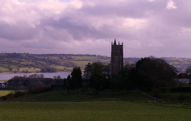
The village is located on the northern edge of the Mendip Hills on the A368, overlooking Blagdon Lake. The headquarters of the dairy company Yeo Valley Organic is located in the village.
When describing Blagdon the names of the three former separate settlements that merged to form Blagdon are usually used: West End, East End, and Street End.
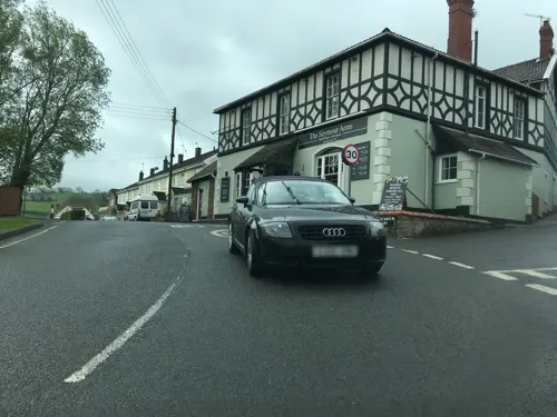
A road serving some housing is named Baynard Close after the Lord of the Manor of Blagdon who founded the forerunner of the current village school in 1687. The New Inn is a Grade II listed building.
Arts and culture
Blagdon is the setting of Chapters 8 and 9 of Victor Canning's best-selling novel of 1934, Mr Finchley Discovers his England.
From the Wikipedia article Blagdon, under CC BY-SA 4.0.
Where to stay2
Churches and places of worship12
Shopping1
Schools, colleges and libraries2
Map of Blagdon
32 places. The map loads OpenStreetMap tiles when you open it.
Getting there and nearby towns
Bristol Airport (BRS) is the nearest airport with scheduled flights listed in OpenStreetMap, 4 miles away.
- Draycott 5 mi south, about 8 min by car
- Yatton 6 mi northwest, about 10 min by car
- Nailsea 8 mi north, about 12 min by car
- Wells 9 mi south, about 14 min by car
- Bristol 10 mi northeast, about 17 min by car
- Clevedon 10 mi northwest, about 16 min by car
- Midsomer Norton 10 mi east, about 17 min by car
- Weston-super-Mare 11 mi west, about 18 min by car
- Portishead 11 mi north, about 18 min by car
- Keynsham 11 mi northeast, about 18 min by car
Drive times are estimates from straight-line distance, not routes.
Towns near Blagdon


Keep exploring
Local news
Headlines from INDB.
Reviews, tips and questions
Loading what members have shared...
Sources and licences
- GeoNames (CC BY 4.0): population, coordinates, regions and time zone
- Mapillary (see each image): photos
- OpenStreetMap contributors (ODbL 1.0): places, airports, map data
- Wikidata (CC0 1.0): elevation, founding date, time zone, website, landmarks and historic places
- Wikimedia Commons (see each image): photos
- Wikipedia (CC BY-SA 4.0): overview and history text
Photo credits
- Blagdon, Rodw, CC0
- Blagdon church and lake, MJ Reilly, CC BY-SA 2.0
- Footpath up from Blagdon - panoramio, Keith Daulby, CC BY 3.0
- Former Methodist Church at Blagdon, Gricharduk, CC BY-SA 4.0
- St. Andrew's, Blagdon. - panoramio, Robert Powell, CC BY-SA 3.0
- Wringtonchurch, Dbown100, CC BY 3.0
- Ubleychurch, Rodw, Public domain
- Butcombechurch, Adrian and Janet Quantock, CC BY-SA 2.0
- Burrignton church, Rodw at English Wikipedia, Public domain
- Blagdon church, Rodw at English Wikipedia, CC BY-SA 3.0
- The plume of Feathers at Rickford - panoramio, Matt Prosser, CC BY-SA 3.0
- Street-level photo, southglos, CC BY-SA 4.0
- Street-level photo, southglos, CC BY-SA 4.0
- Street-level photo, southglos, CC BY-SA 4.0
- Street-level photo, southglos, CC BY-SA 4.0
- Street-level photo, southglos, CC BY-SA 4.0
- Street-level photo, southglos, CC BY-SA 4.0
- Street-level photo, southglos, CC BY-SA 4.0


Page built November 10, 2026. Spotted a mistake? Tell us or suggest a place.