


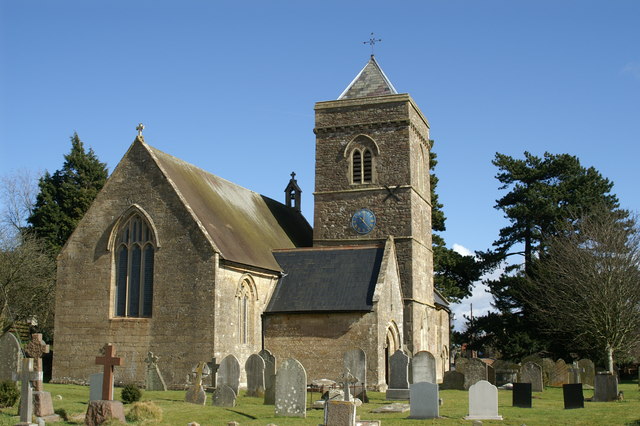

Why visit Nailsea
Townapedia lists 12 museums and landmarks, 15 parks and trails, 34 places to eat, 1 place to stay and 2 attractions in and around town.
Highlights include Backwell School Productions, Nailsea Little Theatre, Nailsea Glassworks and Clevedon Court.
Weather in Nailsea
Forecast from MET Norway (CC BY 4.0). Full forecast
About Nailsea
Nailsea is a town and civil parish in North Somerset, England, 8 miles (13 km) southwest of Bristol, and 11 miles (18 km) northeast of Weston-super-Mare. The nearest village is Backwell, which lies south of Nailsea on the opposite side of the Bristol to Exeter railway line. Nailsea had a population of 15,539 in the 2021 census.
From the Wikipedia article Nailsea (this version), under CC BY-SA 4.0.
Photos of Nailsea

Things to do2

Backwell School Productions
Cinema and theater · 1.4 mi
Backwell School’s public-facing division for performing arts and music productions.
Station Road, Backwell
Museums and landmarks12

Nailsea Glassworks
Monument and historic site
Former glass factory in Nailsea, Somerset, England, UK

Clevedon Court
Museum · 3.2 mi
Grade I listed historic house museum in North Somerset, England, UK

Tyntesfield
Museum · 2.1 mi
Grade I listed historic house museum in North Somerset, England, UK

Cleeve Toot Camp
Monument and historic site · 3.1 mi
Hillfort in North Somerset, England, UK

Parks, trails and playgrounds15





3 more on the map.
Restaurants and cafes34
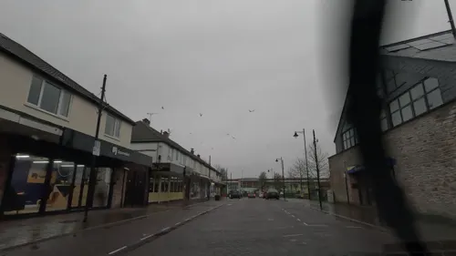

Livro Lounge
Restaurant · Breakfast, Burger, Chicken, Fish And Chips
23-24 Somerset Square
Fr-Sa 09:00-23:00; Su-Th 09:00-00:00


22 more on the map.
History
The name of the town may be derived from the Old English for Naegl's island, although it has also been suggested it was spelt Naylsey in 1657.
The parish of Nailsea was part of the Portbury Hundred. Little is known of the area occupied by Nailsea before the coal mining industry began, although it was used as a quarry in Roman times from which pennant sandstone was extracted. The Romans otherwise ignored Nailsea from 40 to 400 AD, but left a small villa near Jacklands Bridge.
Nailsea's early economy relied on coal mining, which began as early as the 16th century. The earliest recorded date for coal mining in Nailsea was 1507 when coal was being transported to light fires at Yatton. By the late 1700s the town had a large number of pits. Around this time Nailsea was visited by the social reformer Hannah More who founded a Sunday school for the workers. The Elms Colliery,(Middle Engine Pit), one of the most complete examples of an 18th-century colliery left in England, is now in disrepair. It has been designated a Scheduled Ancient Monument and is included in the Heritage at Risk Register produced by English Heritage. Remains of the old pits, most of which had closed down by the late 19th century as mining capital migrated to the richer seams of South Wales, are still visible around the town.
Read more of the history
The coal mines attracted glass manufacturer John Robert Lucas, who in 1788 established the Nailsea Glassworks that became the fourth-largest of its kind in the United Kingdom, mostly producing low-grade bottle glass. The works closed down in 1873, but "Nailsea" glass (mostly made by glass workers at the end of their shift in Nailsea and at other glass works) is still sought after by collectors around the world. The site of the glass works has been covered by a Tesco supermarket car park, leaving it relatively accessible for future archaeological digs. Other parts of the site have been cleared and filled with sand to ensure that the remains of the old glass works are preserved.
Nowhere was a historical hamlet that existed on the west side of the town until 1967, when it was demolished for development. Nowhere Wood, a small residential woodland, is named after it.
The 15th-century Nailsea Court, southwest of the town, is a grade I listed building.
From the History section of Nailsea on Wikipedia, under CC BY-SA 4.0.
More about Nailsea
Geography
The Land Yeo river flows to the east of the town. The North Somerset Levels to the west have been drained and farmed by generations of farmers. Tickenham, Nailsea and Kenn Moors SSSI is a 129.4-hectare (320-acre) biological Site of Special Scientific Interest. The soils in the area include clays of the Allerton and Wentloog Series and peat soils of the Sedgemoor and Godney Series, which are drained by a network of large rhynes and smaller field ditches, which support exceptionally rich plant and invertebrate fauna communities. Exceptional populations of Coleoptera occur, amongst which are at least 12 nationally scarce species and 2 nationally rare species, including Britain's largest water beetle the great silver water beetle (Hydrophilus piceus). There are several other local nature reserves.
The Bucklands Pool/Backwell Lake local nature reserve, southeast of the town centre and close to the Nailsea and Backwell railway station, was constructed as a balancing pond in the mid-1970s, and has since become home to various wildfowl and dragonflies and a foraging area for bats. Bird species seen on the reserve include gadwall, northern shoveler, pochard, tufted duck, grey heron and mute swans.
Economy
Primary income often comes from employment in the service sector, including industries such as insurance and banking, defence related employment, retail and management. Employment within Nailsea includes work in shops, schools, estate agents and banks. Larger businesses in Nailsea include General Electric, and Bristol Wessex Billing Services Ltd., the billing company jointly owned by Bristol Water and Wessex Water. Other businesses are situated at units in the town. Nailsea has three large industrial and business estates located at Southfield Road, Blackfriars Road and Coates Estate (former site of the local cider making industry). Nailsea's shopping area includes Somerset Square, Crown Glass Place, Colliers Walk, and a high street. There are four supermarket chains in the town trand some national banks and estate agents.
The Coates Cider factory in Nailsea was first opened in 1788 and was bought by Showerings of Shepton Mallet in 1956. The brand was subsequently merged with Gaymers and absorbed by Matthew Clark Brands. Prior to Coates, there was Heath Brewery, owned by the Thatcher family, which was situated behind the former Friendship Inn. The site of the old factory is now called 'Coates Estate' and is home to a diverse range of both local and national businesses.
Arts and culture
Nailsea has several pubs and used to have a small nightclub called Decades, formerly known as the AJ's Bar. There are dedicated youth clubs and two Scouting divisions, which organise the Nailsea Carnival and Mayfair respectively. Nailsea has theatre, musical and orchestral groups. Most are open to all ages and meet and perform regularly at different venues including The Scotch Horn Centre, Nailsea Methodist Church, The Mizzymead Centre, The Grove Recreation Centre, and Nailsea Little Theatre. Nailsea's outdoor recreational areas include the playing fields by the Grove Centre and the public park to the rear of the Scotch Horn Centre and Tesco. There are three children's play parks and smaller areas of green land in the town's housing estates. The Millennium Park contains a skatepark (NSP), and a children's play park. There are no cinemas in Nailsea, but The Curzon in nearby Clevedon has been operating since 1912.
The adjacent village of Wraxall has a couple of tourist attractions. Noah's Ark Zoo Farm has displays of exotic, agricultural and domestic animals including rhinoceros, camels, monkeys, reptiles and most recently a giraffe. It offers hands-on experience with animals and a chance to learn about conservation. Tyntesfield, a 19th-century Victorian country house and grounds, was bought and opened up by the National Trust in 2002.
Education
Secondary education in Nailsea is provided by Nailsea School, which attained Technology and Media Arts College specialist status before a £28.8 million revamp in 2010. Nailsea has infants, junior, primary schools, and a music school, some of them including: Kings Hill C of E, Golden Valley, Hannah More Infants, St Francis Catholic School and Grove School. Ravenswood School caters for children with special needs and learning difficulties. There are also playgroups for children in the area who are too young for infants school.
From the Wikipedia article Nailsea, under CC BY-SA 4.0.
Notable people from Nailsea
 Rebecca HollowayNorthern Irish football playerPhoto: Hameltion, CC BY-SA 4.0
- James HeappeyBritish politician (born 1981)
- Stephen NewtonAmateur cricketer and schoolmaster (1853-1916)
- Mervyn KitchenEnglish cricketer (born 1940)
Born in Nailsea, according to Wikidata (CC0). Each name links to its Wikipedia article.
Where to stay1
Churches and places of worship23
Shopping8
Gas and EV charging2
Schools, colleges and libraries12
Healthcare4
Map of Nailsea
113 places. The map loads OpenStreetMap tiles when you open it.
Getting there and nearby towns
Bristol Airport (BRS) is the nearest airport with scheduled flights listed in OpenStreetMap, 4 miles away.
- Portishead 3 mi north, about 6 min by car
- Yatton 4 mi southwest, about 7 min by car
- Bristol 7 mi east, about 11 min by car
- Stoke Gifford 11 mi northeast, about 18 min by car
- Newport 15 mi northwest, about 24 min by car
- Yate 16 mi northeast, about 26 min by car
- Thornbury 16 mi northeast, about 26 min by car
- Wells 16 mi south, about 26 min by car
- Cardiff 18 mi west, about 30 min by car
- Bath 18 mi east, about 28 min by car
Drive times are estimates from straight-line distance, not routes.
Towns near Nailsea


Keep exploring
Local news
Headlines from INDB.
Reviews, tips and questions
Loading what members have shared...
Sources and licences
- GeoNames (CC BY 4.0): population, coordinates, regions and time zone
- Mapillary (see each image): photos
- OpenStreetMap contributors (ODbL 1.0): places, airports, map data
- Wikidata (CC0 1.0): elevation, founding date, time zone, website, landmarks and historic places
- Wikimedia Commons (see each image): photos
- Wikipedia (CC BY-SA 4.0): overview and history text
Photo credits
- Nailsea and Backwell, Dillydillyston at English Wikipedia, CC BY-SA 3.0
- Clevedon 1 (rear 2005), Arthur266, CC BY-SA 3.0
- Tyntesfield 2, Chilli Head from Weston-super-Mare, UK, CC BY 2.0
- Holy Trinity Church Cleeve, John Lord, CC BY-SA 2.0
- Weston in Gordano church, Adrian and Janet Quantock, CC BY-SA 2.0
- Church of St Quiricus and St Juliet Tickenham, Linda Bailey, CC BY-SA 2.0
- Church of St Bridget, Chelvey, from south-west, NotFromUtrecht, CC BY-SA 3.0
- Church Of St Mary And St Edward 2, Rodw, CC BY-SA 3.0
- Church of St Peter Portishead, Rodw, Public domain
- The Old Glass Works, Nailsea label QS:Len,"The Old Glass Works, Nailsea", British School, Public domain
- WraxallAllSaintsChurch, ChurchCrawler, CC BY-SA 2.0
- Backwell School, Rodw, CC0
- HolytrinitychurchnailseaUK, Guiltyspark, CC BY-SA 3.0
- Nailsea School New Building, Thegoodlife55, Public domain
- Giraffe enclosure - Noah's Ark Zoo Farm, Marie Hale, CC BY 2.0
- Shopping centre - panoramio, Jusben, CC BY 3.0
- Street-level photo, editid, CC BY-SA 4.0
- Street-level photo, southglos, CC BY-SA 4.0
- Street-level photo, southglos, CC BY-SA 4.0
- Street-level photo, editid, CC BY-SA 4.0
- Street-level photo, editid, CC BY-SA 4.0
- Street-level photo, southglos, CC BY-SA 4.0
- Street-level photo, editid, CC BY-SA 4.0
- Street-level photo, southglos, CC BY-SA 4.0
- Street-level photo, southglos, CC BY-SA 4.0
- Street-level photo, editid, CC BY-SA 4.0
- Street-level photo, editid, CC BY-SA 4.0
- Street-level photo, southglos, CC BY-SA 4.0
- Street-level photo, editid, CC BY-SA 4.0
- Street-level photo, southglos, CC BY-SA 4.0
- Street-level photo, southglos, CC BY-SA 4.0


Page built November 10, 2026. Spotted a mistake? Tell us or suggest a place.