


Why visit Yatton
Townapedia lists 20 museums and landmarks, 7 parks and trails, 22 places to eat, 3 places to stay and 3 attractions in and around town.
Highlights include Cadbury Hill, Bow Bridge, Cadbury Hill Fort and Cleeve Toot Camp.
Weather in Yatton
Forecast from MET Norway (CC BY 4.0). Full forecast
About Yatton
Yatton is a village and civil parish within the unitary authority of North Somerset, which falls within the ceremonial county of Somerset, England. It is located 11 miles (18 km) south-west of Bristol. Its population in 2011 was 7,552. The parish includes Claverham, a small village which was originally a farming hamlet.
From the Wikipedia article Yatton (this version), under CC BY-SA 4.0.
Photos of Yatton


Things to do3


Bow Bridge
Bridge · 2.2 mi
Bridge in Iwood, Congresbury, Somerset, England, UK

Museums and landmarks20

Cleeve Toot Camp
Monument and historic site · 2.2 mi
Hillfort in North Somerset, England, UK
Boundary Stone CP next to Boundary Stone No 9 Manor of Congresbury
Monument and historic site · 1.3 mi
8 more on the map.
Parks, trails and playgrounds7

Hangstones
Park · 0.4 mi
Hangstones recreation park, featuring two full sized and two junior football pitches, a cricket green in the summer months, and a skate park.

Rock Road Park
Park · 0.5 mi
Home of the Yatton Junior football club. This recreation park features two full sized football pitches, an AstroTurf training ground,...
Restaurants and cafes22
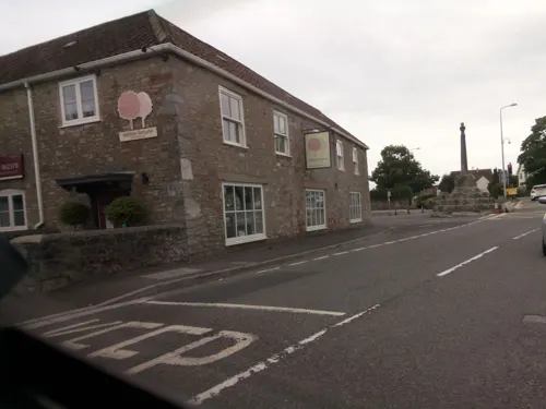
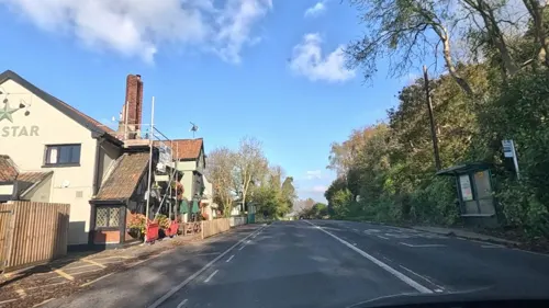
The Cottage Tea Rooms
Cafe · Coffee Shop
102 High Street, Bristol
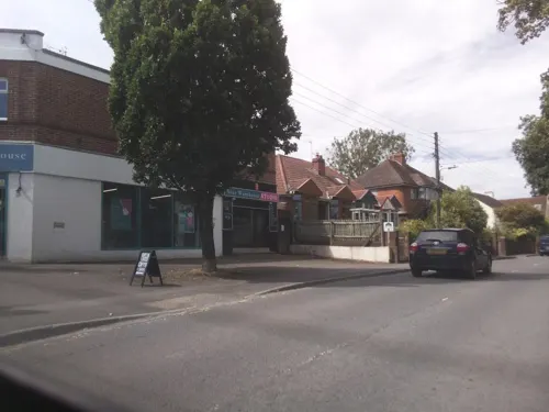

Strawberry Line Cafe
Cafe · Coffee Shop
Station Approach, Bristol
Mo-Fr 08:00-16:00; Sa,Su 09:00-16:00


10 more on the map.
History
The origin of the name Yatton is uncertain. It may come from the Anglo-Saxon 'gatton' meaning 'village on the track'; the track in question is a path of limestone leading from Cadbury Hill. The village has at one time or another been called Jatune, Eaton (from ea [river] and tun i.e. the settlement on the River Yeo and Yatton Blewitt), and is recorded as Lature in the Domesday Book. West Yatton was also known as Yatton-Kaynes in the Elizabethan era.
Situated on an area of slightly higher, drained ground surrounded by moorland (locally called a 'batch'), Yatton was a well-established village by Norman times. The remains of an Iron Age hill fort at Cadbury Hill have been discovered, as well as a Roman villa, temple and hoard of coins. Older Christian burial grounds have also been discovered on Cadbury Hill.
Read more of the history
In the 1840s, the Bristol & Exeter Railway, with Isambard Kingdom Brunel as consulting engineer, was opened. It was initially leased to the Great Western Railway (GWR) but taken back into full ownership in 1849 and gained its own individuality which lasted until 1876 when all the broad gauge companies in the West Country merged into an enlarged GWR. The station was originally called Clevedon Road and renamed Yatton Junction when the Clevedon branch was built in 1847. Other branches followed, to Cheddar/Wells (1869) and the Wrington Vale Light Railway (1901) to Blagdon from Congresbury.
Although the branch line to Blagdon was closed to passengers in 1932, and the Clevedon and Cheddar/Wells lines were closed during the 1960s, the classically Victorian station designed by Brunel is still in use. From 2001 to 2006 the station was operated by Wessex Trains when, in an echo of 1876, it was again absorbed into the new Greater Western Trains Co. It is now possible to walk or cycle along the former route of the Strawberry Line (so called because of the trade in Cheddar's strawberries) from Yatton to Cheddar. A local group successfully raised funding to establish a community cafe in the old waiting room building at the station, and the cafe opened for business in December 2010. Prior to local authority cutbacks, Bakers Dolphin maintained a replacement bus connection between Yatton and Clevedon. There is currently no public transport connection to Clevedon.
In 1922 the site formerly known as 'The Pound' was purchased and the Yatton Parish War Memorial was erected. The memorial is located at Top Scaur, at the Congresbury end of the High Street, and is inscribed with the names of Yatton villagers who died in the First and Second World Wars. Each year on Remembrance Sunday a march is held from St Mary's Church to the memorial, where wreaths are laid by villagers and local organisations.
The village has continued to increase in size with several new developments planned or currently being constructed north of the railway station near North End Road and Arnold's Way. Development to the south and east of the village has made the villages of Yatton, Claverham and Cleeve almost continuous as far as the A370. Cadbury House Country Club is being developed to become a 60-room hotel and leisure centre.
The hamlet of North End lies to the north of the North End roundabout, just before the junction for Kingston Seymour, and contains around 30 properties, including a number of farms.
From the History section of Yatton on Wikipedia, under CC BY-SA 4.0.
More about Yatton
Geography
The area around Yatton and Claverham, which falls within the North Somerset Levels, is a mixture of peat, estuarine alluvium and low hills of sand and gravel with, to the south the limestone ridge of Cadbury Hill, which rises to 250 feet (76 m). On its summit stands an Iron Age hill fort known, in archaeological circles, as Cadbury-Congresbury in order to differentiate it from the Cadbury hillfort in South Cadbury. It appears to have been constructed in the Iron Age when one or more ramparts, with walls and ditches, were built on the steep slopes of the hill to defend an area covering some 8.5 acres (34,000 m2).
Biddle Street has been designated as a Site of Special Scientific Interest where management practices and the variation in the soils has resulted in the watercourses supporting a wide range of aquatic plant communities. Where open water occurs plants such as common water-starwort (Callitriche stagnalis), European frogbit (Hydrocharis morsusranae), fan-leaved water-crowfoot (Ranunculus circinatus). The calcareous influence of the underlying Compton soils also encourages whorled water-milfoil (Myriophyllum verticillatum) and stonewort (Chara sp). Also present are the nationally scarce rootless duckweed (Wolffia arrhiza) and hairlike pondweed (Potamogeton trichoides).
Economy
Today Yatton is a large village. Page's Court — the village's shopping precinct — includes a supermarket and several local shops and takeaways.
There are a number of local businesses, including Pullin's Bakers, Costain Technology Solutions (formerly Simulation Systems Ltd), Stowell Concrete, Smart Systems, Oxford Instruments, and Bob Martin Petcare. Farming remains an important activity in the area.
Fairey Hydraulics was sited in Claverham, becoming Claverham Ltd in 1998. The site closed in 2017, and is today a housing estate.
Education
The local education authority is North Somerset Council. Yatton has a pre-school, infant and junior schools.
Secondary education is not available in the village, and so many of Yatton's children commute daily to the nearby village of Backwell in order to attend Backwell School. The school is a specialist Arts College, and includes a sixth form and takes pupils from the age of 11 (Year 7) to the age of 18 (Year 13). In November 2008, Backwell School was rated as outstanding by Ofsted.
From the Wikipedia article Yatton, under CC BY-SA 4.0.
Where to stay3
Churches and places of worship17
Shopping5
Gas and EV charging2
Schools, colleges and libraries7
Healthcare1
Map of Yatton
87 places. The map loads OpenStreetMap tiles when you open it.
Getting there and nearby towns
Bristol Airport (BRS) is the nearest airport with scheduled flights listed in OpenStreetMap, 4 miles away.
- Congresbury 1 mi southeast, about 2 min by car
- Bristol 11 mi northeast, about 17 min by car
- Newport 16 mi northwest, about 25 min by car
- Cardiff 17 mi northwest, about 27 min by car
- Bath 20 mi east, about 32 min by car
- Gloucester 41 mi northeast, about 1 h by car
- Swindon 46 mi east, about 1 h 15 min by car
- Cheltenham 48 mi northeast, about 1 h 15 min by car
- Swansea 51 mi west, about 1 h 15 min by car
- Exeter 55 mi southwest, about 1 h 30 min by car
Drive times are estimates from straight-line distance, not routes.
Towns near Yatton


Keep exploring
Local news
Headlines from INDB.
Reviews, tips and questions
Loading what members have shared...
Sources and licences
- GeoNames (CC BY 4.0): population, coordinates, regions and time zone
- Mapillary (see each image): photos
- OpenStreetMap contributors (ODbL 1.0): places, airports, map data
- Wikidata (CC0 1.0): elevation, founding date, time zone, website, landmarks and historic places
- Wikimedia Commons (see each image): photos
- Wikipedia (CC BY-SA 4.0): overview and history text
Photo credits
- St Mary's Yatton, NotFromUtrecht, CC BY-SA 4.0
- Kingston Seymour All Saints church, NotFromUtrecht, CC BY-SA 3.0
- Wringtonchurch, Dbown100, CC BY 3.0
- Holy Trinity Church Cleeve, John Lord, CC BY-SA 2.0
- Church of St Bridget, Chelvey, from south-west, NotFromUtrecht, CC BY-SA 3.0
- Kenn church, Adrian and Janet Quantock, CC BY-SA 2.0
- Puxton church, Brian Robert Marshall, CC BY-SA 2.0
- CongresburyChurch, AlanFord at English Wikipedia, Public domain
- St Marys Yatton winter panorama, NotFromUtrecht, CC BY-SA 3.0
- View from Cadbury Hill, NotFromUtrecht, CC BY-SA 3.0
- Hugh llewelyn 6024 (5363552365), Hugh Llewelyn, CC BY-SA 2.0
- Hugh llewelyn 220 001 (7783071404), Hugh Llewelyn, CC BY-SA 2.0
- Hugh llewelyn 43 029 (7783067934), Hugh Llewelyn, CC BY-SA 2.0
- Hugh llewelyn 158 951 (6636834799), Hugh Llewelyn, CC BY-SA 2.0
- Hugh llewelyn 71000 (7767681068), Hugh Llewelyn, CC BY-SA 2.0
- Hugh llewelyn 71000 (5363551073), Hugh Llewelyn, CC BY-SA 2.0
- Hugh llewelyn 6024 (5363454683), Hugh Llewelyn, CC BY-SA 2.0
- Hugh llewelyn 45305 & 70013 (5829915330), Hugh Llewelyn, CC BY-SA 2.0
- Hugh llewelyn 158 798 (7808320226), Hugh Llewelyn, CC BY-SA 2.0
- Street-level photo, southglos, CC BY-SA 4.0
- Street-level photo, southglos, CC BY-SA 4.0
- Street-level photo, southglos, CC BY-SA 4.0
- Street-level photo, editid, CC BY-SA 4.0
- Street-level photo, editid, CC BY-SA 4.0
- Street-level photo, southglos, CC BY-SA 4.0
- Street-level photo, southglos, CC BY-SA 4.0
- Street-level photo, southglos, CC BY-SA 4.0
- Street-level photo, southglos, CC BY-SA 4.0
- Street-level photo, southglos, CC BY-SA 4.0
- Street-level photo, southglos, CC BY-SA 4.0
- Street-level photo, southglos, CC BY-SA 4.0
- Street-level photo, southglos, CC BY-SA 4.0
- Street-level photo, southglos, CC BY-SA 4.0
- Street-level photo, southglos, CC BY-SA 4.0
- Street-level photo, southglos, CC BY-SA 4.0


Page built November 10, 2026. Spotted a mistake? Tell us or suggest a place.