


Why visit Yeadon
Townapedia lists 14 museums and landmarks, 20 parks and trails, 101 places to eat, 3 places to stay and 12 attractions in and around town.
Highlights include Guiseley Theatre, Yeadon Town Hall, Guiseley Cross and Horsforth Golf Course.
Weather in Yeadon
Forecast from MET Norway (CC BY 4.0). Full forecast
About Yeadon
Yeadon is a town within the metropolitan borough of the City of Leeds, West Yorkshire, England.
From the Wikipedia article Yeadon, West Yorkshire (this version), under CC BY-SA 4.0.
Photos of Yeadon


Things to do12
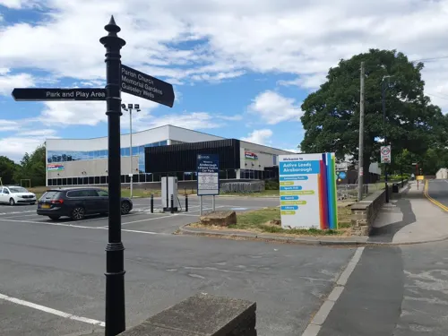
Guiseley Theatre
Cinema and theater · 1.0 mi
Theatre in Guiseley, Leeds, England, a former town hall
The Green



Otley Bridge
Bridge · 3.1 mi
Road bridge in Otley, West Yorkshire, England, UK

Cemetery Viewpoint
Scenic view · 0.8 mi
EGNM Leeds/Bradford Airport Viewing Point 'Cemetery'
Nob Hill Viewpoint
Scenic view · 1.0 mi
Nob Hill Viewing Point Leeds/Bradford Airport
Museums and landmarks14

2 more on the map.
Parks, trails and playgrounds20


Rodley Nature Reserve
Park · 3.4 mi
Wetland reserve on the site of a former sewage works, West Yorkshire, United Kingdom

Yanki Doodlz Play Zone and Diner
Playground
2 Sizers Court, Leeds
Nunroyd Park Community Orchard
Park · 0.5 mi
Https://www.facebook.com/groups/friendsofnunroydpark/
Parkinson's Park community Orchard
Park · 1.5 mi
Https://www.facebook.com/groups/164802993988992/
Springfield Park Community Orchard
Park · 1.0 mi
Https://www.facebook.com/Guiseley-In-Bloom-247245008785129/ 12 apple & plum trees planted in Springfield Park, close to the Aireborough...

8 more on the map.
Restaurants and cafes101


Mumbai Village
Restaurant · Indian · 1.0 mi
Authentic Indian Cuisine. Bar and restaurant.
4-6 The Green, Leeds


Everybodys All Day Social
Cafe · 1.2 mi
91-97 Otley Road, Leeds
Mo-Th 10:00-21:00; Fr,Sa 10:00-01:00; Su 10:00-21:00

The Corner 19 Cafe & Bistro
Cafe · 0.4 mi
111 High Street, Leeds
Mo-We 08:30-15:00; Th-Sa 08:30-15:00,17:00-22:00; Su 09:00-15:00
89 more on the map.
History
Yeadon's name comes from Old English gæh and dūn meaning steep hill, and the hilly part of the High Street has been known as "the Steep" for centuries. It was one of three hill settlements: Rawdon, Yeadon and Baildon, and it has been suggested that Rawdon was the main one, Yeadon being used for burial (there are burial urns nearby) and other religious purposes.
Yeadon was part of the Kingdom of Elmet until overrun by the Anglo-Saxons who transferred religion to Guiseley by building a church and divided Yeadon into two areas, Yeadon and Nether Yeadon, with Saxon lords (thegns). It remained divided until 1630. Following the Danish conquest of Yorkshire Yeadon was part of the Wapentake of Skyrack but still with Saxon lords.
After the Norman Conquest the two manors were taken from their Saxon lords and given to the House of Percy (present Yeadon village) and the Meschines family (Nether Yeadon). According to the Domesday Book it comprised four carucates or about 328 acres. Much of the area was later acquired by Bolton Priory and Kirkstall Abbey who exerted considerable power until the Dissolution of the Monasteries. In 1354 the villagers won a court case against Kirkstall Abbey over 300 acres of moorland between Yeadon Tarn (lake) and Horsforth, which now accommodates Leeds Bradford Airport.
Read more of the history
In this period there were only thirty or so households scattered around three points: where the town centre is now; the main cluster round where the Woolpack is, and a smaller group of cottages further to the west along Yeadon Gill at Nether Yeadon, probably a marketplace. Sheep were farmed and the wool made into cloth locally. Yeadon Gill provided waterpower for a corn mill.
Despite the English Civil War the area prospered and the population more than doubled to more than 400 during the 17th century, with 93 hearths (i.e. fireplace with chimney) recorded. Medieval parcels of land were traded into more efficient farms and a new mill was built. The town was no longer divided and had a significant social organization with poor relief and a constable.
The 18th century saw the establishment of a school (now Layton Cottage) and more stone houses were built replacing the wattle and daub cottages, a windmill and the first steam engine operated mill were built. The people worshipped at the parish church in Guiseley, some distance away, and started demanding their own church in 1714: but did not get one until 1844.
John Yeadon (1764–1833), a lay preacher in the town for more than thirty years, kept a journal about his life, family and events in the locality for most of his adult life. He and his wife, Mary had fourteen children, one of whom had a severe intellectual disability. John conducted services locally, but also in many villages and towns in the Aire and Wharfe Valleys. He attended services conducted by John Wesley, one of the founders of Methodism, many times. The handwritten journal provides detailed insights into town life and the early Methodist Church in the district.
In the 19th century, the population rose rapidly from 1,695 in 1801 to 4,109 in 1851 and 7,396 in 1891 as Yeadon became a manufacturing rather than farming town. It was particularly noted for making women's apparel. To assist trade, New Road (now A65) was built in 1827 through Yeadon, linking Kirkstall with Guiseley and the railway followed in the 1840s. In 1845 it was administratively separated from Guiseley. By 1853 it had gas from the "Yeadon and Guiseley Gas Light Co". The watercourse became badly polluted by effluent from Bradford, Shipley and Bingley, leading to a successful court case against the Bradford Corporation in 1868. The Yeadon Waterworks sank a well in 1861 and began the Cold Harbour Reservoir in 1877. The town's Board of Health was established in 1863, and set up the cemetery and buildings in 1876. In 1880 the town had its own "Yeadon Town Hall and Mechanics' Institute".
Increasing social unrest and labour disputes in the early 20th century led to a major lockout and subsequent hunger marches in 1913. As a result of the dispute, the working week in the textile mills was shortened, and workers received a pay rise, although this fell short of the demands of the trade unions who in consequence streamlined their organisation. In 1937 it became part of the Aireborough district, being the most populous township of over ten thousand.
From the History section of Yeadon, West Yorkshire on Wikipedia, under CC BY-SA 4.0.
More about Yeadon
Geography
The main part of the town is on a hill with a south facing slope towards the Aire valley. It is bounded by the A65 road to the southwest and the A658 road to the southeast. South of the junction of these roads are Nether Yeadon and Little London. To the west of the A65 is New Scarborough, containing many 19th century houses. A public park, Nunroyd Park, to the northwest provides a green break between the housing of Yeadon and Guiseley. This was formerly the house and lands of a mill owner, and before that the parkland belonging to a nunnery, royd meaning a woodland clearing.
Evidence of the medieval settlement is seen in fields to the north in Yeadon Banks which follow the strips of this time, and in the irregular and organic location of buildings around Town Street and Ivegate, described in 1878, as "a bewildering labyrinth of yards and courts and intricate lanes". By contrast the 19th century development produced a regular grid of terraced houses, many of which remain, while the pattern of streets remains for those that have gone. There are also a number of former mill and dyeworks sites.
Economy
The Avro factory next to Leeds Bradford Airport from 1938 to 1946 produced many of the company's wartime planes, including the Lancaster, Lincoln, York and Anson. Several different variants of Lancasters were produced at Yeadon, with a final tally of 695.
Aviation heritage in Yeadon is kept alive by the activities of 2168 (Yeadon) Squadron Air Training Corps.
The national charity Epilepsy Action has its headquarters in the town.
From the Wikipedia article Yeadon, West Yorkshire, under CC BY-SA 4.0.
Notable people from Yeadon
- David WilmanBritish field hockey player
- Moses AyrtonMethodist minister, socialist
- Fred SmithEnglish cricketer born in 1879
- Amos MarshallEnglish county cricketer (1849-1891)
- Willie YeadonEnglish historian (1907-1997)
- Bryan StottEnglish county cricketer (born 1934)
- John CawthraCanadian politician
Born in Yeadon, according to Wikidata (CC0). Each name links to its Wikipedia article.
Where to stay3
Churches and places of worship15
The Parish Church of Saint John the Evangelist
Church · Anglican
Barcroft Grove, Leeds
Shopping16
Gas and EV charging3
Schools, colleges and libraries19
Rawdon St Peter's Church of England Voluntary Controlled Primary School
School · Anglican · 1.2 mi
Town Street, Leeds
Healthcare5
Map of Yeadon
208 places. The map loads OpenStreetMap tiles when you open it.
Getting there and nearby towns
Leeds Bradford Airport (LBA) is the nearest airport with scheduled flights listed in OpenStreetMap, 1 miles away.
- Guiseley 1 mi northwest, about 2 min by car
- Horsforth 3 mi southeast, about 4 min by car
- Otley 3 mi north, about 5 min by car
- Shipley 4 mi southwest, about 6 min by car
- Baildon 4 mi west, about 7 min by car
- Pudsey 5 mi south, about 8 min by car
- Bradford 6 mi southwest, about 9 min by car
- Bingley 6 mi west, about 10 min by car
- Leeds 7 mi southeast, about 12 min by car
- Chapel Allerton 7 mi east, about 11 min by car
Drive times are estimates from straight-line distance, not routes.
Towns near Yeadon


Keep exploring
Local news
Headlines from INDB.
Reviews, tips and questions
Loading what members have shared...
Sources and licences
- GeoNames (CC BY 4.0): population, coordinates, regions and time zone
- Mapillary (see each image): photos
- OpenStreetMap contributors (ODbL 1.0): places, airports, map data
- Wikidata (CC0 1.0): elevation, founding date, time zone, website, landmarks and historic places
- Wikimedia Commons (see each image): photos
- Wikipedia (CC BY-SA 4.0): overview and history text
Photo credits
- Yeadon, Mick Melvin, CC BY-SA 2.0
- Holy Trinity Church, Idle, Rude Health, CC BY-SA 2.0
- Grove Methodist Church, Horsforth (30th December 2013) 001, Mtaylor848, CC BY-SA 3.0
- Billing Fortifications, Moambo, CC BY-SA 4.0
- New Life Community Church, Yeadon Jan 2018, Chemical Engineer, CC BY-SA 4.0
- Guiseley Library (29851834155), Libraries Taskforce, CC BY 2.0
- Yeadon Library (29851829715), Libraries Taskforce, CC BY 2.0
- Horsforth Golf Club, Leeshore1966, CC BY-SA 4.0
- The Clothier's Arms, High Street, Yeadon (12328681664), Tim Green from Bradford, UK, CC BY 2.0
- The Woolpack, Yeadon (6299673049), Tim Green from Bradford, UK, CC BY 2.0
- Trinity Church Rawdon 2016, Chemical Engineer, CC BY-SA 4.0
- RawdonBilling, Dave Sumpner, Public domain
- Yeadon Town Hall 29 June 2018 02, Chemical Engineer, CC BY-SA 4.0
- View of Horsforth Golf Club, Unknown author, CC0
- Street-level photo, trekclimbing, CC BY-SA 4.0
- Street-level photo, mackerski, CC BY-SA 4.0
- Street-level photo, trekclimbing, CC BY-SA 4.0
- Street-level photo, lvl5, CC BY-SA 4.0
- Street-level photo, trekclimbing, CC BY-SA 4.0


Page built November 10, 2026. Spotted a mistake? Tell us or suggest a place.