


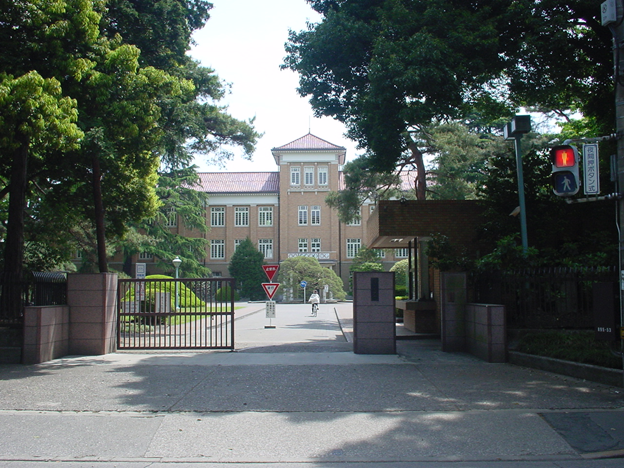

Musashimurayama, Japan
武蔵村山市
Musashimurayama is a town of 70,829 people in Tokyo, Japan, founded in November 3, 1970.
Why visit Musashimurayama
Townapedia lists 35 museums and landmarks, 156 parks and trails, 143 places to eat, 2 places to stay and 11 attractions in and around town.
Highlights include Kunitachi College of Music, Musashino Art University, Kodaira Hirakushi Denchu Art Museum and National Institute of Polar Research.
Weather in Musashimurayama
Forecast from MET Norway (CC BY 4.0). Full forecast
About Musashimurayama
Musashimurayama (武蔵村山市, Musashi-Murayama-shi) is a city located in the west of the Tokyo Metropolis, Japan. As of 1 March 2021, the city had an estimated population of 72,021 in 32,234 households, and a population density of 4,700 people per km2. The total area of the city is 15.32 square kilometres (5.92 sq mi).
From the Wikipedia article Musashimurayama, Tokyo (this version), under CC BY-SA 4.0.
Things to do11

Kunitachi College of Music
School · 1.8 km
Private University in Tokyo

Musashino Art University
School · 2.6 km
University in Kodaira, western Tokyo

Hitotsubashi University
School · 5.7 km
National university in Kunitachi, Tokyo, Japan

Seibu-en
Monument and historic site · 3.2 km
Amusement park in Tokorozawa, Japan




Museums and landmarks35

Kodaira Hirakushi Denchu Art Museum
Museum · 5.2 km
Art museum in Tokyo, Japan

National Institute of Polar Research
Museum · 3.7 km
Japanese research institute for Antarctica

Suzuki Site
Monument and historic site · 6.9 km
Archaeological site in Kodaira, Japan


Bell Tower from Kofuku-ji Temple
Monument and historic site · 3.2 km
Originally located at Kofuku-ji Temple in Nara Prefecture
Benten-do Hall (Former Sutra Repository of Seiryo-ji Temple, Hikone)
Monument and historic site · 3.2 km
Originally, this hexagonal hall was built for the memorial of Ii Naotaka at Seiryoji Temple in Shiga Prefecture, but was moved here in...

Chokugakumon (Imperial Tablet Gate)
Monument and historic site · 3.2 km
Originally located in the Taitoku-in Mausoleum (southern mausoleum of Zojo-ji Temple) of the second Shogun Hidetada, was erected in 1632...
First Pagoda (Former Takatsuki Hatakeyama Shrine Pagoda)
Monument and historic site · 3.2 km
Originally located at Hatayama Shrine in Takatsuki City, Osaka Prefecture, and was moved to what was then the UNESCO Village in 1960. It...
Former Main Gate of Keisho-in Temple
Monument and historic site · 2.8 km
Belonged to Keisho-in (慶性院), a temple that was located in the Yamaguchi Village. When the Murayama Reservoir (Tama Lake) was built in...
Main gate of Fudoji Temple (Gate to the residence of Duke Mori, former lord of the Choshu domain)
Monument and historic site · 3.2 km
The main gate in front of the main hall was relocated from the Edo residence of the Mori clan of the Choshu domain
Monument in honor of Professor Nakajima
Monument and historic site · 2.7 km
Designer of the Komazawa Water Tower (Setagaya). During the Taisho era, as an engineer for Tokyo Prefecture, he was involved in the...
23 more on the map.
Parks, trails and playgrounds156





144 more on the map.
Restaurants and cafes143



高岡珈琲店
Cafe · Coffee Shop, Sandwich · 0.7 km
65, 東大和市
Th-Tu 08:00-17:00

おれんち
Bar and pub · 1.4 km
居心地の良い居酒屋。祝日営業は要確認
Mo-Sa 17:00-24:00; Su off
131 more on the map.
History
The area of present-day Musashimurayama was part of ancient Musashi Province. In Meiji era, the area was organized into four villages within Kitatama District in Kanagawa Prefecture. Kitatama District was transferred to the administrative control of Tokyo Metropolis on April 1, 1893.
The village of Murayama was created on April 1, 1917, and was elevated to town status on November 3, 1954. The population of the town grew extremely rapidly in the 1960s with the development of public housing. Murayama was elevated to city status on November 3, 1970, and was named Musashimurayama.
From the History section of Musashimurayama, Tokyo on Wikipedia, under CC BY-SA 4.0.
Where to stay2
Churches and places of worship42
Daikoku-do Hall (Former Kakinomoto no Hitomaro Memorial Hall from Gokuraku-ji Temple, Nara)
Place of worship · 3.2 km
Rakan-do Hall (Former Hall of Marquis Kaoru Inoue's Residence)
Place of worship · 3.2 km
Shopping50
Gas and EV charging9
Schools, colleges and libraries87
Healthcare47
Map of Musashimurayama
250 places. The map loads OpenStreetMap tiles when you open it.
Getting there and nearby towns
Yokota Air Base (OKO) is the nearest airport with scheduled flights listed in OpenStreetMap, 7 km away.
- Tachikawa 4 km south, about 4 min by car
- Higashimurayama 4 km east, about 4 min by car
- Akishima 5 km southwest, about 5 min by car
- Kodaira 6 km east, about 6 min by car
- Kokubunji 6 km southeast, about 6 min by car
- Tokorozawa 7 km northeast, about 7 min by car
- Higashikurume 8 km east, about 8 min by car
- Hakonegasaki 7 km northwest, about 7 min by car
- Fuchū 9 km southeast, about 9 min by car
- Koganei 9 km southeast, about 9 min by car
Drive times are estimates from straight-line distance, not routes.
Local news
Headlines from INDB.
Reviews, tips and questions
Loading what members have shared...
Sources and licences
- GeoNames (CC BY 4.0): population, coordinates, regions and time zone
- OpenStreetMap contributors (ODbL 1.0): places, airports, map data
- Wikidata (CC0 1.0): elevation, founding date, time zone, website, landmarks and historic places
- Wikimedia Commons (see each image): photos
- Wikipedia (CC BY-SA 4.0): overview and history text
Photo credits
- Musashimurayama city hall, アラツク, CC BY-SA 4.0
- Kunitachiondai2, The original uploader was Hykw-a4 at Japanese Wikipedia ., CC BY-SA 3.0
- Musashino Art University, The original uploader was Hykw-a4 at Japanese Wikipedia ., CC BY-SA 3.0
- Kanematsu auditorium, Wiiii, CC BY-SA 3.0
- Tsudajukuuniv, The original uploader was Hykw-a4 at Japanese Wikipedia ., CC BY-SA 3.0
- Kodaira Hirakushi Denchu Art Museum front, Calton, CC BY-SA 4.0
- National Institute of Japanese Literature, Tamago915 ( talk ), CC BY-SA 3.0
- Suzuki Remains Museum, Nyao148, CC BY-SA 3.0
- Satoyamaminkah, four horsemen, CC BY-SA 3.0
- Showa Commemorative National Government Park 1, Kakidai, CC BY-SA 4.0
- Seibuen Amusement Park (11152952796), Tomohiro Ohtake from Kawasaki, Japan, CC BY 2.0
- Chosundeahakkyo, Unknown author, CC BY-SA 3.0
- Seibu Dome feb 23 2021 various 16 59 23 418000, Nesnad, CC BY 4.0
- Kodaira-Nishi High School, Abasaa, Public domain
- Higashiyamato Hospital, Waka77, CC0
- National Hospital Organization Murayama Medical Center, Waka77, CC0
- Sayama Fudoson Bentendo, Suikotei, CC BY-SA 4.0
- Tokorozawa Konjoin Hondo 1, 京浜にけ, CC BY-SA 3.0
- Sayama Park, Higashiyamato, Tokyo, Japan, User: (WT-shared) Shoestring at wts wikivoyage, CC BY-SA 4.0
- Shosenji-4, 江戸村のとくぞう, CC BY-SA 4.0
- Kodaira Sinmeigu-9, 江戸村のとくぞう, CC BY-SA 4.0
- AzusamiTenjinsha 2019-12-01 sa(1), Araisyohei, CC BY 4.0
- 豊鹿嶋神社正面より, 石井裕光, CC BY-SA 4.0
- Hie-jinja, Kodaira, 運動会プロテインパワー, CC BY-SA 4.0
- Siraumegakuen, The original uploader was Hykw-a4 at Japanese Wikipedia ., CC BY-SA 3.0
- Zojo-ji sanmon, KENPEI, CC BY-SA 3.0
- Seibuen Yuenchi Entrance 2021, Kaze315, CC BY-SA 4.0
- Korea University 2024, 運動会プロテインパワー, CC BY-SA 4.0
- Tokorozawa Sayamafudoson Hondo 1, 京浜にけ, CC BY-SA 3.0
- Higashiyamato-Minami Park, DiKnK8713, CC BY-SA 4.0
- Daitokyo Credit Union Higashiyamato Branch, Suikotei, CC BY 4.0
- Morinaga (5254423015), Shinichi Sugiyama, CC BY-SA 2.0
- LICOPA Higashiyamato, Suikotei, CC BY 4.0
- 旧日立航空機立川変電所 - panoramio, Adachi Masayuki, CC BY-SA 3.0
- 2 Chome Sakuragaoka, Higashiyamato-shi, Tōkyō-to 207-0022, Japan - panoramio (1), ESU, CC BY 3.0
- 2 Chome Sakuragaoka, Higashiyamato-shi, Tōkyō-to 207-0022, Japan - panoramio (2), ESU, CC BY 3.0
- 2 Chome Sakuragaoka, Higashiyamato-shi, Tōkyō-to 207-0022, Japan - panoramio (4), ESU, CC BY 3.0
- 2 Chome Sakuragaoka, Higashiyamato-shi, Tōkyō-to 207-0022, Japan - panoramio (3), ESU, CC BY 3.0
- Hitachi plane Tachikawa transformer substation 20260830 03, Suikotei, CC BY 4.0
- 旧日立航空機立川変電所 - panoramio (1), Adachi Masayuki, CC BY-SA 3.0
- Hachikokuyama Taiken no Sato 2023-09-10, Asanagi, CC0


Page built November 5, 2026. Spotted a mistake? Tell us or suggest a place.