


Bang Khla, Thailand
เทศบาลตำบลบางคล้า
Bang Khla is a town of 13,528 people in Chachoengsao, Thailand, founded in March 14, 1938.
Loading the weather...
Population13,528
GeoNames
Local nameเทศบาลตำบลบางคล้า
RegionChachoengsao
Elevation5 m
16 ft
FoundedMarch 14, 1938
Time zoneAsia/Bangkok
Nearest airportSuvarnabhumi Airport (BKK)
49 km
Why visit Bang Khla
Townapedia lists 2 museums and landmarks in and around town.
Weather in Bang Khla
Forecast from MET Norway (CC BY 4.0). Full forecast
Photos of Bang Khla


Museums and landmarks2

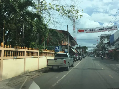
Bangkhla Floating Market
Monument and historic site · 0.8 km
Thetsaban Phatthana 1, Chachoengsao
Churches and places of worship2

Healthcare1

Map of Bang Khla
5 places. The map loads OpenStreetMap tiles when you open it.
Getting there and nearby towns
Suvarnabhumi Airport (BKK) is the nearest airport with scheduled flights listed in OpenStreetMap, 49 km away.
- Chachoengsao 15 km west, about 15 min by car
- Nong Chok 40 km west, about 40 min by car
- Lat Krabang 46 km west, about 46 min by car
- Chon Buri 47 km southwest, about 47 min by car
- Khlong Sam Wa 53 km west, about 53 min by car
- Bueng Kum 58 km west, about 58 min by car
- Suan Luang 60 km west, about 1 h by car
- Bang Kapi 61 km west, about 1 h by car
- Sai Mai 65 km west, about 1 h by car
- Samut Prakan 67 km west, about 1 h by car
Drive times are estimates from straight-line distance, not routes.
Towns near Bang Khla


Keep exploring
Local news
Headlines from INDB.
Reviews, tips and questions
Loading what members have shared...
Sources and licences
- GeoNames (CC BY 4.0): population, coordinates, regions and time zone
- Mapillary (see each image): photos
- OpenStreetMap contributors (ODbL 1.0): places, airports, map data
- Wikidata (CC0 1.0): elevation, founding date, time zone, website
- Wikimedia Commons (see each image): photos
Photo credits
- Flying foxes - Wat Pho Bangkla - panoramio, Thaweesak Churasri, CC BY 3.0
- Houseboat - panoramio, Thaweesak Churasri, CC BY 3.0
- Long-tailed boat - panoramio, Thaweesak Churasri, CC BY 3.0
- Bang Pakong River - May 2010 - 03, Rehman Abubakr, CC BY-SA 4.0
- Bang Pakong River - May 2010 - 02, Rehman Abubakr, CC BY-SA 4.0
- Bang Pakong River - May 2010 - 01, Rehman Abubakr, CC BY-SA 4.0
- ปากน้ำโจ้โล้ - panoramio, Thaweesak Churasri, CC BY 3.0
- สถูปเจดีย์พระเจ้าตากสินที่ปากน้ำโจ้โล้ King Taksin Pagoda - panoramio (1), Thaweesak Churasri, CC BY 3.0
- วัดปากน้ำโจ้โล้-Golden Basilica - panoramio, Thaweesak Churasri, CC BY 3.0
- วัดปากน้ำโจ้โล้ - Belfry - panoramio, Thaweesak Churasri, CC BY 3.0
- วัดปากน้ำโจ้โล้-Golden Basilica - panoramio (1), Thaweesak Churasri, CC BY 3.0
- วัดปากน้ำโจ้โล้-Golden Basilica - panoramio (2), Thaweesak Churasri, CC BY 3.0
- Wat Pak-Nam Arch - panoramio, Thaweesak Churasri, CC BY 3.0
- Street-level photo, mew, CC BY-SA 4.0


Page built November 10, 2026. Spotted a mistake? Tell us or suggest a place.