


Khlong Sam Wa, Thailand
เขตคลองสามวา
Khlong Sam Wa is a city of 169,489 people in Bangkok, Thailand, founded in November 21, 1997.
Why visit Khlong Sam Wa
Townapedia lists 17 museums and landmarks, 31 parks and trails, 122 places to eat, 11 places to stay and 2 attractions in and around town.
Highlights include Siam Park City, Kwan Roam Floating Market (revised), Kwan-Riam Floating Market and Safari World.
Weather in Khlong Sam Wa
Forecast from MET Norway (CC BY 4.0). Full forecast
About Khlong Sam Wa
Khlong Sam Wa (Thai: คลองสามวา, pronounced [kʰlɔ̄ːŋ sǎːm wāː]) is one of the 50 districts (khet) of Bangkok, Thailand. It is bounded by other districts (from north clockwise): Lam Luk Ka district of Pathum Thani province, Nong Chok, Min Buri, Khan Na Yao, Bang Khen, and Sai Mai of Bangkok. As of 2022, it had the highest population of all districts in Bangkok.
From the Wikipedia article Khlong Sam Wa district (this version), under CC BY-SA 4.0.
Photos of Khlong Sam Wa


Things to do2

Siam Park City
Monument and historic site · 8.5 km
Amusement and water park in the Khan Na Yao District of Bangkok, Thailand

Museums and landmarks17

Kwan Roam Floating Market (revised)
Monument and historic site · 8.4 km
soi 187 ถนนรามคำแหง
Sa-Su 06:00-20:00
Kwan-Riam Floating Market
Monument and historic site · 8.6 km
ฃอย187 soi 187 ถนนรามคำแหง
Sa-Su 06:00-20:00
Manatee
Monument and historic site · 3.6 km
Mo-Fr 10:00-16:00;Sa-Su 10:00-16:30;PH 10:00-16:30 open

5 more on the map.
Parks, trails and playgrounds31

Safari World
Park · 3.8 km
Tourist attraction in Bangkok that consists of two parks named Marine Park and Safari Park
99 ถนน ปัญญาอินทรา, แขวง สามวาตะวันตก





19 more on the map.
Restaurants and cafes122
ฌามเช้า
Restaurant · Breakfast, อาหารฮาลาล, เครื่องดื่ม, Coffee Shop, ร้านอาหาร · 6.6 km
21/1 ถนนราษฎร์อุทิศ
เสาร์-อาทิตย์ 7:00-11:30น.
บ้านนิค
Restaurant · Thai, อาหารเช้า, กาแฟ, โจ๊ก, ไข่กระทะ, นมถั่วเหลือง, ขนมปังปิ้ง · 8.6 km
7 ซอยคู้บอน 5 ถนน คู้บอน, กรุงเทพมหานคร
Mo-Su 06:00-21:00
รสมือแม่ กะเพราเป็ดสูตรโบราณ
Restaurant · Thai, Street Food, Pad Krapao · 2.1 km
356 ถนนหทัยราษฎร์
10:00-17:00
ร้านยโสธรแซ่บนัว เจ๊เก๋ - ถนนปัญญาอินทรา คลองสามวา
Restaurant · Thai, อาหารอีสาน, Regional · 3.9 km
209 ถนนปัญญาอินทรา
Mo-Su 10:30-23:00
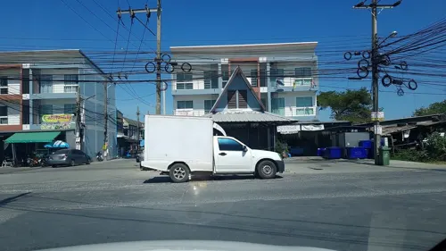
ร้านยโสธรแซ่บนัว เจ๊เก๋ สาขาหทัยราษฎร์ 39
Restaurant · Thai, Regional · 2.9 km
77/1 ซอยหทัยราษฎร์ 39
Mo-Su 11:00-23:00
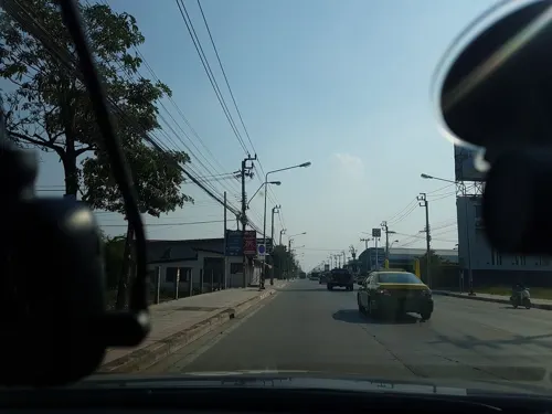
Khao Mai Pla Man By Busso Restaurant
Restaurant · Thai, International · 4.4 km
Mo-Fr 11:00-23:00; Sa-Su 10:00-23:00
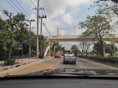
don skippอย่าข้าม!
Cafe · Coffee Shop, Noodle · 2.3 km
1477/4 ถนนนิมิตใหม่
Mo-Su 10:00-20:00

1PEN Cafe and Co
Cafe · Coffee Shop, Thai, Cake, Dessert · 8.7 km
121/211 ซอยรามอินทรา 60 หมู่บ้านชื่นกมล เขตคันนายาว
Mo-Su 07:30-18:00

110 more on the map.
History
Khlong Sam Wa was established as a district on 21 November 1997 by splitting from Min Buri. Khlong Sam Wa was the name of an amphoe (district) in Min Buri and hence the name is used as the district name. In 1947 when the area was still rural, the farming community of Bang Chan was chosen as a centre for Thai studies.
The name "Khlong Sam Wa" literally means "a khlong (canal) with a width of three wa" (about 5.94 m (19.5 ft). The name comes from a legal classification issued during the reign of King Rama V in 1891. At that time, any canal with a width of three wa or more was officially referred to as "Khlong Sam Wa." This legal designation later became the origin of the district's name.
From the History section of Khlong Sam Wa district on Wikipedia, under CC BY-SA 4.0.
Where to stay11
N-Siri Resort & Hotel เอ็นสิริ รีสอร์ท แอนด์ โฮเทล
Motel and hotel · 8.6 km
99/304/1 ลำลูกกาซอย71, ปทุมธานี
N-Siri Resort & Hotel โรงแรมเอ็นสิริ
Motel and hotel · 8.6 km
99/304/1 Lam Luk ka 71, Pathum Thani
Saffron Hill Minburi
Motel and hotel · 8.4 km
66/5 ปากซอยทางเข้าข้างปั๊มน้ำมัน ซัสโก้ เลย
Churches and places of worship32
Wat Sap Samoson Nikon Kasem
Place of worship · Thai Mahanikaya · 7.5 km
Wat Phon Phra Ruang Prasit
Place of worship · Thai Mahanikaya · 8.2 km
Shopping30
Fashion Island Shopping Mall
Shopping center · 8.0 km
591 ถนนรามอินทรา
Gas and EV charging33
PTT Station ปตท.พระยาสุเรนทร์ (น้ำมัน+EV) พีโอออยล์ สาขา23
Gas station · 5.0 km
ถนนพระยาสุเรนทร์
Schools, colleges and libraries32
Healthcare9
Map of Khlong Sam Wa
250 places. The map loads OpenStreetMap tiles when you open it.
Getting there and nearby towns
Don Mueang International Airport (DMK) is the nearest airport with scheduled flights listed in OpenStreetMap, 15 km away.
- Sai Mai 11 km northwest, about 11 min by car
- Bueng Kum 12 km southwest, about 12 min by car
- Nong Chok 14 km east, about 14 min by car
- Bang Kapi 15 km southwest, about 15 min by car
- Lat Phrao 16 km southwest, about 16 min by car
- Wang Thonglang 17 km southwest, about 17 min by car
- Lat Krabang 17 km south, about 17 min by car
- Lak Si 17 km west, about 17 min by car
- Suan Luang 18 km southwest, about 18 min by car
- Chatuchak 20 km west, about 20 min by car
Drive times are estimates from straight-line distance, not routes.
Towns near Khlong Sam Wa


Keep exploring
Local news
Headlines from INDB.
Reviews, tips and questions
Loading what members have shared...
Sources and licences
- GeoNames (CC BY 4.0): population, coordinates, regions and time zone
- Mapillary (see each image): photos
- OpenStreetMap contributors (ODbL 1.0): places, airports, map data
- Wikidata (CC0 1.0): elevation, founding date, time zone, website, landmarks and historic places
- Wikimedia Commons (see each image): photos
- Wikipedia (CC BY-SA 4.0): overview and history text
Photo credits
- Sai Kong Din Tai, Khlong Sam Wa, Bangkok 10510, Thailand - panoramio, Thaweesak Churasri, CC BY 3.0
- Sai Kong Din Tai, Khlong Sam Wa, Bangkok 10510, Thailand - panoramio (1), Thaweesak Churasri, CC BY 3.0
- Safari World, Lerdsuwa, CC BY-SA 3.0
- Fashion Island, Sry85, CC BY-SA 4.0
- วัดพระยาสุเรนทร์ เขตคลองสามวา กรุงเทพมหานคร (5), กสิณธร ราชโอรส, CC BY-SA 4.0
- วัดหนองใหญ่ กรุงเทพ 1, Dharmadana, CC BY-SA 4.0
- วัดบำเพ็ญเหนือ 04, Dharmadana, CC BY-SA 4.0
- Fashion Island,Bangkok (74), กสิณธร ราชโอรส, CC BY-SA 4.0
- สะพานเสรีไทย3, Phoebus 28, CC BY-SA 4.0
- วัดทรัพย์สโมสรนิกรเกษม Wat Sub samo sorn nikon kasem - panoramio, Thaweesak Churasri, CC BY 3.0
- วัดบำเพ็ญเหนือ 02, Dharmadana, CC BY-SA 4.0
- (2024) วัดสัมมาชัญญาวาส เขตคลองสามวา กรุงเทพมหานคร Wat Samma Chanyawat,Khlong Sam Wa,Bangkok (8), กสิณธร ราชโอรส, CC BY-SA 4.0
- คลองแสนแสบ เห็นวัดแสนสุข, Dharmadana, CC BY-SA 4.0
- Safari World - panoramio (1), Anil Kaushik, CC BY-SA 3.0
- Fearful - panoramio, Anil Kaushik, CC BY-SA 3.0
- Dear Deer - panoramio, Anil Kaushik, CC BY-SA 3.0
- Colored Community - panoramio, Anil Kaushik, CC BY-SA 3.0
- Community Meeting - panoramio, Anil Kaushik, CC BY-SA 3.0
- Kakatua - panoramio, Anil Kaushik, CC BY-SA 3.0
- Jungle Safari - panoramio, Anil Kaushik, CC BY-SA 3.0
- Ready to takeoff - panoramio, Anil Kaushik, CC BY-SA 3.0
- Holy Cow - panoramio, Anil Kaushik, CC BY-SA 3.0
- Safari World, Bangkok, Thailand (Unsplash), Stephanie Ecate steffny0206, CC0
- Bengal Tiger - panoramio, Anil Kaushik, CC BY-SA 3.0
- Dolphinarium - panoramio, Anil Kaushik, CC BY-SA 3.0
- Before the Show - panoramio, Anil Kaushik, CC BY-SA 3.0
- Safari World - panoramio, Anil Kaushik, CC BY-SA 3.0
- Black Beer - panoramio, Anil Kaushik, CC BY-SA 3.0
- Bengal Tiger - panoramio - Anil Kaushik, Anil Kaushik, CC BY-SA 3.0
- Foodella, Ella54321, CC BY-SA 4.0
- Treron vernans 372673104, Wich’yanan (Jay) Limparungpatthanakij, CC BY 4.0
- Asilidae - Bangkok 2017, Anonimeco, CC BY 4.0
- ISS018-E-46360 - View of Earth, Earth Science and Remote Sensing Unit , Lyndon B. Johnson Space Center, Public domain
- ภาพจากซิทคอม ครอบครัวโชคดี, พุฒิเมธ วัฒนตฤณากุล, CC BY-SA 4.0
- คลองแสนแสบ Along the Saen Saeb canal - panoramio, Thaweesak Churasri, CC BY 3.0
- คลองแสนแสบ Along the Saen Saeb canal - panoramio (1), Thaweesak Churasri, CC BY 3.0
- ประตูระบายน้ำคลองแสนแสบ Saen Saeb Canal floodgate - panoramio, Thaweesak Churasri, CC BY 3.0
- ประตูระบายน้ำคลองแสนแสบ Saen Saeb Canal floodgate - panoramio (1), Thaweesak Churasri, CC BY 3.0
- Along the canal - panoramio (1), Thaweesak Churasri, CC BY 3.0
- Along the canal - panoramio (2), Thaweesak Churasri, CC BY 3.0
- Dolphin Show - panoramio, Anil Kaushik, CC BY-SA 3.0
- Street-level photo, jetman11, CC BY-SA 4.0
- Street-level photo, igorzo, CC BY-SA 4.0
- Street-level photo, jetman11, CC BY-SA 4.0
- Street-level photo, mishari, CC BY-SA 4.0
- Street-level photo, mishari, CC BY-SA 4.0
- Street-level photo, jetman11, CC BY-SA 4.0
- Street-level photo, kasetitkml_pipitchai, CC BY-SA 4.0
- Street-level photo, ozflor, CC BY-SA 4.0
- Street-level photo, jetman11, CC BY-SA 4.0


Page built November 10, 2026. Spotted a mistake? Tell us or suggest a place.