


Chachoengsao, Thailand
เทศบาลเมืองฉะเชิงเทรา
Chachoengsao is a regional capital of 49,741 people in Chachoengsao, Thailand, founded in 1549.
Why visit Chachoengsao
Townapedia lists 3 museums and landmarks, 4 parks and trails, 5 places to eat, 2 places to stay and 2 attractions in and around town.
Weather in Chachoengsao
Forecast from MET Norway (CC BY 4.0). Full forecast
About Chachoengsao
Chachoengsao (Thai: ฉะเชิงเทรา, pronounced [t͡ɕʰàʔ.t͡ɕʰɤ̄ːŋ.sāw]) is a town (thesaban mueang) in central Thailand, capital of Chachoengsao Province. It is on the banks of the Bang Pakong River. It includes tambon Na Mueang and parts of Ban Mai, Bang Tin Pet, Wang Takhian, and Sothon of Mueang Chachoengsao District. In 2006, it had a population of 60,893.
From the Wikipedia article Chachoengsao (this version), under CC BY-SA 4.0.
Travel tips from other travellers: Chachoengsao on Wikivoyage (CC BY-SA 4.0).
Photos of Chachoengsao


Things to do2

Museums and landmarks3
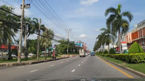

Parks, trails and playgrounds4

Restaurants and cafes5
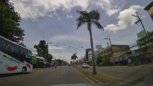


History
Chachoengsao has a history dating back to the reign of King Borommatrailokkanat in the Ayutthaya Kingdom. Most people settled by the Bang Pakong River and along canals. "Luangpho Phuttha Sothon" is a centre of faith of the people of Paet Riu. In the past, Chachoengsao was a fourth class city under the ministry of defence. During the reign of King Rama I, it was attached to the ministry of the interior. Until the reign of King Rama V, who changed the administration system, Chachoengsao became a city. In 1916, its status was changed from a city to a province. "Chachoengsao" is a Khmer word which means 'deep canal'.
From the History section of Chachoengsao on Wikipedia, under CC BY-SA 4.0.
More about Chachoengsao
Geography
The western part of the province is the low river plain of the Bang Pakong River, which is used extensively for farming rice. To the east is more hilly terrain, with an average elevation of more than 100 meter.
From the Wikipedia article Chachoengsao, under CC BY-SA 4.0.
Notable people from Chachoengsao
 Phiravich AttachitsatapornThai actor and modelPhoto: Cinphonix, CC BY-SA 4.0
 Saharat Sontisawatassociation football playerPhoto: DBellamy, CC BY-SA 3.0
 Jakkit NiyomsukThai professional footballerPhoto: Lady.Melon, CC BY-SA 4.0
- Vilard NormcharoenThai footballer (1962-2014)
- Akarawin SawasdeeThai footballer
- Rattapon PiyawuttisakunThai footballer
- Wichan SakiyaThai footballer
Born in Chachoengsao, according to Wikidata (CC0). Each name links to its Wikipedia article.
Where to stay2
Churches and places of worship10
Shopping3
Schools, colleges and libraries12
Healthcare2
Map of Chachoengsao
43 places. The map loads OpenStreetMap tiles when you open it.
Getting there and nearby towns
Suvarnabhumi Airport (BKK) is the nearest airport with scheduled flights listed in OpenStreetMap, 34 km away.
- Nong Chok 29 km northwest, about 29 min by car
- Lat Krabang 31 km west, about 31 min by car
- Chon Buri 37 km south, about 37 min by car
- Khlong Sam Wa 41 km northwest, about 41 min by car
- Bueng Kum 45 km west, about 45 min by car
- Suan Luang 46 km west, about 46 min by car
- Bang Kapi 47 km west, about 47 min by car
- Samut Prakan 52 km west, about 52 min by car
- Wang Thonglang 51 km west, about 51 min by car
- Sai Mai 53 km northwest, about 53 min by car
Drive times are estimates from straight-line distance, not routes.
Towns near Chachoengsao


Keep exploring
Local news
Headlines from INDB.
Reviews, tips and questions
Loading what members have shared...
Sources and licences
- GeoNames (CC BY 4.0): population, coordinates, regions and time zone
- Mapillary (see each image): photos
- OpenStreetMap contributors (ODbL 1.0): places, airports, map data
- Wikidata (CC0 1.0): elevation, founding date, time zone, website
- Wikimedia Commons (see each image): photos
- Wikipedia (CC BY-SA 4.0): overview and history text
Photo credits
- View of Wat Sothonwararam, Heuristics, Public domain
- Chachoengsao Town Municipality Stadium 20180317, El_Loko für www.thai-fussball.com, CC BY 4.0
- Benchamaracharungsarit School Football Field 3, This Photo was taken by Adirach Toumlamoon . Feel free to use any of my images, but please mention me as the author and may send me a message. (ภาพถ่ายสามารถนำไปใช้งานได้เลย..., CC BY 4.0
- Dat Daruni School Campus, Tehben1, CC BY-SA 4.0
- Royal Thai Police-Immigration Police BMW 330e, Thai Police Vehicles, CC BY-SA 2.0
- Benchamaracharungsarit School Building 2 with Cover Way, This Photo was taken by Adirach Toumlamoon . Feel free to use any of my images, but please mention me as the author and may send me a message. (ภาพถ่ายสามารถนำไปใช้งานได้เลย..., CC BY 4.0
- Benchamaracharungsarit School Rest Area B.4, This Photo was taken by Adirach Toumlamoon . Feel free to use any of my images, but please mention me as the author and may send me a message. (ภาพถ่ายสามารถนำไปใช้งานได้เลย..., CC BY 4.0
- Benchamaracharungsarit School Rest Area B.4-2, This Photo was taken by Adirach Toumlamoon . Feel free to use any of my images, but please mention me as the author and may send me a message. (ภาพถ่ายสามารถนำไปใช้งานได้เลย..., CC BY 4.0
- Benchamaracharungsarit School Rest Area B.3, This Photo was taken by Adirach Toumlamoon . Feel free to use any of my images, but please mention me as the author and may send me a message. (ภาพถ่ายสามารถนำไปใช้งานได้เลย..., CC BY 4.0
- Benchamaracharungsarit School Indoor dome, This Photo was taken by Adirach Toumlamoon . Feel free to use any of my images, but please mention me as the author and may send me a message. (ภาพถ่ายสามารถนำไปใช้งานได้เลย..., CC BY 4.0
- Benchamaracharungsarit School Rest Area 1, This Photo was taken by Adirach Toumlamoon . Feel free to use any of my images, but please mention me as the author and may send me a message. (ภาพถ่ายสามารถนำไปใช้งานได้เลย..., CC BY 4.0
- Benchamaracharungsarit School Buddha Hall, This Photo was taken by Adirach Toumlamoon . Feel free to use any of my images, but please mention me as the author and may send me a message. (ภาพถ่ายสามารถนำไปใช้งานได้เลย..., CC BY 4.0
- Statue of King Chulalongkorn at Benchamaracharungsarit School, This Photo was taken by Adirach Toumlamoon . Feel free to use any of my images, but please mention me as the author and may send me a message. (ภาพถ่ายสามารถนำไปใช้งานได้เลย..., CC BY-SA 4.0
- Benchamaracharungsarit School Football Field, This Photo was taken by Adirach Toumlamoon . Feel free to use any of my images, but please mention me as the author and may send me a message. (ภาพถ่ายสามารถนำไปใช้งานได้เลย..., CC BY 4.0
- Benchamaracharungsarit School Building 7, This Photo was taken by Adirach Toumlamoon . Feel free to use any of my images, but please mention me as the author and may send me a message. (ภาพถ่ายสามารถนำไปใช้งานได้เลย..., CC BY 4.0
- Benchamaracharungsarit School Princess Sirindhorn Building, This Photo was taken by Adirach Toumlamoon . Feel free to use any of my images, but please mention me as the author and may send me a message. (ภาพถ่ายสามารถนำไปใช้งานได้เลย..., CC BY 4.0
- Benchamaracharungsarit School Football Field 2, This Photo was taken by Adirach Toumlamoon . Feel free to use any of my images, but please mention me as the author and may send me a message. (ภาพถ่ายสามารถนำไปใช้งานได้เลย..., CC BY 4.0
- Benchamaracharungsarit School Gymnasium, This Photo was taken by Adirach Toumlamoon . Feel free to use any of my images, but please mention me as the author and may send me a message. (ภาพถ่ายสามารถนำไปใช้งานได้เลย..., CC BY 4.0
- Benchamaracharungsarit School Gymnasium 2, This Photo was taken by Adirach Toumlamoon . Feel free to use any of my images, but please mention me as the author and may send me a message. (ภาพถ่ายสามารถนำไปใช้งานได้เลย..., CC BY 4.0
- Royal Thai Police Isuzu D-Max, Thai Police Vehicles, CC BY-SA 2.0
- ประตูด้านข้างวัดเมือง, Nickdhapana, CC BY-SA 3.0
- ประตูกำแพงฝั่งวิหาร, Nickdhapana, CC BY-SA 3.0
- วัดปิตุลาธิราชรังสฤษฎิ์DSC 0825, Cat2you, CC BY-SA 4.0
- วัดปิตุลาธิราชรังสฤษฎิ์DSC 0809, Cat2you, CC BY-SA 4.0
- วัดปิตุลาธิราชรังสฤษฎิ์ อ.เมือง จ.ฉะเชิงเทรา (2), กสิณธร ราชโอรส, CC BY-SA 4.0
- วัดปิตุลาธิราชรังสฤษฎิ์DSC 0803, Cat2you, CC BY-SA 4.0
- หน้าวิหาร, Nickdhapana, CC BY-SA 3.0
- วัดปิตุลาธิราชรังสฤษฎิ์DSC 0828, Cat2you, CC BY-SA 4.0
- วัดปิตุลาธิราชรังสฤษฎิ์DSC 0838, Cat2you, CC BY-SA 4.0
- วัดปิตุลาธิราชรังสฤษฎิ์DSCF8389, Cat2you, CC BY-SA 4.0
- วัดปิตุลาธิราชรังสฤษฎิ์DSC 0777, Cat2you, CC BY-SA 4.0
- วัดปิตุลาธิราชรังสฤษฎิ์DSC 0814, Cat2you, CC BY-SA 4.0
- วัดปิตุลาธิราชรังสฤษฎิ์DSCF8381, Cat2you, CC BY-SA 4.0
- วิหารวัดเมือง, Nickdhapana, CC BY-SA 3.0
- วัดปิตุลาธิราชรังสฤษฎิ์ อ.เมือง จ.ฉะเชิงเทรา, กสิณธร ราชโอรส, CC BY-SA 4.0
- โบสถ์หลัก และวิหารด้านหลัง, Nickdhapana, CC BY-SA 3.0
- ศาลากลางหลังเก่าฉะเชิงเทรา1, Yakuzakorat, CC BY-SA 4.0
- วัดปิตุลาธิราชรังสฤษฎิ์DSCF8369, Cat2you, CC BY-SA 4.0
- วัดปิตุลาธิราชรังสฤษฎิ์DSC 0807, Cat2you, CC BY-SA 4.0
- วัดปิตุลาธิราชรังสฤษฎิ์DSCF8385, Cat2you, CC BY-SA 4.0
- Wat Sothon Wararam Worawihan, ChaChoengSao, Thailand - panoramio, gary4now, CC BY 3.0
- Street-level photo, ThailandCambodia, CC BY-SA 4.0
- Street-level photo, jrcarlsen, CC BY-SA 4.0


Page built November 10, 2026. Spotted a mistake? Tell us or suggest a place.