


Chatuchak subdistrict, Thailand
แขวงจตุจักร
Chatuchak subdistrict is a town of 21,853 people in Bangkok, Thailand, founded in December 1, 2003.
Why visit Chatuchak subdistrict
Townapedia lists 19 museums and landmarks, 25 parks and trails, 140 places to eat, 13 places to stay and 8 attractions in and around town.
Highlights include Major Cineplex Ratchayothin, Bangkok Aquarium, Thai Bank Museum and Museum of Contemporary Art.
Weather in Chatuchak subdistrict
Forecast from MET Norway (CC BY 4.0). Full forecast
About Chatuchak subdistrict
Chatuchak (Thai: จตุจักร, pronounced [t͡ɕàʔ.tùʔ.t͡ɕàk]) is a khwaeng (subdistrict) of Chatuchak District, Bangkok, Thailand. It is a location of the district office.
From the Wikipedia article Chatuchak subdistrict (this version), under CC BY-SA 4.0.
Photos of Chatuchak subdistrict


Things to do8

Major Cineplex Ratchayothin
Cinema and theater · 1.4 km
1839 ถนนพหลโยธิน
Mo-We 10:30-24:00; Th-Su 10:00-24:00

Bangkok Aquarium
Monument and historic site · 2.8 km
Public aquarium in Bangkok, Thailand

Dan Neramit
Monument and historic site · 1.3 km
Amusement park in Thailand




Museums and landmarks19


Museum of Contemporary Art
Museum · 2.8 km
Contemporary Art, museum in Chatuchak, Bangkok


Children's Discovery Museum
Museum · 2.7 km
Museum in Bangkok, Thailand

7 more on the map.
Parks, trails and playgrounds25

Chatuchak Park
Park · 2.1 km
Public park just north of Chatuchak Weekend Market
ถนนกำแพงเพชร 3
Mo-Su 04:30-22:00



Chak Phupha Su Maha Nathee Park
Park · 2.4 km
Park in Bangkok, Thailand
Prachanukun Health Garden สวนสุขภาพ ประชานุกูล
Park · 1.9 km
Prachanukun Health Garden สวนสุขภาพ ประชานุกูล

13 more on the map.
Restaurants and cafes140
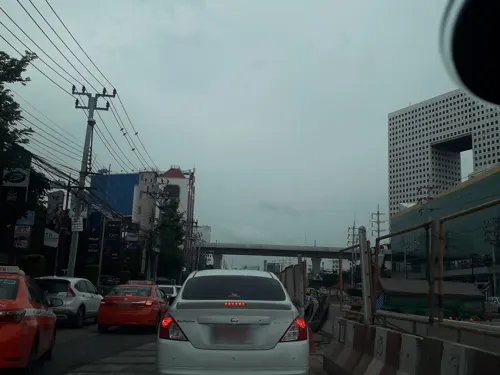
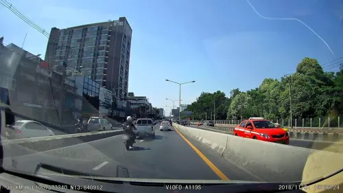
Rung Aroon Coffee Bar
Cafe · Coffee Shop · 2.4 km
21/17 งามวงศ์วาน 56
Mo-Su 07:00-17:00
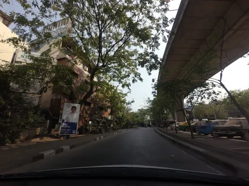
Moon Bar - Rooftop
Bar and pub · 0.6 km
1/24
Su, Tu-Th 18:00-00:00; Fr-Sa 18:00-01:00
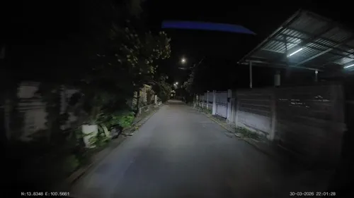

ChaaChaa Malatang - เซ็นทรัลลาดพร้าว
Restaurant · Chinese · 1.4 km
LP-R06 ถนนพหลโยธิน
Mo-Su 11:00-21:30

โรงอาหารกรมพัฒนาที่ดิน
Restaurant · Thai, Noodle, Fried Food, Fruit, Vegetable, Drink · 2.2 km
2003/61 ถนนพหลโยธิน, กรุงเทพมหานคร
Mo-Fr 06:00-14:00
128 more on the map.
History
The name Chatuchak after Chatuchak Park, a public park was built on the occasion of King Bhumibol Adulyadej (Rama IX)'s fourth cycle (48 years old) anniversary (Chatuchak means "fourth cycle"). In late 2003 it was officially declared a subdistrict along with four other subdistricts in Chatuchak.
From the History section of Chatuchak subdistrict on Wikipedia, under CC BY-SA 4.0.
More about Chatuchak subdistrict
Geography
Chatuchak is an area in the southwest of the district. It is bounded by (from the north clockwise): Lat Yao in its district (Ratchadaphisek Road is a borderline), Chomphon in its district (Phaholyothin Road is a borderline), Phaya Thai in Phaya Thai District (Khlong Bang Sue is a borderline), Bang Sue in Bang Sue District (Khlong Prapa and Southern Railway Line are the borderlines).
From the Wikipedia article Chatuchak subdistrict, under CC BY-SA 4.0.
Where to stay13
Churches and places of worship7
Shopping22
Gas and EV charging13
Schools, colleges and libraries26
King Mongkut's University of Technology North Bangkok
School · 4.4 km
Healthcare12
สถานพยาบาลแพทย์แผนจีน มหาวิทยาลัยราชภัฏจันทรเกษม
Hospital · 2.4 km
39/1 ถนนรัชดาภิเษก
Map of Chatuchak subdistrict
250 places. The map loads OpenStreetMap tiles when you open it.
Getting there and nearby towns
Don Mueang International Airport (DMK) is the nearest airport with scheduled flights listed in OpenStreetMap, 11 km away.
- Chatuchak 0 km east, about 1 min by car
- Bang Sue 3 km southwest, about 3 min by car
- Din Daeng 4 km south, about 4 min by car
- Phaya Thai 5 km south, about 5 min by car
- Mueang Nonthaburi 6 km northwest, about 6 min by car
- Lat Phrao 6 km southeast, about 6 min by car
- Huai Khwang 6 km southeast, about 6 min by car
- Bang Phlat 7 km southwest, about 7 min by car
- Dusit 7 km southwest, about 7 min by car
- Lak Si 7 km north, about 7 min by car
Drive times are estimates from straight-line distance, not routes.
Towns near Chatuchak subdistrict


Keep exploring
Local news
Headlines from INDB.
Reviews, tips and questions
Loading what members have shared...
Sources and licences
- GeoNames (CC BY 4.0): population, coordinates, regions and time zone
- Mapillary (see each image): photos
- OpenStreetMap contributors (ODbL 1.0): places, airports, map data
- Wikidata (CC0 1.0): elevation, founding date, time zone, website, landmarks and historic places
- Wikimedia Commons (see each image): photos
- Wikipedia (CC BY-SA 4.0): overview and history text
Photo credits
- สถานแสดงพันธุ์สัตว์น้ำกรุงเทพ, ยุทธนาสาระขันธ์, CC BY-SA 4.0
- Rama 6 bridge, Erzengel, CC BY-SA 4.0
- Rama VII Bridge (downstream, west bank of Chao Phraya River), Xiengyod, CC BY-SA 3.0
- Museum of Contemporary Art (MOCA), Bangkok, Thailand - 20161201-05, Smuconlaw, CC BY-SA 4.0
- Postal scale, Lerdsuwa, CC BY-SA 3.0
- Chatuchak park, Lerdsuwa, CC BY-SA 3.0
- สวนวชิรเบญจทัศ (สวนรถไฟ) IMG 7315, PEAK99, CC BY-SA 4.0
- DPU1, Mrapisit, CC BY-SA 3.0
- Kasetsart University Auditorium, David Supervid, CC BY-SA 4.0
- UTCC 2, Mx. Granger, CC0
- Place ParkQueenSirikit, Thanyakij, Public domain
- Refurbished CentralPlaza Ladprao, Khemkhaeng, CC BY-SA 3.0
- Ratchayothin Cineplex, Jarcje, CC BY-SA 3.0
- Union Mall,Bangkok (44), กสิณธร ราชโอรส, CC BY-SA 4.0
- Vibhavadi Hospital (2), Dharmadana, CC BY 4.0
- Insee Chantarasatit Stadium, Pudt, CC0
- วัดเสมียนนารี เขตจตุจักร กรุงเทพมหานคร (25), กสิณธร ราชโอรส, CC BY-SA 4.0
- เซ็นทรัล ลาดพร้าว เขตจตุจักร กรุงทพมหานคร Central Ladprao Bangkok (3), กสิณธร ราชโอรส, CC BY-SA 4.0
- Horwang School2023, ยุทธนาสาระขันธ์, CC BY-SA 4.0
- Dan Neramit castle in 2005, ong from Seattle, USA, CC BY 2.0
- Kiakkai Bridge - 2026 08 21 - 01, Anna Frodesiak, CC0
- Wachirabenchathat Park Stone Garden 05.23, This Photo was taken by Supanut Arunoprayote . Feel free to use any of my images, but please mention me as the author and may send me a message. (สามารถใช้ภาพได้อิสระ..., CC BY 4.0
- ท่ารถนครชัยแอร์ - panoramio, OB Narak, CC BY 3.0
- Exterior of Thai Bank Museum (2026) 01, Medelam, CC BY-SA 4.0
- ถนนรัชดาภิเษก บริเวณ ตัด ถ.วิภาวดีรังสิต , Rachavibha Junction - panoramio, ::::=UT=::::, CC BY-SA 3.0
- Shinawatra Tower 3 20260118 163358, Jothefiredragon, CC BY-SA 4.0
- Shinawatra Tower 3 20260118 163405, Jothefiredragon, CC BY-SA 4.0
- Shinawatra Tower 3 20260118 163620, Jothefiredragon, CC BY-SA 4.0
- Shinawatra Tower 3 20260118 163734, Jothefiredragon, CC BY-SA 4.0
- Shinawatra Tower 3 20260118 163809, Jothefiredragon, CC BY-SA 4.0
- Shinawatra Tower 3 20260118 164200, Jothefiredragon, CC BY-SA 4.0
- Shinawatra Tower 3 20260118 164209, Jothefiredragon, CC BY-SA 4.0
- Shinawatra Tower 3 20260118 164247, Jothefiredragon, CC BY-SA 4.0
- Shinawatra Tower 3 20260118 164327, Jothefiredragon, CC BY-SA 4.0
- Thai chicken rice, KengSiri, CC BY-SA 3.0
- Mamuang nam pla wan, Pavel from Sydney, AU, CC BY 2.0
- The Central Phaholyothin 20260118 161928, Jothefiredragon, CC BY-SA 4.0
- Energy Complex2023, ยุทธนาสาระขันธ์, CC BY 4.0
- The Central Phaholyothin 20260118 175527, Jothefiredragon, CC BY-SA 4.0
- The Central Phaholyothin 20251214 010059, Jothefiredragon, CC BY-SA 4.0
- Street-level photo, jetman11, CC BY-SA 4.0
- Street-level photo, poramet, CC BY-SA 4.0
- Street-level photo, mishari, CC BY-SA 4.0
- Street-level photo, ThailandCambodia, CC BY-SA 4.0
- Street-level photo, ThailandCambodia, CC BY-SA 4.0
- Street-level photo, jetman11, CC BY-SA 4.0
- Street-level photo, ozflor, CC BY-SA 4.0
- Street-level photo, kasetitkml_pipitchai, CC BY-SA 4.0
- Street-level photo, ozflor, CC BY-SA 4.0
- Street-level photo, ratirat, CC BY-SA 4.0
- Street-level photo, ozflor, CC BY-SA 4.0
- Street-level photo, ThailandCambodia, CC BY-SA 4.0
- Street-level photo, ThailandCambodia, CC BY-SA 4.0
- Street-level photo, ozflor, CC BY-SA 4.0


Page built November 10, 2026. Spotted a mistake? Tell us or suggest a place.