


Lamphun, Thailand
เทศบาลเมืองลำพูน
Lamphun is a regional capital of 43,196 people in Lamphun, Thailand.
Why visit Lamphun
Townapedia lists 5 museums and landmarks, 3 parks and trails, 20 places to eat and 7 places to stay in and around town.
Highlights include Hari Phun Chai National Museum and Khum Sampantawong Museum.
Weather in Lamphun
Forecast from MET Norway (CC BY 4.0). Full forecast
About Lamphun
Lamphun (Northern Thai: ᩃᨻᩪᩁ; Thai: ลำพูน, pronounced [lām.pʰūːn]) is a town (thesaban mueang) in northern Thailand, capital of Lamphun province. It covers the whole tambon Nai Mueang of Mueang Lamphun district. As of 2006 it has a population of 14,030. Lamphun lies 665 km (413 mi) north of Bangkok and 19 km (12 mi) south of Chiang Mai.
From the Wikipedia article Lamphun (this version), under CC BY-SA 4.0.
Travel tips from other travellers: Lamphun on Wikivoyage (CC BY-SA 4.0).
Photos of Lamphun


Museums and landmarks5


Parks, trails and playgrounds3

Restaurants and cafes20
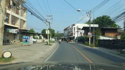
Happy Cup - Bubble tea&toast
Cafe · Coffee, Coffee Shop, Bubble Tea, ชานมไข่มุก, ชานมไต้หวัน, Thai · 1.1 km
07:00-17:30
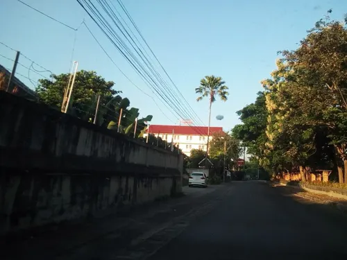
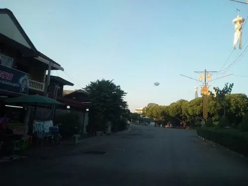


Pizza Lerchor
Restaurant · Steak House, Italian, Thai, Pizza · 1.9 km
ถนนเจริญตา
Tu-Su 10:00-20:00
8 more on the map.
Where to stay7
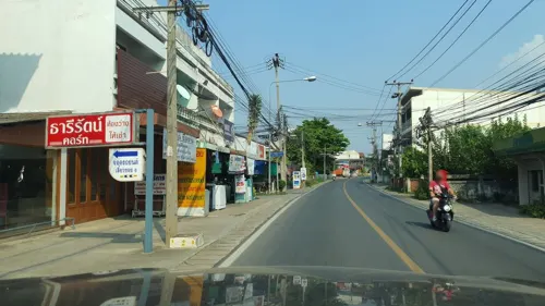
Thareerat Court
Motel and hotel · 0.7 km
Rooms for rent (250-500 Bhat, 2018)
Jammatavee Rd 104

History
Lamphun was founded by Queen Chama Thevi as the capital of the Haripunchai Kingdom, the last and most northerly Mon kingdom in the area which now forms Thailand. Around 25 km (16 mi) south of Chiang Mai, it was constructed in the shape of a conch shell, following the Khuang River on its east side and divided by moats at the remaining points of the compass.
Queen Chama Thevi is remembered in the wat of her name, Wat Chamadevi, which is said to be the resting place of her ashes. Near the town's main morning market in the south-west of the city is a statue of the queen at which offerings are still made today by citizens.
While still living in the north King Mangrai was visited by some merchants from the Mon Kingdom, and hearing of the wealth of Lamphun he determined to conquer it, even against the advice of his councillors.
As it was deemed impossible to take the city by force, he sent a skillful merchant called Ai Fa to gain the confidence of the King Yi Ba, and in time he became the chief minister and managed to undermine the king's authority.
Read more of the history
In 1281, with the people in a state of discontent, Mangrai defeated the Mon Kingdom, and added the city and its wealth to his kingdom, while Yi Ba, the last king of Hariphunchai, was forced to flee south to Lampang. Lamphun was then incorporated into the new Lanna Kingdom. Ai Fa was subsequently appointed king, and King Mangrai began building the fortress Wiang Kum Kam as his new capital.
Lamphun is host to one of northern Thailand's most important temples, Wat Phra That Hariphunchai, featured on the reverse of the one-satang coin. The phra that in the title indicates the presence of a Buddha relic, in this case one of his hairs, which was interred in the chedi in 897, which is probably the founding date of the wat.
The town is surrounded by lush countryside punctuated by rice fields and orchards of the popular fruit, longan, which is celebrated in a festival every August.
From the History section of Lamphun on Wikipedia, under CC BY-SA 4.0.
More about Lamphun
Geography
The town is in the Ping River valley, between the Thanon Thong Chai Range on the west and the Khun Tan Range in the east.
From the Wikipedia article Lamphun, under CC BY-SA 4.0.
Notable people from Lamphun
 Natouch SiripongthonThai actorPhoto: THHeadline中泰头条, CC BY 3.0
 Keni StylesThai pornographic actorPhoto: Toglenn, CC BY-SA 3.0
 Witthaya HloaguneThai football player and managerPhoto: El_Loko für www.thai-fussball.com, CC BY 4.0
- Hatthaporn SuwanThai footballer
- Boonyakait Wongsajaemassociation football player
- Natthaya ThanaronnawatThai athletics competitor
- Saharat KanyarojThai footballer
- Phetsommai Sor.SommaiThai Muay Thai fighter
Born in Lamphun, according to Wikidata (CC0). Each name links to its Wikipedia article.
Churches and places of worship20
Wat San Pa Yang Luang (Khruba Inthon Phra Khru Panya Tham Wat))
Place of worship · 0.7 km
113 ถนนสันป่ายาง ซ.10
Shopping2
Gas and EV charging1
Schools, colleges and libraries8
Healthcare4
Map of Lamphun
70 places. The map loads OpenStreetMap tiles when you open it.
Getting there and nearby towns
Chiang Mai International Airport (CNX) is the nearest airport with scheduled flights listed in OpenStreetMap, 21 km away.
- Pa Sang 9 km southwest, about 9 min by car
- San Pa Tong 13 km northwest, about 13 min by car
- Hang Dong 15 km northwest, about 15 min by car
- Mae Tha 19 km southeast, about 19 min by car
- San Kamphaeng 22 km northeast, about 22 min by car
- Chiang Mai 23 km north, about 23 min by car
- Chom Thong 40 km southwest, about 40 min by car
- Ban Pa Khaem 59 km north, about 59 min by car
- Lampang 60 km southeast, about 1 h by car
- Ban Aen Mai 73 km southwest, about 1 h 15 min by car
Drive times are estimates from straight-line distance, not routes.
Towns near Lamphun


Keep exploring
Local news
Headlines from INDB.
Reviews, tips and questions
Loading what members have shared...
Sources and licences
- GeoNames (CC BY 4.0): population, coordinates, regions and time zone
- Mapillary (see each image): photos
- OpenStreetMap contributors (ODbL 1.0): places, airports, map data
- Wikidata (CC0 1.0): elevation, founding date, time zone, website
- Wikimedia Commons (see each image): photos
- Wikipedia (CC BY-SA 4.0): overview and history text
Photo credits
- WatChamaTheviLamphun0701, Fotograf / Photographer: Heinrich Damm ( User:Hdamm , Hdamm at de.wikipedia.org ), CC BY 2.0
- เจดีย์กู่กุด, Kongnawa, CC BY-SA 3.0
- Wat Phra That Hariphunchai (II), This Photo was taken by Supanut Arunoprayote . Feel free to use any of my images, but please mention me as the author and may send me a message. (สามารถใช้ภาพได้อิสระ..., CC BY 4.0
- WAT PHRATHAT HARIPHUNCHAI 04, Kittipong khunnen, CC BY-SA 3.0
- วัดพระธาตุหริภุญชัย-6, Yakuzakorat, CC BY-SA 4.0
- วัดพระธาตุหริภุญชัย-3, Yakuzakorat, CC BY-SA 4.0
- Wat Phrathat Hariphunchai 002RS, Ritthichai Siangdee, CC BY-SA 4.0
- วัดพระธาตุหริภุญชัย 04, Hong2101, CC BY-SA 4.0
- WAT PHRATHAT HARIPHUNCHAI 07, Kittipong khunnen, CC BY-SA 3.0
- WAT PHRATHAT HARIPHUNCHAI 01, Kittipong khunnen, CC BY-SA 3.0
- Wat Phrathat Hariphunchai 006RS, Ritthichai Siangdee, CC BY-SA 4.0
- WAT PHRATHAT HARIPHUNCHAI 03, Kittipong khunnen, CC BY-SA 3.0
- Wat Phrathat Hariphunchai 001RS, Ritthichai Siangdee, CC BY-SA 4.0
- วัดพระธาตุหริภุญชัย ลำพูน, Suwapan91, CC BY-SA 4.0
- วัดพระธาตุหริภุญชัย-1, Yakuzakorat, CC BY-SA 4.0
- เจดีย์พระธาตุหริภุญชัย, Kingkidton, CC BY-SA 4.0
- เงาพญานาค, Sakchai05, CC BY-SA 4.0
- วัดพระธาตุหริภุญชัย 01, Hong2101, CC BY-SA 4.0
- วัดสุพรรณรังษี, Kongnawa, CC BY-SA 3.0
- วัดพระธาตุหริภุญชัย-5, Yakuzakorat, CC BY-SA 4.0
- วัดหลวง ลำพูน, Kingkidton, CC BY-SA 4.0
- WAT PHRATHAT HARIPHUNCHAI 06, Kittipong khunnen, CC BY-SA 3.0
- Wat Phrathat Hariphunchai 003RS, Ritthichai Siangdee, CC BY-SA 4.0
- วัดพระธาตุหริภุญชัย 02, Hong2101, CC BY-SA 4.0
- Tipitaka Hall, Kittipong khunnen, CC BY-SA 4.0
- Wat Phrathat Hariphunchai 005RS, Ritthichai Siangdee, CC BY-SA 4.0
- WAT PHRATHAT HARIPHUNCHAI 05, Kittipong khunnen, CC BY-SA 3.0
- WAT PHRATHAT HARIPHUNCHAI 02, Kittipong khunnen, CC BY-SA 3.0
- วัดพระธาตุหริภุญชัย 06, Hong2101, CC BY-SA 4.0
- วัดพระธาตุหริภุญชัย 05, Hong2101, CC BY-SA 4.0
- Wat Ton Ko, Mr Atsadang Katwibun, CC BY-SA 3.0
- 111พระบรมธาตุหริภุญไชย, Y.Thanongsak, CC BY-SA 4.0
- สุวรรณเจดีย์ วัดพระธาตุหริภุญชัย, Kongnawa, CC BY-SA 3.0
- Wat Phrathat Hariphunchai 004RS, Ritthichai Siangdee, CC BY-SA 4.0
- KHA-04, Khathar, CC BY-SA 4.0
- วัดพระธาตุหริภุญชัย 03, Hong2101, CC BY-SA 4.0
- WAT PHRATHAT HARIPHUNCHAI 09, Kittipong khunnen, CC BY-SA 3.0
- WAT PHRATHAT HARIPHUNCHAI 10, Kittipong khunnen, CC BY-SA 3.0
- WAT PHRATHAT HARIPHUNCHAI 08, Kittipong khunnen, CC BY-SA 3.0
- วัดพระธาตุหริภุญชัย-4, Yakuzakorat, CC BY-SA 4.0
- Street-level photo, jrcarlsen, CC BY-SA 4.0
- Street-level photo, jrcarlsen, CC BY-SA 4.0
- Street-level photo, jrcarlsen, CC BY-SA 4.0
- Street-level photo, jrcarlsen, CC BY-SA 4.0
- Street-level photo, kyoko, CC BY-SA 4.0
- Street-level photo, jrcarlsen, CC BY-SA 4.0
- Street-level photo, jrcarlsen, CC BY-SA 4.0
- Street-level photo, jrcarlsen, CC BY-SA 4.0
- Street-level photo, jrcarlsen, CC BY-SA 4.0
- Street-level photo, jrcarlsen, CC BY-SA 4.0
- Street-level photo, kyoko, CC BY-SA 4.0
- Street-level photo, kyoko, CC BY-SA 4.0
- Street-level photo, kyoko, CC BY-SA 4.0
- Street-level photo, jrcarlsen, CC BY-SA 4.0
- Street-level photo, ThailandCambodia, CC BY-SA 4.0
- Street-level photo, kyoko, CC BY-SA 4.0
- Street-level photo, kyoko, CC BY-SA 4.0
- Street-level photo, kyoko, CC BY-SA 4.0
- Street-level photo, kyoko, CC BY-SA 4.0
- Street-level photo, jrcarlsen, CC BY-SA 4.0


Page built November 10, 2026. Spotted a mistake? Tell us or suggest a place.