


Samut Songkhram, Thailand
เทศบาลเมืองสมุทรสงคราม
Samut Songkhram is a regional capital of 35,065 people in Samut Songkhram, Thailand.
Why visit Samut Songkhram
Townapedia lists 1 museum or landmark, 1 park or trail, 13 places to eat and 6 places to stay in and around town.
Highlights include Maeklong Railway Market.
Weather in Samut Songkhram
Forecast from MET Norway (CC BY 4.0). Full forecast
About Samut Songkhram
Samut Songkhram (Thai: สมุทรสงคราม (Pronunciation)) is a city in Central Thailand region, the capital of Samut Songkhram province, a route to the south of Thailand. It is 63 kilometres (39 mi) from Bangkok and has a population of 25,623 people as of 2023.
From the Wikipedia article Samut Songkhram (this version), under CC BY-SA 4.0.
Travel tips from other travellers: Samut Songkhram on Wikivoyage (CC BY-SA 4.0).
Photos of Samut Songkhram


Museums and landmarks1

Parks, trails and playgrounds1

Restaurants and cafes13
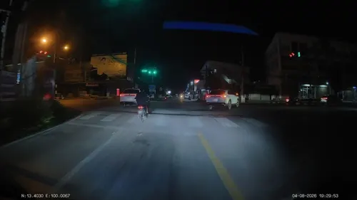
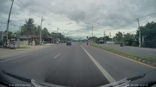


ร้านยายแขก
Restaurant · Breakfast, Thai · 2.4 km
Flower Garden St, Samut Songkhram
1 more on the map.
Where to stay6

History
In the Ayutthaya period the area of Samut Songkhram was known as Suan Nok (Thai สวนนอก, "outer garden") and was administrated by Ratchaburi. During the reign of King Taksin it became a province. It was the birthplace of Queen Amarindra of King Rama I, who also initiated the name Suan Nok. The birthplace of King Rama II in Amphawa district is now a memorial park.
On 29 November 1936 Samut Songkhram town municipality was established, with an area of approximately 3.0 square kilometres (1.2 sq mi). and was expanded to a total area of 8.0 square kilometres (3.1 sq mi) on 10 November 1965.
From the History section of Samut Songkhram on Wikipedia, under CC BY-SA 4.0.
More about Samut Songkhram
Geography
Samut Songkhram is at the mouth of the Mae Klong River to the Gulf of Thailand. By means of canals (khlong) the water of the river is spread through the province for irrigation. At the coast are many evaporation ponds for producing sea salt.
The subdistrict is bordered to the north by Ban Prok and Lat Yai subdistricts, Mueang Samut Songkhram district, to the east by Bang Kaeo and Bang Chakreng subdistricts, Mueang Samut Songkhram district, to the south by Bang Chakreng and Laem Yai subdistricts, Mueang Samut Songkhram district, to the west by Laem Yai and Yai Hat subdistricts, Mueang Samut Songkhram district.
From the Wikipedia article Samut Songkhram, under CC BY-SA 4.0.
Notable people from Samut Songkhram
- Srirasmi SuwadeeMother Of Prince Dipangkorn Rasmijoti
- Pisansin Za-inThai footballer
- Apidej Sit HrunThai Muay Thay fighter
- Somchai ChuayboonchumThai footballer
- Kanison Phoopanassociation football player
- Sarawut JaipechThai futsal player
Born in Samut Songkhram, according to Wikidata (CC0). Each name links to its Wikipedia article.
Churches and places of worship10
Shopping5
Gas and EV charging3
Schools, colleges and libraries7
Healthcare1
Map of Samut Songkhram
47 places. The map loads OpenStreetMap tiles when you open it.
Getting there and nearby towns
Kamphaeng Saen Airport (KDT) is the nearest airport with scheduled flights listed in OpenStreetMap, 77 km away.
- Ratchaburi 24 km northwest, about 24 min by car
- Phetchaburi 34 km south, about 34 min by car
- Nakhon Pathom 45 km north, about 45 min by car
- Ban Pong 47 km north, about 47 min by car
- Nong Khaem 50 km northeast, about 50 min by car
- Bang Bon 51 km northeast, about 51 min by car
- Bang Khae 54 km northeast, about 54 min by car
- Bang Khun Thian 54 km northeast, about 54 min by car
- Phasi Charoen 58 km northeast, about 58 min by car
- Bangkok 66 km northeast, about 1 h by car
Drive times are estimates from straight-line distance, not routes.
Towns near Samut Songkhram


Keep exploring
Local news
Headlines from INDB.
Reviews, tips and questions
Loading what members have shared...
Sources and licences
- GeoNames (CC BY 4.0): population, coordinates, regions and time zone
- Mapillary (see each image): photos
- OpenStreetMap contributors (ODbL 1.0): places, airports, map data
- Wikidata (CC0 1.0): elevation, founding date, time zone, website
- Wikimedia Commons (see each image): photos
- Wikipedia (CC BY-SA 4.0): overview and history text
Photo credits
- Mae Klong in Samut Songkhram, ผู้สร้างสรรค์ผลงาน/ส่งข้อมูลเก็บในคลังข้อมูลเสรีวิกิมีเดียคอมมอนส์ - เทวประภาส มากคล้าย, CC BY 2.5
- Lak Mueang Samut Songkhram - panoramio, Andreas Hörstemeier, CC BY-SA 3.0
- Samut Songkhram province hall - panoramio, Andreas Hörstemeier, CC BY-SA 3.0
- (THA-Samut Songkhram) Tourists taking photos of passing train along Maeklong Railway Market 2024-02-11 (1), S5A-0043, CC BY 2.0
- (THA-Samut Songkhram) State Railway of Thailand 1227 in Samut Songkhram 2024-02-11 (2), S5A-0043, CC BY 2.0
- (THA-Samut Songkhram) State Railway of Thailand 1227 in Samut Songkhram 2024-02-11 (1), S5A-0043, CC BY 2.0
- (THA-Samut Songkhram) Tourists taking photos of passing train along Maeklong Railway Market 2024-02-11 (2), S5A-0043, CC BY 2.0
- (THA-Samut Songkhram) State Railway of Thailand 1216 in Samut Songkhram 2024-02-11, S5A-0043, CC BY 2.0
- (THA-Samut Songkhram) Tourists taking photos of passing train along Maeklong Railway Market 2024-02-11 (3), S5A-0043, CC BY 2.0
- Mae Klong, Mueang Samut Songkhram District, Samut Songkhram 75000, Thailand - panoramio (3), mohigan, CC BY-SA 3.0
- Mae Klong, Mueang Samut Songkhram District, Samut Songkhram 75000, Thailand - panoramio (8), mohigan, CC BY-SA 3.0
- Mae Klong, Mueang Samut Songkhram District, Samut Songkhram 75000, Thailand - panoramio (2), mohigan, CC BY-SA 3.0
- Train at Samut Songkhram market on the rails, Zeugma fr ( talk ) (Antoine FLEURY-GOBERT), CC BY-SA 3.0
- Wat Chong Lom, Kittipong khunnen, CC BY-SA 3.0
- Talad Rom Hoop (I), This Photo was taken by Supanut Arunoprayote . Feel free to use any of my images, but please mention me as the author and may send me a message. (สามารถใช้ภาพได้อิสระ..., CC BY 4.0
- Train Drivers view- The Mahachai Mae Khlong Market Train... - panoramio, Raki_Man, CC BY 3.0
- Wat Ban Laem 01, Kittipong khunnen, CC BY-SA 3.0
- วัดเพชรสมุทรวรวิหาร อ.เมือง จ.สมุทรสงคราม (2), กสิณธร ราชโอรส, CC BY-SA 4.0
- วัดเพชรสมุทรวรวิหาร อ.เมือง จ.สมุทรสงคราม (4), กสิณธร ราชโอรส, CC BY-SA 4.0
- วัดเพชรสมุทรวรวิหาร อ.เมือง จ.สมุทรสงคราม, กสิณธร ราชโอรส, CC BY-SA 4.0
- วัดเพชรสมุทรวรวิหาร อ.เมือง จ.สมุทรสงคราม (3), กสิณธร ราชโอรส, CC BY-SA 4.0
- วัดเพชรสมุทรวรวิหาร จ.สมุทรสงคราม, กสิณธร ราชโอรส, CC BY-SA 4.0
- วัดเพชรสมุทรวรวิหาร จ.สมุทรสงคราม (4), กสิณธร ราชโอรส, CC BY-SA 4.0
- วัดเพชรสมุทรวรวิหาร จ.สมุทรสงคราม (3), กสิณธร ราชโอรส, CC BY-SA 4.0
- วัดเพชรสมุทรวรวิหาร จ.สมุทรสงคราม (2), กสิณธร ราชโอรส, CC BY-SA 4.0
- Wat Ban Laem 02, Kittipong khunnen, CC BY-SA 3.0
- Mahachai Mae Khlong Market - panoramio, Raki_Man, CC BY 3.0
- The Mahachai Mae Khlong Market Train... - panoramio (1), Raki_Man, CC BY 3.0
- The Mahachai Mae Khlong Market Train... - panoramio, Raki_Man, CC BY 3.0
- Durian Shop - panoramio, Raki_Man, CC BY 3.0
- License plate of Thailand 002, Dickelbers, CC BY-SA 4.0
- Maeklong Railway Market, Ewong17, CC BY-SA 4.0
- Talad Rom Hoop (II), This Photo was taken by Supanut Arunoprayote . Feel free to use any of my images, but please mention me as the author and may send me a message. (สามารถใช้ภาพได้อิสระ..., CC BY 4.0
- Tourist police car Thailand 01, Dickelbers, CC BY-SA 4.0
- Tourist police car Thailand 02, Dickelbers, CC BY-SA 4.0
- Maeklong Railway Market 07, Codas, CC BY-SA 4.0
- Maeklong Railway Market 05, Codas, CC BY-SA 4.0
- Maeklong Railway Market 08, Codas, CC BY-SA 4.0
- Maeklong Railway Market 06, Codas, CC BY-SA 4.0
- Temple@Samut Songkram - panoramio, ::::=UT=::::, CC BY-SA 3.0
- Street-level photo, ThailandCambodia, CC BY-SA 4.0
- Street-level photo, ThailandCambodia, CC BY-SA 4.0
- Street-level photo, ThailandCambodia, CC BY-SA 4.0
- Street-level photo, ThailandCambodia, CC BY-SA 4.0


Page built November 10, 2026. Spotted a mistake? Tell us or suggest a place.