


Thawi Watthana, Thailand
แขวงทวีวัฒนา
Thawi Watthana is a town of 76,351 people in Bangkok, Thailand.
Why visit Thawi Watthana
Townapedia lists 1 museum or landmark, 4 parks and trails and 11 places to eat in and around town.
Highlights include Thawi Wanarom Park.
Weather in Thawi Watthana
Forecast from MET Norway (CC BY 4.0). Full forecast
About Thawi Watthana
Thawi Watthana (Thai: ทวีวัฒนา, pronounced [tʰā.wīː wát.tʰā.nāː]) is one of the two khwaengs (sub-districts) of Thawi Watthana District, Bangkok's Thonburi side, apart from Sala Thammasop. In 2015 it had a population of 22,552 people, with total area of 21.521 km2 (8.3093 mi2). It is the location of the district office, and can be considered as the southern part of the district.
From the Wikipedia article Thawi Watthana subdistrict, Bangkok (this version), under CC BY-SA 4.0.
Photos of Thawi Watthana


Museums and landmarks1

House of Museums
Museum · 2.1 km
170/17 Khlong Pho Land, Moo 7, Soi 2, Khlong Pho Rd.
Parks, trails and playgrounds4


Restaurants and cafes11
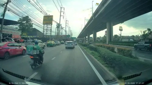
Roast Runner
Cafe · Coffee Shop · 0.6 km
99/7,99/8 ถนนบรมราชชนนี
Mo-Fr 09:00-17:00
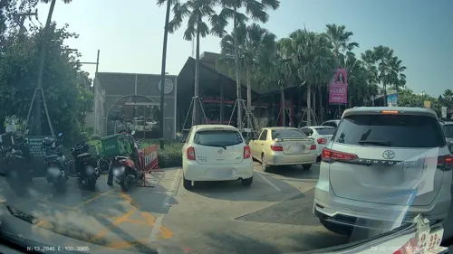

Ca’fa - Café
Cafe · Coffee Shop · 2.4 km
166 บ้านปลายบาง - บ้านคลองมหาสวัสดิ์, ตำบลศาลากลาง

Churches and places of worship2
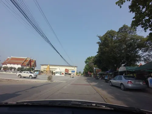

Wat Komut Putta Rungsri
Place of worship · Thai Mahanikaya · 2.1 km
ถนนพุทธมณฑลสาย 3
History
It is named after Khlong Thawi Watthana, that flows through the area. Originally, it was a tambon, part of Amphoe Taling Chan of Thon Buri Province. Until new zoning was organized on March 6, 1998, Thawi Watthana therefore promoted to district and sub-district until now.
From the History section of Thawi Watthana subdistrict, Bangkok on Wikipedia, under CC BY-SA 4.0.
More about Thawi Watthana
Geography
Neighboring sub-districts are (from north clockwise) Sala Thammasop, Bang Phrom and Bang Chueak Nang of Taling Chan District, Bang Phai of Bang Khae and Nong Khang Phlu of Nong Khaem Districts, Salaya of Phutthamonthon and Krathum Lom of Sam Phran Districts, Nakhon Pathom Province.
Like the Sala Thammasop, it can be considered as the agricultural zone with a good atmosphere and fresh air, because it is a suburb Bangkok.
From the Wikipedia article Thawi Watthana subdistrict, Bangkok, under CC BY-SA 4.0.
Shopping4
Gas and EV charging2
Schools, colleges and libraries5
Healthcare1
Map of Thawi Watthana
30 places. The map loads OpenStreetMap tiles when you open it.
Getting there and nearby towns
Don Mueang International Airport (DMK) is the nearest airport with scheduled flights listed in OpenStreetMap, 28 km away.
- Taling Chan 9 km east, about 9 min by car
- Nong Khaem 9 km south, about 9 min by car
- Phasi Charoen 10 km southeast, about 10 min by car
- Bang Khae 11 km south, about 11 min by car
- Bang Kruai 11 km east, about 11 min by car
- Bangkok Noi 11 km east, about 11 min by car
- Bangkok Yai 13 km southeast, about 13 min by car
- Thon Buri 13 km southeast, about 13 min by car
- Bang Bon 14 km south, about 14 min by car
- Bangkok 14 km east, about 14 min by car
Drive times are estimates from straight-line distance, not routes.
Towns near Thawi Watthana


Keep exploring
Local news
Headlines from INDB.
Reviews, tips and questions
Loading what members have shared...
Sources and licences
- GeoNames (CC BY 4.0): population, coordinates, regions and time zone
- Mapillary (see each image): photos
- OpenStreetMap contributors (ODbL 1.0): places, airports, map data
- Wikidata (CC0 1.0): elevation, founding date, time zone, website, landmarks and historic places
- Wikimedia Commons (see each image): photos
- Wikipedia (CC BY-SA 4.0): overview and history text
Photo credits
- ม้านั่งในสวน, Phoebus 28, CC BY-SA 4.0
- Sala Thammasop railway station 20240113 02, Suikotei, CC BY 4.0
- Leica minilux camera 03, Wutthichai Charoenburi, CC BY 2.0
- Sala Thammasop railway station 20240113 03, Suikotei, CC BY 4.0
- Sala Thammasop railway station 20240113 07, Suikotei, CC BY 4.0
- Sala Thammasop railway station 20240113 05, Suikotei, CC BY 4.0
- Sala Thammasop railway station 20240113 08, Suikotei, CC BY 4.0
- Sala Thammasop railway station 20240113 04, Suikotei, CC BY 4.0
- Sala Thammasop railway station 20240113 06, Suikotei, CC BY 4.0
- 202402 Platform of Sala Thammasop Station, MNXANL, CC BY-SA 4.0
- Sala Thammasop railway station, Mx. Granger, CC0
- Street-level photo, mishari, CC BY-SA 4.0
- Street-level photo, ThailandCambodia, CC BY-SA 4.0
- Street-level photo, ThailandCambodia, CC BY-SA 4.0
- Street-level photo, rariyaso, CC BY-SA 4.0
- Street-level photo, rariyaso, CC BY-SA 4.0
- Street-level photo, rariyaso, CC BY-SA 4.0
- Street-level photo, rariyaso, CC BY-SA 4.0
- Street-level photo, ThailandCambodia, CC BY-SA 4.0
- Street-level photo, ThailandCambodia, CC BY-SA 4.0
- Street-level photo, mishari, CC BY-SA 4.0
Page built November 10, 2026. Spotted a mistake? Tell us or suggest a place.