


Why visit Arnstadt
Townapedia lists 231 museums and landmarks, 18 parks and trails, 96 places to eat, 13 places to stay and 53 attractions in and around town.
Highlights include Tierpark Fasanerie, Schafkäserei Ziegenried, Schlossmuseum Arnstadt and Schlossruine Neideck.
Weather in Arnstadt
Forecast from MET Norway (CC BY 4.0). Full forecast
About Arnstadt
Arnstadt (German pronunciation: [ˈaʁnˌʃtat] ) is a town in Ilm-Kreis, Thuringia, Germany, on the river Gera about 20 kilometres (12 mi) south of Erfurt, the capital of Thuringia. Arnstadt is one of the oldest towns in Thuringia, and has a well-preserved historic centre with a partially preserved town wall. The town is nicknamed Das Tor zum Thüringer Wald ("The Gateway to the Thuringian Forest") because of its location on the northern edge of that forest. Arnstadt has a population of approximately 27,000.
From the Wikipedia article Arnstadt (this version), under CC BY-SA 4.0.
Things to do53

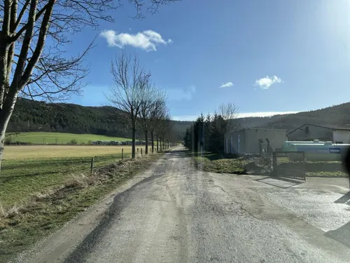



41 more on the map.
Museums and landmarks231


Schlossruine Neideck
Monument and historic site · 0.6 km
Mo-Th 09:00-15:00; Fr 09:00-12:00; Sa,Su 14:00-16:00



Eisenbahnmuseum Bw Arnstadt
Museum · 1.3 km
4 Rehestädter Weg, Arnstadt
We-Fr 10:00-16:00; Sa,Su 10:00-17:00


Ilse Lewin
Monument and historic site · 1.0 km
Stolperstein für Ilse Lewin, geb.Ambach
219 more on the map.
Parks, trails and playgrounds18

Freibad Ichtershausen
Sports field and stadium · 5.3 km
Kassenschluss jeweils eine halbe Stunde vor Schließung.
10 Am Schwimmbad
10:00-19:00





6 more on the map.
Restaurants and cafes96
Lasso
Restaurant · Steak House · 4.8 km
Westernrestaurant
93 Arnstädter Straße, Amt Wachsenburg
Mo,Th 12:00-21:00; Fr 17:00-22:00; Sa 12:00-22:00; Su,PH...

Berggasthaus Alteburg
Restaurant · Regional · 1.6 km
3 Alteburg, Arnstadt
We-Sa 12:00-21:00; Su 12:00-17:00


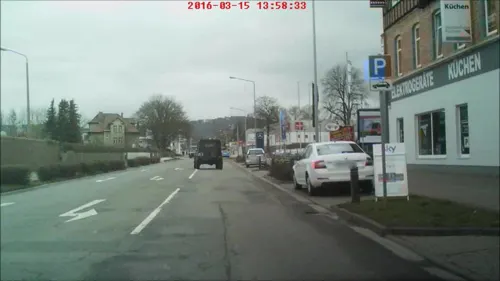
Bio Bäckerei Mann
Bakery
10 Ichtershäuser Straße, Arnstadt
Mo-Fr 05:00-18:00; Sa 05:00-12:00; Su,PH off
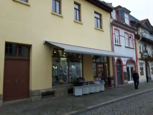
Bugenhagen Classic Lounge
Cafe · Coffee Shop, Bistro · 0.8 km
Café, Bistro, Bar
2 Zimmerstraße, Arnstadt
Mo-Fr 09:00+; Sa,Su 14:00+
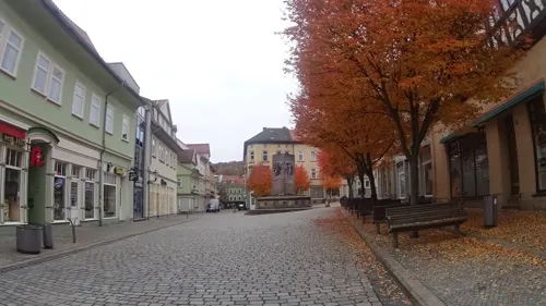


Gasthaus Zum Burgkeller
Restaurant · 0.7 km
12 Erfurter Straße, Arnstadt
Mo,Th 12:00-21:00; Fr,Sa 12:00-22:00; Su 12:00-15:00;Tu,We off
Helbing mein Lieblingsbäcker
Bakery · 0.9 km
49 Ichtershäuser Straße, Arnstadt
Mo-Fr 06:00-21:00; Sa 06:00-20:00; Su,PH off
84 more on the map.
History
A deed of gift issued 1 May 704 in Würzburg by the Thuringian Duke Hedan II to the Anglo-Saxon bishop Willibrord of Utrecht is the first written reference to Arnstadt ("Arnestati"), along with two other towns—the oldest documented reference of settlements in Thuringia and central and eastern Germany. In 726, Arnstadt passed to the Abbey of Echternach, and later to the Abbey of Hersfeld. According to historian August Beck, in 925 the territories of Henry I were extended as a bulwark against the invading Magyars. On 17 December 954, Holy Roman Emperor Otto I made peace in Arnstadt with his rebellious son Liudolf of Swabia and another son, William, whom he appointed Archbishop of Mainz, and decided that the Liebfrauenkirche (Church of Our Lady) would be built.
In the 12th century a part of Arnstadt fell under the rule of the Counts of Kevernburg. On 8 March 1198 the princes of the Holy Roman Empire gathered in Arnstadt and elected Philip of Swabia as King of Germany. In 1220 Arnstadt was first described as a civitas, that is a city. On 21 April 1266, the abbot of the Abbey of Hersfeld granted a charter; thereafter, Arnstadt became a hub for trade in timber, grain, wine and wood.
From the History section of Arnstadt on Wikipedia, under CC BY-SA 4.0.
Where to stay13
Churches and places of worship30
Klosterkirche St. Georg und Marien
Church · Lutheran · 4.0 km
Klosterstraße, Amt Wachsenburg
Shopping30
Gas and EV charging13
Tankstelle Fahrzeug Service GmbH
Gas station · 6.1 km
2 Eischlebener Weg, Amt Wachsenburg
Schools, colleges and libraries20
Staatliches Förderzentrum "Pestalozzischule" - Schulteil Anstadt "Villa Franz"
School · 1.4 km
4 Plauesche Straße, Arnstadt
Healthcare9
Ilm-Kreis-Kliniken Arnstadt-Ilmenau GmbH - Standort Arnstadt
Hospital · 0.7 km
33 Bärwinkelstraße, Arnstadt
Wilhelm-Hey-Apotheke
Clinic and pharmacy · 4.5 km
12 Friedensallee, Amt Wachsenburg
Map of Arnstadt
250 places. The map loads OpenStreetMap tiles when you open it.
Getting there and nearby towns
Erfurt-Weimar Airport (ERF) is the nearest airport with scheduled flights listed in OpenStreetMap, 15 km away.
- Erfurt 16 km north, about 16 min by car
- Ilmenau 18 km south, about 18 min by car
- Gotha 21 km northwest, about 21 min by car
- Waltershausen 28 km west, about 28 min by car
- Zella-Mehlis 29 km southwest, about 29 min by car
- Weimar 31 km northeast, about 31 min by car
- Rudolstadt 30 km southeast, about 30 min by car
- Suhl 31 km southwest, about 31 min by car
- Saalfeld 36 km southeast, about 36 min by car
- Bad Langensalza 37 km northwest, about 37 min by car
Drive times are estimates from straight-line distance, not routes.
Local news
Headlines from INDB.
Reviews, tips and questions
Loading what members have shared...
Sources and licences
- GeoNames (CC BY 4.0): population, coordinates, regions and time zone
- Mapillary (see each image): photos
- OpenStreetMap contributors (ODbL 1.0): places, airports, map data
- Wikidata (CC0 1.0): elevation, founding date, time zone, website, landmarks and historic places
- Wikimedia Commons (see each image): photos
- Wikipedia (CC BY-SA 4.0): overview and history text
Photo credits
- Arnstadt 003, Tilman2007, CC BY-SA 3.0
- Arnstadt 10, Aschroet, CC0
- Stolperstein Fanny Simon (Arnstadt), Aschroet , edited by Cookroach, CC BY-SA 4.0
- Stolperstein Walter Simon (Arnstadt), Aschroet , edited by Cookroach, CC BY-SA 4.0
- Stolperstein Hermann Simon (Arnstadt), Aschroet , edited by Cookroach, CC BY-SA 4.0
- Stolpersteine Arnstadt, Aschroet, CC0
- Arnstadt 9, Aschroet, CC0
- Gullydeckel Arnstadt, Aschroet, CC0
- Walpurgiskloster Arnstadt - 1, Aschroet, CC0
- Arnstadt 11, Aschroet, CC0
- Falkner-Knabe in Arnstadt 4, Aschroet, CC0
- Falkner-Knabe in Arnstadt 5, Aschroet, CC0
- Falkner-Knabe in Arnstadt 3, Aschroet, CC0
- Falkner-Knabe in Arnstadt 2, Aschroet, CC0
- Falkner-Knabe Arnstadt 1, Gerd Fahrenhorst, CC BY 4.0
- Falkner-Knabe in Arnstadt 1, Aschroet, CC0
- Falkner-Knabe Arnstadt 2, Gerd Fahrenhorst, CC BY 4.0
- Falkner-Knabe in Arnstadt 6, Aschroet, CC0
- Milchhof Arnstadt 20210225, Thomas doerfer, CC BY-SA 4.0
- Stolperstein Arnstadt Lessingstraße 3-Frieda Hess, Aschroet, CC BY-SA 4.0
- Stolperstein Arnstadt Lessingstraße 3-Hilde Ledermann, Aschroet, CC BY-SA 4.0
- Stolperstein Arnstadt Lessingstraße 3-Friederike Ledermann, Aschroet, CC BY-SA 4.0
- Stolperstein Arnstadt Lessingstraße 3-Ernst Ledermann, Aschroet, CC BY-SA 4.0
- Stolperstein Arnstadt Lessingstraße 3-Emma Hirsch, Aschroet, CC BY-SA 4.0
- Stolpersteine Arnstadt Lessingstraße 3, Aschroet, CC0
- Stolperstein Arnstadt Lessingstraße 3-Max Ledermann, Aschroet, CC BY-SA 4.0
- Stolperstein Arnstadt Lessingstraße 3-Minna Ledermann, Aschroet, CC BY-SA 4.0
- Stolperstein Arnstadt Lessingstraße 3-Walter Ledermann, Aschroet, CC BY-SA 4.0
- Arnstadt- Hauptbahnhof - geo.hlipp.de - 14468, Stephen Craven on geo.hlipp.de, CC BY-SA 2.0
- Grabmal von E. Marlitt auf dem Alten Friedhof in Arnstadt, Aschroet, CC0
- Arnstadt 8, Aschroet, CC0
- Märzgefallenen-Denkmal Arnstadt 3, Aschroet, CC0
- Theatercafe Arnstadt, Aschroet, CC0
- Theater Arnstadt 2, Aschroet, CC0
- Grabstein von Willibald Alexis auf dem Alten Friedhof in Arnstadt, Aschroet, CC0
- Arnstadt Liebfrauenkirche Nordportal 1900, Unknown author Unknown author, Public domain
- Arnstadt Bachkirche außen Chor 03, Photo: Andreas Praefcke, Public domain
- Oberkirche Arnstadt, 99310 Arnstadt, Pfarrhof 1, EliasDüsentrieb, CC BY-SA 3.0
- Alteburg Turm Arnstadt, Giorno2, CC BY-SA 3.0
- Arnstadt, Burgruine Neideck-001, Tilman2007, CC BY-SA 3.0
- Gottesholz bei Espenfeld, Arnstadt, Aschroet, CC0
- Amt Wachsenburg-Ichtershausen, Klosterkirche Ichtershausen Dm IMG 7399 2025-05-15 13.19, Michielverbeek, CC BY-SA 3.0 de
- Käfernburg Modell, Wikswat, CC BY-SA 3.0
- Wachsenburg-2010, CTHOE, CC BY-SA 3.0
- Marienstift Arnstadt, Giorno2, CC BY-SA 3.0
- Former Walpurga nunnery Arnstadt 1, Giorno2, CC BY-SA 3.0
- Arnstadt, Pfarrhof 1-002, Tilman2007, CC BY-SA 3.0
- Rehestädt Kirche, Mazbln, CC BY-SA 3.0
- Kirche von Hausen (Arnstadt), logoe, CC BY-SA 3.0 de
- Church Marlishausen 1, Aschroet, CC0
- Rudisleben - Kirche, Wikswat, CC BY-SA 3.0
- Jakobsturm Arnstadt, Michael Sander, CC BY-SA 3.0
- ARN-AlterFriedhof-2, SchiDD, CC BY-SA 4.0
- Hotel zur Krone Arnstadt Am Bahnhof 8, Eli-heipa, CC BY-SA 3.0 de
- Ascension church in Arnstadt, Giorno2, CC BY-SA 3.0
- ARN-Prinzenhof1, SchiDD, CC BY-SA 4.0
- Theater Arnstadt 3, Aschroet, CC0
- Arnstadt Schlossmuseum, Mazbln, CC BY-SA 3.0
- Bittstaedt Kirche, Mazbln, CC BY-SA 3.0
- Schwimmbad Ichtershausen 3, Giorno2, CC BY-SA 4.0
- Schlossgarten Arnstadt, Michael Sander, CC BY-SA 3.0
- Riedtor Arnstadt, Michael Sander, CC BY-SA 3.0
- Stolperstein Arnstadt Ried 10-David Ambach, Aschroet, CC BY-SA 4.0
- Stolperstein Arnstadt Ried 10-Edmund Lewin, Aschroet, CC BY-SA 4.0
- Stolperstein Arnstadt Ried 10-Ilse Lewin, Aschroet, CC BY-SA 4.0
- Street-level photo, saschahaberkorn, CC BY-SA 4.0
- Street-level photo, ramap, CC BY-SA 4.0
- Street-level photo, ankeric, CC BY-SA 4.0
- Street-level photo, ramap, CC BY-SA 4.0
- Street-level photo, sennewald63, CC BY-SA 4.0
- Street-level photo, ramap, CC BY-SA 4.0
- Street-level photo, ramap, CC BY-SA 4.0
- Street-level photo, ankeric, CC BY-SA 4.0
- Street-level photo, ramap, CC BY-SA 4.0
- Street-level photo, ramap, CC BY-SA 4.0
- Street-level photo, zoegglmeyr1, CC BY-SA 4.0
- Street-level photo, zoegglmeyr1, CC BY-SA 4.0
- Street-level photo, lostember, CC BY-SA 4.0
- Street-level photo, tian, CC BY-SA 4.0
- Street-level photo, sennewald63, CC BY-SA 4.0
- Street-level photo, saschahaberkorn, CC BY-SA 4.0
- Street-level photo, sennewald63, CC BY-SA 4.0
- Street-level photo, ramap, CC BY-SA 4.0
- Street-level photo, atze02, CC BY-SA 4.0
- Street-level photo, lostember, CC BY-SA 4.0
- Street-level photo, sennewald63, CC BY-SA 4.0
- Street-level photo, ramap, CC BY-SA 4.0
- Street-level photo, ramap, CC BY-SA 4.0
- Street-level photo, sennewald63, CC BY-SA 4.0


Page built November 8, 2026. Spotted a mistake? Tell us or suggest a place.