


Bad Säckingen, Germany
Bad Säckingen is a town of 16,549 people in Baden-Wurttemberg, Germany.
Why visit Bad Säckingen
Townapedia lists 37 museums and landmarks, 24 parks and trails, 84 places to eat, 15 places to stay and 15 attractions in and around town.
Highlights include Wildgehege, Holzbrücke Bad Säckingen, Diebsturm and Müllmuseum.
Weather in Bad Säckingen
Forecast from MET Norway (CC BY 4.0). Full forecast
About Bad Säckingen
Bad Säckingen (German pronunciation: [baːt ˈzɛkɪŋən] ; High Alemannic: Bad Säckinge) is a rural town in the administrative district of Waldshut in the state of Baden-Württemberg in Germany. It is famous as the "Trumpeter's City" because of the book Der Trompeter von Säckingen ("The Trumpeter of Säckingen"), a famous 19th-century novel by German author Joseph Victor von Scheffel.
From the Wikipedia article Bad Säckingen (this version), under CC BY-SA 4.0.
Travel tips from other travellers: Bad Säckingen on Wikivoyage (CC BY-SA 4.0).
Things to do15

Wildgehege
Zoo and aquarium · 2.0 km
Hier finden Tierfreunde die Möglichkeit einheimisches Wild zu beobachten und zu füttern. In mehreren Gehegen sind Wildschweine und Rot-,...
93 Bergseestr., Bad Säckingen
24/7

Holzbrücke Bad Säckingen
Bridge
Rhine bridge from Bad Säckingen, Germany to Stein, Switzerland

Bad Säckingen
Monument and historic site
Municipality in Baden-Württemberg, Germany






3 more on the map.
Museums and landmarks37

Diebsturm
Monument and historic site
Teil der Befestigungsanlage der mittelalterlichen Stadt. 1864 durch den Säckinger Fabrikanten Theodor Bally im neugotischen Stil...
5/5 Schönaugasse, Bad Säckingen

Müllmuseum
Museum · 3.3 km
162 Hauptstraße, Bad Säckingen
Th 15:00-17:00; Su 14:00-17:00|| "sowie nach Voranmeldung"

Schloss Schönau
Monument and historic site
Durch die Herren von Schönau um 1600 anstelle einer früheren wasserburgartigen Anlage erbaut. Typisches Herrenhaus mit polygonalen...
5/1 Schönaugasse, Bad Säckingen




Wildlife Naturkundemuseum
Museum · 2.8 km
In die Ausstellung integriert ist eine der vielfältigsten und wertvollsten Trophäensammlungen auf einer Ausstellungsfläche von 1.400 qm...
We-Fr 14:00-19:00; Sa,Su 11:00-19:00

Gallusturm
Monument and historic site
Nach einem Hochwasser 1343 als Wellenbrecher und Verteidigungsanlage auf der Nordspitze der ehemaligen Inselstadt errichtet. Der Turm...
2 Rheinallee, Bad Säckingen

Pavillion
Monument and historic site
Der aufwändig sanierte Raum bietet Platz für bis zu 70 Personen und steht auch für Stehempfänge und andere Veranstaltungen zur Verfügung.
5/3 Schönaugasse, Bad Säckingen
25 more on the map.
Parks, trails and playgrounds24

Wild Kids
Sports field and stadium · 2.9 km
Im Kinderspieldschungel von Bad Säckingen „Wild Kids“ können Kinder auf 1.500 qm nach Herzenslust spielen und toben.
121 Schaffhauser Straße, Bad Säckingen
We-Fr 13:30-18:00; Sa,Su,PH 11:00-19:00; Mo,Tu off

Golf- und Freizeitwelt Hochrhein
Golf course · 3.0 km
6 hole Par 18
121 Schaffhauser Straße, Bad Säckingen




12 more on the map.
Restaurants and cafes84
Akropolis Athen »Am Rheinblick«
Restaurant · Greek · 0.8 km
87 Friedrichstraße, Bad Säckingen
Mo-Su 11:30-15:00,17:30-24:00; We off

Alte Zunft
Restaurant · Regional
12 Metzgergasse, Bad Säckingen
Tu-Th 11:00-01:00, Fr 11:00-02:00, Sa 10:00-02:00, Su 11:00-20:00
Angelo Bar Restaurant
Restaurant · Regional · 2.9 km
121 Schaffhauser Straße, Bad Säckingen
Mo off "Ruhetag"; Tu-Th 14:00-22:00; Fr 13:00-24:00; Sa...
Cafe Heinritz
Cafe · Cafe, Cake, Breakfast
22 Waldshuter Straße, Bad Säckingen
Tu-Fr 08:00-18:00; Sa 08:00-17:00; PH off
Gasthof zum Anker
Restaurant · Regional · 2.4 km
93 Hauptstrasse, Mumpf
We-Fr 09:00-23:00; Sa 16:00-23:00; Su 10:00-22:00
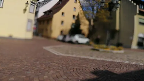
Genuss-Apotheke Freigeist
Restaurant · German
Ein Michelin-Stern am 13.11.2015 erhalten.
11 Schönaugasse, Bad Säckingen
Tu-Sa 11:30-14:30,18:30-23:00
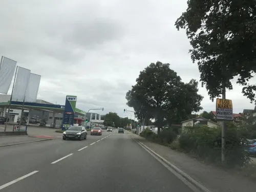
Moda Grill
Restaurant · Turkish · 1.6 km
40 Schaffhauser Straße, Bad Säckingen
We-Su 11:00-22:00; Tu closed

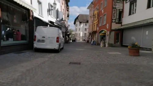
Restaurant - Pizzeria St. Fridolin
Restaurant · Pizza
28 Rheinbrückstraße
Tu-Sa 11:30-14:30,17:30-23:00
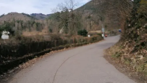


Restaurant Bergsee
Restaurant · German · 2.0 km
1 Am Bergsee, Bad Säckingen
Apr-Oct: Mo-Su,PH 10:30-22:00; Nov-Mar: Mo-Su,PH 10:30-20:00
72 more on the map.
History
The history of the city dates back to the early 6th Century, when Saint Fridolin founded Säckingen Abbey and a church. Around 1200 most of the city was destroyed in a huge fire. Afterwards, construction began in the middle of the town on a Gothic cathedral, called the Fridolinsmünster, which can still be visited today.
In the closing stages of the 1672–1678 Franco-Dutch War, the town was severely damaged by French soldiers commanded by the Comte de Choiseul, following their victory over an Imperial force at Rheinfelden on 7 July 1678.
After the Second World War the city was under control of France from 1945-1952. The city was financially helped by the Swiss Fricktal to get over the financial struggles after the war.
From the History section of Bad Säckingen on Wikipedia, under CC BY-SA 4.0.
Where to stay15
Churches and places of worship14
Fridolinsmünster
Church · Roman Catholic
2 Münsterplatz, Bad Säckingen
Kirche Jesu Christi der Heiligen der Letzten Tage
Church · Mormon · 2.2 km
97 Schaffhauser Straße, Bad Säckingen
Shopping25
Gas and EV charging12
Schools, colleges and libraries20
Praxis für Dr. Hauschka Kosmetik & Fußreflexzonenmassage
School
1 Bahnhofplatz, Bad Säckingen
Healthcare13
Map of Bad Säckingen
250 places. The map loads OpenStreetMap tiles when you open it.
Getting there and nearby towns
Lahr Airport (LHA) is the nearest airport with scheduled flights listed in OpenStreetMap, 91 km away.
- Wehr 9 km north, about 9 min by car
- Rheinfelden 12 km west, about 12 min by car
- Schopfheim 14 km northwest, about 14 min by car
- Steinen 19 km northwest, about 19 min by car
- Grenzach-Wyhlen 20 km west, about 20 min by car
- Lörrach 22 km west, about 22 min by car
- Waldshut-Tiengen 22 km east, about 22 min by car
- Weil am Rhein 25 km west, about 25 min by car
- Neuenburg am Rhein 41 km northwest, about 41 min by car
- Titisee-Neustadt 45 km northeast, about 45 min by car
Drive times are estimates from straight-line distance, not routes.
Local news
Headlines from INDB.
Reviews, tips and questions
Loading what members have shared...
Sources and licences
- GeoNames (CC BY 4.0): population, coordinates, regions and time zone
- Mapillary (see each image): photos
- OpenStreetMap contributors (ODbL 1.0): places, airports, map data
- Wikidata (CC0 1.0): elevation, founding date, time zone, website, landmarks and historic places
- Wikimedia Commons (see each image): photos
- Wikipedia (CC BY-SA 4.0): overview and history text
Photo credits
- Bad Säckingen St Fridolinsmünster Portal, PantaRhei, CC BY-SA 4.0
- Bad Säckingen Fridolinsprozession 2016 - 11, Fotochronist, CC0
- Bad Säckingen — Geschäftszentrum "In der Lohgerbe" — Auffahrt, User:Mattes, CC BY 2.0 de
- Bad Säckingen Fridolinsprozession 2016 - 12, Fotochronist, CC0
- Bad Säckingen Lohgerbe-Center, Fotochronist, CC0
- Bad Säckingen Steinbrückstrasse Trompeterfigur, Fotochronist, CC BY-SA 4.0
- Bad Säckingen Blauer Brunnen Detail, Fotochronist, CC0
- Bad Säckingen Blauer Brunnen, Fotochronist, CC0
- Bad Säckingen Schützenstraße in Richtung Ost, Fotochronist, CC BY-SA 4.0
- Bad Säckingen 2012-08-17 Mattes, User:Mattes, CC BY 2.0 de
- Bad Säckingen Spitalplatz Brunnen Detail, Fotochronist, CC0
- Bad Säckingen Steinentor und Steinbrücke Info, Fotochronist, CC BY-SA 4.0
- Bad Säckingen Spitalplatz Brunnen 2, Fotochronist, CC0
- Bad Säckingen Spitalplatz Brunnen 1, Fotochronist, CC0
- Bad Säckingen Naturdenkmal Linde Steinbrückstraße-Schützengarten, PantaRhei, CC BY-SA 4.0
- Bad Säckingen Brückenfragment, Fotochronist, CC0
- Bad Säckingen Schützenstraße Ost-West-Ansicht, Fotochronist, CC0
- Bad Säckingen — Steinbrückstrasse und Schützenstrasse — Eckhaus, User:Mattes, CC BY 2.0 de
- Bad Säckingen Fridolinsprozession 2016 - 10, Fotochronist, CC0
- Bad Säckingen Steinbrückstraße Süd-Nord-Ansicht, Fotochronist, CC0
- Bad Säckingen Beck Arkaden Alte Basler Str 2 Berliner Kissen, PantaRhei, CC BY-SA 4.0
- Bad Säckingen Erweiterungsbau der Beckarkarden 03, Fotochronist, CC0
- Bad Säckingen — Metzgergasse 2 (Aussenansicht), User:Mattes, CC BY 2.0 de
- Bad Säckingen Rheinbadstraße West-Ost-Ansicht, Fotochronist, CC0
- Bad Säckingen Beck Arkaden Alte Basler Str 2 Südostseite, PantaRhei, CC BY-SA 4.0
- Bad Säckingen Erweiterungsbau der Beckarkarden 05, Fotochronist, CC0
- Bad Säckingen — Schützenstr. 2, Gebäude (Rückansicht), User:Mattes, CC BY 2.0 de
- Bad Säckingen — Schützenstr. 2, Gebäude (Vorderansicht), User:Mattes, CC BY 2.0 de
- Bad Säckingen ehem Gesellschaftshaus Walfischia Detail Rheinbadstraße, Fotochronist, CC0
- Bad Säckingen ehem Gesellschaftshaus Walfischia Rheinbadstraße, Fotochronist, CC0
- Bad Säckingen altes Stadtwappen Siechenmännlein, Fotochronist, CC BY-SA 4.0
- Bad Säckingen — Ballyweg 1, Holzwohnhaus, Außenansicht, User:Mattes, CC BY 2.0 de
- Bad Saeckingen Muensterplatz, Dimelina, CC BY-SA 3.0
- Holzbruecke Bad Saeckingen 01 09, Хрюша, CC BY-SA 3.0
- Bad Säckingen Bergsee 45-16-03, PantaRhei, CC BY-SA 4.0
- Bad Saeckingen Diebsturm, Dimelina, CC BY-SA 3.0
- Schloss Schoenau Bad Saeckingen, Wladyslaw [Disk.] at de.wikipedia, CC BY-SA 3.0
- Bad Säckingen Gloria-Theater Friedrichstraße 21 II (cropped), Fotochronist, CC BY-SA 4.0
- Bad Säckingen Naturdenkmal Galgenbuck 1, PantaRhei, CC BY-SA 4.0
- Wallbach (Bad Saeckingen) Kirche, Dimelina, CC BY-SA 3.0
- Bad Säckingen Schloss Schönau Trompetenmuseum, PantaRhei, CC BY-SA 4.0
- Gallusturm...Rheinallee - panoramio, Pierre Likissas, CC BY 3.0
- Fridolingsmuenster Saeckingen2, Wladyslaw, CC BY-SA 3.0
- Menhir von Bad Säckingen 1, EthoZ, CC BY-SA 4.0
- Bad Säckingen Wildgehege Rotwild, Fotochronist, CC0
- Bad Säckingen - Kursaal außen (2012), User:Mattes, CC BY 2.0 de
- Bad Säckingen Röthekopf-Hütte, Fotochronist, CC BY-SA 4.0
- Müllmuseum in Wallbach (Baden), Fotochronist, CC BY-SA 4.0
- Bad Säckingen Schlosspark Pavillion, Fotochronist, CC BY-SA 4.0
- Street-level photo, hochrheinbiker, CC BY-SA 4.0
- Street-level photo, hochrheinbiker, CC BY-SA 4.0
- Street-level photo, hochrheinbiker, CC BY-SA 4.0
- Street-level photo, Lukas1976, CC BY-SA 4.0
- Street-level photo, hochrheinbiker, CC BY-SA 4.0
- Street-level photo, Lukas1976, CC BY-SA 4.0
- Street-level photo, tbkrtz, CC BY-SA 4.0
- Street-level photo, hochrheinbiker, CC BY-SA 4.0
- Street-level photo, likesopenstreetmap, CC BY-SA 4.0
- Street-level photo, hochrheinbiker, CC BY-SA 4.0
- Street-level photo, Lukas1976, CC BY-SA 4.0
- Street-level photo, hochrheinbiker, CC BY-SA 4.0
- Street-level photo, hochrheinbiker, CC BY-SA 4.0
- Street-level photo, nvbwseifert, CC BY-SA 4.0
- Street-level photo, Lukas1976, CC BY-SA 4.0
- Street-level photo, Lukas1976, CC BY-SA 4.0
- Street-level photo, Lukas1976, CC BY-SA 4.0
- Street-level photo, hochrheinbiker, CC BY-SA 4.0
- Street-level photo, Lukas1976, CC BY-SA 4.0
- Street-level photo, hochrheinbiker, CC BY-SA 4.0
- Street-level photo, hochrheinbiker, CC BY-SA 4.0
- Street-level photo, hochrheinbiker, CC BY-SA 4.0
- Street-level photo, Lukas1976, CC BY-SA 4.0


Page built November 8, 2026. Spotted a mistake? Tell us or suggest a place.